Reno, Nev. (Jan. 22, 2018): Many Western communities rely on snow from mountain forests as a source of drinking water – but for scientists and water managers, accurately measuring mountain snowpack has long been problematic. Satellite imagery is useful for calculating snow cover across open meadows, but less effective in forested areas, where the tree canopy often obscures the view of conditions below.
Now, a new technique for measuring snow cover using a laser-based technology called lidar offers a solution, essentially allowing researchers to use lasers to “see through the trees” and accurately measure the snow that lies beneath the forest canopy.
In a new study published in Remote Sensing of the Environment, an interdisciplinary team of researchers from Desert Research Institute (DRI), the University of Nevada, Reno (UNR), the California Institute of Technology’s Jet Propulsion Laboratory, and California State University described the first successful use of lidar to measure snow cover under forested canopy in the Sierra Nevada.
“Lidar data is gathered by laser pulses shot from a plane, some of which are able to pass light through the tree canopy right down to the snow surface and create a highly accurate three-dimensional map of the terrain underneath,” explained lead author Tihomir Kostadinov, Ph.D., of California State University San Marcos, who completed the research while working as a postdoctoral researcher at DRI. “Passive optical satellite imaging techniques, which are essentially photographs taken from space, don’t allow you to see through the trees like this. We are only starting to take full advantage of all the information in lidar.”
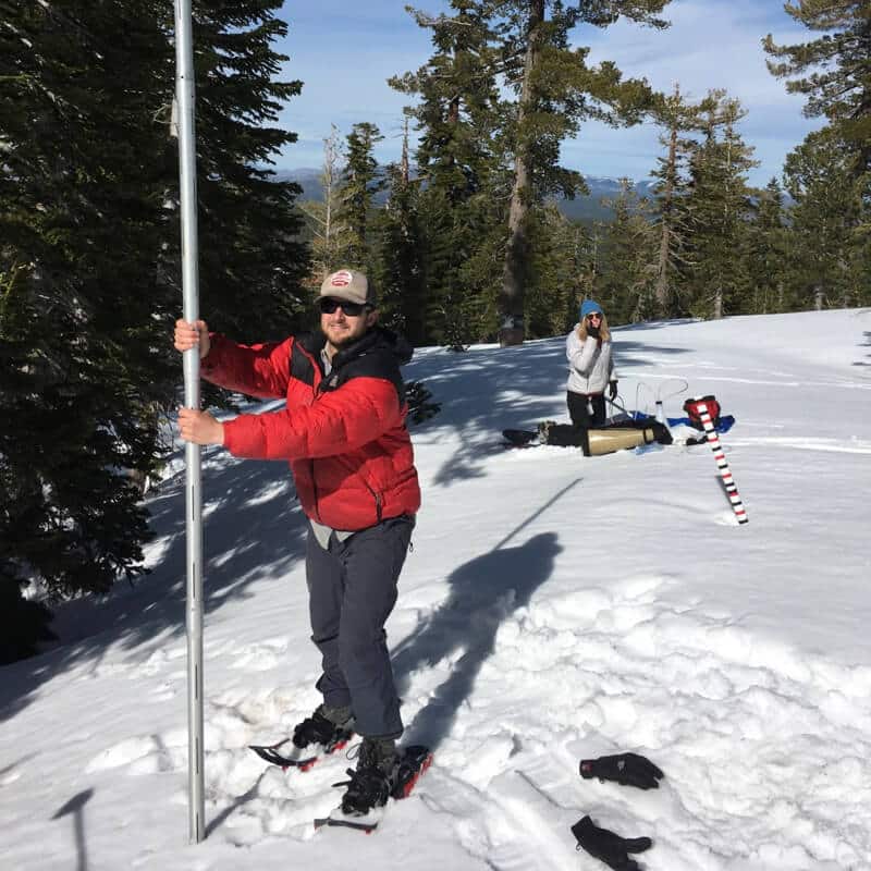
Rowan Gaffney (UNR) surveying the amount of snow at Sagehen Creek Field Station during the NASA airborne campaigns in March 2016. Credit: A. Harpold.
In this study, researchers worked with NASA’s Airborne Snow Observatory to collect lidar data at the University of California, Berkeley’s Sagehen Creek Field Station in the Sierra Nevada by aircraft on three dates during spring of 2016 when snow was present. Additional lidar data and ground measurements facilities by the long-term operation of Sagehen Creek field station were critical to the success of the study.
Analysis of the datasets revealed that the lidar was in fact capable of detecting snow presence or absence both under canopy and in open areas, so long as areas with low branches were removed from the analysis. On-the-ground measurements used distributed temperature sensing with fiber optic cables laid out on the forest floor to verify these findings.
Tree canopies interact with the snowpack in complex ways, causing different accumulation and disappearance rates under canopies as compared to open areas. With the ability to use lidar data to measure snow levels beneath trees, snow cover estimates used by scientists and resource managers can be made more accurate. The importance of this advance could be far reaching, said team member Rina Schumer, Ph.D., Assistant Vice President of Academic and Faculty Affairs at DRI.
“In the Sierra Nevada, April 1st snow cover is what is used to estimate water supply for the year,” Schumer said. “Being able to more accurately assess snow cover is important for California and Nevada, but also all mountainous areas where snowpack is essential to year-round water supply.”
Snow cover estimates are also used by hydrologists for streamflow forecasts and reservoir management. Snow cover data is important to ecologists and biologists for understanding animal migration, wildlife habitat, and forest health, and it is useful to the tourism and recreation industry for informing activities related to winter snow sports.
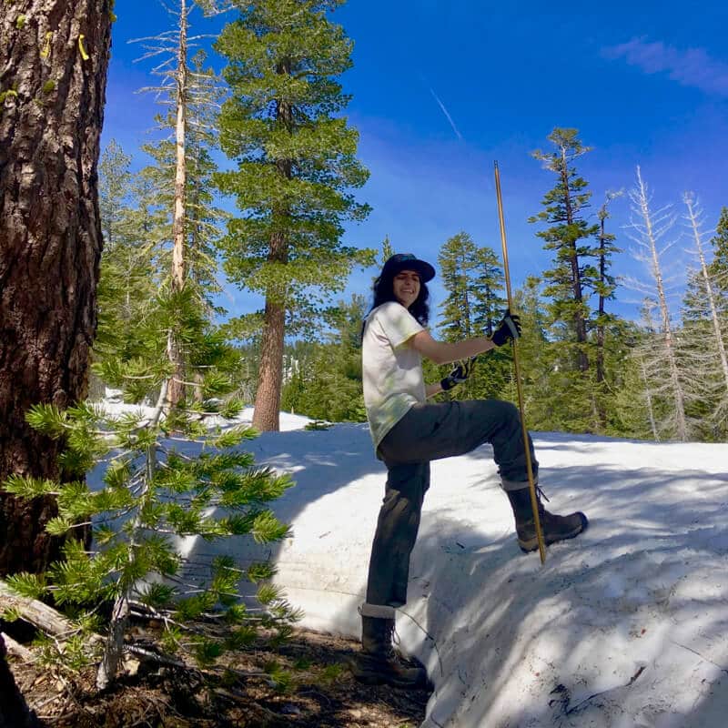
Rose Petersky (UNR) surveying the amount of snow under the forest canopy at Sagehen Creek Field Station during the NASA airborne campaigns in April 2016. The photo clearly shows the reduced snow cover under the canopy that is difficult to measure with satellites. Credit: A. Harpold.
Although lidar data is currently collected via airplane and not easily accessible by all who might like to use it, the study team believes that information gleaned from this study could be used to correct data derived from satellite imagery, which is already widely available from NASA’s MODIS sensor and NASA/USGS’s Landsat satellites.
“This is proof of concept for the method that we think could really expand the extent that we measure snow at high resolution in forests,” said team member Adrian Harpold, Ph.D., Assistant Professor with the Department of Natural Resources at UNR. “I’m now working with a student to extend this approach across multiple sites to improve our understanding of the relationship between snow cover in the open versus under the tree canopy. Then, we hope to use that information to correct and improve satellite remote sensing in forested areas.”
This study was part of a larger NASA EPSCoR project titled Building Capacity in Interdisciplinary Snow Sciences for a Changing World, which aimed to develop new research, technology, and education capacity in Nevada for the interdisciplinary study of snowpack. Objectives included an educational goal of training the next generation of scientists.
“This project brought together people who look at snow from different scientific perspectives, and generated a conversation amongst us,” said Alison Murray, Ph.D., Research Professor at DRI and principal investigator of the NASA EPSCoR project. “In addition to bringing together expertise from three institutions in Nevada (DRI, UNR, and UNLV) in hydrology, remote sensing, geosciences, atmospheric chemistry and snow associated life, we developed strategic alliances with NASA’s airborne snow survey. Where the Nevada researchers might have been studying snow on our own, this interdisciplinary project allowed us to look at snow in an integrated fashion and make some important advances.”
The full study, titled Watershed-scale mapping of fractional snow cover under conifer forest canopy using lidar, is available online from Remote Sensing of the Environment: https://www.sciencedirect.com/science/article/abs/pii/S0034425718305467
The Desert Research Institute (DRI) is a recognized world leader in basic and applied interdisciplinary research. Committed to scientific excellence and integrity, DRI faculty, students, and staff have developed scientific knowledge and innovative technologies in research projects around the globe. Since 1959, DRI’s research has advanced scientific knowledge, supported Nevada’s diversifying economy, provided science-based educational opportunities, and informed policy makers, business leaders, and community members. With campuses in Reno and Las Vegas, DRI serves as the non-profit research arm of the Nevada System of Higher Education. Learn more at www.dri.edu, and connect with us on social media on Facebook, Instagram and Twitter.
Northern Nevada Science Center
2215 Raggio Parkway
Reno, Nevada 89512
PHONE: 775-673-7300
Southern Nevada Science Center
755 East Flamingo Road
Las Vegas, Nevada 89119
PHONE: 702-862-5400