Jan 18, 2023 | Announcements, News releases
A Changing Flood Recipe for Las Vegas
January 18, 2022
LAS VEGAS, Nevada
Urbanization
Climate Change
Flooding
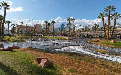
Above: Las Vegas after thunder storm with flood water in November 2019. Photo Credit: 4kodiak, iStock.
A new study shows that urbanization and climate change are changing the strength and seasonality of flooding in the Las Vegas region
Las Vegas, with its rapid urbanization and desert landscape, is highly vulnerable to flooding. For this reason, flood managers have built an extensive system of drainage ditches and detention basins to protect the public. Now, a new study shows how intentional engineering and urban development are interacting with climate change to alter the timing and intensity of flood risk.
In a study published Jan. 6 in The Journal of Hydrometeorology, researchers from DRI, the Clark County Regional Flood Control District, the University of Wisconsin- Madison, and Guangdong University of Technology examine Las Vegas’ changing flood regime. Their results show that flood intensity has increased since the mid-20th century, with an abrupt shift occurring in the mid-1990s. Climate change has also shifted flood seasonality, with the storms and their resultant floods now occurring more frequently in winter, in contrast with the historically stronger summer monsoon season.
“When I looked at the data for annual flood peaks, I could see that something is changing,” said Guo Yu, Ph.D., lead author on the new study and hydrologist at DRI. “I wanted to understand the reason for this change as well as the physical mechanisms driving it, because that will help water managers and the public understand whether such a change will continue in the future, given climate and land use changes here.”
Las Vegas is one of the fastest growing metropolitan regions in the country. In 1950, fewer than 35 thousand people resided in the region; by 2020, that number grew to 2.6 million. Like many cities in the arid Southwest, development centers on the valley floor and spreads up into the natural topography of the surrounding mountains. As concrete and pavement replace more porous desert soils, the risk of flooding in human communities rises – catastrophic floods have caused fatalities as recently as 2022. To mitigate this risk, the Clark County Regional Flood Control District constructed a complex series of storm drains and culverts to capture and direct the flow of water away from populated areas and toward Lake Mead.
Over the same period, climate change has led to shifts in seasonal rainfall patterns. The Southwest has two distinct flood seasons: winter floods produced by atmospheric rivers and summer floods linked to the North American monsoon. Since 1950, daily rainfall amounts have increased in winter and decreased in the summer months.
“Historically, people in Las Vegas haven’t paid as much attention to winter floods as to summer floods,” Yu said. “But our research shows that there will be more frequent winter floods happening because of climate change. This is because the warmer sea surface temperatures on the Pacific coast will cause more atmospheric rivers, like what we’re seeing this January in California. And when these are positioned to bypass the Sierra Nevada mountains, they will very likely hit Las Vegas and cause severe winter rainfall and floods.”
The new research demonstrates an overall picture of shifting intensity and seasonality of floods in Las Vegas. The study authors are continuing to refine their understanding of flood risk in the region with an upcoming study, currently under review, that examines changing rainfall patterns in more detail.
“A lot of research focuses on a single driver – either land use or climate – but in Las Vegas, our study shows that both are changing and interacting with each other,” said Yu.
More information:
The full study, The Nonstationary Flood Hydrology of an Urbanizing Arid Watershed, is available from The Journal of Hydrometeorology: https://doi.org/10.1175/JHM-D-22-0117.1
Study authors include: DRI researchers Guo Yu, Julianne Miller, Benjamin J. Hatchett, and Markus Berli; as well as Daniel B. Wright (University of Wisconsin, Madison); Craig McDougall (Clark County Regional Flood Control District); and Zhihua Zhu (Guangdong University of Technology, Guangzhou, China).
###
About DRI
The Desert Research Institute (DRI) is a recognized world leader in basic and applied environmental research. Committed to scientific excellence and integrity, DRI faculty, students who work alongside them, and staff have developed scientific knowledge and innovative technologies in research projects around the globe. Since 1959, DRI’s research has advanced scientific knowledge on topics ranging from humans’ impact on the environment to the environment’s impact on humans. DRI’s impactful science and inspiring solutions support Nevada’s diverse economy, provide science-based educational opportunities, and inform policymakers, business leaders, and community members. With campuses in Las Vegas and Reno, DRI serves as the non-profit research arm of the Nevada System of Higher Education. For more information, please visit www.dri.edu.
Jan 4, 2023 | Announcements, News releases
DRI Leading $5 Million Regional Climate Adaptation Project
January 4, 2023
RENO, Nevada
CNAP
Climate Adaptation
Climate Resiliency
Above: Cloud of smoke from a California wildfire. CNAP’s projects will support adaptation needs to address some of the most pressing climate issues in the region including the public health impacts of wildfire smoke.
DRI is partnering with Scripps Institution of Oceanography to build climate resiliency through the California Nevada Adaptation Program (CNAP)
The impacts of climate change have been acute in California and Nevada, with most of the last two decades spent in extended drought conditions and 2021 wildfires producing Reno’s worst recorded air quality in the 21st century. Adapting to these challenges will require not only focused research to better predict climatic events, but will also depend on empowering local communities to use this knowledge to make informed decisions in the face of adversity. With $5 million in funding from NOAA’s Climate Adaptation Partners initiative, the California Nevada Adaptation Program (CNAP) will spend the next five years bringing together researchers, community members, and practitioners to cooperatively conduct research and identify solutions.
For the first time, CNAP will be hosted in Nevada under the leadership of DRI’s Tamara Wall, Ph.D., research professor of atmospheric science and deputy director of the Western Regional Climate Center (WRCC). DRI’s long-standing partnership with Scripps Institution of Oceanography at the University of California San Diego will continue, with Dan Cayan, Ph.D., regional climate researcher and CNAP lead since its founding in 1999, and Julie Kalansky, Ph.D., who has served as CNAP program manager for six years, joining Wall to lead the project.
“The goal of CNAP has always been to expand more fully across the California and Nevada region,” Wall says. “This is the first time that DRI is leading CNAP, and it’s also the first time that CNAP is a system-wide effort. Bringing on partners from UNLV and UNR is important for meeting that goal and will help us address climate change impacts across the state.”
California and Nevada have partnered for the CNAP program since 2011, producing research and results that include: the first Nevada Climate Assessment; California’s Fourth Climate Change Assessment; recommendations for updating red flag warnings and the fire weather watch system; and analyses of water use and supply in California’s agricultural communities.
The next five years will focus on adaptation, with an intentional transition from statewide climate research toward preparing communities for local-level action to address regional climate hazards. Six projects will support adaptation needs to address four of the most pressing climate issues in the region: extreme heat, wildfire smoke, coastal flooding, and water scarcity. As part of the project’s commitment to equity and diversity, it will include a mentorship program within community colleges to prepare the future’s workforce to address climate impacts. In addition, a small grants program, Building Capacity through Reciprocity with Tribal Communities, will work to enact community-identified solutions for tribal communities by supporting a Leaders Indigenous Climate Fellowship Program.
“Centering CNAP’s research on adaptation allows us to focus on producing community-centered solutions,” Wall says. “Impacts from climate change are expected to amplify in the coming decades, and disadvantaged communities are the least able to manage those impacts without additional support. Our research includes community partners so that we can adequately understand community needs and concerns and actually improve people’s lives.”
Research Focus Areas
Extreme Heat
Highlights for planned research include creating the Southern Nevada Heat Resilience Lab (SNHRL), a regionally focused program that will bring together public service providers, including emergency responders and social services workers, with scientific experts on extreme heat. Real-time air temperature sensors will be installed in at-risk neighborhoods within Las Vegas, targeting locations such as public transit stops and buses, cooling centers, places with outdoor laborers, and unhoused communities. Following a trial period in Las Vegas, the project aims to expand local heat sensor networks to rural and Indigenous communities, where heat impacts are less well studied and understood
Water Resiliency
In order to help California prepare a more resilient workforce in the face of growing issues with water availability, CNAP will partner with community colleges in the San Joaquin Valley to create climate-related workforce training opportunities. The goal is to create a more climate-technical workforce to support community adaptation to changes in water availability and climate extremes.
Coastal Erosion
Southern California is lined with some of the most heavily used beaches on the West coast, and this region is likely to experience increased flooding and erosion due to sea-level rise. CNAP will partner with collaborators to explore nature-based solutions and Indigenous stewardship as coastal adaptation strategies.
Public Health in the Face of Extreme Heat and Wildfire Smoke
California and Northern Nevada are increasingly experiencing extreme weather conditions with overlapping heat waves and intense wildfires. CNAP will explore the public health impacts of these events by directly assessing a sample of households in Washoe County, Nevada. Research will include installing air sensors to monitor heat exposure and air pollution, conducting interviews to understand decision-making under environmentally challenging conditions, and baseline health monitoring.
Understanding Burnout in Climate Change Professionals
Previous CNAP research has shown that climate change professionals are experiencing high rates of burnout, and institutional support isn’t yet providing adequate resources to this population. CNAP will continue this line of study by evaluating the traits and communities that lead to more psychological resiliency and developing training materials based on the results for the CNAP team and partner networks.
State Climate Assessments
Both California and Nevada will likely produce new statewide climate assessments within the next five years, and CNAP will continue to coordinate among state and local efforts. CNAP will also pilot a mentoring program focused on early career faculty at universities and colleges in California and Nevada.
“NOAA Climate Adaptation Partnerships (CAP, formerly ‘RISA’) advances equitable adaptation through sustained regional research and community engagement,” says Caitlin Simpson, Program Manager, NOAA Climate Adaptation Partnerships. “Climate affects every part of society, and this is most visible to us when we see long-term changes in social and environmental conditions, increased unpredictability, and extreme weather events. We seek to help people plan for and adjust to a changing climate by supporting long-lasting partnerships among scientists, decision makers, and communities. The result is a shared understanding about society’s needs and the co-generation of credible and actionable knowledge to support community solutions. We work within regions composed of multiple US state/territory jurisdictions which share similar climates and cultures.”
“CNAP’s long history in the CAP/RISA program dates from 1997, and features many accomplishments, including substantial scientific contributions to all five of California’s climate assessments in close partnership with the state government. CNAP has achieved deep expertise on sea level rise, drought, water resources, and wildfire planning issues and has closely partnered with a number of federal and nonfederal partners to advance local, state, and regional planning around these issues. The NOAA Climate Program Office is thrilled to fund the California-Nevada Climate Applications Program (CNAP) team for another five years as a part of the CAP/RISA Network.”
More information:
For additional information about CNAP visit: https://www.dri.edu/cnap/
CNAP Principal Investigators include Tamara Wall (DRI), Julie Kalansky (Scripps), and Daniel Cayan (Scripps).
###
About DRI
The Desert Research Institute (DRI) is a recognized world leader in basic and applied environmental research. Committed to scientific excellence and integrity, DRI faculty, students who work alongside them, and staff have developed scientific knowledge and innovative technologies in research projects around the globe. Since 1959, DRI’s research has advanced scientific knowledge on topics ranging from humans’ impact on the environment to the environment’s impact on humans. DRI’s impactful science and inspiring solutions support Nevada’s diverse economy, provide science-based educational opportunities, and inform policymakers, business leaders, and community members. With campuses in Las Vegas and Reno, DRI serves as the non-profit research arm of the Nevada System of Higher Education. For more information, please visit www.dri.edu.
Nov 29, 2022 | Announcements, News releases
Successful Citizen Science Weather Tracking Effort Goes National, Receives Three Additional Years of Funding From NASA
November 29, 2022
RENO, Nevada
Mountain Rain or Snow
Citizen Science
Weather Tracking
Mountain Rain or Snow Project Invites Community Observers Around the Country to Improve Winter Weather Predictions
Satellite technologies often struggle to differentiate snow from rain near the freezing point in mountainous regions, with impacts on flood predictions, avalanche forecasting, snowpack water storage, and road safety. To help improve these technologies, researchers from Lynker, DRI, and the University of Nevada, Reno are partnering with community observers to track winter storm activity across the country through a project called Mountain Rain or Snow. The project has been so successful at collecting data that demonstrates regional variation in the rain-snow threshold that NASA’s Citizen Science for Earth Systems Program is funding an additional three years.
The project began in 2019 as Tahoe Rain or Snow and expanded last year to include mountain regions across the country. Last winter, more than 1,100 people in the Sierra Nevada, Pacific Northwest, Rocky Mountains, and Northeast submitted real-time reports of rain, snow, or mixed precipitation. Community observers submitted 15,000 observations – a six-fold increase over the previous winter.
“Scientists have noticed that satellite predictions are not as effective as ground-based observations,” says Keith Jennings, Ph.D., water resources scientist at Lynker and the project lead. “Direct observations, made by people, are the most accurate way to discover how precipitation phase varies in time and space. We are filling an important gap with this project.”
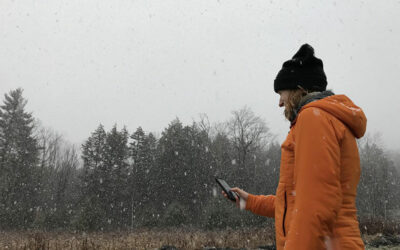
Community members sign up to receive alerts when storms with predicted temperatures near freezing are in the forecast, and submit observations of the type of precipitation they are seeing via a web-based mobile phone app. These reports show that the Sierra Nevada region transitions from rain to snow around 36 degrees Fahrenheit, rather than around the freezing temperature of 32 degrees. In the Rockies, the snow-rain threshold is closer to 40 degrees, while it’s around 33 degrees in the Northeast. Expanding the project to include more regions will help scientists understand how the rain-to-snow temperature threshold varies according to local atmospheric conditions, improve scientists’ ability to make locally-relevant predictions, and improve the technology behind rain-snow estimates.
“With the help of community observers, we are amassing a very large database of ground-based observations. These will ultimately help to improve the predictive technologies that satellites use,” says Meghan Collins, M.S., associate research scientist at DRI. “The data the community observers have helped us collect is a big step towards being able to make those improvements. We understand the state of the problem much better now and will use the next three years to advance the solution.”
Mountain Rain or Snow welcomes new community observers as it expands to additional regions this season, including the Eastern Great Lakes; the Wasatch Range around Salt Lake City; and Western Montana around Missoula. To sign up, observers find the keyword that corresponds to their region at www.rainorsnow.org. Then, text the keyword to 855-909-0798 for guidance on how to participate.
Mountain Rain or Snow is a collaboration between Lynker, DRI, and the University of Nevada-Reno. In addition to the large network of community observers, the project team includes: Keith Jennings of Lynker; Monica Arienzo, Meghan Collins, and Benjamin Hatchett of DRI; Anne Nolin of the University of Nevada, Reno; and several student researchers. The group has expertise in hydroclimatology, hydrology, and geospatial analysis.
###
About Lynker
Lynker delivers innovative solutions to support global environment security and economic prosperity as a trusted partner to governments, communities, industry, and nonprofits. We are a premier science, engineering, and technology company supporting some of the nation’s most important missions from atmosphere to ocean. We are scientists, engineers, conservationists, divers, observers, developers, technologists, educators, outreach specialists, artists, economists, policy specialists, and managers.
About DRI
The Desert Research Institute (DRI) is a recognized world leader in basic and applied environmental research. Committed to scientific excellence and integrity, DRI faculty, students who work alongside them, and staff have developed scientific knowledge and innovative technologies in research projects around the globe. Since 1959, DRI’s research has advanced scientific knowledge on topics ranging from humans’ impact on the environment to the environment’s impact on humans. DRI’s impactful science and inspiring solutions support Nevada’s diverse economy, provide science-based educational opportunities, and inform policymakers, business leaders, and community members. With campuses in Las Vegas and Reno, DRI serves as the non-profit research arm of the Nevada System of Higher Education. For more information, please visit www.dri.edu.
About the University of Nevada, Reno
The University of Nevada, Reno, is a public research university that is committed to the promise of a future powered by knowledge. Nevada’s land-grant university founded in 1874, the University serves 21,000 students. The University is a comprehensive, doctoral university, classified as an R1 institution with very high research activity by the Carnegie Classification of Institutions of Higher Education. Additionally, it has attained the prestigious “Carnegie Engaged” classification, reflecting its student and institutional impact on civic engagement and service, fostered by extensive community and statewide collaborations. More than $800 million in advanced labs, residence halls and facilities has been invested on campus since 2009. It is home to the University of Nevada, Reno School of Medicine and Wolf Pack Athletics, maintains a statewide outreach mission and presence through programs such as the University of Nevada, Reno Extension, Nevada Bureau of Mines and Geology, Small Business Development Center, Nevada Seismological Laboratory, and is part of the Nevada System of Higher Education. Through a commitment to world-improving research, student success and outreach benefiting the communities and businesses of Nevada, the University has impact across the state and around the world. For more information, visit www.unr.edu.
Apr 6, 2022 | Announcements, News releases
Atmospheric Thrist
Temperature
Climate
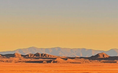
Above: A dry Nevada landscape. New research led by DRI scientists shows that atmospheric thirst is a persistent force in pushing Western landscapes and water supplies toward drought.
Credit: Riccardo Panella/DRI.
New study shows robust increases in atmospheric thirst across much of U.S. during past 40 years
Largest changes centered over Rio Grande region of Southwestern U.S.
Reno, Nev. (April 6, 2022) –In arid Western states, the climate is growing warmer and drier, leading to increased demand for water resources from humans and ecosystems. Now, the atmosphere across much of the U.S. is also demanding a greater share of water than it used to, according to a new study by a team from DRI, University of California, Merced, and Scripps Institution of Oceanography at UC San Diego.
The study was published in the Journal of Hydrometeorology and assessed trends in evaporative demand across the U.S. during a 40-year period from 1980-2020 using five datasets. Evaporative demand, sometimes described as “atmospheric thirst,” is a measure of the potential loss of water from the earth’s surface to the atmosphere based on variables including temperature, humidity, wind speed, and solar radiation.
The team’s findings showed substantial increases in atmospheric thirst across much of the Western U.S. during the past 40 years, with the largest and most robust increases in an area centered around the Rio Grande and Lower Colorado rivers. These regions have experienced changes on the order of two-to-three standard deviations from what was seen during the baseline period of 1980-2000.
“This means that atmospheric thirst conditions in parts of the country are now verging outside of the range that was experienced 20 to 40 years ago, especially in some regions of the Southwest,” said lead author Christine Albano, Ph.D., of DRI. “This is really important to understand, because we know that atmospheric thirst is a persistent force in pushing Western landscapes and water supplies toward drought.”
Figure showing changes in atmospheric thirst, measured in terms of reference evapotranspiration (mm), from 1980-2020. The largest changes are centered over the Rio Grande region of the southwestern U.S.
To learn more about the role that different climate variables play in determining atmospheric thirst, Albano and her colleagues analyzed the relative influences of temperature, wind speed, solar radiation, and humidity. They found that, on average, increases in temperature were responsible for 57 percent of the changes observed in all regions, with humidity (26 percent), wind speed (10 percent), and solar radiation (8 percent) playing lesser roles.
“This study shows the dominant role that warming has played on the increasing evaporative demand and foreshadows the increased water stressors the West faces with continued warming,” said study co-author John Abatzoglou, Ph.D., of University of California, Merced.
For farmers and other water users, increases in atmospheric thirst mean that in the future, more water will be required to meet existing water needs. Some of these changes observed in this study are centered over areas where warming temperatures and lower-than-average precipitation are already creating stress on water supplies.
For example, in the Rio Grande region, the study authors calculated that atmospheric thirst increased by 8 to 15 percent between 1980 and 2020. Holding all else equal and assuming no other changes in management, this means that 8 to 15 percent more water is now required to maintain the same thoroughly-watered crop.
“Our analysis suggests that crops now require more water than they did in the past and can be expected to require more water in the future,” said study co-author Justin Huntington, Ph.D., of DRI.
Other impacts of increased atmospheric thirst include drought, increased forest fire area, and reduced streamflows.
“Our results indicate that, decade by decade, for every drop of precipitation that falls, less and less water is likely to drain into streams, wetlands, aquifers, or other water bodies,” said study co-author Michael Dettinger, Ph.D., of Scripps Institution of Oceanography and DRI. “Resource managers, policy makers, and the public need to be aware of these changes and plan for these impacts now and into the future.”
Members of the team are now developing seasonal to sub-seasonal forecasts of evaporative demand.
“We anticipate these types of forecasts will be important for drought and fire forecasting applications,” said study co-author Dan McEvoy, Ph.D., of DRI.
Additional information:
The full text of the study, A multi-dataset assessment of climatic drivers and uncertainties of recent trends in evaporative demand across the continental U.S., is freely available from the Journal of Hydrometeorology: https://journals.ametsoc.org/view/journals/hydr/23/4/JHM-D-21-0163.1.xml
The study team included Christine Albano (DRI), John Abatzoglou (UC Merced), Daniel McEvoy (DRI), Justin Huntington (DRI), Charles Morton (DRI), Michael Dettinger (Scripps Institution of Oceanography/DRI), and Thomas Ott (DRI).
This research was funded by the Sulo and Aileen Maki Endowment Fund to the Desert Research Institute’s Division of Hydrologic Sciences, the National Oceanic and Atmospheric Administration (NOAA) California-Nevada Climate Applications Program (NA17OAR4310284), NOAA National Integrated Drought Information System California-Nevada Drought Early Warning System (NA20OAR4310253C), the NASA Applied Sciences, Water Resources Program (NNX17AF53G), the U.S. Geological Survey Landsat Science Team (140G0118C0007), and USDA-NIFA project (2021-69012-35916).
###
About DRI
The Desert Research Institute (DRI) is a recognized world leader in basic and applied environmental research. Committed to scientific excellence and integrity, DRI faculty, students who work alongside them, and staff have developed scientific knowledge and innovative technologies in research projects around the globe. Since 1959, DRI’s research has advanced scientific knowledge on topics ranging from humans’ impact on the environment to the environment’s impact on humans. DRI’s impactful science and inspiring solutions support Nevada’s diverse economy, provide science-based educational opportunities, and inform policymakers, business leaders, and community members. With campuses in Las Vegas and Reno, DRI serves as the non-profit research arm of the Nevada System of Higher Education. For more information, please visit www.dri.edu.
About UC Merced
UC Merced opened in 2005 as the newest member of the University of California system and is the youngest university to earn a Carnegie research classification. The fastest-growing public university in the nation, UC Merced is on the cutting edge of sustainability in campus construction and design and supports high-achieving and dedicated students from the underserved San Joaquin Valley and throughout California. The Merced 2020 Project, a $1.3 billion public-private partnership that is unprecedented in higher education, nearly doubled the physical capacity of the campus with 11 buildings earning Platinum LEED certification.
About Scripps Oceanography
Scripps Institution of Oceanography at the University of California San Diego is one of the world’s most important centers for global earth science research and education. In its second century of discovery, Scripps scientists work to understand and protect the planet, and investigate our oceans, Earth, and atmosphere to find solutions to our greatest environmental challenges. Scripps offers unparalleled education and training for the next generation of scientific and environmental leaders through its undergraduate, master’s and doctoral programs. The institution also operates a fleet of four oceanographic research vessels, and is home to Birch Aquarium at Scripps, the public exploration center that welcomes 500,000 visitors each year.
About UC San Diego
At the University of California San Diego, we embrace a culture of exploration and experimentation. Established in 1960, UC San Diego has been shaped by exceptional scholars who aren’t afraid to look deeper, challenge expectations and redefine conventional wisdom. As one of the top 15 research universities in the world, we are driving innovation and change to advance society, propel economic growth and make our world a better place. Learn more at ucsd.edu.
Jan 22, 2019 | News releases, Research findings
Reno, Nev. (January 22, 2019): For meteorologists, effectively communicating weather forecasts and their related dangers is essential in maintaining the health, safety, and resilience of communities. A new study published by a team of researchers from the University of Nevada, Reno (UNR), the Desert Research Institute (DRI), and the National Weather Service (NWS) Reno suggests that effective communication isn’t only about sharing information on upcoming weather events—it’s about building trust and common ground between forecasters and the public.
A common focus of science communication research is the difficulty of communicating technical information about weather forecasts to the public, including the likelihood that the forecasted events will actually come to pass. However, personal risks and uncertainty about potential impacts also affect how people respond to and act upon information about subjects like weather forecasts.
In a study published in the Bulletin of the American Meteorological Society, researchers sought to investigate the effect of personal uncertainties on people’s responses to weather forecasts by analyzing posts by the NWS Reno on Facebook. Researchers analyzed a total of 470 Facebook posts by the NWS Reno and 6,467 user comments on the posts about high impact weather events from January to May 2017. This range overlapped with the Reno area’s record wet period during from October 2016 to April 2017, a time when the region’s residents were impacted by several high impact weather events.
The team’s analysis showed that the public’s uncertainty about weather forecasts isn’t usually technical—more often, it’s personal.
“The NWS Reno’s Facebook community engages far less with the technical uncertainties of forecasts than with the personal risks implied in those forecasts,” said Kathryn Lambrecht, Ph.D., lead author on the study and Assistant Director of the Composition and Communication in the Disciplines program at UNR. “People in this community frequently use the NWS posts to share their own experiences with weather, express concern, and reach out to family and friends, not to calculate the technical likelihood of a forecast.”
What’s more, this study’s results showed that posts that used “commonplaces”—or expressions of common values or norms among a community—generated the strongest responses, many of which acknowledged a connection or understanding between the NWS Reno and its followers on Facebook.

Most of the population in the Reno area is located in valleys where it only snows occasionally. Feet of snow can fall in the higher elevations of the Sierra Nevada with the Reno area receiving little to no snow accumulation, so the public often asks “Is it really going to snow down here [in the valley]?” The commonplace “down here” was added to what became a widely shared and commented forecast graphic on the NWS Reno Facebook page.
“Commonplaces speak the language of the community,” explained Ben Hatchett, co-author on the study and assistant professor of atmospheric science at DRI. “We found that the posts using shared language in forecasts helped build a feeling of solidarity among the NWS Reno and followers. Perhaps more importantly, this encouraged sharing of forecasts between users through tagging and comments, broadening the distribution of the posts.”
Because high-impact weather events can severely impact life and property, it is imperative that the public trusts the information coming from the National Weather Service or emergency managers. Commonplaces, this study revealed, can be an effective way for forecasters to build trust with the community and encourage behavioral changes—like changing driving routes or stocking up on sandbags—that ultimately promote public safety.
From here, the team is considering applying for more funding in order to scale up their research and see if their results are consistent in other regions beyond the Reno area.
Researchers on this study included a meteorologist, an atmospheric scientist, a STEM education expert, and a pair of rhetoricians, scholars who study how communication forms communities—an unusual combination of disciplines.
“Past research has shown that science communication benefits from bringing together multiple types of expertise,” Hatchett said. “Our group came together organically, and the result was a highly transdisciplinary project. Personally, I think it is one of the most unique and collaborative projects I have been a part of, which made it even more fun.”
This project was supported by the Nevada NASA Space Grant Consortium and the Desert Research Institute.
The full study, titled “Improving Visual Communication of Weather Forecasts with Rhetoric” is available online from the Bulletin of the American Meteorological Society: https://journals.ametsoc.org/doi/abs/10.1175/BAMS-D-18-0186.1
###
The Desert Research Institute (DRI) is a recognized world leader in basic and applied interdisciplinary research. Committed to scientific excellence and integrity, DRI faculty, students, and staff have developed scientific knowledge and innovative technologies in research projects around the globe. Since 1959, DRI’s research has advanced scientific knowledge, supported Nevada’s diversifying economy, provided science-based educational opportunities, and informed policy makers, business leaders, and community members. With campuses in Reno and Las Vegas, DRI is one of eight institutions in the Nevada System of Higher Education.
Nevada’s land-grant university founded in 1874, the University of Nevada, Renoranks in the top tier of best national universities by U.S. News and World Report and is steadily growing in enrollment, excellence and reputation. The University serves nearly 22,000 students. Part of the Nevada System of Higher Education, the University is home to the University of Nevada, Reno School of Medicine, University of Nevada Cooperative Extension and Wolf Pack Athletics. Through a commitment to world-improving research, student success and outreach benefiting the communities and businesses of Nevada, the University has impact across the state and around the world. For more information, visit www.unr.edu.
Jan 22, 2019 | News releases, Research findings
Reno, Nev. (Jan. 22, 2018): Many Western communities rely on snow from mountain forests as a source of drinking water – but for scientists and water managers, accurately measuring mountain snowpack has long been problematic. Satellite imagery is useful for calculating snow cover across open meadows, but less effective in forested areas, where the tree canopy often obscures the view of conditions below.
Now, a new technique for measuring snow cover using a laser-based technology called lidar offers a solution, essentially allowing researchers to use lasers to “see through the trees” and accurately measure the snow that lies beneath the forest canopy.
In a new study published in Remote Sensing of the Environment, an interdisciplinary team of researchers from Desert Research Institute (DRI), the University of Nevada, Reno (UNR), the California Institute of Technology’s Jet Propulsion Laboratory, and California State University described the first successful use of lidar to measure snow cover under forested canopy in the Sierra Nevada.
“Lidar data is gathered by laser pulses shot from a plane, some of which are able to pass light through the tree canopy right down to the snow surface and create a highly accurate three-dimensional map of the terrain underneath,” explained lead author Tihomir Kostadinov, Ph.D., of California State University San Marcos, who completed the research while working as a postdoctoral researcher at DRI. “Passive optical satellite imaging techniques, which are essentially photographs taken from space, don’t allow you to see through the trees like this. We are only starting to take full advantage of all the information in lidar.”

Rowan Gaffney (UNR) surveying the amount of snow at Sagehen Creek Field Station during the NASA airborne campaigns in March 2016. Credit: A. Harpold.
In this study, researchers worked with NASA’s Airborne Snow Observatory to collect lidar data at the University of California, Berkeley’s Sagehen Creek Field Station in the Sierra Nevada by aircraft on three dates during spring of 2016 when snow was present. Additional lidar data and ground measurements facilities by the long-term operation of Sagehen Creek field station were critical to the success of the study.
Analysis of the datasets revealed that the lidar was in fact capable of detecting snow presence or absence both under canopy and in open areas, so long as areas with low branches were removed from the analysis. On-the-ground measurements used distributed temperature sensing with fiber optic cables laid out on the forest floor to verify these findings.
Tree canopies interact with the snowpack in complex ways, causing different accumulation and disappearance rates under canopies as compared to open areas. With the ability to use lidar data to measure snow levels beneath trees, snow cover estimates used by scientists and resource managers can be made more accurate. The importance of this advance could be far reaching, said team member Rina Schumer, Ph.D., Assistant Vice President of Academic and Faculty Affairs at DRI.
“In the Sierra Nevada, April 1st snow cover is what is used to estimate water supply for the year,” Schumer said. “Being able to more accurately assess snow cover is important for California and Nevada, but also all mountainous areas where snowpack is essential to year-round water supply.”
Snow cover estimates are also used by hydrologists for streamflow forecasts and reservoir management. Snow cover data is important to ecologists and biologists for understanding animal migration, wildlife habitat, and forest health, and it is useful to the tourism and recreation industry for informing activities related to winter snow sports.

Rose Petersky (UNR) surveying the amount of snow under the forest canopy at Sagehen Creek Field Station during the NASA airborne campaigns in April 2016. The photo clearly shows the reduced snow cover under the canopy that is difficult to measure with satellites. Credit: A. Harpold.
Although lidar data is currently collected via airplane and not easily accessible by all who might like to use it, the study team believes that information gleaned from this study could be used to correct data derived from satellite imagery, which is already widely available from NASA’s MODIS sensor and NASA/USGS’s Landsat satellites.
“This is proof of concept for the method that we think could really expand the extent that we measure snow at high resolution in forests,” said team member Adrian Harpold, Ph.D., Assistant Professor with the Department of Natural Resources at UNR. “I’m now working with a student to extend this approach across multiple sites to improve our understanding of the relationship between snow cover in the open versus under the tree canopy. Then, we hope to use that information to correct and improve satellite remote sensing in forested areas.”
This study was part of a larger NASA EPSCoR project titled Building Capacity in Interdisciplinary Snow Sciences for a Changing World, which aimed to develop new research, technology, and education capacity in Nevada for the interdisciplinary study of snowpack. Objectives included an educational goal of training the next generation of scientists.
“This project brought together people who look at snow from different scientific perspectives, and generated a conversation amongst us,” said Alison Murray, Ph.D., Research Professor at DRI and principal investigator of the NASA EPSCoR project. “In addition to bringing together expertise from three institutions in Nevada (DRI, UNR, and UNLV) in hydrology, remote sensing, geosciences, atmospheric chemistry and snow associated life, we developed strategic alliances with NASA’s airborne snow survey. Where the Nevada researchers might have been studying snow on our own, this interdisciplinary project allowed us to look at snow in an integrated fashion and make some important advances.”
The full study, titled Watershed-scale mapping of fractional snow cover under conifer forest canopy using lidar, is available online from Remote Sensing of the Environment: https://www.sciencedirect.com/science/article/abs/pii/S0034425718305467
The Desert Research Institute (DRI) is a recognized world leader in basic and applied interdisciplinary research. Committed to scientific excellence and integrity, DRI faculty, students, and staff have developed scientific knowledge and innovative technologies in research projects around the globe. Since 1959, DRI’s research has advanced scientific knowledge, supported Nevada’s diversifying economy, provided science-based educational opportunities, and informed policy makers, business leaders, and community members. With campuses in Reno and Las Vegas, DRI serves as the non-profit research arm of the Nevada System of Higher Education. Learn more at www.dri.edu, and connect with us on social media on Facebook, Instagram and Twitter.
Northern Nevada Science Center
2215 Raggio Parkway
Reno, Nevada 89512
PHONE: 775-673-7300
Southern Nevada Science Center
755 East Flamingo Road
Las Vegas, Nevada 89119
PHONE: 702-862-5400
Jan 3, 2019 | News releases, Research findings
Reno, Nev. (January 3, 2018): To protect communities in arid landscapes from devastating wildfires, preparation is key. New research from the Desert Research Institute (DRI) in Reno may aid in the prevention of large fires by helping meteorologists and fire managers in the Southwestern U.S. to forecast periods of likely wildfire activity.
Each summer, from June through September, a weather pattern called the North American monsoon brings thunderstorms to the Southwestern U.S., with lightning that often sparks wildfires.
The new study, which published in the International Journal of Climatology, examined twenty common weather patterns that occur during the North American monsoon season, and identified relationships between certain weather patterns and times of increased fire activity.
One of the most problematic weather patterns, the team learned, was when dry and windy conditions gave way to lightning storms in May and June – a time when fuels tended to be at their driest and monsoon rains had not yet soaked the region with added moisture. When lightning storms were followed by another hot, dry, windy period, increased fire activity was even more likely.
“A lot of fire meteorologists know from experience that this is how things happen, but our study actually quantified it and showed how the patterns unfold,” said lead author Nick Nauslar, Ph.D., who completed this research while working as a graduate student at DRI under Tim Brown, Ph.D. “No one had ever really looked at large fire occurrence in the Southwest and how it related to atmospheric patterns.”
To identify problematic weather patterns, Nauslar and his team looked at monsoon season weather data collected from April through September over the 18-year period from 1995-2013. They then classified wildfire activity over the same period into days or events that were considered “busy” by fire managers in their study area, and used an analysis technique called Self-Organizing Maps to detect relationships between the two datasets.
In addition to identifying relationships between specific weather patterns and fire activity, their analysis also looked for patterns in wildfire occurrence and fire size throughout the season. Analysis of more than 84,000 wildfires showed that although July was the month that the most wildfires occurred, wildfires that occurred during the month of June (prior to the arrival of much monsoonal moisture) were more likely to develop into large fires. In July and August, when the heaviest monsoonal precipitation typically occurs, the percentage of fires that developed into large fires decreased.
“Our goal with this study was to provide fire weather meteorologists in the region with information to help inform fire forecasts, and I think we were able to identify some important patterns,” said Brown, Director of the Western Regional Climate Center at DRI.
Nauslar, who is now employed as a mesoscale assistant and fire weather forecaster for the National Oceanic and Atmospheric Administration (NOAA) Storm Prediction Center in Norman, Oklahoma, hopes that the findings of this study will help fire managers in the Southwest to proactively identify periods when wildfires are more likely to occur, and to allocate firefighting resources accordingly.
“I think a lot of what we learned confirms forecaster experience about the types of atmospheric patterns that are problematic with regard to wildfire occurrence in the Southwest,” Nauslar said. “I hope that people in operations can really use this information, and help refine it and build upon it.
Other DRI scientists who contributed to this research included Benjamin Hatchett, Ph.D., Michael Kaplan, Ph.D., and John Mejia, Ph.D. The full study, titled “Impact of the North American monsoon on wildfire activity in the southwest United States,” is available online from the International Journal of Climatology: https://rmets.onlinelibrary.wiley.com/doi/abs/10.1002/joc.5899
The Desert Research Institute (DRI) is a recognized world leader in basic and applied interdisciplinary research. Committed to scientific excellence and integrity, DRI faculty, students, and staff have developed scientific knowledge and innovative technologies in research projects around the globe. Since 1959, DRI’s research has advanced scientific knowledge, supported Nevada’s diversifying economy, provided science-based educational opportunities, and informed policy makers, business leaders, and community members. With campuses in Reno and Las Vegas, DRI serves as the non-profit research arm of the Nevada System of Higher Education. Learn more at www.dri.edu, and connect with us on social media on Facebook, Instagram and Twitter.
Northern Nevada Science Center
2215 Raggio Parkway
Reno, Nevada 89512
PHONE: 775-673-7300
Southern Nevada Science Center
755 East Flamingo Road
Las Vegas, Nevada 89119
PHONE: 702-862-5400
Nov 16, 2018 | Announcements, News releases
Reno, Nev. (Nov. 15, 2018) – The Southwest Climate Adaptation Science Center (SW CASC), a collaborative partnership between regional research institutions and the United States Geological Survey (USGS), recently received a five-year, $4.5 million grant from the USGS to renew support for the center’s research on climate science and adaption throughout the region.
The SW CASC was established in 2011 to provide objective scientific information and tools that land, water, wildlife, and cultural resource managers and other interested parties could apply to anticipate, monitor, and adapt to climate change impacts in the southwestern United States. Based at the University of Arizona, the SW CASC is a consortium that also includes the Desert Research Institute; University of California, Davis; University of California, Los Angeles; Scripps Institution of Oceanography at UC San Diego; Colorado State University; and Utah State University.
With its renewed funding, the SW CASC will build on its almost seven years of collaborative research and outreach. Over the next five years, SW CASC researchers are aiming to produce new scientific information alongside decision makers and managers to help make more informed planning decisions about the region’s highest priority issues, including the allocation of resources.
“We go beyond the routine of academic research, where the goal is to advance knowledge by publishing peer-reviewed papers,” said Stephen Jackson, USGS director of the SW CASC and adjunct professor of geosciences and natural resources and environment. “I like to call what we do ‘research plus,’ because we do that, plus create various products that are directly useful to managers.”
The Southwest is an ecologically varied region, with ecosystems including deserts, mountains, forests, and coasts, hosting some of the most iconic vegetation and wildlife in the U.S. Since it encompasses the hottest and driest region of the U.S., the Southwest faces a number of challenges associated with rising temperatures, including record low snowpack, increased flooding, and extreme wildfires. Land and resource managers at every level of government need up-to-date, accessible research on these topics to be prepared for changes and to anticipate future challenges.
“Through the SW CASC, we’re actively broadening the pool of scientists engaged in research related to climate adaptation in the Southwest in order to provide more information and resources to drive the decision-making process” said Tamara Wall, Ph.D., deputy director of the Western Regional Climate Center (WRCC) at DRI and a Principal Investigator for SW CASC.
SW CASC’s portfolio of scientific resources directly available to managers includes the SCENIC web application, developed by WRCC scientists. A searchable database of climate information about the Southwest dating back to 1980, the SCENIC app allows users to visualize and analyze historic data such as precipitation and temperature as well as climate projections.
According to Wall, DRI researchers will soon be launching a new and improved SCENIC 2.0 application that will feature an improved user interface, graphic outputs, and quicker information processing.
For more information on the SW CASC, please visit: https://www.swcasc.arizona.edu.
Emily Litvack of the University of Arizona Research, Discovery, & Innovation Office contributed to this release.
###
The Desert Research Institute (DRI) is a recognized world leader in basic and applied interdisciplinary research. Committed to scientific excellence and integrity, DRI faculty, students, and staff have developed scientific knowledge and innovative technologies in research projects around the globe. Since 1959, DRI’s research has advanced scientific knowledge, supported Nevada’s diversifying economy, provided science-based educational opportunities, and informed policy makers, business leaders, and community members. With campuses in Reno and Las Vegas, DRI serves as the non-profit research arm of the Nevada System of Higher Education.
Sep 10, 2018 | Announcements, News releases
Reno, NV (Sept 10, 2018) – Scientists from the Western Regional Climate Center (WRCC) at the Desert Research Institute (DRI) in Reno, NV are pleased to announce the release of a long-awaited update to a climate mapping tool called the California Climate Tracker (https://wrcc.dri.edu/Climate/Tracker/CA/).
Originally launched in 2009, the California Climate Tracker was designed to support climate monitoring in California and allows users to generate maps and graphs of temperature and precipitation by region. The 2018 upgrade incorporates substantial improvements including a more user-friendly web interface, improved accuracy of information based on PRISM data, and access to climate maps and data that go back more than 120 years, to 1895.

The map above, created using California Climate Tracker, shows mean temperature percentile rankings for different climatological regions in California during June – August 2018. Credit: Dan McEvoy, DRI.
“One really significant change between the old and new versions of the California Climate Tracker is that in the previous version, you weren’t able to look at archived maps,” said Daniel McEvoy, Ph.D., Assistant Research Professor of Climatology at DRI and member of the Climate Tracker project team. “Now you can say for example, ‘I want to see what the 1934 drought looked like,’ and go back and get the actual maps and data from 1934. You can also look at graphs of the data and see trends in temperature and precipitation over time.”
In addition to providing historical and modern data for regions across California, this easy-to-use web-based tool can be used to produce publication-quality graphics for reports, articles, presentations or other needs. It can be accessed for free by anyone with a standard web browser and an internet connection.
“The California Climate Tracker was initially designed and developed for use by the California Department of Water Resources, but we hope it is also useful to a much broader community of water managers, climatologists, meteorologists and researchers in California,” McEvoy said.

The map above, created using California Climate Tracker, shows precipitation percentile rankings for various climatological regions in California during October 2017 – August 2018. Credit: Dan McEvoy, DRI
The recent upgrade to this tool was the work of Nina Oakley, Ph.D., Justin Chambers, and McEvoy, all of whom are part of the Western Regional Climate Center at DRI. The original version of the California Climate Tracker tool was developed at DRI and designed by John Abatzoglou, Ph.D., now of the University of Idaho, based on a system for identifying regional patterns of climate variability within the state of California that he developed with Laura Edwards, M.S, now State Climatologist and Climate Field Specialist for the South Dakota State Climate Office, and the late Kelly Redmond, Ph.D., former regional climatologist for WRCC and DRI.
The California Climate Tracker was built with support from and in collaboration with the California Department of Water Resources. The team is currently in the process of building a similar tool for Nevada and are seeking funding partners to sponsor that work.
To access the California Climate Tracker tool, please visit: https://wrcc.dri.edu/Climate/Tracker/CA/
For more information on the Western Regional Climate Center at DRI, please visit: https://wrcc.dri.edu
###
The Desert Research Institute (DRI) is a recognized world leader in basic and applied interdisciplinary research. Committed to scientific excellence and integrity, DRI faculty, students, and staff have developed scientific knowledge and innovative technologies in research projects around the globe. Since 1959, DRI’s research has advanced scientific knowledge, supported Nevada’s diversifying economy, provided science-based educational opportunities, and informed policy makers, business leaders, and community members. With campuses in Reno and Las Vegas, DRI serves as the non-profit research arm of the Nevada System of Higher Education. For more information, please visit www.dri.edu.
Dec 7, 2017 | News releases, Research findings
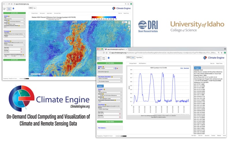
Reno, NV (Thursday, December 7, 2017): Working with large environmental datasets is a complex and time-consuming endeavor, often requiring huge amounts of data storage, specialized high-performance computers and technical knowledge. Climate Engine (ClimateEngine.org), a new, free web-based application created by a team of scientists at the Desert Research Institute (DRI), University of Idaho, and Google is aiming to change all of that.
New research published and featured on the cover of the November issue of the Bulletin of the American Meteorological Society (BAMS) outlines how Climate Engine improves the accessibility of climate and weather data by allowing users to create on-demand maps or graphs of various earth observation datasets using a standard web browser. Datasets are stored and processed in the cloud on the Google Earth Engine platform, eliminating the need for users to download, store and process large data files on their computers.
Climate Engine provides access to a variety of geospatial datasets that track vegetation, snow and water across the planet, as well as climate datasets that track temperature, precipitation and winds.
One of the web application’s greatest strengths, according to Dr. Justin Huntington, co-principal investigator of the Climate Engine project and associate research professor of hydrology at DRI, lies in the application’s ability to quickly and easily pair satellite imagery with different climate variables.
“We can process field-scale Landsat satellite imagery like we’ve never been able to before,” Huntington said. “For example, we can look at over 30 years of vegetation changes in a certain area and then pair those changes with the same historical record of climate, all within one platform, in a matter of seconds.”
In the paper Climate Engine: Cloud Computing and Visualization of Climate and Remote Sensing Data for Advanced Natural Resource Monitoring and Process Understanding, the authors describe the development, design and potential uses for this tool. The paper highlights various case studies related to drought, wildfire and agriculture, which each provide examples of how Climate Engine can be used to generate on-demand maps and time-series analyses of different conditions and extreme events.
The authors outline the capability of this cutting-edge tool to analyze temperature change in the Arctic, evaluate vegetation stress during a historic drought in the Great Plains, map fire danger and burned acreage in Idaho, monitor groundwater-dependent ecosystems in Nevada, and support famine early-warning efforts in Ethiopia.
Because Climate Engine is free and requires no specialized software to use, Huntington and his colleagues hope that it will be useful to researchers and decision-makers around the world.
“Our work allows decision makers unprecedented access to analyzing big data related to environmental monitoring on their desktops and tablets without needing a supercomputer by using cloud computing resources provided by Google,” said John Abatzoglou, co-principle investigator of Climate Engine and associate professor of geography at the University of Idaho. “The ability to analyze such data in real time will help fill an information void and improve our ability to sustain our environmental resources including water.”
After using the web application to create a map or graph, results can be downloaded or shared in common file formats, saving users hours of time that was once spent downloading and processing large data archives.
“That’s the beauty of Climate Engine,” Huntington said. “Instead of downloading archives to get to the answer, you can just download the answer.”
Climate Engine was originally unveiled at the White House Water Summit in 2016. In the time since the product launched, the web application has been used by more than 8,000 unique visitors across the globe.
Recently, Climate Engine team members Huntington and Dr. Katherine Hegewisch of the University of Idaho presented a talk at the Famine Early Warning System (FEWS) science meeting in Washington D.C., and Hegewisch hosted a workshop for African FEWS field scientists.
Climate Engine will also be on display at the upcoming American Geophysical Union Annual Fall Meeting in New Orleans. The event is the largest and preeminent Earth and space science meeting in the world.
In the future, the Climate Engine team plans to continue adding new datasets such as sea surface temperature and European satellite data. They are also planning to add agency-specific spatial averaging domains, such as agency management boundaries and crop zones, and also hope to continue expanding their education and outreach efforts.
The idea behind Climate Engine, says Huntington, is to make large datasets available to researchers, decision-makers, journalists, farmers, or anyone else who might benefit from the information – and in an easy-to-use, approachable and simple format.
Climate Engine was primarily funded by Google and federal programs of the National Integrated Drought Information System, Famine Early Warning System Network, U.S. Geological Survey’s Landsat Science Team, and Bureau of Land Management’s Nevada State Office.
For more information and use the Climate Engine web application visit – ClimateEngine.org
###
The Desert Research Institute (DRI) is a recognized world leader in investigating the effects of natural and human-induced environmental change and advancing technologies aimed at assessing a changing planet. For more than 50 years DRI research faculty, students, and staff have applied scientific understanding to support the effective management of natural resources while meeting Nevada’s needs for economic diversification and science-based educational opportunities. With campuses in Reno and Las Vegas, DRI serves as the non-profit environmental research arm of the Nevada System of Higher Education. For more information, please visit www.dri.edu.
The University of Idaho, home of the Vandals, is Idaho’s land-grant, national research university. From its residential campus in Moscow, UI serves the state of Idaho through educational centers in Boise, Coeur d’Alene and Idaho Falls, a research and Extension center in Twin Falls, plus Extension offices in 42 counties. Home to more than 11,000 students statewide, UI is a leader in student-centered learning and excels at interdisciplinary research, service to businesses and communities, and in advancing diversity, citizenship and global outreach. UI competes in the Big Sky Conference and Sun Belt Conference. Learn more at www.uidaho.edu.
Nov 17, 2017 | Announcements, News releases
Reno, NV (Friday, November 17, 2017): A climate research program led by scientists at the Desert Research Institute (DRI) and the Scripps Institution of Oceanography at the University of California, San Diego has received funding from the National Oceanic and Atmospheric Administration (NOAA) to improve the ability of decision makers in California and Nevada to prepare and plan for extreme weather and climate events such as drought, wildfire, heatwaves, and sea level rise.
NOAA’s Regional Integrated Sciences and Assessments (RISA) Program granted a total of $7.5 million in competitive research awards to four institutions in Arizona, New Mexico, California, and Nevada.
The California-Nevada Applications Program (CNAP), a DRI and Scripps collaboration that has spent more than 15 years understanding climate risks and providing cutting-edge climate science to stakeholders in the region, will receive $3 million over the next five years. CNAP has been part of the RISA program since 1999.
“We (CNAP) do both research and work as a boundary organization,” explains Tamara Wall, Ph.D., co-director of CNAP and deputy director of the Western Regional Climate Center at DRI. “We work with the people who produce climate information and the people who use it on a daily basis. Our online data tools, observational data, and publications make the climate information pipeline both wider and shorter, thereby making the climate data critical to on-the-ground decisions more accessible and easier to understand.”
With the new grant, the CNAP program will focus on climate-driven impacts related to water resources, natural resources, and coastal resources. This includes wildfire warnings and health impacts, sea-level rise and flooding, precipitation events in the Great Basin, climate information for underserved farmers, communication and coordination of the California/Nevada Drought Early Warning System, and research projects related to extreme precipitation, seasonal to sub-seasonal forecasting, and incorporation of new evaporative demand data into water management in Southern Nevada.
“The RISA program helps bridge the gap by partnering scientists and key decision makers,” said Dan Cayan, research meteorologist at Scripps and co-director of CNAP. “The goal is to have informed stakeholders who can use the latest research to anticipate, prepare for, and respond to climate impacts, and for our researchers to be able to directly support on-the-ground decisions to improve climate resiliency and inform policy.”
The new RISA funding will allow CNAP staff to work closely with communities, resource managers, land planners, public agencies, nongovernmental organizations, and the private sector to advance new research on how weather and climate will impact the environment, economy, and society. These teams will also develop innovative ways to integrate climate information into decision-making.
For more than 20 years, the RISA Program has produced actionable weather and climate research, helping to reduce economic damages that Americans face due to droughts, floods, forest fires, vector-borne diseases, and a host of other extreme weather impacts. A network of 11 RISA teams across the country works hand-in-hand with stakeholders and decision makers across the United States to ensure that research and information is responsive and able to effectively support responses to extreme events. The interagency National Integrated Drought Information System (NIDIS) co-funds drought components of these awards.
CNAP draws together climate and hydrologic expertise at Scripps with physical and social scientists from DRI, as well as other research institutions in California and Nevada. CNAP research teams have developed collaborations with key decision makers across both states. CNAP has worked closely with Washoe County Emergency Management office, California Energy Commission and has taken a leading role in the three completed and now fourth ongoing, California Climate Assessments. In addition, the team has collaborated with California Department of Water Resources on several of their climate focused efforts and plays a key role in supporting the California Nevada Drought Early Warning System (CA/NV DEWS).
CNAP teams also work closely with fire agencies throughout the West to help officials better understand relationships between climate and fire, build institutional knowledge of fire fighters, and provide tools and information to help inform fire agency decisions.
In Nevada, CNAP teams work with Great Basin tribes to understand barriers to climate data and has helped develop a resilience plan with Washoe County. Most recently CNAP is working with Southern Nevada Water Authority, Science Climate Alliance – South Coast, and the Bureau of Land Management (BLM) on climate related projects. RISA is a program in the Climate Program Office, within NOAA’s Office of Oceanic and Atmospheric Research.
More information about the RISA program and teams is available at http://cpo.noaa.gov/Meet-the-Divisions/Climate-and-Societal-Interactions/RISA/RISA-Teams.
Learn more about CNPA at – https://scripps.ucsd.edu/programs/cnap/cnap-program/
###
The Desert Research Institute (DRI) is a recognized world leader in investigating the effects of natural and human-induced environmental change and advancing technologies aimed at assessing a changing planet. For more than 50 years DRI research faculty, students, and staff have applied scientific understanding to support the effective management of natural resources while meeting Nevada’s needs for economic diversification and science-based educational opportunities. With campuses in Reno and Las Vegas, DRI serves as the non-profit environmental research arm of the Nevada System of Higher Education. For more information, please visit www.dri.edu.
Scripps Institution of Oceanography at the University of California San Diego, is one of the oldest, largest, and most important centers for global science research and education in the world. Now in its second century of discovery, the scientific scope of the institution has grown to include biological, physical, chemical, geological, geophysical, and atmospheric studies of the earth as a system. Hundreds of research programs covering a wide range of scientific areas are under way today on every continent and in every ocean. The institution has a staff of more than 1,400 and annual expenditures of approximately $195 million from federal, state, and private sources. Scripps operates oceanographic research vessels recognized worldwide for their outstanding capabilities. Equipped with innovative instruments for ocean exploration, these ships constitute mobile laboratories and observatories that serve students and researchers from institutions throughout the world. Birch Aquarium at Scripps serves as the interpretive center of the institution and showcases Scripps research and a diverse array of marine life through exhibits and programming for more than 430,000 visitors each year. Learn more at www.scripps.ucsd.edu and follow us at Facebook, Twitter, and Instagram.
At the University of California San Diego, we constantly push boundaries and challenge expectations. Established in 1960, UC San Diego has been shaped by exceptional scholars who aren’t afraid to take risks and redefine conventional wisdom. Today, as one of the top 15 research universities in the world, we are driving innovation and change to advance society, propel economic growth, and make our world a better place. Learn more at www.ucsd.edu.
NOAA’s Climate Program Office helps improve understanding of climate variability and change in order to enhance society’s ability to plan and respond. NOAA provides science, data, and information that Americans want and need to understand how climate conditions are changing. Without NOAA’s long-term climate observing, monitoring, research, and modeling capabilities we couldn’t quantify where and how climate conditions have changed, nor could we predict where and how they’re likely to change.