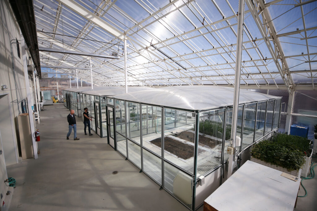
Jan 25, 2023 | Blog, Featured researchers
Lynn Fenstermaker: Celebrating a Career in Ecological Remote Sensing and NASA Space Grant Leadership
January 25, 2023
LAS VEGAS, NEV.
Lynn Fenstermaker
Remote Sensing
NASA Space Grant
Above: Always looking for NASA Mission relevant images, Lynn Fenstermaker took this photograph of the Neowise Comet with the Big Dipper above along the Lee Canyon Road in the Spring Mountains on July 18, 2020.
Credit: Lynn Fenstermaker/DRI.
Lynn Fenstermaker, Ph.D., recently retired from DRI after 32 years. Throughout her career as an ecologist and remote sensing scientist, she tackled large-scale questions about environmental stressors, including the impacts of climate change and wildfires on Great Basin and Mojave Desert ecosystems.
Her long list of career achievements includes serving as Director of the Nevada Space Grant Consortium and Nevada NASA EPSCoR, as well as two statewide research programs examining the effects of climate change: the Nevada Desert FACE Facility (NDFF) and the Mojave Global Change Facility (MGCF). She also acted as Director of the Nevada Climate-ecohydrological Assessment Network (NevCAN). Fenstermaker served on three national boards (National Space Grant Foundation, National Space Grant Council Executive Committee, and NASA EPSCoR Caucus) and a state board that governs the Nevada Institute for Autonomous Systems. At DRI, she served as Deputy Director of the Division of Earth and Ecosystem Sciences.
Fenstermaker – who was recently admitted to her high school’s hall of fame – shared some of the biggest projects of her career, plans for retirement, and the advice she would give to young scientists following in her footsteps.
Fenstermaker (with Eric Knight, UNLV) collecting multi-spectral images with UAS.
Credit: Lynn Fenstermaker/DRI.
DRI: What first brought you to DRI?
Fenstermaker: When I first came to Las Vegas, I had just wrapped up all but the writing for my master’s degree in agronomy at the Pennsylvania State University. I took a job with the EPA’s Remote Sensing Lab, where I got involved in a lot of projects all across the country, from Montana down through Nevada. (Note: Fenstermaker worked on the EPA’s first ever GIS project, which modeled groundwater contaminant plumes to identify the sources of contamination. This project helped demonstrate how GIS could produce useful information for the EPA).
After I finished my master’s in 1986, I moved to Las Vegas to take a job at Lockheed, where I worked for a little over two years. While I was there, I got to know the director of the Environmental Research Center at UNLV and worked there for three years. When I decided to leave, I created my position at DRI, which was initiating a cooperative agreement with the EPA lab here in Las Vegas. So, I said “Hey, I would like to do this work, but I’d like to do it in collaboration with the other remote sensing scientists at DRI.” The EPA said yes, so I sort of created my own position.
I’ve been at DRI ever since, and that’s been 32 years. Which doesn’t seem possible because I’m still young on the inside.
Fenstermaker’s nearly all-female PSU team competing at the National Soil Judging Contest in Nebraska. Fenstermaker is second from the right.
Credit: Lynn Fenstermaker/DRI.
DRI: What encouraged you to stay at DRI for so many years?
Fenstermaker: I like the flexibility of being able to take on different projects. Everyone who’s been at DRI for some length of time knows that funding can be challenging – there were times when I scrambled for funding, particularly when we lost the cooperative agreement with the EPA lab. It was at that time that I decided to go for my Ph.D., so I was working full time in a soft money environment, keeping myself fully funded, taking classes, and working on a dissertation – It took me 11 years to finish my Ph.D.
After my Ph.D. I thought about going to a university to teach and do research while having a hardwired salary. But then I talked with faculty about all the university stressors, and I thought, “Well, at DRI there’s only one big stressor – and that’s keeping yourself funded.” So, I networked a lot, and I think having a collaborative spirit really helped me to get involved in various projects, as well as my organizational skills.
DRI: Tell me about the NevCAN project.
Fenstermaker: NevCAN’s goals were to develop standardized infrastructure with real time data collection to measure and analyze the effects of climate variability and change on ecosystems and disturbance regimes. We also wanted to better quantify and model changes in water balance and supply under climate change.
Essentially, it’s a series of meteorological stations with common sensors across two mountain ranges in Nevada. The stations are centered within each ecosystem type. And we’re looking at weather variability and climate at different elevations.
We measure incoming solar radiation (long and shortwave), and incoming precipitation, as well as factors that affect that including wind speed, wind direction, and air temperature at different heights. We also measure soil moisture and soil temperature, and within vegetation, we measure the fate of the water: how much is transpired from trees or evaporated from the soil surface, how much went into deep leaching and potentially could enter the groundwater at some point in time.
Unfortunately, when you’re looking at climate variability and change, you can’t just measure for five years and say, voila – no, it’s long-term monitoring. And a lot of the federal agencies don’t want to pay for long term monitoring.
NevCAN transect locations in Nevada’s Snake Range.
Credit: Lynn Fenstermaker/DRI.
DRI: Can you describe some of your other large projects, the Desert FACE Facility, and the Mojave Global Change Facility?
Fenstermaker: The Desert FACE facility fumigated an intact ecosystem with elevated CO2 to determine plant and ecosystem response to the increased CO2. We published a Nature paper in 2014 that was pretty much a summary of the project data. What was interesting about this is that overall, we saw retention of carbon in the soil, not in the plant matter.
The Mojave Global Change Facility looked at what would happen with soil disturbance, nitrogen deposition and increased summer monsoon precipitation. Because earlier climate models predicted an increase in summer rain in the Mojave Desert due to global warming, we simulated increased summer precipitation. The models have since changed, and both the models and weather data clearly show that this isn’t the case. Monsoon flow is not bringing more summer precipitation into the Mojave Desert.
We’re maintaining both sites for future research, because they’re really unique, one-of-a-kind research sites in the world.
Fenstermaker hand-digging holes for rain gauges at the Mojave Global Change Facility.
Credit: Lynn Fenstermaker/DRI.
DRI: Tell me more about your work as the Director of Nevada NASA EPSCoR.
Fenstermaker: EPSCoR is the Established Program to Stimulate Competitive Research. It’s a program funded by Congress for states who receive less than 0.75% of all NSF research dollars, or less than 10% of all federal research dollars.
The history of this program is interesting. During World War II, there was a lot of buildup along the coasts of the United States. And a lot of industry was concentrating in these regions, and as universities started partnering with industry to build their programs, they got a lot of research dollars. Additionally, most of the NASA centers are located along the coast. There are only a few that are quasi- interior, like Glenn Research Center in Ohio, but the rest are in Virginia, Texas, California, and Louisiana. This is why the interior states largely got left behind. EPSCoR is a way of spreading out the funding to the interior states who do not have those industry collaborations or that rich history of developing unique research infrastructure capabilities. The states that primarily benefit are Nevada, New Mexico, Wyoming, Idaho, Missouri, Mississippi, South Carolina, Alaska, Montana, Nebraska, North and South Dakota, Vermont, and New Hampshire. The Nevada Desert FACE facility was a DOE EPSCoR project.
Fenstermaker served as the Director of Nevada NASA EPSCoR and the Nevada Space Grant Consortium.
Credit: Lynn Fenstermaker/DRI.
DRI: You also served as Director of the Nevada Space Grant Consortium. Can you talk a little about that?
Fenstermaker: NASA requires that in EPSCoR states, whoever is the Space Grant director also serves as that state’s NASA EPSCoR director. Space Grant is all about improving STEM education, so we run solicitations and review panels to make sub awards to Nevada faculty and students. Some of the most important solicitations we do are undergraduate research scholarships, graduate student fellowships, and student internships at NASA centers.
I convene a faculty review panel of at least three members, each one from a different Nevada System of Higher Education institution, to review all of the applications, then convene the panel and make the selection for who receives funding. I do the same for faculty awards. On the Space Grant side, we fund faculty to improve higher education or pre-college education. For both of those we have a hands-on training component for either college students or pre-college students. One of the successful programs has been a program where a UNR faculty member mentors at an engineering high school in Reno, and they build a human-powered rover to take to Huntsville, Alabama, to participate in national competitions. And every time they’ve gone, they’ve won one or more awards.
On the pre-college side, in addition to the hands-on training for students, we also fund teacher training. The DRI Science Alive team has been quite successful at applying for these funds.
So, I oversee all of that, and go to the national meetings: I’ve served on the National Space Grant Council Executive Committee, which is the group of directors from across the country that connects the Space Grant program to NASA’s Office of STEM Engagement. I’m handing over the role of Secretary of that Committee to Eric Wilcox, the incoming NV Space Grant and NV NASA EPSCoR Director.
DRI: What are your plans for retirement?
Fenstermaker: I’m going to exercise more, and I’ll continue to work part time. I’m going to try to wrap up things with NevCAN and with the Desert FACE and Mojave Global Change Facilities so they can remain intact and be passed forward.
I also started watercolor painting a couple of years ago, which is fun. And I’ll keep hiking and bicycling. Basically, I’ll be figuring out this transition as it happens.
DRI: What advice do you have for young researchers or young climate change scientists?
Fenstermaker: Not to have too high of expectations — I always compared myself with people that were putting out 200+ publications over the course of their career, and that’s just not who I am. It’s important to learn who you are and accept yourself, recognize your strengths, as well as where to challenge yourself — and to network. Communication is critical.
Don’t strive for perfection, or you’ll really disappoint yourself or fall behind. Just strive to meet your obligations and do it reasonably well. Also, you’ve got to schedule personal time, as well as work time. For example, if you’re going to a conference in a cool area, schedule a couple of days before or after and do a little sightseeing, take a significant other with you and make time for family and yourself so that you don’t burn out.
A young Lynn Fenstermaker presented 4-H projects on soil conservation, geology, fossils, and insects.
Credit: Lynn Fenstermaker/DRI.
DRI: Is there anything else you think is important?
Fenstermaker: A few more words of wisdom: Watch for windows of opportunity, because a lot of things I got involved in came from communicating with people who opened a window of opportunity for me, and I said yes.
Overall, DRI has been a great place to work, particularly at the Southern Nevada Sciences Center. It feels like family. It’s a great organization because you have the flexibility to go in a lot of different directions with your research, and work collaboratively across disciplines and across institutions, which is really rewarding.
Jan 17, 2023 | Blog, Featured researchers
Estom Yumeka Maidu Student Teaches DIY Air Filtration Techniques to Help Reservation Communities During Wildfire Season
January 17, 2023
RENO, NEV.
By Robin Smuda, Climate Reporter Intern
Air Filtration
Reservation Communities
Wildfire Season
Wildfires affect all in their way, from the places burned as fuel to the areas filled with smoke. Across the western U.S., climate change is leading to warmer, drier conditions and contributing to longer, more active fire seasons. In the Great Basin and other parts of the western U.S., indoor air filtration during wildfire season has become a problem. Many houses have no particulate filtration systems, and this is especially true on reservations. Possible solutions can be expensive and materials can be hard to obtain, but Piercen Nguyen and his colleagues Meghan Collins and Jade Nguyen of DRI have a proven solution.
HEALTH IMPACTS OF WILDFIRE SMOKE
Piercen Nguyen, DRI workshop intern and member of Enterprise Rancheria, Estom Yumeka Maidu Tribe, is a student at the University of Nevada, Reno, and became interested in the health impacts of wildfire smoke while working on a project for the Center for Genomic Medicine at DRI in Reno, Nev. Studying lung cell damage from prolonged episodes of wildfire smoke, he saw the physical effects of smoke on lung tissue.
According to Nguyen, the standard way of studying lung tissue involves using liquid smoke extracts introduced to the tissue. However, the team at DRI took a more realistic approach by “generating wildfire smoke and pumping it directly into an exposure chamber containing lung tissues,” Nguyen said.
Nguyen explains that they found that a type of cancer cell seemed to be resilient to wildfire smoke. They also found that wildfire smoke from different geographic areas has unique consequences on lung cell functions. This research had him thinking about the effects of smoke on communities. Back home in California, Nguyen’s community has been damaged by fires in the past, and his community members have been exposed to fire smoke heavily over time. People who rely on evaporative cooling systems have had to choose between overheating or breathing clean air, Nguyen said. Working with this project and seeing the effects of smoke on lung tissue sparked the idea to develop a usable solution for these communities.
Fire is an issue that hits very close to home for Nguyen. “There are tribal members, who have lost homes like, one person in my tribe lost their home twice to wildfires,” Nguyen said.
A PROBLEM MADE WORSE BY CLIMATE CHANGE
In the western U.S., fire has always been a part of life, but decades of fire suppression have led to unhealthy fuel buildups, and changes in climate such as increased drought and heat are contributing to longer and more active fire seasons. These effects of climate change touch the whole region. Wildfire smoke is harsh and dangerous for communities even if a fire is not threatening them. Communities have an exacerbated problem of poor air quality in these times, and some people need extra air filtration equipment for their homes.
Tools like the AirNow map show the dangers of fire and smoke in real-time. And regions like Northern Nevada have issues with fire danger and pollution from larger fires in Western areas. Recently the danger of this smoke has grown and stayed hazardous during summer and fall.
As seen in the graphics below, EPA air quality data from the summer and fall seasons of 2020 and 2021 in the Reno and Douglas County areas of Nevada show PM 2.5 reached “moderate” to “hazardous” levels for longer than any other period on record. PM2.5 is particulate matter that is less than 2.5 micrometers in diameter and is generated by various sources including wildfire smoke.
A tile plot generated from the EPA website shows a long period of “moderate” to “hazardous” air quality in Reno, Nev. during the summer and fall of 2020 and 2021. These were the most severe periods of poor air quality on record for this region, dating back to 1999.
In Douglas County, Nev., PM2.5 data has only been collected regularly since 2013, but patterns support what has been observed in Reno. Residents of Douglas County experienced long periods of “moderate” to “hazardous” air quality during late summer and fall of 2020 and 2021.
TRIBAL HOUSING CHALLENGES
Tribal housing infrastructure is very susceptible to issues like wildfire and smoke. Standing buildings are usually old designs that can have issues like lead paint and toxic flooring. They can be manufactured homes or trailers that are long past expected use. Elements like extreme cold and heat waves are an issue throughout the Great Basin, but many reservation homes are only equipped with woodfire stoves for heating, and swamp coolers, window units, or nothing for cooling.
On the Stewart colony of the Washoe Tribe of Nevada and California, most homes have nothing or swamp coolers for cooling air.
“So, people have to choose between either dealing with the heat or if it’s smokey outside, you know, just dealing with the smoke,” Nguyen said.
Using only low-cost materials that are easily found at a home improvement store like Home Depot, Nguyen learned how to make a simple air filtration system alongside the swamp coolers that were built into many reservation homes.
The do-it-yourself (DIY) filter system has been around a while, Nguyen remarked. The type of system he learned to build has been shown to be both effective and safe by the U.S. EPA {US, 2022, Research on DIY Air Cleaners to Reduce Wildfire Smoke Indoors}. The cost is under $50 and uses a box fan, cardboard, tape, and two air filters.
This design was made and chosen for keeping cost and complexity low. We also talked about manufactured air purifiers. Nguyen said most will work for smoke, just one must research the filter and have money for the cost.
BUILDING A DIY AIR FILTER
The price and availability of air filters are major issues for rural Tribal Communities, due to the distance many people would need to travel to buy supplies and the economics of the areas. This means many communities are staying at risk of wildfire smoke (and wildfires themselves).
For the last year, the researchers have been doing workshops on different reservations in Northern Nevada and Northern California to teach people how to build low-cost filtration systems for their homes. They received a grant in May of 2022 from the DRI Lander Endowment that allows them to provide the materials to these communities for free. So far, they have held 10 workshops that have helped 93 people build their own air filter systems.
In this workshop, DRI researchers provided materials to make a DIY air filter that utilized two filters to make a wedge shape. However, Nguyen adds that in a pinch, you can simply use a single filter fastened to a box fan and still get effective results. He adds that for safety reasons, it is crucial to use a box fan built in 2012 or later as manufacturer safety regulations have since been updated.
Watching a workshop at the Washoe Tribe’s Community Center at Carson Colony on September 15, 2022, the process was very easy.
Nguyen showed the group how to build an air filter using a box fan, a decent size cardboard sheet cut from the fan’s box (~1.5ft. on each side), two MERV 13 filters, and a few yards of Duct Tape or similar brand of tape. Triangular pieces were cut from the cardboard, and then all was assembled. So simple that personal touches were naturally added: showing the graphic from the box or not; what tape color, and where the cable should come out for their house.
PHOTOS: THREE STEPS TO BUILDING A DIY AIR FILTER
Step 1: Tape two filters together using duct tape.
Step 2. Stand the filters on end, and tape them to a box fan in a triangular arrangement.
Step 3: Cut a triangular piece of cardboard to fit the top of the air filtration system. Attach with tape.
IMPROVING YOUR HOME’S AIR FILTRATION
Whether you live in a house, apartment, or another type of housing, if your home does have an air filtration system, it is important to know that filter quality is important. Filters are labeled by particles filtered: one is weakest, and 20 is strongest. The EPA recommends a better filter for filtering out smoke. However, you cannot just add thicker filters to your wall AC unit or central air system because that could damage the system. Additionally, two other rating systems are commonly used to classify filter quality: MPR and FPR. In these cases, it is recommended to use FPR 10 or MPR 1500 or better.
Filters work physically collecting certain size particulates, and filtration systems are designed for specific filter sizes. When we inspected the filters in our homes, Nguyen and I both found that our filters were the weakest possible – like looking through a sheet of paper — and probably not helping effectively during fire season.
There are a few different filter types available. HEPA filters are the gold standard and can remove most smoke particulates. However, availability can be an issue even in large population centers. Nguyen explained that during periods of heavy smoke, places like Home Depot run out and he has had to try and order cases that are on backorder.
Air filters also need to be replaced regularly. According to Nguyen, they should be replaced every three to six months, or possibly more often during periods of heavy smoke. He recommends checking air filters every month during fire season, and potentially replacing them monthly if you notice a visual change such as discoloration from the particulates being filtered.
“People have had an overwhelmingly positive response to the workshops,” Nguyen said. He added that several people expressed their excitement to use the DIY air purifiers to improve the air quality for both themselves and loved ones who may experience conditions like asthma or COPD. Workshop attendees also remarked to Nguyen and colleagues how helpful the DIY air purifiers were in combating hazardous downwind air quality resulting from the Northern California Mosquito wildfire event in the months of September and October 2022.
Piercen Nguyen, member of Enterprise Rancheria, Estom Yumeka Maidu Tribe, teaches a workshop on air quality and air filtration.
Credit: Provided by Piercen Nguyen.
Dec 21, 2022 | Blog, Featured researchers
Tim Minor: Celebrating a Career in GIS and Remote Sensing
DECEMBER 21, 2022
RENO, NEV.
Tim Minor
GIS
Remote Sensing
Above: Minor piloting a drone; he is a FAA-certified Remote Pilot in Command.
Tim Minor, M.A, recently retired from DRI after 31 years. His successful career as a geographic information systems (GIS) and remote sensing scientist brought him to DRI in 1991; he served as Deputy Director of DEES from 2012 to 2018, and Interim Executive Division Director of DEES from 2018 to 2021.
Minor’s work uses satellite and drone imagery to map and analyze invasive species, surface disturbance, ground water resources, and mountain watershed water quality, among many other applications. He is a FAA-certified Remote Pilot in Command, and he taught introductory and advanced courses in GIS applications and image processing methods.
DRI sat down with Minor to discuss his long career as a scientist and competitive runner, his career highlights (featuring a Ghanaian marathon), and his advice for young scientists (including his own son, Blake, an associate research scientist in DHS).
Minor conducting field work with DRI biologist Mary Cablk, whom he frequently worked alongside.
DRI: What first brought you to DRI?
Minor: Well, I grew up in Pacific Grove, California, and went to Monterey Peninsula College, and then got a scholarship to come to the University of Nevada. I only stayed two years, finished off my degree and went back to grad school at U.C. Santa Barbara. I got an offer to come up to Reno in 1989 to work for a mining company that needed a geologic remote sensing person. While I was working for them, I started meeting some people from DRI, and I just thought it was an amazing place.
There was a guy named Jonathan Davis who was a mentor of mine. He was one of my teachers at UNR and I was really looking forward to working with him, Dave Mouat, and some of the other amazing people at DRI. I didn’t know quite how that would work, but things just kind of fell in place. I got a job at DRI in 1991.
The sad part was that I was really looking forward to working with Jonathan Davis — his wife worked with me at my mining company — but they were involved in a horrible car accident a couple of months before I got to DRI; Jonathan was tragically killed. We have a Jonathan Davis scholarship in DEES in his name.
DRI: And you’ve been at DRI ever since?
Minor: Yep, I stayed at DRI for 31 years. I think one of the things that really helped me is that in the GIS/remote sensing field, there are opportunities to work on a lot of diverse projects. I started off working on an air quality project, and then I started doing a lot of stuff with water, biology, and vegetation. And it just kind of took off from there — it was very rewarding.
You know, I have a master’s degree, not a Ph.D. So, despite everyone calling me doctor all these years, I’m not. What I hope to have inspired here is that with your master’s, you can still go pretty far at DRI. I’m pretty proud of the fact that I became a director with a master’s.
I never really felt a ton of pressure to get my PhD. I was also still competing a lot – I was still running very seriously in the 90s and into the 2000s, so I had to make some choices. And I chose to continue to be a runner and have a career on that side instead of going after the Ph.D.
A newspaper clipping from the Reno-Gazette Journal that covered Minor’s 1993 marathon race in Ghana. Minor finished in 9th place with only 3 hours of sleep in the preceding two days due to traveling.
DRI: Tell me more about your competitive running career.
Minor: I ran competitively for a long time, from the time I was 15 to age 51. I ran for Nevada as an undergrad and then I just kept going.
DRI: What inspired you to become a specialist in remote sensing?
Minor: I’ve always been a map freak. I think since I was four or five years old, I was the geeky kid in the back of the car telling my mom and dad where to go because I was looking at maps. I was just fascinated by spatial relationships. People talk about cognitive mapping and our brains and I just always loved thinking about, “Okay, where are we going, and how do we get there?” But I didn’t know what I could do with that. I remember as I got to junior college, I was like, “What am I going to really do? Is there anything you could do with this stuff?” And that’s kind of when remote sensing was starting to really take off and become a science unto itself. And then of course, GIS came along later, but the key for me was taking remote sensing classes at UNR back in the late 70s. And that got me even more excited about it and the possibilities.
But what really helped me take off was UC Santa Barbara. Santa Barbara was way ahead of its time in terms of quantitative spatial analysis in geography. Every job I’ve gotten has been a UCSB connection, even at DRI.
DRI: What are some of your career highlights?
Minor: The biggest highlight goes all the way back to ’93 through ’98, when I was working on the Hilton Foundation projects with World Vision doing water development in developing countries. In 1993, I went to Ghana, West Africa and participated in some of the initial fieldwork that was involved in trying to develop better drinking water access for small villages in the central part of Ghana. And it was the most amazing experience.
I started off things with a bang in ‘93. I got off the plane and slept that night, and then the next morning ran a marathon. There was a marathon going on in the capital of Accra and one of my colleagues who was already there had signed me up. I thought he was just joking and I didn’t even know it was a full marathon, it was a little crazy. I couldn’t drink the water at the aid stations, so they had to drive around and give me water, but they got lost. So, it got a little hot as you can imagine. But talk about total immersion right off the bat. I just fell in love with the country and the people.
I love everything that came out of that. I showed my daughter, Emily, the pictures from Ghana and shared my experiences. And when she graduated from high school, she went over and worked in an orphanage in Ghana and just loved it herself. So, it was a really cool family legacy thing. As for the project itself, you know, sometimes in research, you wonder “What is this really doing for people? How is it impacting society? How is it impacting people and helping them?” Well, something like drilling a water well in a small village that can totally change the quality of the water and the quality of the life was pretty impactful. Without a doubt that was the best thing I was ever involved in.
DRI: Tell me more about the project in Ghana.
Minor: Well, it was unique in that it was a partnership, with Ghanaians basically running the program there. So many times with some of these projects in developing countries, you have people who want to do well but it ends up getting a little cloudy. We saw programs where other European countries had come in and tried to build mechanized wells, but the problem was that when they broke down, nobody would come to fix them. So, they were just gathering cobwebs and dust. The World Vision’s trick was to build simple hand pump wells, and they taught the villagers how to repair them. Our role was basically putting the x’s on the ground — we were telling them based on our geophysics and our remote sensing and our hydrologic knowledge, this is probably the best place to drill. Other projects would often just drill in the center of the village without any real forethought about the best hydrological position. And because it was hand pumps, water tables had to be relatively shallow, right? They couldn’t be super deep wells.
DRI: Are these wells still in use?
Minor: Very much so, yes. Braimah Apambire is involved with this project and he’s done some amazing things. And so yes, a lot of those wells and things are still active and still going. It’s pretty cool.
Tim Minor speaking with students at a STEM camp held at the University of Nevada, Reno in September.
DRI: How have things changed since you first started your career?
Minor: Well, let’s start with the science itself. Back in the day — and I really feel like an old geezer when I talk about this — computing power wasn’t what it is now. And I share this with my son Blake, who is a hydrologist at DRI in DHS – he’s got an office 50 feet away from the cube I’m in now. And it’s a little surreal that he is an assistant research scientist at DRI, but he’s been working at DRI for almost nine years because he started as an undergrad. I always joke with him that he has no idea how good he has it, with Earth Engine and the processing power he has at his fingertips. What takes him a few minutes to do now literally used to take me days.
The advancement of computer technology, the cloud and all the other computing power that’s out there, it’s just absolutely revolutionized the science of remote sensing, GIS, and spatial analysis. To watch that over my 41 years of working has just been unbelievable.
I love where DRI has gone. I’ll be very frank because I was on the Diversity Committee, but I’m encouraged to see that we’re finally reaching some diversity goals that I think we could actually feel good about. We’ve still got a ways to go, definitely. I really respect my longtime female colleagues at DRI — they’re very much pioneers in what they do. I think it’s so fantastic that we are finally getting there. You know, it’s just taken a long time.
In general, I like the diversity at DRI and how it’s evolved. I always thought that was one of our strengths, and one of our biggest selling points, our scientific diversity. One of the huge advantages I had as a GIS/remote sensing expert is all these different science disciplines use GIS and remote sensing in different ways. So, one day I would be working with the hydrologists, and the next day with the air quality folks, and the next day with the biologists. It’s just a really cool place for me to work and I think it’s one of the ways I was able to sustain my funding, by staying diversified. When I became a director, I told people all the time, “The key to us surviving at this place is diversification.” Both within your scientific discipline, but also thinking outside your discipline and how you may be able to work with others.
DRI: How has working at DRI impacted your scientific research and network?
Minor: The network’s been amazing. We used to joke about ourselves being the Santa Barbara mafia. We’ve always had this pretty good network, if you will, of all these people from Santa Barbara who have gone off and worked in all kinds of amazing places, and DRI just added to that exponentially. The connectivity and the networking I’ve been able to do across the world has been astounding. I’m just amazed at all the wonderful people I’ve been able to work with from countries like Brazil and Ghana, Israel and Europe, Canada, Mexico, Australia, China. It’s just been phenomenal. It’s incredible how your network just expands worldwide.
DRI: What advice do you have for young scientists?
Minor: Diversify. You know, I would tell people to do what I didn’t do – don’t be in such a rush. Do a little gap program. Go check things out. Go travel. And when you travel, maybe go visit a science center and see what they’re doing, it helps establish your future network. Learn a language. It’s fantastic, it helps with everything. Work on your math skills. Math and stats, those will take you a long way, especially in my particular field, statistics was so valuable. But the biggest thing is diversifying — get a minor in something. I think that’s what’s really important. Don’t be so siloed in with how you professionally identify yourself.
DRI: Do you speak another language?
Minor: A little bit of French, and one of the goals I have now that I’m retired is to get much better with Spanish.
DRI: That’s a great goal. That also feeds into my next question: what are your plans for retirement?
Minor: Well, become better at Spanish, and travel. Just in the last eight months, we went to Europe and did a bike tour, and took my parents to Kauai. And then we went to Sayulita, Mexico to do a little surfing.
We have a trailer so we’re going to be doing a lot of camping. I used to coach high school cross country and track for nine years, and I may go back to coaching because there are many aspects of it I enjoyed. My wife Shannon and I are race directors for Moms on the Run, a local charity race that supports cancer survivors. That keeps us pretty busy in the winter and spring.
Also, I’m doing the classic DRI semi-retirement, so I’m coming back January 3rd as an hourly. I’m very involved in the Integrated Terrain Analysis Program. I did a phased retirement, and what it taught me is I love science too much — I don’t want to just completely walk away.
DRI: Is there anything else you think is important that we didn’t discuss?
Minor: Well, I’ve always had a goal to work with Blake on a project. It’d be pretty cool to work with my son.
It’s just been a fantastic adventure. All the things I’ve gotten to do, if I’m writing up my life story – DRI was such a catalyst for some amazing experiences. I wouldn’t trade it for anything. It was a little scary when I ventured into the administrative realm. I got voted in as a deputy director, and then years later I was suddenly interim director. But I wouldn’t trade any of that because as a director I got to find out about all the other unique things people were doing, within our own division and across the institute. You know, things that you sometimes aren’t aware of when you’ve got your head down and are focused on your own research. It was just amazing to see what people were doing.
Nov 21, 2022 | Announcements, News releases
Scientists Uncover Conditions Key to Formation of the Great Barrier Reef
November 21, 2022
RENO, Nevada
K’gari
Sand Island
Great Barrier Reef
Above: Fraser Island, off Australia’s eastern Queensland coast, is the world’s largest sand island, stretching over 120km. Photo by John Natoli, istock.com.
Credit: John Natoli, iStock Photo.
New research shows that the growth of K’gari, the world’s largest sand island, was crucial for creating the clear waters that allowed the Great Barrier Reef to flourish.
Australia’s famed Great Barrier Reef is known for being the world’s largest coral reef – overflowing with marine life, it is the only living thing visible from space. Scientists have long sought to understand the conditions that led to the reef’s formation, as conditions seemed suitable long before the reef’s birth. Now, a new study claims the answer might be K’gari, the world’s largest sand island (also known as Frasier Island).
Nick Patton, Ph.D., a postdoctoral researcher now at DRI, teamed up with an international group of researchers from Sweden, New Zealand, Australia, and the United States for the study published Nov. 14 in Nature GeoScience. Their research showed that the sand island formed between 700,000 and 800,000 years ago, and that the reef was only able to establish once the island protected it from the northern flow of sand that naturally occurs in this area.
“The Great Barrier Reef is the world’s largest coral reef ecosystem, yet what I find so interesting is that we still do not really know what caused its initial inception,” says Daniel Ellerton, Ph.D., of Stockholm University and the study’s lead author. “Previous research has highlighted that several mechanisms are likely responsible and here we demonstrate an additional factor that should be considered.”
K’gari juts out like a finger from Australia’s eastern coast below the far southern reach of the Great Barrier Reef. The island itself is a UNESCO World Heritage area, covered with lush rainforest and freshwater dune lakes. It formed as wave action carried sediment north along the coast. As the sediment accumulated, the island formed a barrier that protected the coastal region to the north. Without the island, the coral reef would be covered in this drifting sand.
The timing of the island’s formation is due to a major shift in the Earth’s climate called the Mid-Pleistocene Transition, which saw glacial cycles extend from about 40,000 years to around 100,000. The longer cycle allowed for ice caps to grow larger, decreasing sea levels across the planet.
“Our work highlights how changes in sea-level variability approximately 700,000 years ago directly caused a dramatic reorganization of the coast and the formation of the Great Barrier Reef, as we know it today,” says Patton.
There is evidence that the Great Barrier Reef is around 650,000 years old, supporting the theory that K’gari directed sand away from Australia’s northeastern coast, providing the clear waters needed for coral growth.
To determine the age of K’gari, the researchers used a method called optically stimulated luminescence dating. This method provides an age estimate for the last time that sediments, like quartz sand, were exposed to light.
“These large coastal dune fields have rich geologic and climatic archives that provide important information on Earth’s history,” Patton says.
The research team engaged with the traditional inhabitants of K’gari and the adjacent Cooloola Sand Mass (the Butchulla and Kabi’ Kabi’ peoples, respectively) through an Australian Research Council Discovery Grant to understand the formation and evolution of these systems.
Studies that look back in time don’t only help us understand how ecosystems formed – they can also provide a glimpse into the possible future, the researchers say.
“Sea-level change is something we often hear about in the news, but I did not realize the sheer power of the ocean until working on this project,” Patton says. “As we observe in this study, rising and falling sea-levels have the ability to both create and destroy entire coastlines and ecosystems.”
“This research highlights the complex evolution of coastal environments over long timescales,” Ellerton says. “Coastlines globally are at risk from rising sea-levels under predicted global warming which poses a serious threat. If we are going to manage coasts and coral reefs under climate change scenarios, we need to understand how these complex responses occur.”
More Information:
The full study, Fraser Island and initiation of the Great Barrier Reef linked by Middle Pleistocene sea-level change, is available from Nature Geoscience: https://doi.org/10.1038/s41561-022-01062-6
###
About DRI
The Desert Research Institute (DRI) is a recognized world leader in basic and applied environmental research. Committed to scientific excellence and integrity, DRI faculty, students who work alongside them, and staff have developed scientific knowledge and innovative technologies in research projects around the globe. Since 1959, DRI’s research has advanced scientific knowledge on topics ranging from humans’ impact on the environment to the environment’s impact on humans. DRI’s impactful science and inspiring solutions support Nevada’s diverse economy, provide science-based educational opportunities, and inform policymakers, business leaders, and community members. With campuses in Las Vegas and Reno, DRI serves as the non-profit research arm of the Nevada System of Higher Education. For more information, please visit www.dri.edu.
Nov 15, 2022 | Announcements, News releases
Footprints Claimed as Evidence of Ice Age Humans in North America Need Better Dating, New Research Shows
November 15, 2022
RENO, Nevada
Footprints
Dating
Ice Age Humans
Above: Closeup photographs of excavated human trackways from the shores of an ice age lake that once filled the Tularosa Basin in south-central New Mexico, in what is now White Sands National Park.
Credit: Jeff Pigati & Kathleen Springer, USGS.
The preserved footprints found in New Mexico’s Lake Otero Basin would upend scientific understanding of how, and when, humans first arrived in North America, if they are accurately dated. A new study brings the age claim into question.
The wide expanse of an ancient lakebed in New Mexico holds the preserved footprints of life that roamed millennia ago. Giant sloths and mammoths left their mark, and alongside them, signs of our human ancestors. Research published in September 2021 claimed that these footprints are “definitive evidence of human occupation of North America” during the last ice age, dating back to between 23 and 21 thousand years ago. Now, a new
study disputes the evidence of such an early age.
Scientists from DRI, Kansas State University, the University of Nevada, Reno, and Oregon State University caution in Quaternary Research that the dating evidence is insufficient for claims that would so radically alter our understanding of when, and how, humans first arrived in North America. Using the same dating method and materials, the new study shows that the footprints could have been left thousands of years later than originally claimed.
“I read the original Science article on the human footprints at White Sands and was initially struck not only by how tremendous the footprints were on their own, but how important accurate dating would be,” says Charles Oviatt, emeritus professor of geology at Kansas State University and one of the new study’s authors. “I saw potential problems with the scientific tests of the dates reported in the Science paper.”
“It really does throw a lot of what we think we know into question,” says David Rhode, Ph.D., a paleoecologist at DRI and co-author of the new study. “That’s why it’s important to really nail down this age, and why we’re suggesting that we need better evidence.”
Archaeologists and historians use a number of methods to determine the timing of historic events. Based on these methods, scientists tend to agree that the earliest known dates of humanity’s colonization of North America lie between 14 and 16 thousand years ago, after the last ice age. If the original claims are correct, current chronological models in fields as varied as paleogenetics and regional geochronology would need to be reevaluated.
“23 to 21 thousand years ago is in a timeframe where you need to really pay attention to how people got into North America,” says Rhode. “At that time, there was a huge, mile-high mountain range of ice covering Canada to the north, and the pathway down the Pacific Coast wasn’t very accommodating either – so it may have been that people had to come here much earlier than that.”
By studying ancient DNA from human fossils and using rates of genetic change (a sort of molecular clock using DNA), paleogeneticists surmise that the American Southwest was first occupied no earlier than 20 thousand years ago. If the footprints are older, it throws into question the use and integrity of these genetic models. It’s possible that the ages from one study at a single site in a New Mexico lake basin are valid, and that age estimates from a variety of other fields are invalid, the authors write, but more robust evidence is needed to confirm the claims.
At the center of the debate are the tiny seeds of an aquatic plant used to age the footprints. The timeframe for the seeds was identified using radiocarbon dating methods, in which researchers examine a type of carbon known as Carbon-14. Carbon-14 originates in the atmosphere and is absorbed by plants through photosynthesis. These carbon isotopes decay at a constant rate over time, and comparing the amount of Carbon-14 in the atmosphere to the amount present in fossilized plant material allows scientists to determine their approximate age. But the plant species used, Ruppia cirrhosa, grows underwater and therefore obtains much of its carbon for photosynthesis not directly from the atmosphere as terrestrial plants do, but from dissolved carbon atoms in the water.
“While the researchers recognize the problem, they underestimate the basic biology of the plant,” says Rhode. “For the most part, it’s using the carbon it finds in the lake waters. And in most cases, that means it’s taking in carbon from sources other than the contemporary atmosphere – sources which are usually pretty old.”
This method is likely to give radiocarbon-based age estimates of the plant that are much older than the plants themselves. Ancient carbon enters the groundwater of the Lake Otero basin from eroded bedrock of the Tularosa Valley and the surrounding mountains, and occurs in extensive calcium carbonate deposits throughout the basin.
The authors demonstrated this effect by examining Ruppia plant material with a known age from the same region. Botanists collected living Ruppia plants from a nearby spring-fed pond in 1947 and archived them at the University of New Mexico herbarium. Using the same radiocarbon dating method, the plants that were alive in 1947 returned a radiocarbon date suggesting they were about 7400 years old, an offset resulting from the use of ancient groundwater by the plant. The authors note that if the ages of the Ruppia seeds dated from the human footprints were also offset by roughly 7400 years, their real age would be between 15 and 13 thousand years old – a date which aligns with ages of several other known early North American archaeological sites.
The dating of the footprints can be resolved through other methods, including radiocarbon dating of terrestrial plants (which use atmospheric carbon and not carbon from groundwater) and optically stimulated luminescence dating of quartz found in the sediment, the authors write.
“These trackways really are a great resource for understanding the past, there’s no doubt about that,” says Rhode. “I’d love to see them myself. I’m just cautious about the ages that the researchers put to them.”
More Information:
The full study, A critical assessment of claims that human footprints in the Lake Otero basin, New Mexico date to the Last Glacial Maximum, is available from Quaternary Research: https://doi.org/10.1017/qua.2022.38
Study authors include Charles Oviatt (K-State), David B. Madsen (UNR), David Rhode (DRI), and Loren G. Davis (OSU).
###
About DRI
The Desert Research Institute (DRI) is a recognized world leader in basic and applied environmental research. Committed to scientific excellence and integrity, DRI faculty, students who work alongside them, and staff have developed scientific knowledge and innovative technologies in research projects around the globe. Since 1959, DRI’s research has advanced scientific knowledge on topics ranging from humans’ impact on the environment to the environment’s impact on humans. DRI’s impactful science and inspiring solutions support Nevada’s diverse economy, provide science-based educational opportunities, and inform policymakers, business leaders, and community members. With campuses in Las Vegas and Reno, DRI serves as the non-profit research arm of the Nevada System of Higher Education. For more information, please visit www.dri.edu.
About the University of Nevada, Reno
The University of Nevada, Reno, is a public research university that is committed to the promise of a future powered by knowledge. Nevada’s land-grant university founded in 1874, the University serves 21,000 students. The University is a comprehensive, doctoral university, classified as an R1 institution with very high research activity by the Carnegie Classification of Institutions of Higher Education. Additionally, it has attained the prestigious “Carnegie Engaged” classification, reflecting its student and institutional impact on civic engagement and service, fostered by extensive community and statewide collaborations. More than $800 million in advanced labs, residence halls and facilities has been invested on campus since 2009. It is home to the University of Nevada, Reno School of Medicine and Wolf Pack Athletics, maintains a statewide outreach mission and presence through programs such as the University of Nevada, Reno Extension, Nevada Bureau of Mines and Geology, Small Business Development Center, Nevada Seismological Laboratory, and is part of the Nevada System of Higher Education. Through a commitment to world-improving research, student success and outreach benefiting the communities and businesses of Nevada, the University has impact across the state and around the world. For more information, visit www.unr.edu.
Sep 20, 2022 | Announcements, News releases
Scientists Unveil New System for Naming Majority of the World’s Microorganisms
September 20, 2022
LAS VEGAS, Nev.
Microorganisms
SeqCode
Prokaryotes
Above: Fluorescent-stained bacteria (pink) and archaea (green) from near-boiling water from Great Boiling Spring in Gerlach, Nevada. Photo credit: Jeremy Dodsworth.
The SeqCode is a universal system, created through collaboration of hundreds of scientists, to formally register and name single-celled microorganisms known as prokaryotes.
Reposted from https://www.unlv.edu/news/release/scientists-unveil-new-system-naming-majority-worlds-microorganisms.
What’s in a name? For microorganisms, apparently a lot.
Prokaryotes are single-celled microorganisms – bacteria are an example – that are abundant the world over. They exist in the oceans, in soils, in extreme environments like hot springs, and even alongside and inside other organisms including humans.
In short, they’re everywhere, and scientists worldwide are working to both categorize and communicate about them. But here’s the rub: Most don’t have a name.
Less than 0.2% of known prokaryotes have been formally named because current regulations – described in the International Code of Nomenclature of Prokaryotes (ICNP) – require new species to be grown in a lab and freely distributed as pure and viable cultures in collections. Essentially, to name it you have to have multiple physical specimens to prove it.
In an article published Sept. 19 in the journal Nature Microbiology, a team of scientists present a new system, the SeqCode, and a corresponding registration portal that could help microbiologists effectively categorize and communicate about the massive number of identified yet uncultivated prokaryotes.
“Our goal is to unite field and laboratory studies in microbiology and respond to significant recent advancements in environmental genomics by providing a path to formally name the majority of identified yet unnamed prokaryotes,” said UNLV microbiologist Brian Hedlund, lead author on the paper and key collaborator on the development of the SeqCode. “The SeqCode should serve the community by promoting high genome quality standards, good naming practice, and a well-ordered database.”
Creating the SeqCode
Nearly 850 scientists representing multiple disciplines from more than 40 countries participated in a series of NSF-funded online workshops in 2021 to develop the new SeqCode, which uses genome sequence data for both cultivated and uncultivated prokaryotes as the basis for naming prokaryotes.
Since the 2000s, scientists who study prokaryotes in environments all over the world have used environmental genomics techniques to sample and study them, and hundreds of thousands of genome sequences are available in public databases. The community participating in the workshops, which were organized by Hedlund and colleague Anna-Louise Reysenbach from Portland State University, overwhelmingly supported the development of an alternative to the ICNP that would accept DNA sequence data and ultimately improve resources for researchers.
“The key pieces are in place for an orderly expansion of prokaryotic systematics to the entire prokaryotic tree of life,” said William B. Whitman, SeqCode corresponding author and University of Georgia microbiologist. “This expansion will serve the research and the broader community by providing a common language for all prokaryotes that is systematically organized and supported by data-rich genomic datasets and associated metadata.”
To qualify for inclusion in the SeqCode, genomeses must meet rigorous scientific standards to ensure quality, stability, and open data sharing. And, though it’s not yet universally accepted, the SeqCode fundamentally aligns with established international principles for naming other organisms, including plants and animals.
“Any organism with a high-quality genome sequence – from a pure culture or not – can be named under the SeqCode,” said Hedlund. “We will also automatically accept all names formed under the ICNP. I expect through time that the SeqCode will be used much more frequently than the ICNP.”
Creating Clarity Amongst Chaos
One of the primary goals for the new system, authors argue, is to reverse a trend in the field where “unregulated” names are used in literature out of necessity. This can lead to mistakes that increase the likelihood of subsequent renaming later on, making it difficult for scientists to review and compare data and communicate effectively. Conversely, authors argue that the SeqCode “embraces findability, accessibility, interoperability, and reusability principles.”
Hedlund referenced Chlamydia and related organisms as an example. Since these organisms can’t be grown, stored, or distributed as pure cultures, they’re currently unable to be officially named.
“It could be pretty confusing for clinicians to not have valid names for newly discovered chlamydiae,” says Hedlund. “There’s a risk of those names being poorly cataloged, which could stifle tracking of disease outbreaks and communication among scientists, doctors, and the public.”
Overcoming Controversy
Despite its intended goal to create clarity and synergy with accepted standards for naming, the move is not without controversy.
The SeqCode follows a previous attempt by scientists to modify the ICNP to allow uncultivated prokaryotes to be named based on having a DNA sequence that would serve as the evidence (or ‘type’) for the organism – as opposed to the ICNP rules now which require a culture into two permanent collections.
In 2020, a team led by Desert Research Institute biologist Alison Murray published a paper, also in Nature Microbiology, that was co-authored or endorsed by nearly 120 scientists representing 22 countries calling for action on the proposed modifications of the ICNP to accept DNA sequences as types or to go an alternate route. However, the proposed modifications were rejected by the International Committee on Systematics of Prokaryotes, the group responsible for governing the naming of prokaryotes.
“It is clear that the global community of scientists is ready for a paradigm change in how we name prokaryotes – to be inclusive of the breadth of prokaryotic life,” said Murray. “Modern genome technologies can resolve genomes of uncultivated organisms at the high degree of precision needed to ensure integrity and provide stability to the field of microbiology. Naming these taxa is the way to communicate their existence, their evolutionary history and predict their physiological capabilities.”
The 2020 setback led to a redoubling of efforts among the growing cadre of scientists and, ultimately, the “alternative route” which led to the formation of the SeqCode.
“Many people came to the table to share their perspectives, their energy, and their skills to make it happen,” said Hedlund. “The response to our workshops from scientists all over the world was incredible and helped validate why the time has come to formally make a change in how prokaryotes are named.”
Tension still exists among some scientists, who argue that less can be known about uncultivated prokaryotes than those that can be grown and manipulated in a lab as pure cultures. Additionally, nuances in processing and interpreting DNA sequence data could potentially lead to erroneous conclusions, a point that Hedlund claims is also true of studies of pure cultures.
The authors say this new system is not intended to discourage traditional cultivation of prokaryotes, but instead is designed by the scientific community to improve communication across the microbial sciences.
“We view this ‘SeqCode v.1.0’ as a necessary first step toward a unified system of nomenclature to communicate the full diversity of prokaryotes and we will cooperate with the community toward the realization of this vision,” authors write.
More information:
The paper, “SeqCode: a nomenclatural code for prokaryotes described from sequence data” was published Sept. 19 in the journal Nature Microbiology. Learn more about the SeqCode at https://seqco.de/.
###
About DRI
The Desert Research Institute (DRI) is a recognized world leader in basic and applied environmental research. Committed to scientific excellence and integrity, DRI faculty, students who work alongside them, and staff have developed scientific knowledge and innovative technologies in research projects around the globe. Since 1959, DRI’s research has advanced scientific knowledge on topics ranging from humans’ impact on the environment to the environment’s impact on humans. DRI’s impactful science and inspiring solutions support Nevada’s diverse economy, provide science-based educational opportunities, and inform policymakers, business leaders, and community members. With campuses in Las Vegas and Reno, DRI serves as the non-profit research arm of the Nevada System of Higher Education. For more information, please visit www.dri.edu.
About UNLV
UNLV is a doctoral-degree-granting institution of more than 30,000 students and nearly 4,000 faculty and staff that has earned the nation’s highest recognition for both research and community engagement from the Carnegie Foundation for the Advancement of Teaching. UNLV offers a broad range of respected academic programs and is committed to recruiting and retaining top students and faculty, educating the region’s diverse population and workforce, driving economic activity, and creating an academic health center for Southern Nevada. Learn more at unlv.edu.
Sep 19, 2022 | Blog, Featured researchers
Restoring our relationship with hímu (willow) requires human interaction rather than protection
SEPT 19, 2022
RENO, NEV.
By Robin Smuda, Climate Reporter Intern
dá∙bal (dah-ball; big sage), ťá∙gɨm (tdah-goom; pinion pine), and hímu (him-oo; willow) are why Wá∙šiw (Washo) live here.
In between the high lush landscape of dáɁaw (Lake Tahoe) and the expanse of arid landscapes within the Great Basin, the Wá∙šiw have lived here and have lived with this community for countless generations. The continuation of life for the Wá∙šiw is based around plants that always stand: dá∙bal, ťá∙gɨm, and hímu. With them, survival is always possible, and they can help us understand our problems. But current viewpoints that prioritize protection over interaction with the environment are at odds with strong traditional relationships between the Wá∙šiw people and these plants.
Wá∙šiw traditional homelands (shown in light and dark green) are located in the mountains and valleys around dáɁaw (Lake Tahoe), along what is now the California-Nevada border. Today, most Wá∙šiw people live in colonies and communities of the Carson Valley of Nevada (shown in black).
Credit: Washoe Tribe of Nevada and California.
HÍMU IN WÁ∙ŠIW WEAVING
hímu, particularly the willow that grows in the valleys around the Lake Tahoe region (“valley hímu,” also known as coyote willow) is especially important to Wá∙šiw basket weaving for tradition and quality material. Baskets can be woven from most materials, but quality Wá∙šiw basketry wants and sometimes requires strong valley hímu for its strength and clean color.
Healthy valley hímu can grow long stalks independently, but human encouragement is the traditional way. Traditional growth patterns were propagated by planting hímu, pruning them, having fire consume or interact with them, shaping them to provide shade from hot sun-filled days, and more. The continued handling leads the plant to grow long and strong.
“My great aunts, the Smokey Sisters, and other elder basket weavers like Marie Kizer and Florine Conway, harvested and tended to the willow in Dresslerville along the river and surrounding areas,” said Melanie Smokey, Wá∙šiw basket weaver. “They would talk to the willow and were proud of this area. They graciously accepted visitors who asked to harvest willow in the area. Once everyone gathered their bounty, then they would all go to the Senior Center where a pre-planned good meal was served in honor of the guests. They were proud of their Wá∙šiw má∙š, their lands. Their baskets didn’t just hang on a wall, their baskets were used to gather, to sift pinenut and acorn flour in, and to cook in. They wanted basketry to continue so they taught and encouraged young people.”
Without the human touch, knots, bends, and eyes (from buds of branches) can become common. These become hindrances for collection of the long stalks that are necessary for a strong product and create weaknesses in the weaving.
Valley hímu has become the main variant of willow used for weaving, despite other types being readily available, because of the ability to grow tall and straight. These willows create the structure of the basket. hímu that grows in the mountains (“mountain hímu”) grows low and bunched, providing shorter stalks that make for weaker baskets, which last for one season at most.
Mountain hímu that grows in the Tahoe Basin has been used for fishing traps or twine, and temporary burden baskets, explained Smokey. The hímu in Northern Nevada’s arid low valleys is stronger, straighter, and necessary for complete and keepable baskets.
The long stalks of valley hímu create baskets of maximum strength that hold together under use of fire for roasting or carrying heavy objects for years. The feeling and fact of strength from valley hímu is most apparent in baby boards, which carry the next generation, make the child feel safe, and last for decades.
A ~100 year old Wá∙šiw hímu burden basket that was used over 2 lifetimes. Basket was on display as part of Wa She Shu It’ Deh at Meeks Bay, courtesy of Melba Rakow.
VALLEY HÍMU IN DECLINE: DROUGHT, HEAT, FIRE, AND MORE
Valley hímu on Wá∙šiw lands are under stress from drought and heat. hímu that is tall and healthy enough for weaving is practically nonexistent in the wild in Carson Valley, according to local weavers. Wá∙šiw weavers have harvested usable stalks in limited amounts from the Nature Conservancy preserve at River Fork Ranch in the Carson Valley, but finding quality hímu in other areas is so difficult that gatherers protect locations from many people out of respect, for the land is not a guarantee.
“…my cousin Sue goes clear to Oregon to get hers because this lady grows it for her in her yard,” says Melba Rakow, Wá∙šiw Elder and employee of the Culture and Language Resources Department of the Washoe Tribe of Nevada and California.
In addition to drought and heat, the unnaturally long and powerful fires from years of current forest management practices and climate change harm valley hímu as they tear through the landscape. hímu is burned down, damaged, or in some cases preemptively destroyed with herbicide as they are seen as an agricultural weed and potential fire hazard.
Changes in the timing of the warm season may also be impacting the timing of hímu flowering. Wá∙šiw weavers have noticed that the timing of flowering is becoming more unpredictable. Analysis of weather data by Paige Johnson and Kyle Bocinsky from the Native Climate team found that in Minden, Nev., the first warm spell of the year (measured as 7 consecutive days where the minimum daily temperature rose above 28oF) has been happening earlier in the year. Their data shows that the first warm spell is occurring about 2.8 days earlier every decade, which amounts to nearly 3 weeks over the last 70 years.
The earliest 7-day warm spells recorded each year at a weather station in Minden, Nev.
Credit: Paige Johnson and Kyle Bocinsky, Native Climate.
INTERACTION, NOT EXPLOITATION
Some of the problems facing Wá∙šiw today are the ability to restart traditional valley hímu growing practices and access to land, water, and money needed to propagate them. Many of the best areas for hímu growing are controlled by resource production and natural conservation mindsets. Most parks and natural areas in the Carson Valley are designed to keep nature in its pure state. Ranches that surround the Carson River and lusher areas of the Carson Valley are focused on livestock production and control large areas of land and water.
Working and living with the land gets us to a healthier environment, says Herman Filmore, Director of Culture/Language Resources Department of the Washoe Tribe of Nevada and California. The plants and land are sovereign beings, and we live with them, which includes human interaction and use. He explains that the idea of untamed wilderness Indigenous peoples lived in is detrimentally wrong. Plants were harvested and propagated on purpose. Landscapes were managed and areas were cleared. The difference is that human needs were not the only concerns.
Campsites were used and plants were cared for, but not always, as rest is important for the plants and the landscape, says Rakow. The overworking of land is something she has seen in her life. Ranchers in the Carson Valley used to have cattle graze one area and let that area heal for years before using the land again. Today, this is much less common.
Valley hímu growth near an unkept creek. Note that the majority of the branches are broken or twisted and unusable for weaving.
A RETURN TO TRADITIONAL WAYS
These are long-standing problems, but solutions are underway. For the first time in a generation, valley hímu is now being worked with on Wá∙šiw land in mass. It is a return and reimagining of what was done before. Rhiana Jones and the Washoe Tribe’s Environmental Department have been working on a pilot project to grow hímu that will be accessible to the whole community. She and others have propagated hímu stalks on the Dresslerville Reservation in the Carson Valley using traditional methods of fire and pruning to encourage great-quality stalks.
While efforts to have valley hímu in our community again are growing stronger, much still needs to be done in order to restore our relationship with this plant and the landscape as a whole. hímu faces many of the same challenges that we do — less water, intense heat, destruction of the environment, and out-of-control fire. They are resilient, as they always have been. It falls on people to become reconnected and move forward with them for generations to come.
Robin Smuda is a Wašiw person and a member of the Washoe Tribe of Nevada and California. Currently, they are a reporter intern with Native Climate at DRI and studying Cultural Anthropology at the University of Nevada, Reno. Robin is planning on studying Ethno-Archeology and Indigenous Studies in grad school, with a focus on the transition from pre- and post-contact in the Great Basin.
Jul 14, 2022 | Announcements, News releases
“Buen Aire Para Todos” project will create a new air quality monitoring system for Latinx community in East Las Vegas
July 14, 2022
LAS VEGAS, Nev.
Air Quality Monitoring
East Las Vegas
Buen Aire Para Todos
Above: Residential suburban neighborhood in Las Vegas, Nevada heading east from the Stratosphere.
Credit: cristianl, iStock.
Latinx communities in East Las Vegas will soon have access to an improved air quality monitoring program, thanks to a $300k grant from the Environmental Protection Agency (EPA) for a new project called Buen Aire Para Todos. This project will be led by ImpactNV with support from DRI, the City of Las Vegas, Make the Road Nevada, and the Las Vegas-Clark County Library District.
Residents of East Las Vegas (pop. 101,685) are disproportionally impacted by poor air quality and extreme heat, due to factors such as pollution from major highways, older homes without air conditioning, low access to personal vehicles, and low incomes (median household income $29,994). Buen Aire Para Todos will help to address some of the long-standing issues related to environmental justice and air quality in East Las Vegas, where approximately 65 percent of residents are Hispanic and many work in outdoor service jobs.
“ImpactNV is excited to lead this collaborative environmental justice grant for three important reasons,” said ImpactNV Director Lauren Boitel. “First, it showcases the strength of our organizations history of partnership and driving action for change in areas of need. Second, it provides a tangible example of how diverse sustainability is in its application, impact, and ability to improve the lives of all Nevadans. And finally, it elevates Nevada’s sustainability leadership nationally to be the recipient of such a competitive federal funding opportunity from the EPA.”
Buen Aire Para Todos will improve the air quality monitoring capabilities in East Las Vegas through the creation of a new air quality monitoring system made up of stationary and mobile outdoor sensors, as well as indoor sensors.
Ten stationary outdoor Purple Air sensors will be installed on public buildings, street lights, or other public areas. Ten mobile sensors will be placed on food carts and food trucks, in partnership with business-owners. And 20 indoor sensors will be placed in the residences of voluntary program participants, in association with a program to test the effectiveness of HVAC air filters.
These sensors will provide improved data on air quality for local residents, and allow the City of Las Vegas to access real time, high resolution data for one of the City’s most vulnerable neighborhoods.
“The project connects residents to science that directly impacts their lives,” said Associate Research Professor Derek Kauneckis, Ph.D., of DRI. “It develops a neighbor-level air quality monitoring grid where the community has control over the data.”
The project will also focus on expanding community awareness, education, and outreach to help residents better understand air quality measurements and health impacts of poor air quality and extreme heat. The project team will conduct community focus groups, organize educational outreach events, and share data with community members.
“Our membership of more than 10,000 consists primarily of immigrant, working families throughout East Las Vegas who have been shouldering the burden of confronting the negative impacts of a warming planet for years,” said State Director of Make the Road Nevada Leo Murieta. “It’s these directly impacted families who have been finding solutions to protect their loved ones day in and day out, so we are excited to work in partnership with our coalition to elevate these voices so we can create sustainable solutions for future generations of Nevadans.”
This project will begin in July 2022 and continue until June 2024.
Buen Aire Para Todos is a collaborative effort between nonprofit, academic, and public sector organizations in Southern Nevada who are united around the goal of developing solutions for cleaner air, better health, and reduced vulnerabilities to extreme heat. This project supports EPA’s Strategic Plan Goal of increasing transparency and public participation related to causes, effects, prevention, and control of air pollution.
“One of the priorities for the city of Las Vegas is to improve our residents’ quality of life,” said Las Vegas City Councilwoman Olivia Diaz. “Air pollution disproportionately affects low-income communities, like many of the Ward 3 families that live in my district. Ensuring better air quality is certainly a health issue that will benefit residents, especially children whose lungs are most vulnerable and are more likely to be hospitalized with respiratory issues. The city of Las Vegas is a leader in sustainable programming and I want to thank the EPA, ImpactNV and all the partners in the Buen Aire Para Todos project for their help in improving the quality of life for our residents.”
###
About ImpactNV
ImpactNV is Nevada’s social, economic and environmental sustainability alliance. Founded in 2008, ImpactNV has served as an independent nonprofit comprised of some of Nevada’s largest public and private entities and NGOs, including MGM Resorts International, Caesars Entertainment, Clark County, the City of Las Vegas, City of Reno and Dignity Health/Intermountain Healthcare. The goal of this alliance is to make Nevada and its communities more environmentally, economically and socially resilient and sustainable.
About Make the Road Nevada
Make The Road Nevada is a non-profit organization based in Las Vegas, Nevada. Our family of organizations hail from the east coast, where they have changed the face of community organizing in immigrant communities and become an immutable force for good. The states of New York, New Jersey, Connecticut, Pennsylvania all bear the fruits of our work, and it is time for Make The Road to make the difference in our communities in the west coast. Our vision for Nevada begins with building a strong grassroots foundation in Las Vegas and it ends with elevating the power of working class immigrant communities in every community around the state. We do this by informing, empowering, and mobilizing our community to take action on important issues that directly affect their families and loved ones.
About Las Vegas-Clark County Library District
The award-winning Las Vegas-Clark County Library District is an independent taxing entity that serves a diverse community across 8,000 square miles. Through its 25 branches and website, the Library District offers a collection of 3.2 million items consisting of books, movies, music (including streaming and downloadable), online resources, as well as free programs for all ages. The Library District is a vibrant and vital member of the community offering limitless learning; business and career advancement; government and social services support; and best of all, a place where customers find a sense of culture and community. For more information, and to support Library District programs, please visit LVCCLD.org.
About DRI
The Desert Research Institute (DRI) is a recognized world leader in basic and applied environmental research. Committed to scientific excellence and integrity, DRI faculty, students who work alongside them, and staff have developed scientific knowledge and innovative technologies in research projects around the globe. Since 1959, DRI’s research has advanced scientific knowledge on topics ranging from humans’ impact on the environment to the environment’s impact on humans. DRI’s impactful science and inspiring solutions support Nevada’s diverse economy, provide science-based educational opportunities, and inform policymakers, business leaders, and community members. With campuses in Las Vegas and Reno, DRI serves as the non-profit research arm of the Nevada System of Higher Education. For more information, please visit www.dri.edu.
Media contacts:
Lauren Boitel
Executive Director, ImpactNV
Director@impact-nv.org
702-460-7047
Janette Mata
Communications Director, Make the Road Nevada
janette.mata@maketheroadnv.org
818-282-5223
Detra Page
Communications Manager, DRI
Detra.Page@dri.edu
702-862-5597
Margaret Kurtz
Public Information Office, City of Las Vegas
mkurtz@lasvegasnevada.gov
702-229-6993
Jul 8, 2022 | Blog, Featured researchers
Heading to the Mountains?
The Living Snow Project needs your help
JULY 8, 2022
RENO, NEV.
By Kelsey Fitzgerald
Living Snow Project
Snow Algae
Citizen Science
Featured research by DRI’s Alison Murray, Meghan Collins, Jaiden Christopher, Eric Lundin, and Sonia Nieminen.
On a cool and breezy morning in late spring, DRI Research Professor Alison Murray, Ph.D. and student intern Sonia Nieminen hiked up a ski slope at Mount Rose Ski Area, outside of Reno. The ground, wet from snowmelt, squished and squelched beneath their feet as they crossed a hillside of soggy grass to reach a remnant patch of late-season snow.
They were out to find snow algae – a type of freshwater algae that thrives in late-season snowpack. Although snow algae is best known for being pink, it actually comes in colors ranging from yellow to orange, light-green, brown, light pink, or a bright watermelon pink.
“There’s a whole microbial community that lives in the snow, and snow algae is the food source that gets it all started,” Murray explained. “They are a primary producer, so they bring organic carbon into the snow that feeds a diverse community of bacteria, fungi, protozoans and other multicellular animals. For example, little rotifers, tartigrades, mites, and spiders also call the snow ecosystem home.”
Alison Murray, Sonia Nieminen, and KOLO reporter John Macaluso look for snow algae among snow patches at Mount Rose, May 31, 2022.
Murray, Nieminen, Meghan Collins, Jaiden Christopher, and Eric Lundin at DRI are studying snow algae as part of the Living Snow Project (https://wp.wwu.edu/livingsnowproject/) – a collaboration between DRI and Robin Kodner and her team at Western Washington University. The project aims to learn more about the ecology, diversity, and prevalence of snow algae in the Cascade and Sierra Nevada mountains, with help from citizen scientists.
“The literature is pretty spotty on the biology of snow and snow algae,” Murray said. “A lot is known about just a few species of snow algae, but we want to see what else is out there, and learn more about the role that algae play in the snowpack in a changing climate.”
Alison Murray digs into a patch of light pink snow at Mount Rose Ski Area to collect a snow algae sample.
To collect a sample of snow algae, Murray and Nieminen first looked for patches of discolored snow. They dug down a few inches with a shovel, and then opened a sample collection kit – a pair of rubber gloves and a small plastic tube filled with a small amount of preservative. They used the lid of the tube to scoop some snow into the tube, then gave it a shake and sealed it. Finally, they recorded their location and sample number using the project’s smartphone app.
Top Left:
Participants in the Living Snow Project receive sample collection kits with specific instructions on how to collect a snow algae sample.
Top Right: Snow algae samples are collected using a plastic tube filled with a small amount of preservative.
Bottom: Sonia Nieminen collects a snow algae sample at Mount Rose Ski Area.
Just off the boardwalk at Tahoe Meadows, the team came across another patch of lightly pink pigmented snow and stopped to collect some samples. Snow algae spend the winter in the soil, Murray explained, and remain there until the wetness and light conditions of melting snowpack trigger the algae’s flagellated growth phase. The algae move to the top of the snowpack, where they develop sunscreen-like pigments that turn them shades of orange, pink, or deep red.
Top Left:
DRI scientist Alison Murray collects a snow algae sample at Tahoe Meadows.
Top Right: Sonia Nieminen collects a snow algae sample at Tahoe Meadows. Rubber gloves help to prevent the contamination of samples with any microbiota on the researcher’s hands.
Bottom: Samples tubes containing snow algae collected at Tahoe Meadows in Nevada during late spring 2022.
In the sample tubes, the snow samples appeared muted shades of brown, yellow, and light pink. But back in the laboratory at DRI, Eric Lundin placed the samples under a light microscope, and the red pigments became easier to see.
“The algae appear red due to astaxanthin, a pigment that protects snow algae from UV radiation,” Lundin explained.
Next, he examined the samples using fluorescence microscopy and DAPI staining. DAPI is a fluorescent dye that is attracted to DNA. Using fluorescence microscopy, the snow algae appear as red circular cells due to the autofluorescence of chlorophyll.
Finally, he looked at the samples using confocal microscopy, which uses specific wavelengths of light to induce fluorescence and shows the 3-D structure of the cells as a 2-D image. In these images, blue indicates the presence of DNA. Chlorophyll appears red, clearly showing the presence of snow algae. The snow algae cells are often coated with a layer of bacterial cells, and some debris too.
Top Left:
Snow algae cells (red) from the Mount Rose sites were identified in the laboratory using a light microscope. Pollen grains are large and appear to have two “ears” on either side of the main pollen particle, that helps the pollen grains get transported by the wind, they are often referred to as Mickey-Mouse shaped.
Top Right: Using fluorescence microscopy and DAPI staining to examine a sample, snow algae appear as red circular cells. Pollen grains, if the nucleus is still intact, emit blue light due to the presence of DNA. Other material seen in the image is a combination of bacteria, plants, dirt, and extracellular material.
Bottom: Snow algae, some of which are surrounded by bacterial cells (blue) as viewed with confocal microscopy. Blue indicates the presence of DNA, and red indicates presence of chlorophyll.
Want to participate in the Living Snow Project?
For the second year in a row, the group has put out a call to action to the outdoor recreation community for help tracking snow algae blooms, recording observations, and collecting samples of snow algae from backcountry areas during the late spring into the summer. By enlisting the help of volunteers, the research team is able to cover much more ground than they could alone.
“We appreciate the help of anyone who is out in the mountains in the early summer – hikers, summer skiers, or anyone else – who can help us collect samples or just use their phones to log locations where snow algae is found and how prevalent it is,” Murray said.
Are you heading to the mountains and interested in participating in the Living Snow Project? Instructions for how to participate are available on the Living Snow website: https://wp.wwu.edu/livingsnowproject/
###
About DRI
The Desert Research Institute (DRI) is a recognized world leader in basic and applied environmental research. Committed to scientific excellence and integrity, DRI faculty, students who work alongside them, and staff have developed scientific knowledge and innovative technologies in research projects around the globe. Since 1959, DRI’s research has advanced scientific knowledge on topics ranging from humans’ impact on the environment to the environment’s impact on humans. DRI’s impactful science and inspiring solutions support Nevada’s diverse economy, provide science-based educational opportunities, and inform policymakers, business leaders, and community members. With campuses in Las Vegas and Reno, DRI serves as the non-profit research arm of the Nevada System of Higher Education. For more information, please visit www.dri.edu.
Mar 7, 2022 | Blog, Featured projects
Inspiring solutions: DRI’s Community Environmental Monitoring Program tracks radioactivity in Nevada’s air and water
March 7, 2022
LAS VEGAS, NV
By Kelsey Fitzgerald
CEMP
Radiation Monitoring
Citizen Science
Above: Community Environmental Monitoring Program (CEMP) Station on DRI’s campus in Las Vegas.
DRI’s Community Environmental Monitoring Program (CEMP) recently celebrated 40 years of radiation monitoring around the Nevada National Security Site, is one of the Institute’s longest-running programs – and its earliest citizen science success story.
Imagine this: You live in a Southern Nevada community located close to a historic nuclear testing site. You’ve heard stories from older relatives about watching mushroom clouds from atomic testing back in the 1950s and stories about “downwinders” in neighboring states who later developed cancer. Although nuclear testing stopped almost three decades ago, you can’t help but wonder about the unseen hazards that might be carried in the air on windy days. Or what might be slowly seeping into your drinking water.
For residents of communities surrounding the Nevada National Security Site (NNSS), these concerns are not imaginary — they are questions of everyday life. The NNSS, formerly the Nevada Test Site, was ground zero for more than 900 underground and atmospheric nuclear tests between 1951 and 1992. Today, the NNSS is used for a variety of missions related to national security rather than as a full-scale nuclear testing site, but public concern about exposure to harmful radiation lives on.
For more than 40 years, DRI’s Community Environmental Monitoring Program (CEMP) has worked to address fears about radiation exposure and provide answers to the concerned public in communities surrounding the NNSS through a simple but impactful solution: putting radioactivity data in the hands of the people.
Station Manager Don Curry checks the gages at the Community Environmental Monitoring Program Station on the DRI campus in Las Vegas. Curry has been part of the CEMP since 1991.
The CEMP: a brief history
Founded in 1981 as a collaborative effort involving DRI, the Environmental Protection Agency (EPA), and the Department of Energy (DOE), which funds the program through the National Nuclear Security Administration’s Nevada Field Office, the CEMP operates a network of 23 radiation and environmental monitoring stations spread throughout Southern Nevada, Utah, and California. Each station is staffed by pairs of local citizens who serve as points of contact for residents of their communities, and who are part of the official chain of custody for air filter samples they collect on a regular basis at the stations.
The program was born during a time when active nuclear testing was still going on at the NNSS. It was not long after the 1979 nuclear accident at Three Mile Island, and public distrust for the government was running high. In the aftermath of that accident, a group of local concerned citizens formed an independent monitoring network, which greatly improved public confidence in the monitoring process and results. Scientists from the DOE and EPA who had been deployed to assist with the monitoring of the Three Mile Island accident brought the idea back to Nevada, and the CEMP was born. By providing communities surrounding the NNSS with the tools to monitor radioactivity themselves and trusted community members to help interpret the data, the CEMP proved a powerful way to address citizens’ fears and concerns.
“I’m a huge proponent of giving the public a hands-on role that goes way above and beyond what the regulations might require,” said CEMP Project Director Ted Hartwell of DRI. “All of these stations are placed with the idea that we want them to be very publicly visible. A lot of them are at schools. One is at the post office in Beatty and one is at the post office in Tecopa. We have one at Southern Utah University in Cedar City and one at the BLM offices in Ely. The whole idea is that they’re visible, they’ll attract attention, and they’re staffed by trusted neighbors.”
In 1999, full technical operation of the CEMP was turned over from the EPA to DRI, and Hartwell took the helm as project director. Stations were upgraded to include meteorological instrumentation, and DRI scientist Greg McCurdy developed a program website, which for the first time allowed members of the public to access radioactivity and weather data in near real-time.
Today, DRI continues to administer the program, which employs a network of 46 Community Environmental Monitors (two per station) and 10 DRI scientists, staff members, and student interns who assist with various aspects of the program, including performing regular station maintenance, sample processing, website administration, and public outreach activities.
A dedicated volunteer base
Many program participants are new arrivals, but some have been with the CEMP for decades. The people of the CEMP, says Hartwell, are the true power behind the program. They are responsible for collecting data, and more importantly, they are the connecting force that relays the data back to their communities. About half of the program participants are science teachers, who are encouraged to include the information they learn from the program into their lessons.
Don Curry, age 83, is one of the program’s longest-serving participants – a CEMP station manager in Las Vegas for more than 30 years. He began with the program in 1991, not long after moving to Las Vegas to teach high school biology. For Curry, the CEMP provided an amazing opportunity to integrate real-world environmental data into the lessons that he did with his students.
“My students would go to the CEMP station to check on it; some took it on as their own class research projects and started communicating with other station managers in Utah and Nevada,” Curry said. “I used it in my environmental science classes to teach kids about radiation and how it affects the environment. We also worked with the EPA to develop an international radon testing network, where we collected samples from all over the world, and kids learned how to do radon testing themselves.”
The long-term impact of the program on his students was significant, Curry said.
“Anything that shows kids what a professional scientist does is astounding to them; it gives them a foot in the door. For a kid to see that they can have a career and get paid for working in science, that’s very cool. Having kids exposed to that is very important.”
Curry retired from teaching in 2009 but remains active as an AP biology tutor and visits his CEMP station several times per week. For Curry, some of the best parts about being a CEMP station manager have been the opportunity to participate in things that are happening at DRI and the tremendous amount he has learned about radiation issues.
Each summer, the CEMP organizes a workshop for program participants, in which prominent experts from the radiation research community are invited to speak on timely topics – for example, updates from Chernobyl or Fukushima. These are typically held in person, although the past two years’ workshops were held virtually due to COVID.
“The CEMP has been one of the highlights of my career because it has connected me to numerous things in many directions,” Curry said. “While I was teaching, it was one of the most important things I did all year. Now that I’m retired, I love having the CEMP as a small window into all of the things that are happening at the DRI campus.”
Station Manager Don Curry collects data at the Community Environmental Monitoring Program Station on the DRI campus in Las Vegas. Curry and a second CEMP team member visit the station three times per week.
Lessons learned
So, what has the CEMP learned over 40 years of radioactivity monitoring? For the most part, they’ve been able to show their communities that there’s nothing to be afraid of.
“This is a program that’s been around for a lot of years, but we’ve never seen anything that would be of concern to the general population,” said Don Newman, another long-time CEMP participant who began as a station manager in Cedar City, Utah in 1990.
CEMP data has helped dispel rumors and ease fears when accidents occur near the NNSS. Once, they were able to prove that a small test rocket that landed near Goldfield, Nevada was not nuclear-related. Another time, the data helped ease public concerns after an accident involving medical isotopes on the highway between Beatty and Goldfield.
The Fukushima nuclear accident in 2011 was a big moment for the program, Hartwell and Newman recall. The CEMP stations were the first to both detect and publicly report the detection of radionuclides from that accident in Japan here in Nevada.
“That was a pretty serious event, but it also really showed that our network was functioning as it should,” Hartwell said. “We were able to pick up these radionuclides of concern from a source several thousands of miles away, and yet we haven’t detected anything like that coming from the NNSS, which is just 75 or 100 miles up the road from Las Vegas, since full-scale testing ceased in 1992.
“Additionally, we were able to assist our local representatives in conveying accurate information to their communities to help them realize that, while we were certain that we were detecting radionuclides from an accident thousands of miles away, the exposure levels were thousands to millions of times less here in the United States than the ionizing radiation we’re exposed to 24/7 from the natural environment,” Hartwell added.
As time passes, public concern has shifted from the risk of airborne radiation to concern about what is in the groundwater, says Hartwell. About ten years ago, contaminants were detected in the groundwater outside the boundaries of the NNSS, but still a long way from public water sources.
The CEMP has performed water testing in the communities that are downgradient from the NNSS for decades, and works closely with Nye County, which operates a separate community-based water monitoring program, to convey the results of these studies to participants. At present, they have not detected any traces of contamination in the water, but if they do, their communities can rest assured that the CEMP monitors will be the first to let them know about it.
“It’s one of those programs where it goes along quietly for a long time, then there’s some event that CEMP participates in that really brings home the importance of the program,” said Hartwell.
More information:
For more information on the CEMP, please visit: https://cemp.dri.edu/. CEMP personnel are happy to provide presentations for classrooms, organizations or events. If you have a group interested in a presentation on the CEMP and the history of nuclear testing in Nevada, please contact Ted Hartwell (Ted.Hartwell@dri.edu) or place a presentation request through the project website: CEMP Presentation Request Form (dri.edu).
DRI faculty and staff who work on the CEMP program include: Ted Hartwell, Beverly Parker, Cheryl Collins, Greg McCurdy, Lynn Karr, John Goreham, Patriz Rivera, Pam Lacy, Rebekah Stevenson, and Sydney Wahls.
Jan 20, 2022 | Blog, Featured projects
Seeking answers from the ashes
January 20, 2022
RENO, NEV.
By Kelsey Fitzgerald
Above: A soil collection field site located within the perimeter of Dixie fire. November 18, 2021.
DRI scientists study soil dynamics in the wake of Sierra Nevada wildfires
After a wildfire, soils in burned areas become temporarily water-repellent, resulting in increased risk of flooding and erosion in the months that follow. Scientists and land managers have never thoroughly understood why or how this happens – but when last summer’s Dixie, Tamarack, and Caldor fires burned through the Sierra Nevada in close proximity to DRI’s Reno campus, scientists Brad Sion, Ph.D., Vera Samburova, Ph.D., and Markus Berli, Ph.D., jumped into action.
The team, led by Sion, obtained a Rapid Response Research grant from the National Science Foundation for a new project aimed at exploring the impacts of wildfires on physical and chemical properties of burned soils.
Above, left: Brad Sion, Ph.D., Assistant Research Professor of Geomorphology, holds a frozen chunk of burned soil at a soil sample collection site near Kirkwood in the wake of the Tamarack Fire.
Above, right: Vera Samburova, Ph.D., inspects soils in a burned area near Frenchman Lake that was affected by the Beckwourth Complex Fire.
To collect soil samples before the burned areas were impacted by rain or snowfall, time was of the essence. In October, the team made several trips to nearby fire sites to collect soil samples and to conduct field measurements of soil water repellency.
Then, in late October, a major atmospheric river storm came through. The team’s next visit to the fire sites revealed a changed landscape – a real-world example of how wildfires and water repellent soils can impact ecosystems and infrastructure.
“When we first went out into the field, the sites were very dry and ash-covered,” said Samburova. “When we went back out after the atmospheric river storm, we saw lots of mudslides along the roads, and even dirt on top of the road in some places. The soil was very mushy at the surface, but bone dry within centimeters below. And a lot of water was staying on the surface. It was hard to walk on – very slippery.”
Above, left: The results of a water droplet penetration test on burned soils at the Dixie fire show a high degree of soil water repellency.
Above, right: After a late October atmospheric river storm passed through the region, researchers observed erosion and mudslides field sites at the Dixie fire.
An interdisciplinary approach
Although previous studies have examined impacts of fire on soils in a controlled laboratory setting, the new DRI study will be one of the first to investigate changes in soil properties and their interrelationships using samples collected directly from freshly burned forests. This work builds upon earlier research by co-investigators Samburova and Berli, which investigated the impacts of fire smoke on water repellency of sand samples.
The team, which includes experts from all three of DRI’s research divisions, is approaching their research questions from several angles. Sion is leading the effort to measure the hydraulic (water-related) and thermal (heat-related) properties of burned soils. Samburova is analyzing organic compounds found in the burned soil samples, and Berli is conducting tests to assess the degree of soil water repellency.
Together, their results will provide new insight into linkages between fire burn severity, changes in soil thermal and hydraulic properties, and more.
“Our goal is to understand from a basic science perspective, what the cause is for these various soil characteristics pre- and post- fire,” said Sion. “If we can look at different fire conditions and the soil conditions that result, then we can say something about how a soil may respond in the future, and eventually that information can be extrapolated to different landscape settings.”
At present, the researchers have completed sample collection and are analyzing samples in their respective laboratories in Reno and Las Vegas. They plan to return to their field sites next fall to see how the soil water repellency changes over time.
As climate warms and western wildfire activity increases, Sion and his colleagues believe that understanding how forest fires impact soil properties will continue to be a topic of growing importance.
“Climate change and wildfires are not problems that are unique to the Sierras,” Sion said. “Whether you’re in the Pacific Northwest, Canada, Alaska, or elsewhere, you’re seeing increases in fire activity. People are thinking about the landscape responses and what they mean.”
Diana Brown, Staff Research Scientist of Geomorphology, analyzes samples in the Soil Characterization and Quaternary Pedology laboratory in Reno. The soil samples have been saturated with water and contain tensiometers and heat probes to analyze hydraulic and thermal properties of the soil.
Funding for this study is provided by the National Science Foundation (award # 2154013). Additional DRI scientists participating in this project include Hans Moosmüller, Ph.D., Diana Brown, M.S., Chris Baish, M.S., Janelle Bustarde, Palina Bahdanovich, Shelby Inouye, Adam Hackbarth, Zimri Mena and Kendrick Seeber.
###
About DRI
The Desert Research Institute (DRI) is a recognized world leader in basic and applied environmental research. Committed to scientific excellence and integrity, DRI faculty, students who work alongside them, and staff have developed scientific knowledge and innovative technologies in research projects around the globe. Since 1959, DRI’s research has advanced scientific knowledge on topics ranging from humans’ impact on the environment to the environment’s impact on humans. DRI’s impactful science and inspiring solutions support Nevada’s diverse economy, provide science-based educational opportunities, and inform policymakers, business leaders, and community members. With campuses in Las Vegas and Reno, DRI serves as the non-profit research arm of the Nevada System of Higher Education. For more information, please visit www.dri.edu.
Dec 7, 2021 | Blog, Featured researchers
Meet Charlotte van der Nagel, Graduate Researcher
DECEMBER 6, 2021
LAS VEGAS, NEV.
Geoscience
Ecohydrology
Ecosystem Sciences
Above: Charlotte van der Nagel during sunrise at Reflection Canyon, Utah.
Credit: Charlotte van der Nagel.
Charlotte van der Nagel is a graduate research assistant with the Division of Earth and Ecosystems Sciences at DRI in Las Vegas and a Ph.D. student in the Geoscience program at University of Nevada, Las Vegas. Learn more about Charlotte and her graduate research in this interview with DRI’s Behind the Science blog!
DRI: What brought you to DRI?
van der Nagel: I am originally from the Netherlands. I worked with Dr. Henry Sun at DRI for half a year in 2020 as part of the research for my master’s thesis. This time allowed me to get to know DRI – and Nevada as a whole – and I sure liked it a lot! So, when a Ph.D. position became available that continued the research I had already started the year before, I didn’t doubt for a single second and applied for it, which brought me back to DRI and Las Vegas in August 2021.
DRI: What are you studying?
van der Nagel: The main focus of my study is ecohydrology. This discipline focuses on the interaction between water and ecology. I am particularly interested in how the desert ecosystem can support life with such limited water availability.
Charlotte van der Nagel in the field digging a hole to bury multiple TDR sensors to monitor soil moisture distribution over depth and time in Arrow Canyon near Moapa, NV.
Credit: Charlotte van der Nagel.
DRI: What research projects are you working on? And who at DRI are you working with?
van der Nagel: I work with my Ph.D. advisor Dr. Henry Sun. My main project is a study that focuses on the occurrence of barren circles of on average 13ft in diameter, surrounding a central ant nest. These circles are found throughout most of the western U.S. and are even visible from satellite images. Ants keep the circles barren by cutting down any seedling that wants to establish inside of the circle, yet ants depend on these plants for their food source. By keeping the circle barren, the ants take away their nearest food source, which does not make sense from a biological viewpoint. In this study, we will try to find the driving force for ants to display this disk clearing behavior.
Another project I recently started working on involves regional die-back of Screwbean Mesquite trees. As these trees are of high ecological significance, there is a lot of interest from different agencies to study the die-back and find possible causes to explain and possibly revert this die-back. For this study, I will be looking at soil moisture conditions, N15 and O18 isotopes of the trees, and sulfide concentrations and redox conditions in the groundwater.
Charlotte van der Nagel is working with her advisor, Dr. Henry Sun, to study ants nests found within barren circles in the Great Basin and other western ecosystems. Ants keep the circle barren by cutting down vegetation that grows inside the circle, but scientists do not yet understand the reason for this behavior.
Credit: Charlotte van der Nagel.
DRI: What are your short-term and long-term goals while at DRI?
van der Nagel: As I just started my Ph.D. program a couple of months ago, my short-term goal would be to get both my projects up and running, so that I will start getting results in. In the meantime, I am planning on learning as much as I can about the various topics my research includes.
In the long-term, I want to engage in more cross-disciplinary research. Often, a research problem is not easily classified as one field of work. For example, my ant circle study requires not only knowledge of hydrology, but also of ecology and biology. If you exclusively look at one of those disciplinaries, you will inevitably miss a lot of potentially important findings in the other fields. I therefore want to extend my area of focus and I feel like DRI would be a great place for this.
DRI: Tell us about yourself. What do you do for fun?
van der Nagel: Coming from a country that is flat and very densely populated, I love spending all my free time out of the city, enjoying the vastness of the desert. You can find me every weekend out hiking, climbing, camping, kayaking or off-roading – the more remote, the better. I really like that Las Vegas is close to so many great national parks and try to make every weekend into an adventure. One of the most amazing things I have done so far was driving 2 hours on a rough off-road, then hiking 10 miles with a heavy backpack to camp on the edge of Reflection Canyon, Utah. The most rewarding hike I have ever done!
Charlotte van der Nagel hiking Angels Landing in Zion National Park, Utah.
Credit: Charlotte van der Nagel.
Nov 22, 2021 | News releases, Research findings
Within an Antarctic Sea Squirt, Scientists Discover a Bacterial Species With Promising Anti-Melanoma Properties
December 1, 2021
RENO, NEV.
By Kelsey Fitzgerald
Antarctic Sea Squirt
Melanoma
Health
Above: Late spring at Arthur Harbor. The waters surrounding Anvers Island, Antarctica, are home to a species of sea squirt called Synoicum adareanum. New research has traced the production of palmerolide A, a key compound with anti-melanoma properties, to a member of this sea squirt’s microbiome.
Credit: Alison E. Murray, DRI
New study brings important advances for Antarctic science and natural products chemistry
There are few places farther from your medicine cabinet than the tissues of an ascidian, or “sea squirt,” on the icy Antarctic sea floor – but this is precisely where scientists are looking to find a new treatment for melanoma, one of the most dangerous types of skin cancer.
In a new paper that was published today in mSphere, a research team from DRI, Los Alamos National Laboratory (LANL), and the University of South Florida (USF) made strides toward their goal, successfully tracing a naturally-produced melanoma-fighting compound called “palmerolide A” to its source: a microbe that resides within Synoicum adareanum, a species of ascidian common to the waters of Antarctica’s Anvers Island archipelago.
“We have long suspected that palmerolide A was produced by one of the many types of bacteria that live within this ascidian host species, S. adareanum,” explained lead author Alison Murray, Ph.D., research professor of biology at DRI. “Now, we have actually been able to identify the specific microbe that produces this compound, which is a huge step forward toward developing a naturally-derived treatment for melanoma.”
Synoicum adareanum in 80 feet of water at Bonaparte Point, Antarctica. New research has traced the production of palmerolide A, a key compound with anti-melanoma properties, to a suite of genes coded in the genome by a member of this sea squirt’s microbiome.
Credit: Bill J. Baker, University of South Florida.
The full study, Discovery of an Antarctic ascidian-associated uncultivated Verrucomicrobia with anti-melanoma palmerolide biosynthetic potential, is available from mSphere.
The bacterium that the team identified is a member of a new and previously unstudied genus, Candidatus Synoicihabitans palmerolidicus. This advance in knowledge builds on what Murray and her colleagues have learned across more than a decade of research on palmerolide A and its association with the microbiome (collective suite of microbes and their genomes) of the host ascidian, S. adareanum.
In 2008, Murray worked with Bill Baker, Ph.D., professor of chemistry at USF and Christian Riesenfeld, Ph.D., postdoctoral researcher at DRI to publish a study on the microbial diversity of a single S. adareanum organism. In 2020, the team expanded to include additional researchers from LANL, USF, and the Université de Nantes, and published new work identifying the “core microbiome” of S. adareanum – a common suite of 21 bacterial species that were present across 63 different samples of S. adareanum collected from around the Anvers Island archipelago.
In the team’s latest research, they looked more closely at the core microbiome members identified in their 2020 paper to determine which of the 21 types of bacteria were responsible for the production of palmerolide A. They conducted several rounds of environmental genome sequencing, followed by automated and manual assembly, gene mining, and phylogenomic analyses, which resulted in the identification of the biosynthetic gene cluster and palmerolide A-producing organism.
“This is the first time that we’ve matched an Antarctic natural product to the genetic machinery that is responsible for its biosynthesis,” Murray said. “As an anti-cancer therapeutic, we can’t just go to Antarctica and harvest these sea squirts en masse, but now that we understand the underlying genetic machinery, it opens the door for us to find a biotechnological solution to produce this compound.”
“Knowing the producer of palmerolide A enables cultivation, which will finally provide sufficient quantity of the compound for needed studies of its pharmacological properties,” added Baker.
A diver collects samples of Synoicum adareanum in support of a microbiome and biosynthetic gene cluster study. Palmer Station Antarctica, March 2011.
Credit: Bill Dent, University of South Florida.
Many additional questions remain, such as how S. adareanum and its palmerolide-producing symbiont are distributed across the landscape in Antarctic Oceans, or what role palmerolide A plays in the ecology of this species of ascidian. Likewise, a detailed investigation into how the genes code for the enzymes that make palmerolide A is the subject of a new report soon to be published.
To survive in the harsh and unusual environment of the Antarctic sea floor, ascidians and other invertebrates such as sponges and corals have developed symbiotic relationships with diverse microbes that play a role in the production of features such as photoprotective pigments, bioluminescence, and chemical defense agents. The compounds produced by these microbes may have medicinal and biotechnological applications useful to humans in science, health and industry. Palmerolide A is one of many examples yet to be discovered.
“Throughout the course of disentangling the many genomic fragments of the various species in the microbiome, we discovered that this novel microbe’s genome appears to harbor multiple copies of the genes responsible for palmerolide production,” said Patrick Chain, Ph.D., senior scientist and Laboratory Fellow with LANL. “However the role of each copy, and regulation, for example, are unknown. This suggests palmerolide is likely quite important to the bacterium or the host, though we have yet to understand it’s biological or ecological role within this Antarctic setting.”
“This is a beautiful example of how nature is the best chemist out there,” Murray added. “The fact that microbes can make these bioactive and sometimes toxic compounds that can help the hosts to facilitate their survival is exemplary of the evolutionary intricacies found between hosts and their microbial partners and the chemical handshakes that are going on under our feet on all corners of the planet.”
Andrew Schilling (University of South Florida) dives in 100 feet of water at Cormorant Wall, Antarctica. Samples for microbiome characterization were collected by SCUBA divers working in the chilly subzero seas off Anvers Island, in the Antarctic Peninsula.
Credit: Bill J. Baker, University of South Florida.
More information:
The full study, Discovery of an Antarctic ascidian-associated uncultivated Verrucomicrobia with antimelanoma palmerolide biosynthetic potential, is available from mSphere.
Study authors included Alison Murray (DRI), Chein-Chi Lo (LANL), Hajnalka E. Daligault (LANL), Nicole E. Avalon (USF), Robert W. Read (DRI), Karen W. Davenport (LANL), Mary L. Higham (DRI), Yuliya Kunde (LANL), Armand E.K. Dichosa (LANL), Bill J. Baker (USF), and Patrick S.G. Chain (LANL).
This study was made possible with funding from the National Institutes of Health (CA205932), the National Science Foundation (OPP-0442857, ANT-0838776, and PLR-1341339), and DRI (Institute Project Assignment).
###
About DRI
The Desert Research Institute (DRI) is a recognized world leader in basic and applied environmental research. Committed to scientific excellence and integrity, DRI faculty, students who work alongside them, and staff have developed scientific knowledge and innovative technologies in research projects around the globe. Since 1959, DRI’s research has advanced scientific knowledge on topics ranging from humans’ impact on the environment to the environment’s impact on humans. DRI’s impactful science and inspiring solutions support Nevada’s diverse economy, provide science-based educational opportunities, and inform policymakers, business leaders, and community members. With campuses in Las Vegas and Reno, DRI serves as the non-profit research arm of the Nevada System of Higher Education. For more information, please visit www.dri.edu.
About The University of South Florida
The University of South Florida is a high-impact global research university dedicated to student success. Over the past 10 years, no other public university in the country has risen faster in U.S. News and World Report’s national university rankings than USF. Serving more than 50,000 students on campuses in Tampa, St. Petersburg and Sarasota-Manatee, USF is designated as a Preeminent State Research University by the Florida Board of Governors, placing it in the most elite category among the state’s 12 public universities. USF has earned widespread national recognition for its success graduating under-represented minority and limited-income students at rates equal to or higher than white and higher income students. USF is a member of the American Athletic Conference. Learn more at www.usf.edu.
About Los Alamos National Laboratory
Los Alamos National Laboratory, a multidisciplinary research institution engaged in strategic science on behalf of national security, is managed by Triad, a public service oriented, national security science organization equally owned by its three founding members: Battelle Memorial Institute (Battelle), the Texas A&M University System (TAMUS), and the Regents of the University of California (UC) for the Department of Energy’s National Nuclear Security Administration. Los Alamos enhances national security by ensuring the safety and reliability of the U.S. nuclear stockpile, developing technologies to reduce threats from weapons of mass destruction, and solving problems related to energy, environment, infrastructure, health, and global security concerns.
Jul 27, 2021 | Blog, Featured projects
From COVID-19 to Drought:
Collaborating on Emerging Challenges Across Indian Country
July 27, 2021
RENO, NEV.
By Kelsey Fitzgerald
COVID-19
Drought
Emergency Response
Featured work by the Native Waters on Arid Lands project’s COVID-19 Working Group.
On a recent Friday, Maureen McCarthy, Ph.D., of the Desert Research Institute (DRI) and Vicki Hebb of the University of Nevada, Reno (UNR) did the same thing they’ve done each Friday since the COVID-19 pandemic began, nearly 70 Fridays ago: they kicked off a weekly Zoom call with the Native Waters on Arid Lands (NWAL) project’s COVID-19 Working Group, an ever-expanding network of Tribal Extension Agents, agricultural producers, educators, and federal agency leaders from U.S. Department of Agriculture (USDA), Federal Emergency Management Agency (FEMA) and other agencies across the U.S. that are working together to solve problems and share information across Indian Country.
On the call were many regulars and a few new faces, whom McCarthy and Hebb greeted warmly, chatting about recent hot weather in South Dakota, Montana, and elsewhere around the U.S. before getting into the day’s agenda. First, weekly updates from program leaders of the USDA Office of Tribal Relations, USDA-National Institute of Food and Agriculture (NIFA), FEMA, and the Intertribal Agriculture Council (IAC) on new programs, grant opportunities, and upcoming events. Then, a presentation on the week’s featured topic – an update on wildfire projections for the coming summer from Nick Nauslar, Bureau of Land Management fire meteorologist with the National Interagency Fire Center in Boise.
“Basically, we’re just problem solving and information sharing,” said McCarthy, program director for NWAL. “We have people each week who give regular updates from their agencies, and then we have a featured topic that’s related to the ongoing challenges or interests of the group – which could be anything from food security to COVID vaccine education to drought briefings. We’ve created a platform that didn’t exist before in Indian Country for people to share information among themselves.”
NWAL Team member Kyle Bocinsky presents information on drought to the COVID-19 Working Group during a Zoom call in April 2021.
New problems, new platform
The COVID-19 pandemic produced unexpected challenges for people in all parts of the world, but hit particularly hard in many reservation communities across the U.S. due to factors such as lack of access to clean water, overcrowded homes, intergenerational families, high rates of disease, lack of access to health care, and economic challenges. In mid-March of 2020, several members of the NWAL team reported to McCarthy that tribes in their regions were facing a number of dire pandemic-related problems; in response, McCarthy, Hebb, Trent Teegerstrom (tribal extension director for the University of Arizona), and Staci Emm (tribal extension coordinator for UNR) began organizing weekly Zoom calls with USDA program leaders and NWAL tribal partners from across Indian Country to facilitate direct communication about urgent on-the-ground issues.
“There were loads of problems,” McCarthy said. “People were confused about what COVID was. They didn’t know what was going on. Hopi and Navajo didn’t have wood, they didn’t have water, they didn’t have PPE (personal protective equipment), they were running out of food. They were running out of hay for their livestock.”
The first several calls provided a platform for tribal members and tribal extension agents from various reservations to communicate their most urgent challenges and needs. They also featured briefings from medical professionals about what COVID-19 was, how it was spreading, and what actions could be taken by tribal communities and educators. From there, connections were made, and the group slowly expanded in size and scope.
“When we started, we thought we would do these calls for a few weeks or a few months,” Hebb said. “It grew from our immediate group – the Native Waters on Arid Lands team – to now having representatives from tribes all over the country, including Alaska, as well as key tribal agricultural organizations and federal agency partners. Now we’re more than a year into it, with close to 200 people on the weekly invite list.”
The NWAL team’s ArcGIS StoryMap, “COVID-19 in Indian Country,” tracked impacts of the COVID-19 pandemic shared on the weekly Zoom calls, as well as the group’s COVID-19 response projects. Click the photo above to view the StoryMap.
Projects and accomplishments
One of the group’s earliest accomplishments was to develop a list of urgent issues and actionable items for federal agency partners. Requests included reimbursements for farmers who had to keep animals alive during livestock trading shutdowns, loan relief to cover grazing leases, funding for local food production programs, and improved access to medical supplies and COVID-19 test kits.
Certain problems voiced on the calls were solved just by putting the right people in touch with each other. For example, on a call in May 2020, representatives from the Hopi Tribe and Navajo Nation spoke to the desperate need for firewood to heat their homes. A Forest Service representative offered up a supply of wood from a nearby forest thinning project and others from the Working Group joined forces to locate a trucking company and make it happen, resulting in the delivery of more than 100 cords of wood to Hopi and Navajo communities.
As other challenges surfaced, the Working Group mobilized to assist. When hay was in short supply on the Hopi Reservation last June, the group coordinated a donation of 350 bales to feed hungry livestock. When water quality became a concern in tribal buildings that were left vacant during COVID-19 closures, the group partnered with a water testing and purification company, Nephros, to analyze water samples. When a representative from an Alaskan Native community spoke to the need for essential non-food items in villages hit hard by COVID-19 last December, the group organized a successful donation drive for items such as cleaning supplies, hand sanitizer, and winter clothing for children. And in February 2021, when call participants voiced concerns about rumors and misinformation around the COVID-19 vaccines, the Working Group created a new website called “Facts Not Fear” to supply accurate information and educational resources to individuals in Indian Country.
“I think this group has just done an enormous amount – we’ve changed a lot of people’s lives, in little ways that were really, really important, especially during COVID,” said Erin Riley, national program leader for USDA-NIFA. “A lot of people really needed assistance, and we were able to provide that. I also think that one thing that we did that was special was we were really able to work together between the government, project directors, non-government organizations, and communities in a way that is a model for how things are supposed to work under our particular political structure.”
Pam Lalo, Hopi Veterinarian Technician, unloads hay bales after a hay delivery to the Hopi Nation on June 27, 2020. Credit: Robinson Honani, Hopi Department of Natural Resources. Click photo above to read full story.
In May 2020, the COVID-19 Working Group arranged for the delivery of more than 100 cords of wood to the Hopi Tribe and Navajo Nation. Click the photo above to read the full story.
When a representative from an Alaskan Native community spoke to the need for essential non-food items, the COVID-19 Working Group organized a successful donation drive. Click photo above to read the full story.
In response to concerns about rumors and misinformation around COVID-19 vaccines, the Working Group created a website called “Facts Not Fear.” Click the image above to visit the site.
Looking forward: From the challenges of COVID-19 to ongoing impacts of extreme drought
Over time, it has become clear that the weekly calls are meeting a need. Although the problems may change from week to week, the benefits of connecting with like-minded partners and tackling big problems together won’t be going away any time soon.
As certain pandemic-related challenges have begun to fade, new challenges are emerging. The southwestern U.S. is now experiencing extreme to exceptional levels of drought, and the Working Group continues to meet weekly via Zoom for a presentation on a timely issue and collaboration on what the group can do to assist. Recent call topics have included drought projections, COVID-19 vaccine information, mental health and farm stress, drought impacts on pollinators and invasive species, and wildfire forecasts.
“I think the most important thing that’s come out of our weekly calls is that there’s a trusted place to exchange information and that we are able to get reliable information out to people on the ground really fast,” Hebb said. “This is really helping tribal producers make decisions that improve their livelihoods.”
More information:
The Native Waters on Arid Lands Project: https://nativewaters-aridlands.com
The NWAL COVID-19 Working Group StoryMap- https://nativewaters-aridlands.com/covid19
Facts Not Fear: https://factsnotfearcovid.com
###
About DRI
The Desert Research Institute (DRI) is a recognized world leader in basic and applied environmental research. Committed to scientific excellence and integrity, DRI faculty, students who work alongside them, and staff have developed scientific knowledge and innovative technologies in research projects around the globe. Since 1959, DRI’s research has advanced scientific knowledge on topics ranging from humans’ impact on the environment to the environment’s impact on humans. DRI’s impactful science and inspiring solutions support Nevada’s diverse economy, provide science-based educational opportunities, and inform policymakers, business leaders, and community members. With campuses in Las Vegas and Reno, DRI serves as the non-profit research arm of the Nevada System of Higher Education.
About Native Waters on Arid Lands
The Native Waters on Arid Lands (NWAL; https://nativewaters-aridlands.com) project seeks to enhance the climate resiliency of agriculture on American Indian lands of the Great Basin and Southwest by building the capacity within tribal communities to develop and implement reservation-wide plans, policies, and practices to support sustainable agriculture and water management. Partners in the project include the Desert Research Institute; the University of Nevada, Reno; the University of Arizona; First Americans Land-Grant Consortium; Utah State University; Ohio University; and the Federally Recognized Tribal Extension Program in Nevada and Arizona. This project is funded by the U.S. Department of Agriculture’s National Institute of Food and Agriculture
Jul 15, 2021 | News releases, Research findings
Wildfire Smoke Exposure Linked to Increased Risk of Contracting COVID-19
July 15, 2021
RENO, NEV.
By Kelsey Fitzgerald
Wildfire Smoke
COVID-19
Health
Above: Wildfire smoke has been linked to increased risk of contracting COVID-19, according to the results of a new study.
Credit: U.S. Department of Agriculture (public domain image)
A new DRI-led study finds a 17.7 percent rise in COVID-19 cases after a prolonged 2020 wildfire smoke event in Reno, Nev.
Wildfire smoke may greatly increase susceptibility to SARS-CoV-2, the virus that causes COVID-19, according to new research from the Center for Genomic Medicine at the Desert Research Institute (DRI), Washoe County Health District (WCHD), and Renown Health (Renown) in Reno, Nev.
In a study published earlier this week in the Journal of Exposure Science and Environmental Epidemiology, the DRI-led research team set out to examine whether smoke from 2020 wildfires in the Western U.S. was associated with an increase in SARS-CoV-2 infections in Reno.
To explore this, the study team used models to analyze the relationship between fine particulate matter (PM 2.5) from wildfire smoke and SARS-CoV-2 test positivity rate data from Renown Health, a large, integrated healthcare network serving Nevada, Lake Tahoe, and northeast California. According to their results, PM 2.5 from wildfire smoke was responsible for a 17.7 percent increase in the number of COVID-19 cases that occurred during a period of prolonged smoke that took place between Aug. 16 and Oct. 10, 2020.
“Our results showed a substantial increase in the COVID-19 positivity rate in Reno during a time when we were affected by heavy wildfire smoke from California wildfires,” said Daniel Kiser, M.S., co-lead author of the study and assistant research scientist of data science at DRI. “This is important to be aware of as we are already confronting heavy wildfire smoke from the Beckwourth Complex fire and with COVID-19 cases again rising in Nevada and other parts of the Western U.S.”
Wildfire smoke may greatly increase susceptibility to SARS-CoV-2, the virus that causes COVID-19, according to new research from the Center for Genomic Medicine at the Desert Research Institute, Washoe County Health District, and Renown Health in Reno, Nev.
The full text of the study, “SARS-CoV-2 test positivity rate in Reno, Nevada: association with PM2.5 during the 2020 wildfire smoke events in the western United States,” is available from the Journal of Exposure Science and Environmental Epidemiology: https://www.nature.com/articles/s41370-021-00366-w
Reno, located in Washoe County (population 450,000) of northern Nevada, was exposed to higher concentrations of PM2.5 for longer periods of time in 2020 than other nearby metropolitan areas, including San Francisco. Reno experienced 43 days of elevated PM2.5 during the study period, as opposed to 26 days in the San Francisco Bay Area.
“We had a unique situation here in Reno last year where we were exposed to wildfire smoke more often than many other areas, including the Bay Area,” said Gai Elhanan, M.D., co-lead author of the study and associate research scientist of computer science at DRI. “We are located in an intermountain valley that restricts the dispersion of pollutants and possibly increases the magnitude of exposure, which makes it even more important for us to understand smoke impacts on human health.”
Kiser’s and Elhanan’s new research builds upon past work of studies in San Francisco and Orange County by controlling for additional variables such as the general prevalence of the virus, air temperature, and the number of tests administered, in a location that was heavily impacted by wildfire smoke.
“We believe that our study greatly strengthens the evidence that wildfire smoke can enhance the spread of SARS-CoV-2,” said Elhanan. “We would love public health officials across the U.S. to be a lot more aware of this because there are things we can do in terms of public preparedness in the community to allow people to escape smoke during wildfire events.”
More information:
Additional study authors include William Metcalf (DRI), Brendan Schnieder (WCHD), and Joseph Grzymski, a corresponding author (DRI/Renown). This research was funded by Renown Health and the Nevada Governor’s Office of Economic Development Coronavirus Relief Fund.
The full text of the study, “SARS-CoV-2 test positivity rate in Reno, Nevada: association with PM2.5 during the 2020 wildfire smoke events in the western United States,” is available from the Journal of Exposure Science and Environmental Epidemiology: https://www.nature.com/articles/s41370-021-00366-w
###
About DRI
The Desert Research Institute (DRI) is a recognized world leader in basic and applied environmental research. Committed to scientific excellence and integrity, DRI faculty, students who work alongside them, and staff have developed scientific knowledge and innovative technologies in research projects around the globe. Since 1959, DRI’s research has advanced scientific knowledge on topics ranging from humans’ impact on the environment to the environment’s impact on humans. DRI’s impactful science and inspiring solutions support Nevada’s diverse economy, provide science-based educational opportunities, and inform policymakers, business leaders, and community members. With campuses in Las Vegas and Reno, DRI serves as the non-profit research arm of the Nevada System of Higher Education. For more information, please visit www.dri.edu.
About Renown Health
Renown Health is the region’s largest, local not-for-profit integrated healthcare network serving Nevada, Lake Tahoe, and northeast California. With a diverse workforce of more than 7,000 employees, Renown has fostered a longstanding culture of excellence, determination, and innovation. The organization comprises a trauma center, two acute care hospitals, a children’s hospital, a rehabilitation hospital, a medical group and urgent care network, and the region’s largest, locally owned not-for-profit insurance company, Hometown Health. Renown is currently enrolling participants in the world’s largest community-based genetic population health study, the Healthy Nevada Project®. For more information, visit renown.org.
About Washoe County Health District Air Quality Management Division –
The Air Quality Management Division (AQMD) implements clean air solutions that protect the quality of life for the citizens of Reno, Sparks, and Washoe County through community partnerships along with programs and services such as air monitoring, permitting and compliance, planning, and public education. To learn more, please visit OurCleanAir.com.
Media Contact:
May 3, 2021 | Blog, Featured researchers
DRI and partners test new method for reseeding native forests after wildfire
MAY 3, 2021
RENO, NEV.
By Kelsey Fitzgerald
Forest Restoration
Technology
Wildfire
Patrick Melarkey of the Desert Research Institute flies the drone during a reseeding flight at the Loyalton Fire burn area on April 22, 2021.
Drones are being tested for use in reseeding projects in other parts of the world, including California and the Pacific Northwest, but this project marks the first time this technology has been tested in the Eastern Sierra. For a trial area, the group selected a 25-acre site in a portion of the Humboldt-Toiyabe National Forest that burned in the Loyalton Fire of August, 2020.
A hillside burned by the Loyalton Fire during August 2020. On April 22, 2021, the Desert Research Institute, Flying Forests, the Sugar Pine Foundation, and the Humboldt-Toiyabe National Forest conducted a reseeding project at this site using new drone technology.
Prior to the drone reseeding event, DRI archaeologist Dave Page, M.A., conducted aerial mapping at the burn site. This detailed imagery was used to determine an appropriate flight path for dispersing seeds evenly across the burn area, and was programmed into software that guided the drone during the reseeding mission.
A drone carrying small seed balls of Jeffrey pine takes flight during a reseeding project at the Loyalton Fire burn area on April 22, 2021.
On April 22nd and 23rd, 2021, DRI scientists Patrick Melarkey and Jesse Juchtzer provided technical expertise as drone pilots for the reseeding portion of the project. Over the course of two days of flying, Melarkey and Juchtzer dropped 25,000 Jeffrey pine seedballs across the 25-acre burn area. The drone made a total of 35 flights, carrying approximately 700-750 seedballs per flight.
Above: Patrick Melarkey and Jesse Juchtzer from DRI fly a drone carrying small seed balls of Jeffrey pine during a reseeding project at the Loyalton Fire burn area on April 22, 2021.
The seed balls were provided by the Sugar Pine Foundation, which worked with local community volunteers to collect more than 30 pounds of Jeffrey pine seed during the past year. The seed was combined with soil and nutrients into small balls that could be carried and distributed by the drone.
Small seedballs containing seeds of Jeffrey pine were prepared by the Sugar Pine Foundation in preparation for reseeding the Loyalton Fire burn area by drone. Each seedball contains approximately 3 seeds of Jeffrey pine. April 22, 2021.
The technology used on this project to plant with drones was invented by Dr. Lauren Fletcher of Flying Forests. Fletcher is a 5th generation Nevadan and graduate of the University of Nevada, Reno, Stanford, and Oxford.
Above, left: Personnel from Flying Forests load seedballs of Jeffrey pine into a drone prior to a reseeding flight at the Loyalton Fire burn area on April 22, 2021. Above, right: Lauren Fletcher of Flying Forests invented the seed-spreading technology that was used during the drone reseeding project.
Replanting native trees in burned areas can help stabilize slopes, reduce erosion, discourage growth of non-native plant species, and speed up the recovery of critical habitat for wildlife. Reforestation of burned areas is often done by planting small tree seedlings – but in areas far from roads or areas with especially steep terrain, this method can be expensive, labor-intensive, and dangerous. Spreading seeds by drone may provide a safer, cheaper, and easier alternative.
Next, the group will monitor and study the area to observe the success rate of this method of restoration.
Looking west from a hillside burned by the Loyalton Fire during August 2020. On April 22, 2021, the Desert Research Institute, Flying Forests, the Sugar Pine Foundation, and the Humboldt-Toiyabe National Forest conducted a reseeding project on the burn area using new drone technology.
###
About Desert Research Institute
The Desert Research Institute (DRI) is a recognized world leader in basic and applied interdisciplinary research. Committed to scientific excellence and integrity, DRI faculty, students, and staff have developed scientific knowledge and innovative technologies in research projects around the globe. Since 1959, DRI’s research has advanced scientific knowledge, supported Nevada’s diversifying economy, provided science-based educational opportunities, and informed policy makers, business leaders, and community members. With campuses in Reno and Las Vegas, DRI serves as the non-profit research arm of the Nevada System of Higher Education.
Nov 16, 2020 | Announcements, News releases
Above: In Coal Valley, located in Lincoln County, Nev., dry playas and ancient shorelines of ice-aged lakes hold clues to some of the Great Basin’s earliest inhabitants. DRI archaeologists are working to learn more about these ancient cultures through a new luminescence dating technique. Credit: DRI.
Reno, Nev. (Nov 16, 2020) – In Lincoln County, Nev., dry playas and ancient shorelines of ice-aged lakes hold clues to some of the Great Basin’s earliest inhabitants – but assigning precise dates to archaeological artifacts and features buried within the region’s shifting sands and silts has long proved challenging.
Now, with new funding from the Lincoln County Archaeological Initiative managed by the Bureau of Land Management, a group of scientists led by Christina Neudorf, Ph.D. and Teresa Wriston, Ph.D. of the Desert Research Institute (DRI) in Reno will improve our knowledge of Lincoln County’s rich archaeological history by developing and refining a new technique in luminescence dating.
Luminescence dating, which uses light emitted by minerals to date events in the past, is a technique most commonly applied to silt or sand samples. In this project, the research team will apply new methods in luminescence dating to analyze the burial ages of larger rock samples.
“Trying to develop a technique to date the burial ages of rocks will help us better understand the lake levels of the past and when people would have used or settled along these beaches,” said Neudorf, Assistant Research Professor of Geology and manager of DRI’s Luminescence Laboratory. “We think this will be more accurate than dating sand, which often gets reworked and redeposited over time.”
The project involves several phases. Researchers will first conduct fieldwork in Coal Valley, located within the Basin and Range National Monument, to gather rock samples from pre-approved areas close to known archaeological sites. They will then process the samples at the DRI Luminescence Laboratory in Reno by extracting and dating quartz and feldspar from the rock. Finally, the team will analyze their data and produce a technical report detailing enhanced knowledge of lake history and archaeology for the use of future archaeological surveys in Lincoln County. They will also produce a series of videos that summarize the work.
The ability to date rock surfaces using luminescence dating is an exciting advance that will help archaeologists more quickly identify appropriate areas of the landscape for study, Wriston said. Eventually, she hopes to be able to use this technique to date rock art by identifying when the rock surface was covered with paint, or to date when particular artifacts that have been buried were last used or exposed to light.
“This technique will really revolutionize Paleoamerican archaeological studies in the west,” Wriston said. “We know that people used these shorelines; that’s what attracted the earliest people to the Great Basin. This luminescence dating technique will help us build on results of previous work in the Coal Valley area of Lincoln County and give us a more complete picture of the ancient lake history and people’s place in it.”
###
The Desert Research Institute (DRI) is a recognized world leader in basic and applied interdisciplinary research. Committed to scientific excellence and integrity, DRI faculty, students, and staff have developed scientific knowledge and innovative technologies in research projects around the globe. Since 1959, DRI’s research has advanced scientific knowledge, supported Nevada’s diversifying economy, provided science-based educational opportunities, and informed policy makers, business leaders, and community members. With campuses in Reno and Las Vegas, DRI serves as the non-profit research arm of the Nevada System of Higher Education. For more information, please visit www.dri.edu.
Nov 10, 2020 | Announcements, News releases
Caption: Pictographs from a site at Fort Hunter Liggett, processed with D-stretch imagery. DRI Archaeologists will soon travel to Fort Hunter Liggett, in California, to document rock art in high resolution. Credit: Fort Hunter Liggett.
Las Vegas, Nev. (Nov. 10, 2020) – Long ago, before widespread European-American settlement, ancestors of the Salinan Tribe left rock art featuring colorful handprints and abstract symbols at various sites located along narrow valleys and rugged hills in southern Monterey County, Calif. This month, a group of Desert Research Institute (DRI) archaeologists will document several of these sites using high resolution photography, in partnership with the U.S. Army’s Fort Hunter Liggett Cultural Resources Management Program.
The project, which is co-led by DRI’s Greg Haynes, Ph.D. and Dave Page, M.A., with technical support from staff at Fort Hunter Liggett, will provide updated photographic documentation and a rock art management plan for pictographs (images painted on rock) and petroglyphs (images carved into rock) at eight different sites located on the grounds of Fort Hunter Liggett. One site, called La Cueva Pintada, or the Painted Cave, is estimated to have hundreds of pictographs and is listed on the National Register of Historic Places.
“Many of the pictographs are handprints, but kind of unusual – they look like they were made by people swiping their fingers across the rock face,” Haynes said. “There are also various abstract symbols. They’re multicolored – red, white, black, yellow, and possibly blue or green – so part of our work will be to determine what pigments were used and to advise the Army on how to best preserve them.”
The DRI project team includes Megan Stueve, M.A., who will provide expertise in rock art recording and in the photographic documentation of pictographs using D-stretch imagery, a computer program that helps bring out colors that can’t be seen with the naked eye.
“D-stretch, short for decorrelation stretching, is a type of image processing that essentially stretches or exaggerates the colors to make them easier to see,” Stueve explained. “Images that you can already see become very visible and that those are faint hopefully become more visible.”

DRI Archaeologists will use D-Stretch imagery to document rock art at Fort Hunter Liggett in high resolution. The photographs on the left, showing pictographs from a site at Fort Hunter Liggett, have not been altered; The photographs on the right, processed with D-stretch imagery, show the pictographs in greater detail. Credit: Fort Hunter Liggett.
In addition to petroglyphs and pictographs, the Salinan people of this region left behind an abundance of bedrock mortars, circular depressions in rock outcrops that were likely used for grinding food items such as acorns, but may also have been used to grind the pigment to make the pictographs. The extensive use of the area might indicate it was used as a habitation locale or meeting area, or possibly for ceremonial purposes, Stueve said.
Although all of the sites that the DRI team will visit have been documented previously, some site records have not been updated in more than 30 years. As part of this project, they will provide Fort Hunter Liggett with up-to-date site records and photographs, and also make recommendations for future study and preservation of these pictographs and petroglyphs.
“The Army wants a management plan for the preservation of these historical resources,” Haynes said. “In addition to these pictographs, there are a few other important historic sites nearby. There’s a mission called Mission San Antonio de Padua that was founded in 1771 by Father Junipero Serra, and a hacienda that was built for William Randolph Hearst. It’s an important area with an interesting history.”
###
The Desert Research Institute (DRI) is a recognized world leader in basic and applied interdisciplinary research. Committed to scientific excellence and integrity, DRI faculty, students, and staff have developed scientific knowledge and innovative technologies in research projects around the globe. Since 1959, DRI’s research has advanced scientific knowledge, supported Nevada’s diversifying economy, provided science-based educational opportunities, and informed policy makers, business leaders, and community members. With campuses in Reno and Las Vegas, DRI serves as the non-profit research arm of the Nevada System of Higher Education. For more information, please visit www.dri.edu.
Sep 22, 2020 | News releases, Research findings
Photo caption: Smoke from wildfires covering the city of Sparks, Nevada. Credit: GChapel, Adobe Images.
Reno, Nev. (Sept. 22, 2020) – For people who suffer from asthma, wildfire smoke is more hazardous than other types of air pollution, according to a new study from the Desert Research Institute (DRI), the Renown Institute for Health Innovation (Renown IHI) and the Washoe County Health District (WCHD).
The study, which published last month in the journal Environmental Health, examined associations between airborne particulate matter (PM) from sources such as wildfire, transportation and industry, and medical visits for asthma at Renown Health’s emergency departments and urgent care centers in Reno, Nev. during the six-year period from 2013-2018.
According to their results, on days when wildfire smoke was present, elevated levels of PM2.5 (fine particles of 0-2.5 micrometers in size, about 30 times smaller than a human hair) led to a 6.1 percent increase in medical visits for asthma patients when compared with days of similar pollution levels that came from non-wildfire sources.
“Since we found significantly stronger associations of PM2.5 with asthma visits when wildfire smoke was present, our results suggest that wildfire PM is more hazardous than non-wildfire PM for patients with asthma,” said lead author Daniel Kiser, M.S., Data Scientist with DRI and Renown IHI.
Above, a timelapse video from DRI’s Western Regional Climate Center shows an impressive smoke front move into the city of Reno on August 18, 2013. The smoke, which rolls in at approximately 1:05 in the video, was from the American River fire near Sacramento, Calif.
An increase in the harmfulness of PM from wildfires compared to PM from other sources may be attributable to differences in the chemical composition of PM or changes in human behavior, since people are more likely to be outdoors in the summer, when wildfires typically occur. The research team notes that caution should be used when applying these results to other areas of the country, such as the Southeastern United States, since the harmfulness of wildfire smoke may be affected by the type of fuel that is being burned. Other factors, such as the distance that wildfire smoke was carried by the wind and burn temperature, may also play a role in the harmfulness of wildfire smoke.
The researchers found that air quality in the Reno area was affected by wildfire smoke on a total of 188 days during the study period. A total of 18,836 asthma-related emergency room and urgent care visits occurred over the same five-year period of time, indicating that the influences of wildfire smoke and other types of air pollution on this medical condition are important to understand.
“In places like Reno, where wildfire events occur regularly during parts of the year and are expected to become more frequent in the future, an accurate understanding of the impacts of wildfire smoke on population health is critical,” Kiser said.

From left to right, this series of three photos documents recent air quality conditions on clear, moderate, very smoky days in Stead, Nev. Credit: Daniel Kiser/DRI.
Additional Information:
The full text of the article “Particulate matter and emergency visits for asthma: a time-series study of their association in the presence and absence of wildfire smoke in Reno, Nevada, 2013–2018,” is available from Environmental Health: https://ehjournal.biomedcentral.com/articles/10.1186/s12940-020-00646-2
To learn more about the Renown Institute for Health Innovation, please visit: https://www.dri.edu/renown-ihi/
###
About the Desert Research Institute
The Desert Research Institute (DRI) is a recognized world leader in basic and applied interdisciplinary research. Committed to scientific excellence and integrity, DRI faculty, students, and staff have developed scientific knowledge and innovative technologies in research projects around the globe. Since 1959, DRI’s research has advanced scientific knowledge, supported Nevada’s diversifying economy, provided science-based educational opportunities, and informed policymakers, business leaders, and community members. With campuses in Reno and Las Vegas, DRI serves as the non-profit research arm of the Nevada System of Higher Education. For more information, visit www.dri.edu.
Aug 25, 2020 | Blog, EEL, Featured projects
DRI scientists investigate effectiveness of heat warnings along US-Mexico border
Anthropology
Meteorology
Climatology
Population Heath
Above: Aerial view of California’s Imperial Valley, where daytime temperatures during summer months can reach as high as 120 degrees. Credit: Thomas Barrat/Shutterstock.com
Featured research by DRI’s Kristin VanderMolen, Ben Hatchett, Erick Bandala, and Tamara Wall
In July and August, daytime temperatures along parts of the US-Mexico border can reach as high as 120 degrees – more than 20 degrees above normal human body temperature. For agricultural workers and others who live and work in the region, exposure to these extreme high temperatures can result in serious health impacts including heat cramps, heat exhaustion, heat stroke, and heat-related death.
Although the National Weather Service and public health organizations issue heat warnings to communicate risk during extreme heat events, heat-related illness and death are still common among vulnerable populations. Now, a group of DRI scientists led by Kristin VanderMolen, Ph.D., Assistant Research Professor with DRI’s Division of Atmospheric Sciences, is trying to figure out why.
“With the continued increase in episodes of extreme heat and heat waves, there has been an increase in warning messaging programs, yet there continue to be high numbers of heat-related illness and death in communities along the US-Mexico border,” VanderMolen said. “So, there’s this question – if agencies are doing all of this messaging, and people are still getting sick and even dying, then what’s going on?”
An agricultural field in California’s Imperial Valley, where DRI researchers are exploring questions about heat messaging and vulnerability in populations of agricultural workers and others who are vulnerable to heat-related illness and death.
Credit: Winthrop Brookhouse/Shutterstock.com
Assessing heat messaging: An interdisciplinary approach
In 2018, VanderMolen and colleagues Ben Hatchett, Ph.D., Erick Bandala, Ph.D., and Tamara Wall, Ph.D. received funding from NOAA’s International Research and Applications Project (IRAP) to explore questions about heat messaging and vulnerability in two pairs of US-Mexico border cities, San Diego-Tijuana and Calexico-Mexicali. Collectively these areas form the boundaries of the Cali-Baja Bi-national Megaregion. This unique transboundary location integrates the economies of the United States and Mexico, exporting approximately $24.3 billion worth of goods and services each year.
With expertise in the areas of anthropology, meteorology, climatology, and population health, this interdisciplinary team of researchers is now working on this problem from several angles. They are using climate data to characterize and assess past heat extremes as well as using long-range weather forecasts and climate projections to help improve the ability to put out advance messaging about future heat waves. They are working to identify and map populations that are particularly vulnerable to extreme heat and are collaborating with local agencies to understand why people may or may not take protective action during heat waves.
From initial conversations with local civic organizations and public health agencies, the team has learned that the reasons people may not be following heat warnings are complex. Recommended actions such as “stay indoors and seek air-conditioned buildings,” or “take longer and more frequent breaks,” may not be realistic for agricultural workers or others who don’t have access to air-conditioned spaces. There can even be negative consequences for those who choose to seek medical help.
“A big piece of the story that we’ve heard from some of the independent groups that work with agricultural workers in the region is that if someone gets sick and doesn’t show up for work, they can lose their job,” Hatchett explained. “If they go to the hospital and somebody sees them or hears about it, they can lose their job. There are some really big issues related to people not feeling okay with trying to get the help they need.”
“There is evidence to suggest that cases of heat-related illness and death are underreported, probably severely underreported,” VanderMolen added. “The demographics of the individuals for documented cases don’t reflect the population demographics overall. We know that there are a lot of inequalities in that area that may get in the way of people reporting illness.”
A map of summer maximum near-surface temperatures over the 30-year period from 1981–2010 shows that Imperial Valley (at the border between Mexico and the southeastern corner of California) is the hottest place in in North America, with an average maximum temperature from June to August of 40° Celsius (104° Fahrenheit). Data is from the North American Regional Reanalysis.
COVID-19 complications and next steps
Originally, VanderMolen was planning to travel to the US-Mexico border this summer to do one-on-one interviews with members of vulnerable populations, but the COVID-19 pandemic has resulted in unforeseen complications.
Imperial County has been hit very hard by COVID-19, compounding the effects of extreme heat for the vulnerable populations that VanderMolen and her team hope to work with. The pandemic has also made it unfeasible to travel to the region to do face-to-face interviews, and has created challenges in coordinating with local agencies that are now overwhelmed in their efforts to address COVID-19.
“It’s a really interesting place and time to do this work because there are questions about what it means to be on stay-at-home orders and limited travel orders when it’s 114 degrees outside and you don’t have reliable air conditioning or its cost is prohibitive,” VanderMolen said. “At the same time, because they’re so overwhelmed right now with caseload, most folks in the area can’t really afford to address issues beyond COVID-19.”
As the research team works to navigate a path forward that is safe for both the interviewers and interviewees, they remain committed to developing information that will help vulnerable populations along the border.
“I hope that the information we provide is something decision-makers can use to make the right decision or create legislation that can help protect workers in the field, or at least call attention to the kind of inequalities and risk that the people there are being exposed to,” Bandala said. “Or, if we can produce information to change the mindset of the people to start thinking of themselves as a population at risk, and put more attention on the heat warnings, that will suffice for me to feel satisfied with the results of our research.”
The US-Mexico border is just one of many places around the globe where heat-related illness is a problem, added Hatchett – and many of those places happen to be where a lot of our food is grown or where important industries are located.
“I think this is a somewhat ubiquitous problem around the planet. We have these really important places that are susceptible to environmental extremes and these people that we rely on to have these regions be productive in terms of agriculture or industry. Unfortunately, those people are often the most susceptible and underserved populations to these compound environmental hazards,” Hatchett said. “It’s so easy to forget them, but one of the goals of this project is really to bring to light the importance of aiming much-needed resources at trying to help those populations and those places.”
Jun 25, 2020 | Announcements, News releases
Carson City, Nev. – The Desert Research Institute (DRI) has successfully spun out its first research-based company focused on innovative solutions in agriculture with support from the Governor’s Office of Economic Development (GOED) Knowledge Fund.
Tu Biomics Inc., inspired by DRI’s expertise in microbial ecology, is an agricultural biotechnology company that targets the soil health challenges associated with industrial-scale farming. In conjunction with DRI’s plant and molecular biology scientists, Tu Biomics is developing a platform of organically derived biocontrol agents (BCAs) as a sustainable, effective alternative to currently available synthetic chemistry options.
After GOED funded a $350,000 Knowledge Fund research project at DRI, Tu Biomics subsequently received nearly $1 million in seed financing from venture investors and industry partners.
“Identifying and developing the technology further towards market readiness as well as the actual Tu Biomics business formation is an excellent example of how GOED’s Knowledge Fund works,” said Michael Brown, GOED Executive Director.

DRI researchers Jay Arnone and Jessica Larsen examine garlic samples grown in DRI’s advanced climate-controlled EcoCell research facility in Reno, Nevada.
Subsequently, the state venture program Battle Born Growth Escalator provided key seed funding. Through the Knowledge Fund and Battle Born Growth Escalator, crucial components of Innovation Based Economic Development (IBED) were reinforced by utilizing GOED’s programs enabling an effective continuum of converting research into launching businesses.
“DRI scientists have long supported Nevada’s agricultural industry. The innovations coming out of our labs were the catalyst in creating Tu Biomics, which is developing commercially viable organic solutions for farmers addressing their biggest crop yield issues,” said Mike Benjamin, President of the Desert Research Corporation, which serves as DRI’s technology commercialization entity.
“The creation of Tu Biomics, with its strong leadership, engaged board of directors and a leading industry partnership, is a validation that Nevada’s higher education research and development engine is working,” Benjamin added. “We will continue to support the research coming out of DRI and tech transfer will continue to thrive by creating solutions for our state and region throughout this adverse economic period.”
In collaboration with the largest garlic grower and shipper in the U.S., the Tu Biomics research team has demonstrated the ability of its BCAs to suppress eight (8) economically significant soil-borne diseases affecting hundreds of agricultural and ornamental plants globally. The team is currently focused on pathogens that impact the key crops of garlic, leafy greens, and strawberries.
“Tu Biomics is another example of the growth of the entrepreneurial and investor community in northern Nevada”, said Brian Speicher, former business development lead at DRI, and CEO of Tu Biomics. “There is a deep reservoir of basic and applied science at DRI, and I believe this is just the first spin-out of many addressing challenges in a number of industries.”

DRI’s Frits Went Laboratory includes four very unique controlled environment chambers. This advanced research facility in Reno, Nevada served as the foundation for DRI researchers to help Tu Biomics develop its lab-to-field trials targeting harmful pathogens in garlic, leafy greens, and strawberry crops.
###
About the Governor’s Office of Economic Development
Created during the 2011 session of the Nevada Legislature, the Governor’s Office of Economic Development is the result of a collaborative effort between the Nevada Legislature and the Governor’s Office to restructure economic development in the state. GOED’s role is to promote a robust, diversified and prosperous economy in Nevada, to stimulate business expansion and retention, encourage entrepreneurial enterprise, attract new businesses and facilitate community development. More information on the Governor’s Office of Economic Development can be viewed at diversifynevada.com.
About the Desert Research Institute
The Desert Research Institute (DRI) is a recognized world leader in basic and applied interdisciplinary research. Committed to scientific excellence and integrity, DRI faculty, students, and staff have developed scientific knowledge and innovative technologies in research projects around the globe. Since 1959, DRI’s research has advanced scientific knowledge, supported Nevada’s diversifying economy, provided science-based educational opportunities, and informed policymakers, business leaders, and community members. With campuses in Reno and Las Vegas, DRI serves as the non-profit research arm of the Nevada System of Higher Education. For more information, visit www.dri.edu.
Jun 25, 2020 | News releases, Research findings
New study reveals key information about the microbiome of an important anticancer compound-producing Antarctic marine invertebrate
Microbiology
Melanoma
Ascidians
Could the cure for melanoma – the most dangerous type of skin cancer – be a compound derived from a marine invertebrate that lives at the bottom of the ocean? A group of scientists led by Alison Murray, Ph.D. of the Desert Research Institute (DRI) in Reno think so, and are looking to the microbiome of an Antarctic ascidian called Synoicum adareanum to better understand the possibilities for development of a melanoma-specific drug.
Ascidians, or “sea squirts”, are primitive, sac-like marine animals that live attached to ocean-bottoms around the world, and feed on plankton by filtering seawater. S. adareanum, which grows in small colonies in the waters surrounding Antarctica, is known to contain a bioactive compound called “Palmerolide A” with promising anti-melanoma properties – and researchers believe that the compound is produced by bacteria that are naturally associated with S. adareanum.
In a new paper published this month in the journal Marine Drugs, Murray and collaborators from the University of South Florida, the Los Alamos National Laboratory, and the Université de Nantes, France, present important new findings measuring palmerolide levels across samples collected from Antarctica’s Anvers Island Archipelago and characterizing the community of bacteria that make up the microbiome of S. adareanum.
“Our longer-term goal is to figure out which of the many bacteria within this species is producing palmerolide, but to do this, there is a lot we need to learn about the microbiome of S. adareanum,” Murray said. “Our new study describes many advances that we have made toward that goal over the last few years.”
Synoicum adareanum: The Antarctic sea squirt, Synoicum adareanum at 80’ (24 meters) lives amongst the red algae, bryozoans and starfish on the seafloor. It is a non-motile benthic species that gets its nutrition from microorganisms and organic carbon in the seawater. Its microbiome hosts a suite of different microorganisms that can provide defenses against predation and infection in some cases. Tissues of this animal were found to contain high levels of a compound that is active against melanoma, which is thought to be produced by a member of the sea squirt’s microbiome.
In 2008, Murray worked with Bill Baker, Ph.D., of the University of South Florida, and DRI postdoctoral researcher Christian Riesenfeld, Ph.D., to publish a study on the microbial diversity of one individual S. adareanum. Their new study builds upon this research by characterizing the microbial diversity of 63 different individuals that were collected from around Anvers Island.
Their results identify a what the researchers call the “core microbiome” of the species – a common suite of 21 bacterial taxa that were present in more than 80 percent of samples, and six bacterial taxa that were present in all 63 samples.
“It is a key “first” for Antarctic science to have been able to find and identify this core microbiome in a fairly large regional study of these organisms,” Murray said. “This is information that we need to get to the next step of identifying the producer of palmerolide.”
Another “first” for Antarctic science, and for the study of natural products in nature in general, was a comparison of palmerolide levels across all 63 samples that showed the compound was present in every specimen at high (milligram per gram specimen tissue) levels, but the researchers found no trends between sites, samples, or microbiome bacteria. Additional analysis looking at the co-occurrence relationships of the taxa across the large data set showed some of the ways that bacteria are interacting with each other and with the host species in this marine ecosystem.
“The microbiome itself is unique in composition from other ascidians, and seems to be pretty interesting, with a lot of interaction,” Murray said. “Our study has opened the doors to understand the ecology of this system.”
From the assemblage of bacteria that the researchers have identified as making up the core microbiome of S. adareanum, they next hope to use a genomics approach to finally be able to identify which of the bacteria are producing palmerolide – an important and needed advancement toward the development of a melanoma treatment.
“It would be a really big deal to use this compound to develop a drug for fighting melanoma, because there are just so few drugs at the moment that can be used to treat it,” Murray said. “If we can identify the bacteria that produce this chemical, and with its genome understand how to cultivate it in a laboratory setting, this would enable us to provide a sustainable supply of palmerolide that would not rely on harvesting wild populations of this species in Antarctica.”
Anvers Island Antarctica: Samples for microbiome characterization were collected by SCUBA divers working on the sea ice off Anvers Island, in the Antarctic Peninsula. Diving through holes cut in the sea ice requires dry suites, and relatively short dive times. (photographed Prof. Bill Baker in the hole, and his graduate student Chris Petri suited on the sled).
DNA-stained micrograph: Cultivation efforts led to isolation of a new bacterial species affiliated with the Pseudovibrio genus – a group known to produce bioactive compounds – this is the first cold-adapted member of this genus. This strain has unusual branching morphology (seen in the DNA-stained micrograph), and storage granules that appear yellow.
“It is a key “first” for Antarctic science to have been able to find and identify this core microbiome in a fairly large regional study of these organisms,” Murray said. “This is information that we need to get to the next step of identifying the producer of palmerolide.”
Additional information
The full text of the study, “Uncovering the Core Microbiome and Distribution of Palmerolide in Synoicum adareanum Across the Anvers Island Archipelago, Antarctica,” is available from Marine Drugs: https://www.mdpi.com/1660-3397/18/6/298/htm
This research was supported by the National Institute of Health, National Cancer Institute, and the National Science Foundation.
###
About the Desert Research Institute
The Desert Research Institute (DRI) is a recognized world leader in basic and applied interdisciplinary research. Committed to scientific excellence and integrity, DRI faculty, students, and staff have developed scientific knowledge and innovative technologies in research projects around the globe. Since 1959, DRI’s research has advanced scientific knowledge, supported Nevada’s diversifying economy, provided science-based educational opportunities, and informed policy makers, business leaders, and community members. With campuses in Reno and Las Vegas, DRI serves as the non-profit research arm of the Nevada System of Higher Education. For more information, please visit www.dri.edu.
Media Contact
Justin Broglio
Communications Manager, Desert Research Institute
775-762-8320
Justin.Broglio@dri.edu
@DRIScience
Jun 8, 2020 | News releases, Research findings
International Consortium of Scientists Propose New Naming System for Uncultivated Bacteria and Archaea
Microbiology
Nomenclature
Taxonomy
The long-standing rules for assigning scientific names to bacteria and archaea are overdue for an update, according to a new consensus statement backed by 119 microbiologists from around the globe.
Bacteria and archaea (single-celled organisms that lack cell nuclei) make up two of the three domains of life on Earth, and are named according to the International Code of Nomenclature of Prokaryotes (ICNP; the Code). At present, the Code only recognizes species that can be grown from cultures in laboratories – a requirement that has long been problematic for microbiologists who study bacteria and archaea in the wild.
Since the 1980s, microbiologists have used genetic sequencing techniques to sample and study DNA of microorganisms directly from the environment, across diverse habitats ranging from Earth’s icy oceans to deep underground mines to the surface of human skin. For a vast majority of these species, no method yet exists for cultivating them in a laboratory, and thus, according to the Code, they cannot be officially named.
“There has been a surge in recent years in genome-based discoveries for archaea and bacteria collected from the environment, but no system in place to formally name them, which is creating a lot of chaos and confusion in the field,” said Alison Murray, Ph.D., Research Professor of Biology at the Desert Research Institute (DRI) in Reno. “Being able to represent the diversity of uncultivated organisms known by their genome sequences in a common language is incredibly important.”
Deep-sea hydrothermal vent chimney from the Mid-Atlantic Ridge. Many new microbial genomes have been described from these environments.
Credit: Anna-Louise Reysenbach and Woods Hole Oceanographic Institution.
In an article published this week in the journal Nature Microbiology, Murray and her collaborators present the rationale for updating the existing regulations for naming new species of bacteria and archaea, and propose two possible paths forward.
As a first option, the group proposes formally revising the Code to include uncultivated bacteria and archaea represented by DNA sequence information, in place of the live culture samples that are currently required. As an alternative, they propose creating an entirely separate naming system for uncultivated organisms that could be merged with the Code at some point in the future.
“For researchers in this field, the benefits of moving forward with either of these options will be huge,” said Brian Hedlund, Ph.D., Professor of Life Sciences at the University of Nevada, Las Vegas. “We will be able to create a unified list of all of the uncultivated species that have been discovered over the last few decades and implement universal quality standards for how and when a new species should be named.”
For example, researchers who use DNA sequencing to study the human microbiome – the thousands of species of Bacteria and Archaea that that live inside and on the human body – would have a means of assigning formal names to the species they identify that are not yet represented in culture collections. This would improve the ability for researchers around the world to conduct collaborative studies on topics such as connections between diet and gut bacteria in different human populations, or to build off of previous research.
This micrograph is a representative Antarctic marine sample of bacteria and archaea that has been stained with a fluorescent dye (DAPI) that binds to DNA. A typical sample of Antarctic seawater harbors 200 to over 600 different taxa based on the diversity of 16S rRNA gene sequences. Only a small fraction of this diversity, < 1%, has been cultivated, or matches sequences of cultivated bacteria and archaea in publicly accessible databases. Through developing a nomenclature system that represents the uncultivated majority, a path for communicating diversity will benefit particularly, those microbial scientists working in natural, bio-engineered, and host-associated ecosystems.
Credit: Alison Murray/DRI.
A proposed update to the International Code of Nomenclature of Prokaryotes would allow scientists to assign official names to uncultivated species of Bacteria and Archaea, such as the specimens shown in this enrichment culture of heat-loving Bacteria and Archaea from a hot spring.
Credit: Anna-Louise Reysenbach.
“It sets the framework for a path forward to provide a structured way to communicate the vast untapped biodiversity of the microbial world within the scientific community and across the public domain” said Anna-Louise Reysenbach, Ph.D., Professor of Biology at Portland State University. “That’s why this change is so important.”
The article and proposed plans are the culmination of a series of workshops that were funded by the National Science Foundation. The next step, says Murray, is to figure out an implementation strategy for moving forward with one of the two proposed plans, while engaging the many microbiologists who contributed to this consensus statement and others around the world who want to help see this change enacted. So far, many have been eager to participate.
“This is an exciting field to be in right now because we’re describing diversity of life on Earth and uncovering new phyla just like scientists were back in the 1800s when they were still discovering larger organisms,” Murray said. “Lots of paradigms have been changing in how we understand the way the world works, and how much diversity is out there – and this is another change that needs to be made. We’re going to need to change it or we’re going to live in chaos.”
“Lots of paradigms have been changing in how we understand the way the world works, and how much diversity is out there – and this is another change that needs to be made. We’re going to need to change it or we’re going to live in chaos.”
Additional information
This project was supported by the National Science Foundation. Additional authors included DRI’s Duane Moser, Ph.D.
To view the full text of the aricle “Roadmap for naming uncultivated Archaea and Bacteria” in Nature Microbiology, please visit: https://www.nature.com/articles/s41564-020-0733-x
For more information on lead author Alison Murray, Ph.D. and her research, please visit: https://www.dri.edu/alison-murray-research/
###
About the Desert Research Institute
The Desert Research Institute (DRI) is a recognized world leader in basic and applied interdisciplinary research. Committed to scientific excellence and integrity, DRI faculty, students, and staff have developed scientific knowledge and innovative technologies in research projects around the globe. Since 1959, DRI’s research has advanced scientific knowledge, supported Nevada’s diversifying economy, provided science-based educational opportunities, and informed policy makers, business leaders, and community members. With campuses in Reno and Las Vegas, DRI serves as the non-profit research arm of the Nevada System of Higher Education. For more information, please visit www.dri.edu.
Media Contact
Kelsey Fitzgerald
Science Writer, Desert Research Institute
775-741-0496
Kelsey.Fitzgerald@dri.edu
@DRIScience
May 7, 2020 | Blog, Featured researchers
Meet Tiffany Pereira, M.S.
Botany
Research
Scientific Illustration
Meet DRI scientist Tiffany Pereira and learn about her work in botany and scientific illustration in this interview with DRI’s Behind the Science blog.
Tiffany Pereira, M.S., is an assistant research scientist with the Division of Earth and Ecosystem Sciences at the Desert Research Institute in Las Vegas. She has been a member of the DRI community since July of 2019, and specializes in field biology, range ecology, and scientific illustration. Tiffany is originally from southern California, and holds a bachelor’s degree in environmental studies from University of Southern California and a Master’s degree in Ecology and Evolutionary Biology from the University of Nevada, Las Vegas (UNLV). In her free time, she enjoys doing artwork, singing in a community choir, hiking, and taking care of a small army of pets – ten species of frogs, geckos, a salamander, a caecilian (a legless amphibian), and three snakes.
DRI scientist Tiffany Pereira collects a sample of Merriams Bearpoppy (Arctomecon merriami), a sensitive species, at Tule Springs Fossil Beds National Monument in April, 2020.
Photograph by Ali Swallow/DRI.
DRI: What do you do here at DRI?
Pereira: I specialize in the flora and fauna – so, plants and animals – of the desert southwest, and the ecological processes going on in the region. In my work, I try to provide land managers and resource managers with sound advice and sound research to back up issues that they might have when it comes to protecting and conserving our natural resources. I’m also a scientific illustrator, so I try whenever I can to incorporate artwork into what I do.
I started here at DRI in July of 2019 after graduating with my masters from UNLV, so I haven’t been here quite a year yet – but so far, one of my main tasks has been to provide resource management planning out at the Nevada Test and Training Range. I’m also working on a new project to do a botanical inventory out at Tule Springs Fossil Beds National Monument.
Las Vegas Bearpoppy (Arctomecon california), another sensitive species found at Tule Springs Fossil Beds National Monument. April 2020.
Photograph by Ali Swallow/DRI.
DRI: Where is Tule Springs Fossil Beds National Monument, and what do you hope to learn there?
Pereira: Tule Springs is a new park that was formed by the National Park Service in 2014 on land that was formerly managed by the BLM. It is a vast landscape, and it’s located on the north edge of Las Vegas with housing developments that back right up to the border, so it is what you would consider an urban park. The park is known for the presence of Ice Age fossils – including some really cool ancient mammals like mammoths, lions, bison, ground sloths, and camels – but there is also a diverse array of modern-day Mojave Desert flora and fauna on the site that hasn’t really been studied yet.
The park managers at Tule Springs are facing some unique challenges, because people used to have basically unlimited access to do whatever they wanted on the land. Now, the park is trying to manage the land and resources in a more sustainable way, but they don’t have much baseline data to support what they are trying to accomplish. It’s hard to manage rare plants and invasive species if you don’t really know what’s out there, or where those populations are occurring. So, that’s where this botanical inventory comes in.
Above: Tiffany Pereira collects samples of Merriams Bearpoppy (Arctomecon merriami; the white flower) and Las Vegas Bearpoppy (Arctomecon californica; the yellow flower) at Tule Springs Fossil Beds National Monument in April, 2020. Both are sensitive species, says Tiffany, and it is special to have them both in the park.
Photographs by Ali Swallow/DRI.
How do you do a botanical inventory?
Well, the monument itself is 22,605 acres. It’s a really large area to cover, so we can’t aim for 100 percent coverage, but we will go out to randomly located sample sites to get a feel for the vegetation, the cover, and what the dominant species are. Then we’ll move to different spots and get different plants from different areas – for example, if we spend some time in a creosote shrub community, then we’ll move down into a sand dune community, or down into the washes. We will also go out at different times of year in order to capture peak flowering periods of each major group of plants. Our job to collect specimens that will be stored in an herbarium at the Nevada State Museum as a permanent record of the plants found at this monument, and also to create a species list for the park, like a checklist. That’s where scientific illustration might come in – I might try to illustrate some of the more prolific species, or rare or special status species found on the monument.
Tiffany Pereira works at Tule Fossil Beds National Monument in April, 2020.
Photograph by Ali Swallow/DRI.
Why do you like to use scientific illustration in your work? What do you see as the benefit of an illustration, over, say, a photograph?
Oftentimes, especially with certain medical, botanical, or wildlife illustrations, illustrations are done in black and white. That’s because you can actually get a lot more detail and texture to come across in an illustration than in a normal photograph. It also is better for people who are colorblind, or who have trouble discerning the subtleties of color.
With an illustration of a plant, you can look at multiple examples and sort of illustrate the average to get the best possible representation of that particular species or specimen, rather than just choosing one and saying “all right, this is the one I’m going to take a picture of.” You can also show multiple life stages at once, or show a specimen from different angles.
Scientific illustration is actually something that has been around forever. All of the graphics in our textbooks, those are scientific illustrations. Early researchers like Darwin and Audubon, they had to rely on illustration to convey their findings and to progress their fields. So, it does have a very deep thread winding through the course of scientific discovery. And in the age of trying to think more about science communication, and getting our work out there in an accessible and sharable way, a picture is still worth a thousand words. Why read an abstract that is confusing and painstaking, when you can look at a visual abstract that graphically depicts the findings of a paper?
In addition to the more traditional approaches to scientific illustration, there are also some more modern scientific illustration techniques that are accepted as part of this growing field. The use of stacking software is one, where you take photos through a microscope and focus them at different levels, then use software to compress and combine ten or twenty images into one beautiful photo that is focused all the way through.
“In the age of trying to think more about science communication, and getting our work out there in an accessible and sharable way, a picture is still worth a thousand words.”
How did you become interested in scientific illustration?
When I was younger, I wanted to be a Disney animator because I loved illustration, I loved artwork. As I got older, my love for science kind of chipped in on that – but I always had a mentality of “why not both”? As an undergrad, I combined the two as much as I could – I was a science major, but I also minored in fine arts. And then, I was pleasantly surprised to come across the whole field of scientific illustration, and realize that it really is its own thing.
Once I learned that scientific illustration was a field in its own right, I thought, never again will I try to separate the two aspects of my being. There really is a field that combines science and art, and that’s exactly how I am as a person. So, I incorporated it as part of my undergrad, I had a whole chapter of my master’s thesis dedicated to it, and I’m pleased and grateful to DRI for allowing that to be a part of my career now.
DRI scientist Tiffany Pereira works at Tule Springs Fossil Beds National Monument in April, 2020.
Photograph by Ali Swallow/DRI.
Feb 26, 2020 | Blog, Featured researchers
Ken McGwire, Ph.D., is an associate research professor of geography with the Division of Earth and Ecosystem Sciences at the Desert Research Institute in Reno. He specializes in environmental mapping, monitoring and modeling using satellite imagery and geographic information systems (GIS), software for viewing and analyzing geographical data. Ken came to DRI in 1994 from the University of California Santa Barbara, where he earned bachelor’s, master’s, and doctoral degrees in geography. In his free time, he enjoys skiing and backpacking in the Sierra Nevada.
DRI: What do you do here at DRI?
Ken McGwire: I study how things vary in space and across time in the environment, using satellite image analysis, computer mapping, and general database and programming skills. I came to DRI 25 years ago from U.C. Santa Barbara with degrees in physical geography, and what I’ve worked on here at DRI has been all over the place. There are so many cool interdisciplinary connections you can make here; I’ve found a lot of opportunities to apply the sorts of ways I look at the world to other disciplines.
I’ve worked on everything from 3-D imaging projects with paleontologists, to scanning images of ice cores, to working with virologists from the University of Nevada, Reno on epidemiology studies. I was a member of the science team for a NASA satellite mission called “Earth Observing 1,” looking at the ability to map invasive species with a type of technology called hyperspectral imaging. Lately, I’ve been doing a lot of work with some of the older, well-used satellite systems – making use of the long archive of historical observations to look at how the environment has varied and may be changing over time.
DRI: We understand that you’ve recently completed a detailed statewide map of all of Nevada’s wetland areas. Can you tell us about that project?
McGwire: Yes, about two years ago, I was awarded a grant from the US Environmental Protection Agency through the Nevada Natural Heritage Program, in collaboration with the Nature Conservancy, the Spring Stewardship Institute, and the Nevada Division of Wildlife, to develop a better understanding of the distribution of where wetlands are in Nevada, and to develop tools for characterizing how they change over time.
Different land management agencies define wetlands differently – the boundary for what the Forest Service uses to define a wetland may be different from what the Bureau of Land Management uses, for example. So, the first part of that project was to compile a statewide map of Nevada’s wetlands using data from multiple different agencies and sources. This map is now available on the DRI website.
A second part of that project was to develop a wetland analysis tool to help land managers and scientists from across the state better understand how various wetland areas have been changing over time. This tool, called WetBar, is used within the ArcMap GIS software package. It links the state wetland map with information about each wetland, and with an archive of satellite imagery dating back to 1985 that is available in Google Earth Engine.

McGwire’s wetland map and WetBar ArcGIS analysis tool can be used to learn about how wetland areas in Nevada are changing over time. This wetland is located at The Nature Conservancy’s 7J Ranch Preserve near Beatty, Nevada.
DRI: How is this wetland analysis tool used? Can you give us an example?
McGwire: WetBar allows you to identify, group, and sort different wetland sites based on different criteria. I can use it to look at the boundary of a water body like Lake Mead, and how the shoreline of the lake has retreated or flooded over time. For example, using Landsat satellite imagery that goes back to 1985, I can use this tool to select only areas of the lake that have been flooded for 15 to 30 years, and create a map of just that area. This might help researchers get a feel for site conditions prior to visiting a field site, or help them to visualize the impacts of water withdrawals or changes in climate on a water body like Lake Mead.
There are a lot of other ways you can use this tool. You can sort all of the wetland areas in the database by climate sensitivity, based on how much the wetlands have changed in satellite imagery over the last three decades. This could help land managers to prioritize certain sites for protection, or determine how frequently a certain species can withstand flooding. You can use it to monitor reservoir depletion, or how long it takes a reservoir to fill. I recently received funding to provide outreach to people about what this toolbar can do, and try to get feedback on what other functions would make it more useful to decision makers, so more capabilities may be added as the project moves forward.

(Click to enlarge) Screenshot of a wetland map made using the WetBar ArcGIS toolbar. By linking satellite imagery to known data about various wetlands in Nevada, scientists can use this tool to learn about changes in water and vegetation cover over time.
DRI: Does your any of your work take you out into the field? McGwire: Yes, definitely. Most of my fieldwork in the last couple years has been supporting the Great Basin Unified Air Pollution Control District (GBUAPCD)’s efforts to control dust emissions from Owens Lake, which has become mostly a dry lakebed since the 1920s due to water diversion to Los Angeles. The lakebed is in a desert environment, and as the wind blows, clouds of sediment can blow toward Arizona. It was the biggest source of PM10 air pollution in the country for a while.
To mitigate the dust, GBUAPCD has developed a variety of land cover treatments. They’ve turned portions of the lakebed into detention areas, which can be shallow flooded. They do drip irrigation of saltgrass in areas that have natural vegetation, to try to get vegetation to establish and grow on the lakebed. They spread gravel in some areas, and in other areas they’re distributing some of the natural brines from the center of the lake to form a hard salt crust. So I’ve been working with the GBUAPCD to develop monitoring methods to monitor the status of these treatments, which requires creating maps of treatment areas, as well as field visits to monitor conditions on the ground.
What do you enjoy most about your line of work?
McGwire: Working with satellite imagery is very visual, and the scientific investigation aspect of what we do creates a lot of variety in terms of intellectual stimulation. There’s a creative aspect to it, a visual aspect to it, and I enjoy finding ways to make that sort of way of looking at the world useful to other people.
To learn more about Ken McGwire and his work, please visit his DRI directory page.
Feb 19, 2019 | News releases, Research findings
Reno, Nev. (Feb. 19, 2019): Microbes play a key role in Earth’s nitrogen cycle, helping to transform nitrogen gas from the atmosphere back and forth into organic forms of nitrogen that can be used by plants and animals.
New research from the Desert Research Institute in Reno, Nev. provides new insight into how this process happens, through the examination of a unique species of microbe called Intrasporangium calvum that was found in a contaminated groundwater well at Oak Ridge National Laboratory Field Research Station in Tennessee.
The study, which published in Frontiers in Microbiology in January, examined the response of I. calvum to different concentrations of environmental resources and how those differences impacted the microbe’s nitrogen cycling ability. The study team also investigated the evolution of this microbe, the biochemistry behind the reactions, and how each of those factors interact with the environment.
Although most microbes perform just one step in the nitrogen cycle – converting nitrogen gas (N2) from the atmosphere to ammonia (NH3) in the soil, for example – the research team discovered that I. calvum could perform two types of reactions: respiratory ammonification and denitrification. Respiratory ammonification retains nitrogen in an ecosystem as ammonium in the soil or water, while denitrification sends nitrogen on a path back to the atmosphere as a gas.
“The microbe that we studied is unique because it can essentially ‘breathe’ in nitrogen and then send the nitrogen along one of two pathways, ‘exhaling’ either ammonium or nitrous oxide,” said David Vuono, Ph.D., postdoctoral researcher fellow with DRI’s Division of Earth and Ecosystem Sciences and Applied Innovation Center, and lead author of the new study. “This is kind of like humans breathing in oxygen and then having the ability to exhale either carbon dioxide or methane.”
Sample bottles of I. calvum are sterilized via flame in the Genomics Laboratory at DRi. February 2019. Credit: DRI.
With the ability to perform more than one type of reaction – either sending nitrogen back to the atmosphere or retaining it in the soil or water – Vuono and his team wondered what would trigger the microbe to select one pathway versus the other. Previous studies had concluded that the ratio of carbon (C) to nitrate (NO3–) in the surrounding environment was the determining factor, but Vuono wondered if the story wasn’t actually more complex.
In this study, Vuono and his team looked beyond the C:NO3–ratio to investigate the importance of the overall concentration of each nutrient. They tested the response of I. calvumunder conditions of both high and low resource availability, while keeping the ratio of C:NO3–at a constant level.
According to their findings, it is the resource concentration, rather than the C:NO3–ratio, that determines pathway selection. When grown under low carbon concentrations, the team found that these microbes were more likely to process nitrogen by ammonification; under high carbon concentrations, denitrification prevailed.
“As we learned, the concentration of nutrients available to these microbes is what determines where the nitrogen ends up, whether it takes a pathway back towards the atmosphere or returns to ammonium,” Vuono explained. “That is a really important distinction, because depending on the environment that you’re in, you may want to remove nitrogen or you may want to retain it.”
In a waterway, for example, high levels of nitrogen can cause algae blooms and dead zones; by creating conditions that favor denitrification, it is possible that microbes could be triggered to send nitrogen back to the atmosphere. In an agricultural field, on the other hand, nitrogen deficiencies in the soil can lead to poor plant growth; by creating conditions that would promote respiratory ammonification, microbes could be prompted to retain nitrogen in the soils, eliminating or lessening the need for chemical fertilizers.
This study was funded by the Nevada Governor’s Office of Economic Development (GOED), the Desert Research Institute postdoctoral research fellowship program, Ecosystems and Networks Integrated with Genes and Molecular Assemblies (ENIGMA), and Oak Ridge National Laboratory (US Department of Energy, Office of Science, Office of Biological and Environmental Research).
Other DRI scientists who contributed to this study included Robert Read, John A. Arnone III, Iva Neveux, Evan Loney, David Miceli, and Joseph Grzymski.
The full study, titled Resource Concentration Modulates the Fate of Dissimilated Nitrogen in a Dual-Pathway Actinobacterium, is available online from Frontiers in Microbiology (22 January 2019): https://doi.org/10.3389/fmicb.2019.00003
Jan 22, 2019 | News releases, Research findings
Reno, Nev. (Jan. 22, 2018): Many Western communities rely on snow from mountain forests as a source of drinking water – but for scientists and water managers, accurately measuring mountain snowpack has long been problematic. Satellite imagery is useful for calculating snow cover across open meadows, but less effective in forested areas, where the tree canopy often obscures the view of conditions below.
Now, a new technique for measuring snow cover using a laser-based technology called lidar offers a solution, essentially allowing researchers to use lasers to “see through the trees” and accurately measure the snow that lies beneath the forest canopy.
In a new study published in Remote Sensing of the Environment, an interdisciplinary team of researchers from Desert Research Institute (DRI), the University of Nevada, Reno (UNR), the California Institute of Technology’s Jet Propulsion Laboratory, and California State University described the first successful use of lidar to measure snow cover under forested canopy in the Sierra Nevada.
“Lidar data is gathered by laser pulses shot from a plane, some of which are able to pass light through the tree canopy right down to the snow surface and create a highly accurate three-dimensional map of the terrain underneath,” explained lead author Tihomir Kostadinov, Ph.D., of California State University San Marcos, who completed the research while working as a postdoctoral researcher at DRI. “Passive optical satellite imaging techniques, which are essentially photographs taken from space, don’t allow you to see through the trees like this. We are only starting to take full advantage of all the information in lidar.”

Rowan Gaffney (UNR) surveying the amount of snow at Sagehen Creek Field Station during the NASA airborne campaigns in March 2016. Credit: A. Harpold.
In this study, researchers worked with NASA’s Airborne Snow Observatory to collect lidar data at the University of California, Berkeley’s Sagehen Creek Field Station in the Sierra Nevada by aircraft on three dates during spring of 2016 when snow was present. Additional lidar data and ground measurements facilities by the long-term operation of Sagehen Creek field station were critical to the success of the study.
Analysis of the datasets revealed that the lidar was in fact capable of detecting snow presence or absence both under canopy and in open areas, so long as areas with low branches were removed from the analysis. On-the-ground measurements used distributed temperature sensing with fiber optic cables laid out on the forest floor to verify these findings.
Tree canopies interact with the snowpack in complex ways, causing different accumulation and disappearance rates under canopies as compared to open areas. With the ability to use lidar data to measure snow levels beneath trees, snow cover estimates used by scientists and resource managers can be made more accurate. The importance of this advance could be far reaching, said team member Rina Schumer, Ph.D., Assistant Vice President of Academic and Faculty Affairs at DRI.
“In the Sierra Nevada, April 1st snow cover is what is used to estimate water supply for the year,” Schumer said. “Being able to more accurately assess snow cover is important for California and Nevada, but also all mountainous areas where snowpack is essential to year-round water supply.”
Snow cover estimates are also used by hydrologists for streamflow forecasts and reservoir management. Snow cover data is important to ecologists and biologists for understanding animal migration, wildlife habitat, and forest health, and it is useful to the tourism and recreation industry for informing activities related to winter snow sports.

Rose Petersky (UNR) surveying the amount of snow under the forest canopy at Sagehen Creek Field Station during the NASA airborne campaigns in April 2016. The photo clearly shows the reduced snow cover under the canopy that is difficult to measure with satellites. Credit: A. Harpold.
Although lidar data is currently collected via airplane and not easily accessible by all who might like to use it, the study team believes that information gleaned from this study could be used to correct data derived from satellite imagery, which is already widely available from NASA’s MODIS sensor and NASA/USGS’s Landsat satellites.
“This is proof of concept for the method that we think could really expand the extent that we measure snow at high resolution in forests,” said team member Adrian Harpold, Ph.D., Assistant Professor with the Department of Natural Resources at UNR. “I’m now working with a student to extend this approach across multiple sites to improve our understanding of the relationship between snow cover in the open versus under the tree canopy. Then, we hope to use that information to correct and improve satellite remote sensing in forested areas.”
This study was part of a larger NASA EPSCoR project titled Building Capacity in Interdisciplinary Snow Sciences for a Changing World, which aimed to develop new research, technology, and education capacity in Nevada for the interdisciplinary study of snowpack. Objectives included an educational goal of training the next generation of scientists.
“This project brought together people who look at snow from different scientific perspectives, and generated a conversation amongst us,” said Alison Murray, Ph.D., Research Professor at DRI and principal investigator of the NASA EPSCoR project. “In addition to bringing together expertise from three institutions in Nevada (DRI, UNR, and UNLV) in hydrology, remote sensing, geosciences, atmospheric chemistry and snow associated life, we developed strategic alliances with NASA’s airborne snow survey. Where the Nevada researchers might have been studying snow on our own, this interdisciplinary project allowed us to look at snow in an integrated fashion and make some important advances.”
The full study, titled Watershed-scale mapping of fractional snow cover under conifer forest canopy using lidar, is available online from Remote Sensing of the Environment: https://www.sciencedirect.com/science/article/abs/pii/S0034425718305467
The Desert Research Institute (DRI) is a recognized world leader in basic and applied interdisciplinary research. Committed to scientific excellence and integrity, DRI faculty, students, and staff have developed scientific knowledge and innovative technologies in research projects around the globe. Since 1959, DRI’s research has advanced scientific knowledge, supported Nevada’s diversifying economy, provided science-based educational opportunities, and informed policy makers, business leaders, and community members. With campuses in Reno and Las Vegas, DRI serves as the non-profit research arm of the Nevada System of Higher Education. Learn more at www.dri.edu, and connect with us on social media on Facebook, Instagram and Twitter.
Northern Nevada Science Center
2215 Raggio Parkway
Reno, Nevada 89512
PHONE: 775-673-7300
Southern Nevada Science Center
755 East Flamingo Road
Las Vegas, Nevada 89119
PHONE: 702-862-5400
Dec 3, 2018 | Blog, Featured researchers
Christine Albano is a hydrologist and graduate student pursuing her Ph.D. She’ll be attending AGU for the first time this year.
DRI: In a couple of sentences, what is the ‘plain English’ summary of what you are presenting at AGU?
Christine Albano: Through our research, we are examining how the nature and magnitude of atmospheric river impacts vary across the western US in terms of contributions to snowpack, soil moisture, and river flows. We further describe the relative roles of atmospheric and land surface conditions during atmospheric river storms in determining how precipitation is partitioned into soil moisture, river flow, and snowpack.
DRI: What are you most looking forward to at AGU this year? What do you hope to learn, or who do you hope to connect with?
CA: This is my first AGU, so I’m looking forward to (and bracing for!) the spectacle of 25,000+ scientists gathering all in one place. I’m also really looking forward to connecting with others from across the country who are working on similar research questions and to the exposure to research topics that I don’t even know exist yet.
DRI: There’s a challenge on Twitter right now for AGU presenters called #HaikuYourResearch that asks scientists to communicate their research in the form of a Haiku, a 3-line poem that uses just 5 syllables in the first line, 7 syllables in the second line, and 5 syllables in the final line. Would you be interested in attempting a haiku about your research?
CA:
Rivers in the sky
Where will the rainwater go?
The VIC model tells
DRI: The theme of this year’s meeting is “What Science Stands For.” From your perspective, what does science stand for?
CA: To me, science stands for the pursuits of truth, understanding, and discovery. It stands for the progress of humankind, understanding the universe in which we live, and our ability to create.
Meet Christine at her AGU poster, “Spatial and Temporal Variability of Atmospheric River Hydrologic Impacts across the Western U.S.,” happening Monday, December 10th during the morning session. (Session H11V-0754 in the program.)
###
This Q&A is part of a series of profiles of DRI scientists who will be participating in the 2018 AGU Fall Meeting, to be held in Washington DC during the week of December 10th. Learn more about this annual meeting of 24,000 scientists from a wide range of disciplines here: https://fallmeeting.agu.org/2018/.
Oct 3, 2018 | Blog, Featured researchers
Henry Sun, Ph.D., is an associate research professor of microbiology with the Division of Earth and Ecosystem Sciences at the Desert Research Institute in Las Vegas. Henry specializes in the study of microscopic organisms that live in extreme environments, often using specimens from here on earth to learn about possibilities for life on Mars. He is originally from China and has a bachelor’s degree in botany and master’s degree in phycology (the study of algae) from Nanjing University. He also holds a Ph.D. in microbiology from Florida State University and completed a post-doc in astrobiology (the study of life in the universe) at the Jet Propulsion Lab in Pasadena, CA. Henry has been a member of the DRI community since 2004. In his free time, he enjoys playing pickup basketball with friends in Las Vegas, and spending time with his wife and two kids.
DRI: What do you do here at DRI?HS: I do quite a few things, all centered around the study of life in extreme environments – places that are in one way or another similar to Mars. We are studying what we call analog environments, trying to understand whether there’s life in these places that are comparable to Mars, learning how to go about detecting life and organisms, and developing ideas for reliable instruments that we can send to Mars to look for life there.
DRI: How did you become interested in this line of work?
HS: It started in graduate school, when I was given the opportunity to go to Antarctica, to a place called the Dry Valleys, to do my dissertation work. Until 1976, this was a place thought to be devoid of all life. But my former adviser, Imre Friedmann, extrapolating from his work in the hot deserts in the southwestern U.S., discovered thriving communities of microalgae and cyanobacteria in the pore spaces in the Antarctic sandstone. Sandstone is translucent, so sunlight can penetrate the first few millimeters. The stone holds onto water in the pore spaces so it doesn’t dry out right away. And that’s all you need to support life. I fell in love with these organisms on my very first trip there.

Henry Sun at work in Antarctica, January 2005.
DRI: What did you learn from studying those organisms?
HS: Probably the most remarkable thing we have learned about these organisms is that they have a very slow growth rate. We have monitored a few rocks closely over the last 50 years and never saw any appreciable signs of growth. In fact, they are so long-lived that their age can be determined by radiocarbon decay. In other words, if you look at their radiocarbon content, you would think they are dead, fossilized organisms. But we know they are alive because as soon as we thaw them to a normal temperature they start to breathe, taking up carbon dioxide and releasing oxygen. And because they start to grow and reproduce when we put them in a petri dish and incubate at more favorable temperature conditions.
That said, we still have a lot to learn about these organisms, and the opportunity for a serious study presented itself this year. When my former advisor passed away in 2007, he left behind a large collection of thousands of rocks from Antarctica, amassed over his career, in a walk-in -30oC freezer at Florida State University in Tallahassee, Florida. Last year, Florida State decided to decommission that building, and the samples were about to be thrown out. This past June, with a little help from DRI and NASA, we raised some money and purchased three freezers. I drove to Florida and hauled all of the samples back in a cargo van full of coolers and dry ice. I moved the entire collection to Las Vegas without them ever being thawed, so now they are sitting at DRI waiting to be studied.

An outcrop of Antarctic sandstone at one of Henry Sun’s field sites.
DRI: What are you planning to do with these samples?
HS: Inside of the freezers, the samples are kept at temperatures of -30oC (-22oF) and in complete darkness, but the microbes are still alive. As I said, we have thousands of samples. Only two samples have been studied using modern-day DNA analysis. So, the first thing we want to is a comprehensive molecular study and find out what lives in these samples.
We are also working with colleagues at the NASA Ames Research Center to look for cyanobacteria that can grow not using the visible light, but using the infrared. Visible light, which photosynthetic organisms prefer, is filtered out by the sandstone. But the infrared is still present. It is not as good as the visible, but that is all the organisms at the bottom of the colonized zone have. We speculate that they may subsist on the infrared.

Closeup of one of Henry Sun’s Antarctic rock samples, home to unknown species of microorganisms.
DRI: What do you like best about what you do?
HS: I feel most rewarded when we engage school teachers and their students in what we do. We do this through a program called Spaceward Bound, which was created by Chris McKay, DRI’s Nevada Medalist from two years ago. The goal is to train the next generation of space explorers in remote but scientifically interesting places that are analogous to the moon or Mars. The reason why we need to start this now is because the first human mission to Mars may happen as early as the 2030s. The scientists who will go to Mars to study its environment are still in school today. We have done several Spaceward Bound expeditions in the Mojave and Death Valley area with teachers and students from Nevada. To me, there is no greater reward than to see children get inspired by the work we do so that one day they may become scientists themselves and continue to push back the frontier of knowledge.

Henry Sun talks with a student at DRI’s 2018 ‘May Science Be With You’ event in Las Vegas.
For more information on Henry Sun and his research, continue to his research page: https://www.dri.edu/directory/henry-sun
Jul 20, 2018 | News releases, Research findings
Stone tool assemblage recovered from the Gault Site. Credit: Produced by N Velchoff, The Gault School of Archaeological Research.
Luminescence dating confirms human presence in North America prior to 16 thousand years ago, earlier than previously thought
July 20, 2018 (Reno, NV) – For decades, researchers believed the Western Hemisphere was settled by humans roughly 13,500 years ago, a theory based largely upon the widespread distribution of Clovis artifacts dated to that time. Clovis artifacts are distinctive prehistoric stone tools so named because they were initially found near Clovis, New Mexico, in the 1920s but have since been identified throughout North and South America.
In recent years, though, archaeological evidence has increasingly called into question the idea of “Clovis First.”Now, a study published by a teamincluding DRI’s Kathleen Rodrigues, Ph.D. student, and Amanda Keen-Zebert, Ph.D., associate research professor, has dated a significant assemblage of stone artifacts to 16-20,000 years of age, pushing back the timeline of the first human inhabitants of North America before Clovisby at least 2,500 years.
Significantly, this research identifies a previously unknown, early projectile point technology unrelated to Clovis, which suggests that Clovis technology spread across an already well-established, indigenous population.
“These projectile points are unique. We haven’t found anything else like them,” said Tom Williams, Ph.D., Postdoctoral Research Associate in the Department of Anthropology at Texas State University and lead author of the study. “Combine that with the ages and the fact that it underlies a Clovis component, and the Gault site provides a fantastic opportunity to study the earliest human occupants in the Americas.”
The research team identified the artifacts at the Gault Site in Central Texas, an extensive archaeological site with evidence of continuous human occupation. The presence of Clovis technology at the site is well-documented, but excavations below the deposits containing Clovis artifacts revealed well-stratified sediments containing artifacts distinctly different from Clovis.

To determine the ages of these artifacts, Rodrigues, Keen-Zebert, and colleagues used a process called optically stimulated luminescence (OSL) dating on the sediments surrounding them. In OSL, researchers expose minerals that have long been buried under sediment layers to light or heat, which causes the minerals to release trapped potassium, uranium, and thorium electrons that have accumulated over time due to exposure to ambient, naturally occurring radiation.When the trapped electrons are released, they emit photons of light which can be measured to determine the amount of time that has elapsed since the materials were last exposed to heat or sunlight.
“The fluvial nature of the sediments deposited at the Gault Site have created a poor environment for preservation of organic materials, so radiocarbon dating has not been a useful technique to apply in this region,” said Kathleen Rodrigues, graduate research assistant in DRI’s Division of Earth and Ecosystem Sciences. “This made luminescence dating a natural choice for dating the archaeological materials here. We are really pleased with the quality of the results that we have achieved.”
Jayme Blaschke of the Texas State University Office of Media Relations contributed to this release.
The Desert Research Institute (DRI) is a recognized world leader in investigating the effects of natural and human-induced environmental change and advancing technologies aimed at assessing a changing planet. For more than 50 years DRI research faculty, students, and staff have applied scientific understanding to support the effective management of natural resources while meeting Nevada’s needs for economic diversification and science-based educational opportunities. With campuses in Reno and Las Vegas, DRI serves as the non-profit environmental research arm of the Nevada System of Higher Education. For more information, please visit www.dri.edu.
Apr 24, 2018 | News releases, Research findings
Above: Cave opening at the Mule Springs Rockshelter in southern Nevada’s Spring Mountain Range. Credit: Jeffrey Wedding, DRI.
Las Vegas, NV (April 24, 2018): If you want to know about your ancestors today, you can send a little saliva to a company where – for a fee – they will analyze your DNA and tell you where you come from. For scientists trying to find out about ancient peoples, however, the challenge is more complex.
Research published in the journal PLOS ONE by a team of archaeologists and microbiologists from Nevada’s Desert Research Institute (DRI) and Southern Illinois University Carbondale (SIU) showcases the use of modern research methods to uncover clues about the genetic ancestry of Native Americans who inhabited the Desert Southwest during the last thousand years.
“We were surprised by the consistency with which we were able to recover intact human DNA from a common type of plant-based artifact,” explained co-principal investigator Duane Moser, Ph.D., an associate research professor of microbiology at DRI and director of DRI’s Environmental Microbiology Laboratory.
During the Late Holocene Epoch, which began 12,000 to 11,500 years ago and continues through the present, occupants of the Mule Spring Rockshelter in the foothills of the Spring Mountains of southern Nevada commonly gathered agave and yucca plants for food. The artichoke-like hearts and inner leaves of the plants were roasted then chewed to consume the sweet fleshy pulp. This left wads of stringy fibers called ‘quids,’ which were spit out and left behind.
In the late 1960s, researchers from DRI and the University of Nevada, Las Vegas (UNLV) led by Richard Brooks, recovered thousands of quids at the rockshelter. Put into storage for half a century without any consideration for DNA preservation, a DRI-led research team decided to re-examine the quid specimens as possible repositories for ancient DNA.
“The quid’s coarse texture is excellent for capturing skin cells from the mouth, making them the equivalent of the modern-day cheek swab,” explained Susan Edwards, an associate research archaeologist at DRI and co-principal investigator who first thought of applying DNA extraction techniques to the quid samples.

A wad of stringy agave plant fibers commonly called ‘quids’. Credit: DRI
The research team used laboratory and computational resources at DRI’s Southern Nevada Science Center in Las Vegas, and later at SIU, to identify changes in the mitochondrial DNA sequences that are maintained in ancestrally related populations called haplogroups. These haplogroups can then be compared to Native American tribes and other ancient DNA lineages.
The study showed that the Mule Spring Rockshelter quid specimens ranged in age from about 350 to 980 years old. Because Mule Spring Rockshelter sits at a crossroads between the southern Great Basin, the Mojave Desert, and the Southwest Puebloan cultures, these results may provide a better timeline for an important but contentiously debated event in human history known as the Numic Spread.
Today’s Numic people contend they have always been here, a position some scientists readily support. However, some evidence suggests that Numic-speaking ancestors of contemporary native peoples spread from southern California throughout the Great Basin about 500 to 700 years ago; a date range which overlaps with the current study. Other studies suggest a much earlier arrival.
This research marks only the second time that scientists have been able to sequence human DNA from plant-based artifacts, expanding upon an approach utilized by Steven LeBlanc of Harvard University.
“Since these materials were also radiocarbon dated, in essence they provide a time-resolved hotel registry for this unique site over a period of hundreds of years,” added Moser.
As an added benefit of utilizing DNA from quid samples (rather than from more traditional sources such as bones or teeth), the research team found that they were able to obtain the information they needed while being respectful of cultural sensitivities.
“The distinct advantage of this genetic technique, is that it does not require the sampling of human remains” said Scott Hamilton-Brehm, lead author on the study and assistant professor of microbiology at SIU who completed his postdoctoral research at DRI.
In the future, the team hopes to continue this work by targeting additional quids from the Mule Spring Rockshelter collection, with the possibility of corroborating evidence of older dates for habitation of the site suggested by prior studies of more traditional cultural artifacts. Plans are in the works to perform similar studies on quids from other Great Basin sites to glean additional information about the movements of ancient peoples and utilize more powerful analytical approaches to obtain greater DNA sequence coverage than was obtained by this pilot study.
“We look forward to learning more about Native American presence in the Great Basin and Southwest area, and how the data compares over time,” added Lidia Hristova, a graduate of the UNLV Anthropology Program who conducted much of the hands-on DNA extraction from the samples while working as an undergraduate research assistant at DRI and studying at UNLV.
The full study, “Ancient human mitochondrial DNA and radiocarbon analysis of archived quids from the Mule Spring Rockshelter, Nevada, USA,” is available online from PLOS ONE: http://journals.plos.org/plosone/article?id=10.1371/journal.pone.0194223
Mule Spring Rockshelter is a protected cultural resource located on BLM-managed lands. DRI access to the Mule Spring collection was granted under permit and loan agreement.
Tim Crosby, Communications and Marketing Strategist at SIU Carbondale contributed to this press release.
Additional photos available upon request.
###
The Desert Research Institute (DRI) is a recognized world leader in investigating the effects of natural and human-induced environmental change and advancing technologies aimed at assessing a changing planet. For more than 50 years DRI research faculty, students, and staff have applied scientific understanding to support the effective management of natural resources while meeting Nevada’s needs for economic diversification and science-based educational opportunities. With campuses in Reno and Las Vegas, DRI serves as the non-profit environmental research arm of the Nevada System of Higher Education. For more information, please visit www.dri.edu.
Feb 1, 2018 | News releases, Research findings
To a casual observer, desert lands may appear a barren vista of sand and soil, sparsely dotted with shrubbery and cacti but, in reality, they are lush with microscopic plants: lichens, mosses, and cyanobacteria. There isn’t an inch of soil that is without these organisms.
“These organisms are a critical component of the desert ecosystem: they stabilize soils against erosion and provide essential nutrients to plants,” says NEXUS scientist Dr. Henry Sun, a research microbiologist at the Desert Research Institute (DRI).
These coverings-known as cryptogamic crusts-while providing essential ecosystem services, are also very fragile. Both the installation of solar farms and regular maintenance activities can disturb and remove this biological layer. “Such activities can destroy the crusts and result in increased dust emission,” Sun says. “And, once destroyed, they take decades to recover.”
Consequently, Sun and his graduate student, Lynda Burns, are trying to understand the impacts that large scale solar farms will have on this component of desert ecosystems and how to develop mitigation strategies to help prevent, or remediate any damage. “The goal of our research is to know the vulnerabilities of the organisms that build these protective crusts and to use the information to guide future restoration mitigation efforts in the context of solar plant impacts,” Sun says.
Banking Biology
The presence of these non-flowering plants is a key indicator of a healthy desert ecosystem. As well as forming a protective soil crust, and a barrier to erosion, they also provide nutrients to plants, mediate the transfer of water and provide a base for seed germination and plant growth. In addition, the cyanobacteria can convert the nitrogen in the atmosphere into compounds that act as fertilizers for other plants, via a process called nitrogen fixation. “So you fix nitrogen using solar energy into a form that is available to plants,” Sun says.
Recognizing the importance of these crusts, and also their vulnerabilities, scientists have been investigating how to protect them. One suggested approach has been to harvest the crusts prior to a disturbance such as the installation of a solar farm, and save them. Once the construction is complete, the researchers’ suggestion is then to use the preserved crusts to inoculate the soil and aid in restoring the new crust.
The desert can prove a harsh environment for plants with temperatures and rainfall fluctuating between extremes. Also, a process called photochemical oxidation, facilitated by the sun’s ultraviolet rays can result in reactive oxygen species that are extremely damaging to life. “For this strategy to be effective, we need to know if the organisms lose vitality during storage, how long they would survive, and how to help them survive and thrive once they’ve been re-introduced to the desert habitat,” Sun says.
The scientific community does not yet know the answers to such questions and it was a knowledge gap that the NEXUS team set out to close. They began by collecting and saving the organisms in the soil crust and set about trying to understand how long those samples could survive and whether they could be successfully reintroduced to the desert environment. “There were two questions we’re trying to answer,” Sun says. “One, whether you can store the organisms and, two, when you reintroduce them what can we do to help them re-establish?”
Putting Crusts to the Test
In the lab, the scientists started their investigations by storing lichen samples from the Mojave Desert for different periods of time. In their natural habitat the lichens in the crusts alternate between drying out and hydration. During the desiccation process, they suffer from cellular damage but once they are hydrated repair and growth is possible. In their experiments, the researchers watered the stored samples and then monitored their recovery. “Healthy specimens become active within a minute of watering and compromised lichens go through a period of repair before they become productive,” Sun says. The researchers assumed that those lichens that showed no activity after 8 hours were dead.
Using this methodology, the scientists found that lichens can be stored dry at room temperature in ambient air for up to a year without any significant decline in vitality. One-year old samples showed similar behavior to fresh samples: once they were given water they were ready to use light energy and photosynthesize. Three and even ten-year-old samples were weaker and it would take them between 25 and 200 minutes to restore photosynthesis after the addition of water.
The scientists then attempted to determine how ultraviolet (UV) rays would impact the lichens when they were reintroduced back into the desert. The crust lichens protect themselves from UV light by synthesizing compounds that create a screen that blocks the harsh rays. Even when the researchers put intense UV source as close as 25 centimeters away for one week the lichens suffered only minor damage. “It was well within their ability to repair,” Sun says. “This level of ionizing radiation resistance is unparalleled in the microbial world.”
The scientists did find, however, that the lichens were vulnerable to high concentrations of ozone. Fumigation in ozone for long periods caused photochemical oxidation, killing Collema, a cyanobacterial lichen, and severely damaging Placidium, a green algal lichen. Previous studies on the stress tolerance of crust-forming organisms considered only the impacts of UV radiation and desiccation. “Our work showed that photochemical oxidation presents a more severe stress than UV and desiccation,” Sun says. “And this has implications for crust storage and restoration.”
Given the evidence that the crust lichens are primarily vulnerable to oxidation, Sun recommends that the samples be stored in a non-oxidizing gas, such as nitrogen, instead of ambient atmosphere, to minimize oxidative stress. In the field, amending the soil with antioxidants could protect the newly restored “seed” organisms from oxidation and thereby help them grow faster. Both the ability of the organisms to be stored and their ability to survive typical desert conditions bodes well for the future, Sun says. “The research suggests that crust restoration is feasible and should be considered by land managers and solar companies,” Sun says.
This story was written by Jane Palmer and was originally published by the Solar-Energy-Water-Environment Nexus Project. For more information about the Nexus Project, visit: https://solarnexus.epscorspo.nevada.edu/
The Desert Research Institute (DRI) is a recognized world leader in investigating the effects of natural and human-induced environmental change and advancing technologies aimed at assessing a changing planet. For more than 50 years DRI research faculty, students, and staff have applied scientific understanding to support the effective management of natural resources while meeting Nevada’s needs for economic diversification and science-based educational opportunities. With campuses in Reno and Las Vegas, DRI serves as the non-profit environmental research arm of the Nevada System of Higher Education. For more information, visit www.dri.edu.