Integrated Terrain Analysis Program
Program Description
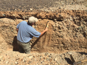
The highly variable nature of terrain (e.g. topography, ground/vegetation cover, soil type) can greatly impact global military operations. Mission success, including operational mobility, weapon performance, communications, and counter IED/landmine, all depend on accurate knowledge of terrain conditions. Unfortunately, accurate terrain data in areas of strategic interest is commonly limited or inaccurate.
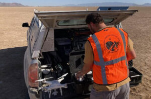
DRI developed the Integrated Terrain Analysis Program (ITAP) to advance technology to provide prompt and accurate characterization of all terrain types and conditions using a combination of space and airborne information and science-expert analysis. The objective of ITAP is to provide customer focused, science-based knowledge of terrain conditions tailored to specific military issues and challenges.
About ITAP
The highly variable nature of the terrain (e.g., topography, ground/vegetation cover, soil condition) greatly impacts the success of military operations. Mission success, including operational mobility, weapon performance, communications, and counter IED/landmine, all depend on accurate knowledge of terrain condition. Unfortunately, accurate terrain data in areas of strategic interest is commonly limited or inaccurate. DRI developed the Integrated Terrain Analysis Program (ITAP) to advance technology that provides prompt and accurate characterization of all terrain types and conditions using a combination of space- and airborne- information and science-expert analysis. The objective of ITAP is to provide customer-focused, science-based knowledge of terrain conditions tailored to specific military issues and challenges.
Desert Research Institute (DRI) scientists provide the U.S. Department of Defense (DoD) with a wide range of science-based information in support of global military objectives. Generating positive results is based on DRI’s unique, team-based structure that overlaps all critical scientific aspects of land, air, and water. DRI support ranges from enhancing sustainability of military installations, to test and evaluation of military equipment, to providing soil and terrestrial data in support of military tactical operations.
Department of Defense Sponsors and Principal Activity
ERDC Cold Regions Research and Engineering Laboratory (CRREL)
- Terrain evaluation for mobility in areas of interest across eastern Europe
- Identifying U.S. analog soil-terrain sites representing eastern Europe and the Korean Peninsula
- Technology development to characterize important soil parameters for IED/landmine detection
- Advancing technology to measure soil dust emission at high wind speeds and high flux rates
- Determining areas of high dust emission potential across the southwestern U.S.
- Developed methods for UAS-based thermal and optical sensors to predict subsurface moisture
- Developed methods for remote sensing imagery to predict soil strength for military operations
Army Research Office (2003-2012)
- Developed methods to predict soil/terrain conditions in areas of interest for military operations
- Characterized soil strength parameters for military installations in tropic, temperate, polar, and desert regions
- Developed technology to measure and monitor energy and mass balance across the soil-atmosphere boundary
- Developed new cost-effective methods to monitor ecosystem status, enhancing range sustainability
- Produced an innovative, cost-effective, soil-terrain model to predict location of cultural resource features
- Developed and tested portable technology for the rapid measurement of soil dust emission in remote locations
Army Yuma Proving Ground (1998-2018)
- High-resolution measurements of surface roughness for vehicle mobility and durability test courses
- Measurement of soil dielectric, seismic, thermal, and physical attributes: landmine/C-IED test lanes
- Developed technology to measure and monitor Degraded Visual Environment (DVE) type dust clouds
- Produced global physiographic, landcover, and climatic maps defining Military Operating Environments
- Investigated desert dust impacts on military equipment as applied to test operations
- Produced a series of soil and terrain maps linking YPG test areas with countries of interest
- Developing a GIS geospatial platform enhancing access to 20 years of YPG soil and terrain test data
- Comprehensive soil and terrain characterization of vehicle durability, mobility, and dust test courses
- Conducted cultural resource investigations to enhance use of YPG terrain for test operations
- Soil characterization for heavy vehicle test courses in Suriname
Joint Improvised Explosive Device Defeat Organization (JIEDDO) (2009–2012)
- Analysis of ground impacts to radio frequency propagation
- Soil geophysical research and characterization of the YPG Joint Experimental Range Complex (JERC) in support of counter-IED operations
Air Force Weather Agency, Offutt Air Force Base (2009–2011)
- Development of comprehensive dust emission data for dust/sand storm forecasting in USACENTCOM AOR
- Generated detailed landform and land cover maps for CENTCOM AOR
Army Center for Health Promotion and Preventative Medicine (2005-2007)
- Enhanced particulate matter (dust/aerosols) surveillance for Forward Operating Bases across southwest Asia
- Determined military personnel exposure levels of chemical elements in soils and dust
Other Department of Defense Project Sponsors
- Combat Capabilities Development Command (formerly Research, Development, and Engineering Command (RDECOM)
- Night Vision and Electronic Sensors Directorate, ERDC-CRREL (NVESD)
- Strategic Environmental Research and Development program (SERDP)
- US Military academy (USMA) West Point
- Air Force Research laboratory (AFRL)
Services Offered
- Analysis of dust impacts to military equipment and operations
- Comprehensive characterization of dust and aerosols: mineralogical, emissions, airborne transport, modeling
- Terrain and environmental evaluation and mapping for military operations and training (U.S. to global).
- Field and laboratory characterization of soil, sediment, and rock properties
- Local to global assessment of military operating environments (tropic, desert, cold-region, temperate) in support of test and evaluation activities and military operations
- Comprehensive environmental analysis (climate, vegetation, hydrology, cultural resources) to support range operations and sustainability
- Global to local remote-sensing, terrestrial image analysis, digital elevation data
- Hydrological modeling, evaluation, monitoring, analysis (surface and ground water)
- Sustainability of test and training ranges (natural and cultural resources)
- UAS airborne production and analysis of optical, thermal, and digital elevation models of military terrain
- Extensive GIS and remote sensing capabilities for terrain and environmental analysis
CONTACT
Eric McDonald, Ph.D.
Program Director
Eric.McDonald@dri.edu
LAB LOCATION
Desert Research Institute
2215 Raggio Parkway
Reno, NV 89512
DIVISION
Earth & Ecosystem Sciences