Integrated Terrain Analysis Program Field Equipment

Field Equipment & Capabilities
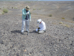
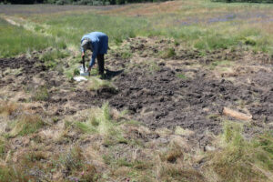
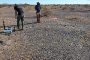
The Integrated Terrain Analysis Program utilizes a wide range of field equipment and instrumentation for characterizing soil properties, modeling digital terrain, measuring dust emission, and more. The ITAP program provides prompt and accurate characterization of all terrain types and conditions using a combination of space and airborne information and science-expert analysis.
Click on any of the drop down items below for more information on field capabilities.
Uncrewed Aircraft Systems (UAS) - Drone
Uncrewed Aircraft Systems (UAS) – Drone
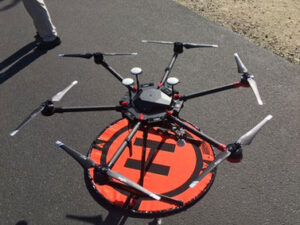
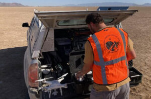
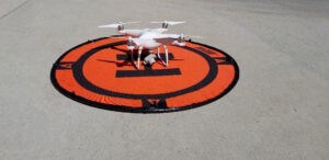
DRI has a wide range of small Uncrewed Aircraft Systems (UAS) capabilities. DRI’s fleet includes the WingtraOne GEN II, Phantom 4 Pro, DJI Matrice 600 Pro Hexacopter and Mavic Mini. Each UAS offers portability, increased payload capacity, or camera resolution.
The primary use of UAS imagery is for photogrammetry, where a series of overlapping images are used to reconstruct a spatially accurate 3D-point-cloud of the terrain. The final products typically are very high-resolution (up to 5 cm) Digital Elevation Models (DEMs) and up to ~1 cm resolution orthomosaic imagery datasets, which are incredibility useful for a variety of GIS and soil-based analysis. Some UAS have the capability to mount external cameras or sensors for NIR or thermal, like the Matrice 600 Pro or the WingtraOne.
The DJI Matrice 600 Pro Hexacopter offers RGB with a 12 MP camera, and increased payload capacity with both thermal or near-infrared cameras.
The Mavic Mini offers RGB imagery with a 12 MP camera and is our most portable UAS ideal for remote field trips.
The Phantom 4 Pro offers RGB imagery with a 20 MP camera, which is ideal for most photogrammetric studies. With higher-resolution imagery than the Mavic Mini and Matrice 600 Pro, the Phantom 4 Pro provides a good balance between portability and image quality.
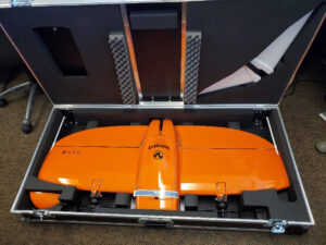
The WingraOne GEN II is a fixed wing UAS which offers RGB imagery with a 42 MP Sony RX1R II camera and the high resolution multispectral and thermal sensor MicaSense Altum with 5 multispectral sensors (R, G, B, RE, NIR) plus thermal band, and an onboard PPK GPS allowing for horizontal accuracy up to 1cm and vertical up to 3 cm without traditional ground control. The WingtraOne has an increased flight time of up to 59 minutes (~3 times longer than the Phantom 4).
Portable In-Situ Wind Erosion Laboratory (PI-SWERL)
The Portable In-Situ Wind Erosion Laboratory (PI-SWERL) is a portable wind tunnel comparable to that of in-line wind tunnels except with increased portability. The PI-SWERL measures real-time dust emission concentrations in both PM10 and total suspended particulate.
Dynamic Cone Penetrometer (DCP)
The dual-mass dynamic cone penetrometer (DCP) measures penetration resistance as a function of soil depth. Penetration resistance is a measure of the force required to drive a probe into the subsurface and is correlated with material strength and compaction. The DCP consists of a hard cone tip mounted on a drive rod that is attached to a slide hammer of known mass. The DCP is used to calculate the California Bearing Ratio (CBR), which is an evaluation of the mechanical strength of the material, for different depth intervals.
Photogrammetry
DRI has a wide range of photogrammetry capabilities. Photogrammetry refers to programs which utilize several overlapping images used to recreate spatially accurate 3D point-cloud models similar to LiDAR data except with much higher (<5 cm) resolution. When aerial imagery is collected by drones or UAS, these point-clouds can have billions of points and cover larger (>1km2) areas. Photogrammetry not only documents via point-cloud data, but also produces Digital Elevation Models (DEMs) and orthomosaic imagery datasets.
Nuclear Density Gauge
The Troxler nuclear density gauge consists of a 137Cs source rod that emits gamma radiation into the subsurface soil and a radiation detector that measures the radiation counts. The radiated signal is attenuated by the soil mineral material and by the presence of moisture within the pore space via energy losses or scattering, allowing for in-situ measurements of bulk density and soil moisture.
Clegg Impact Tester
The Clegg Impact Soil Tester is used to measure the bearing capacity of road subgrades and base course materials through repeated hammer drops on the soil surface. The setup consists of a cylindrical guide tube, hammer, and electronic control unit that is used to measure the impact deceleration of a hammer with known mass dropped from a constant height.
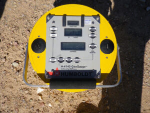
GeoGauge
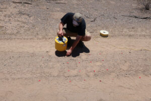
The Humboldt H-4140 GeoGauge measures soil stiffness and related geophysical properties. The GeoGauge provides a quick method to evaluate the strength of unconsolidated materials by measuring differences in material stiffness. The GeoGauge operates at 25 distinct frequencies within a small range of high-frequency values (100-196 Hz) and measures deflection of the material caused by the applied force to estimate soil stiffness.
Shear Vane
The shear vane measures in-situ shear strength from two different sizes of fabricated tapered four-blade vanes. The vane shear test measures the torque required to shear a cylindrical surface in the soil. The vane is hammered into the soil surface with as little surface disturbance as possible and then a torque wrench is attached to the top of the vane to measure the force at which a cylindrical soil surface fails around the vane.
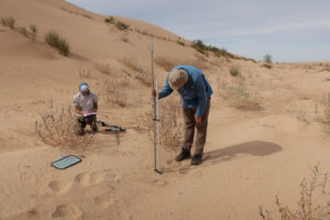
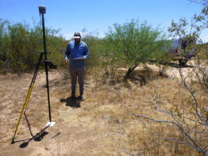
GPS
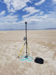
The Trimble r10 GNSS receivers (rover and base) GPS system is capable of fast and accurate GPS measurements, with survey grade accuracy (<1 cm). The Trimble r10 is used for surveying Ground Control Points (GCPs) for UAS photogrammetry studies.
CONTACT
Brad Sion, Ph.D.
Program Director
Brad.Sion@dri.edu
LAB LOCATION
Desert Research Institute
2215 Raggio Parkway
Reno, NV 89512
DIVISION
Earth & Ecosystem Sciences