Integrated Terrain Analysis Program Field Equipment
Visual Surface Roughness Look-up Table for PI-SWERL Measurements
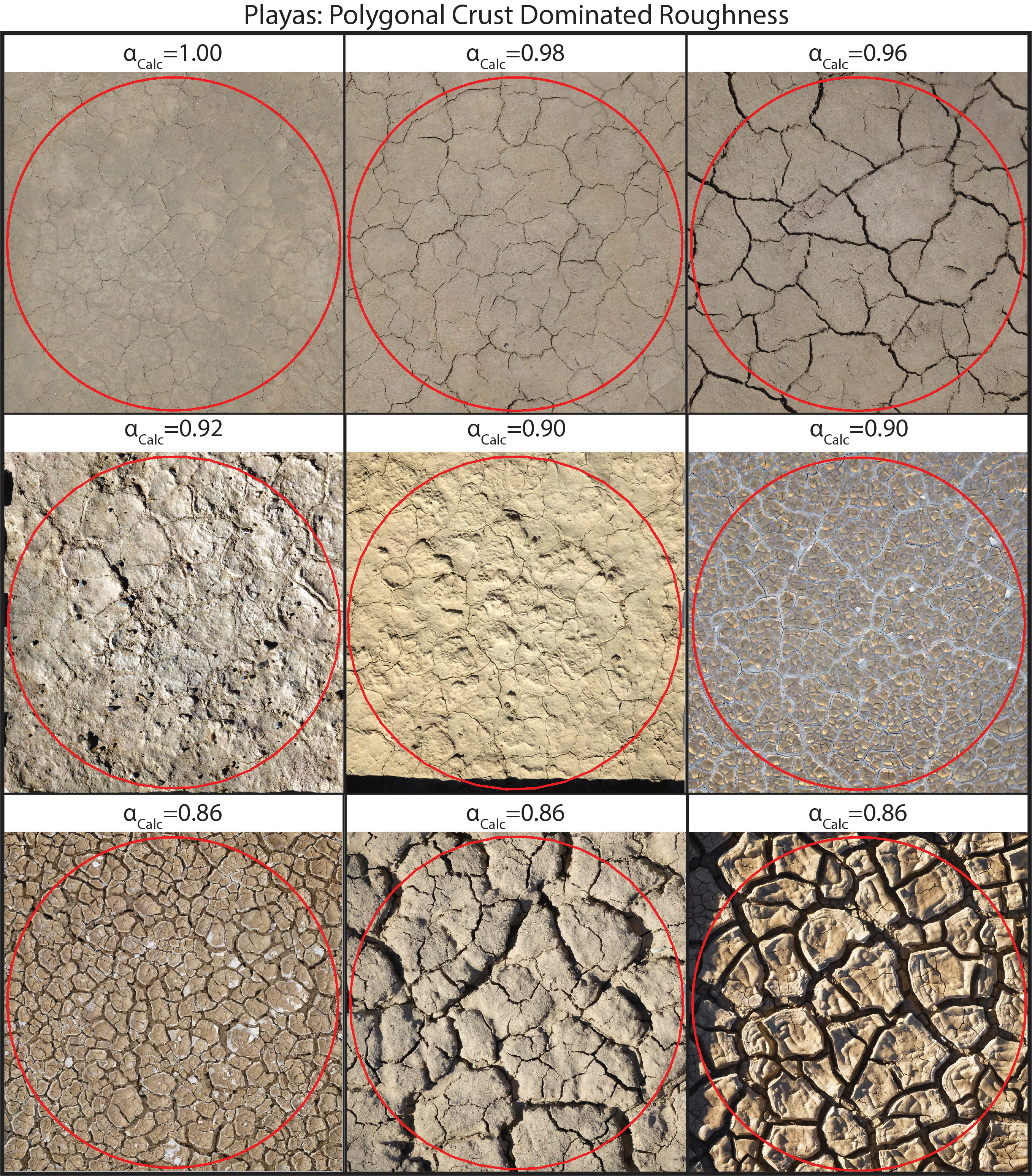
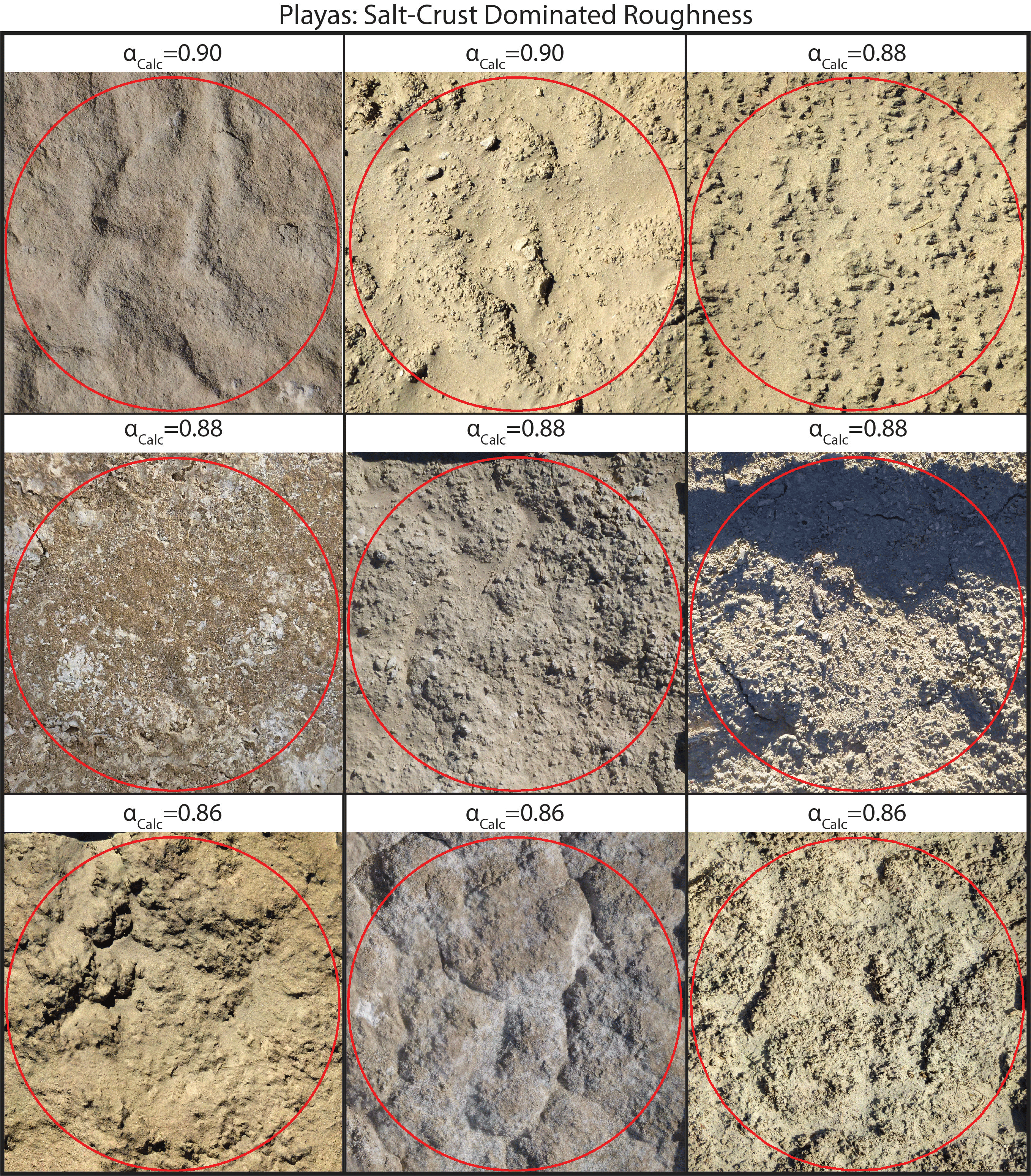
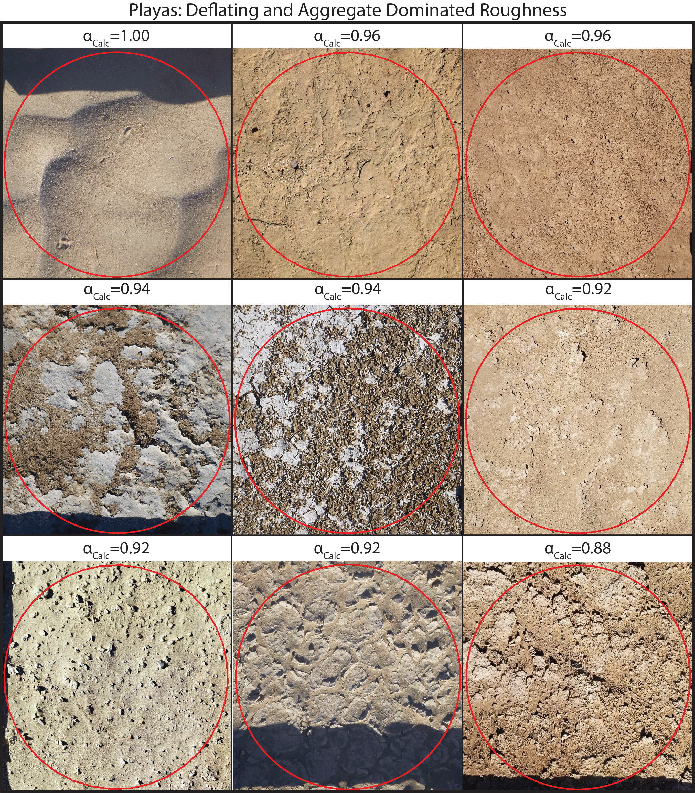
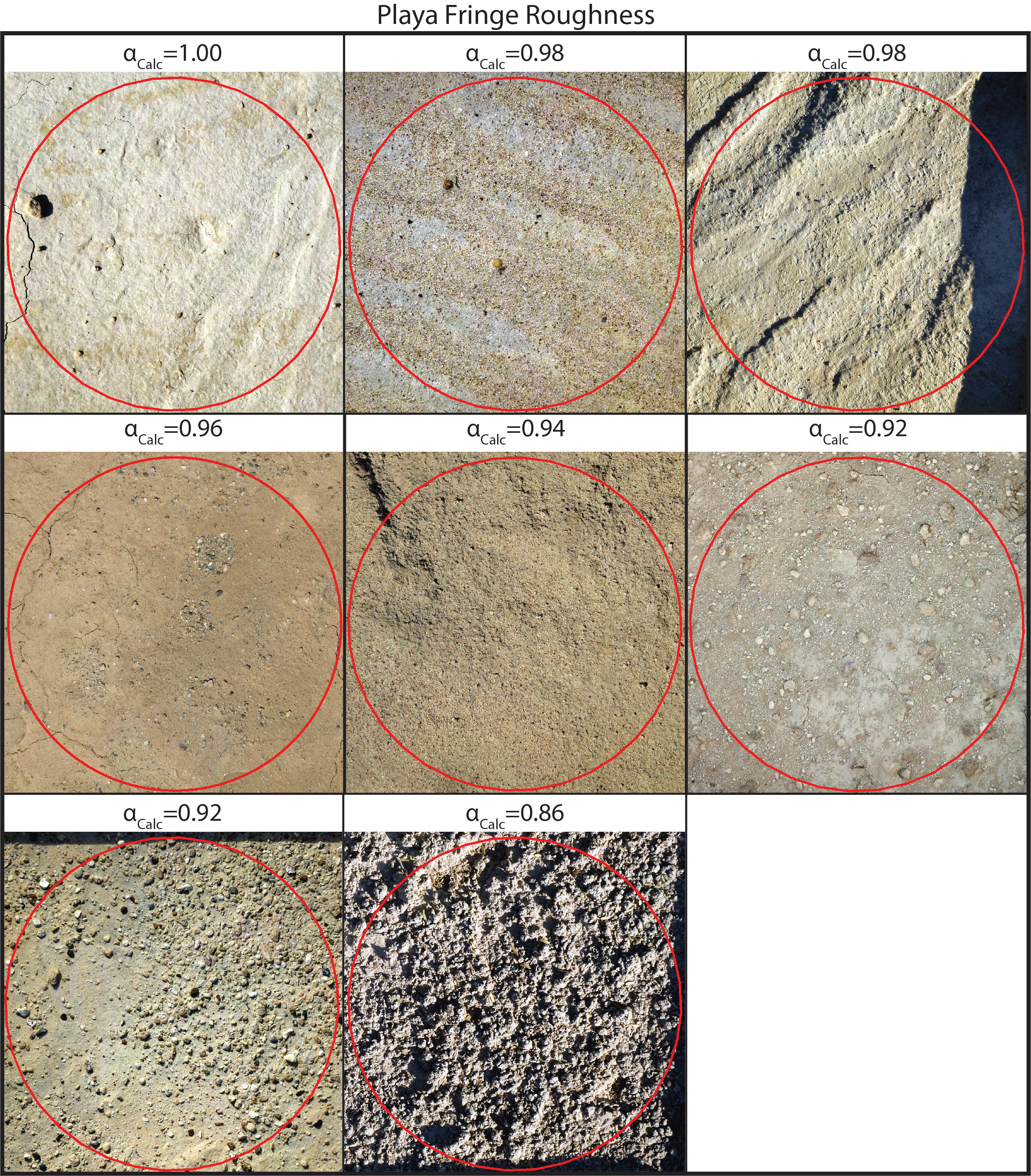
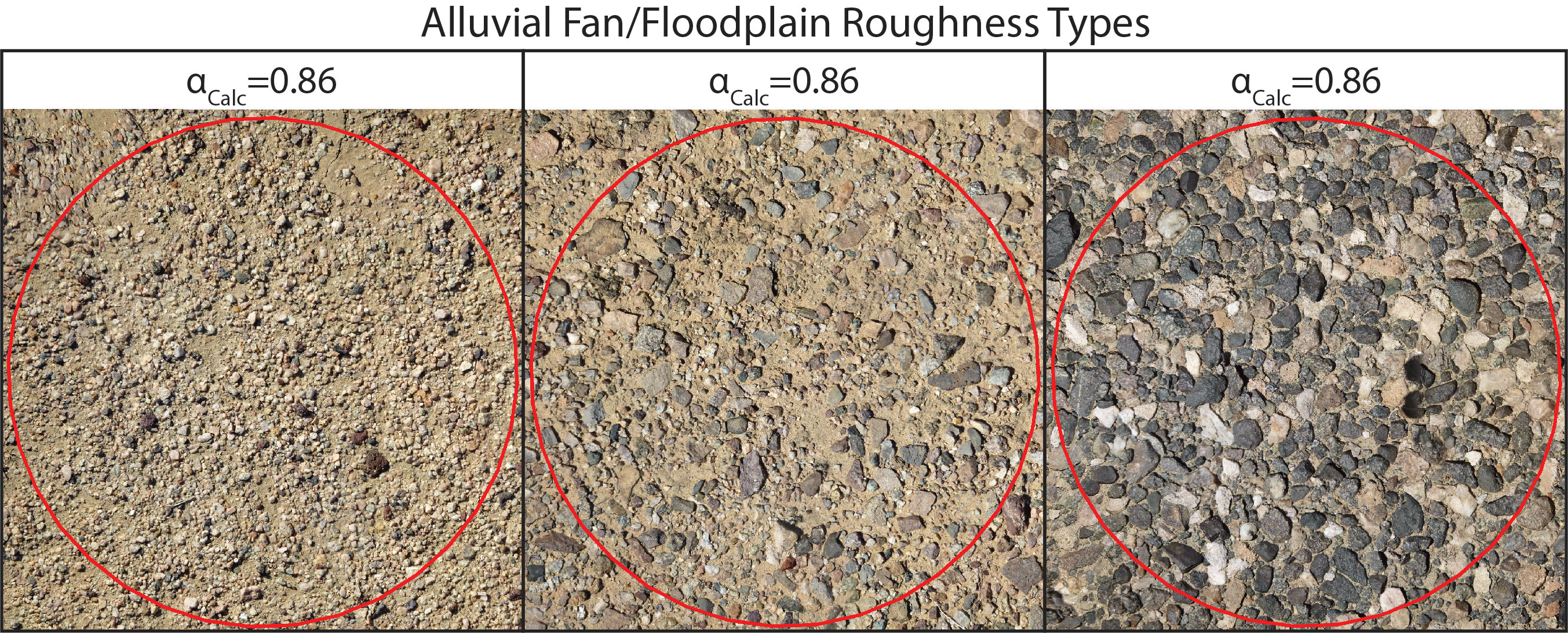
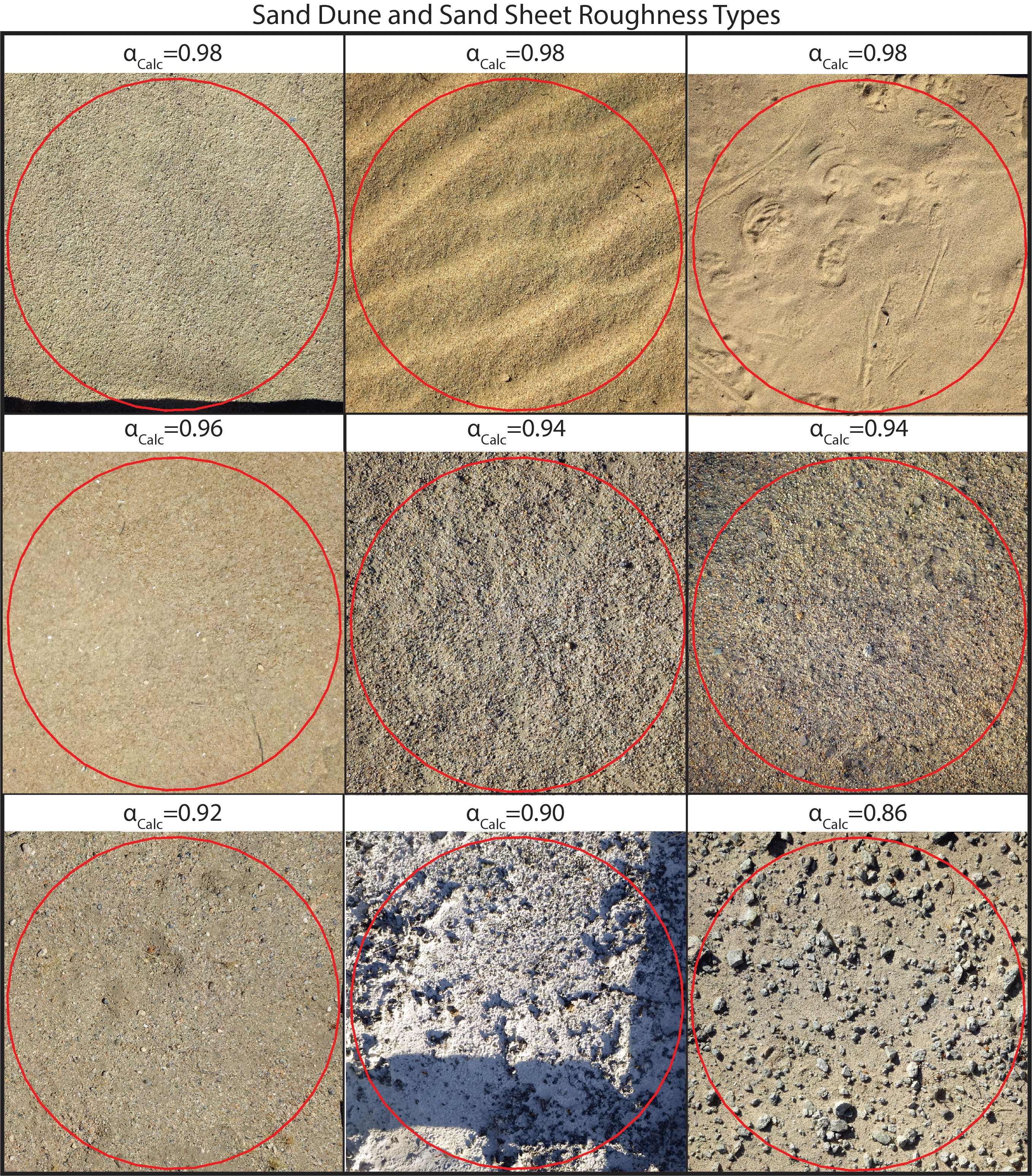
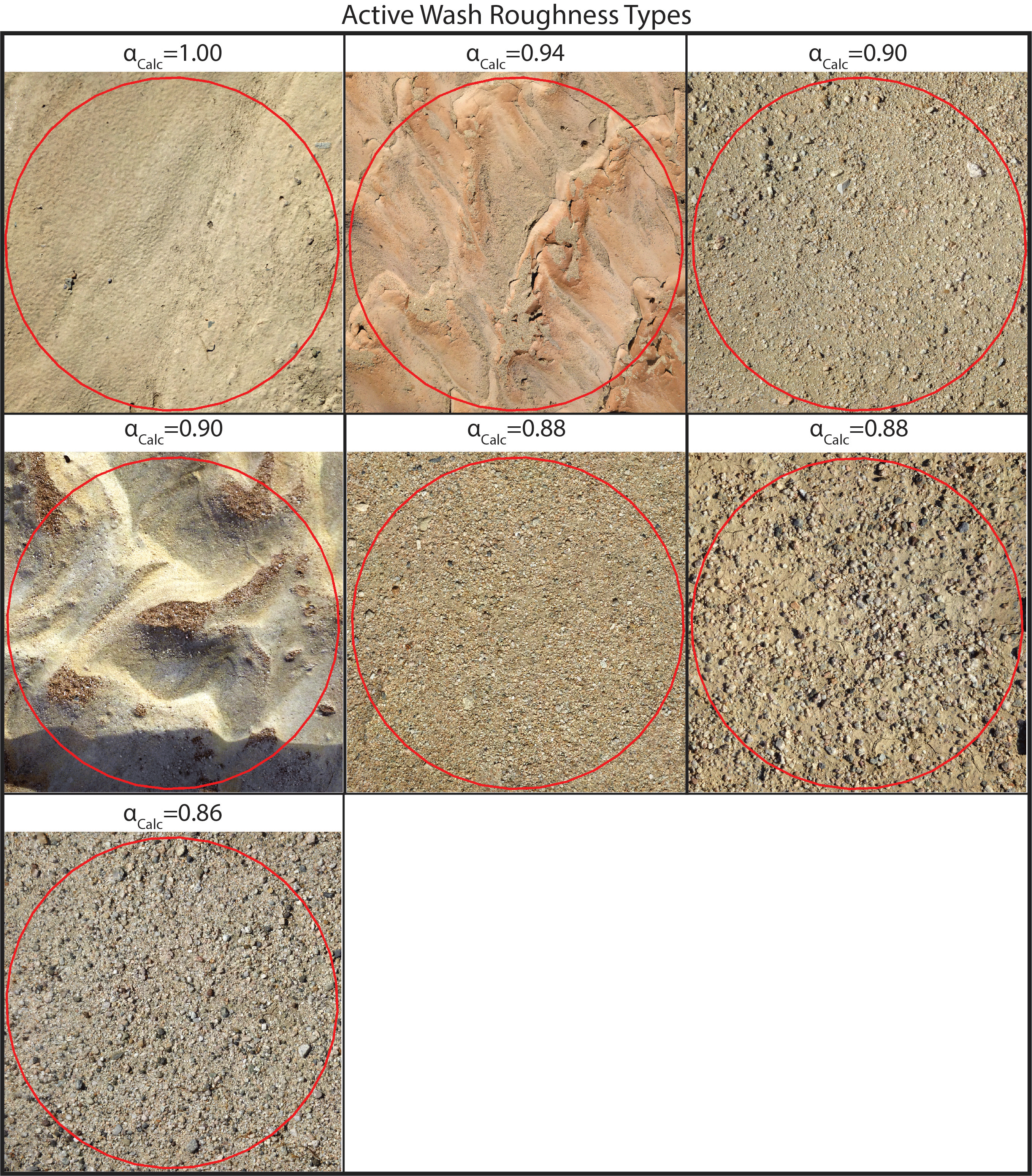
Below is a database of surface roughness of emissive desert landforms. The surface roughness parameter, alpha (α), has been calculated directly from a high-resolution microtopographic Digital Elevation Model. Visual comparison of high-resolution images alongside calculated α values are compiled here for commonly encountered field surfaces. These are presented as a new look-up table for assigning α values to field surfaces for correcting PI-SWERL measurements for surface roughness, expanding on the look-up table of Etyemezian et al. (2014). Consistent visual comparison to these surfaces when assigning alpha will remove some of the subjectivity in assigning α values, further constraining an important source of error that exists in current PI-SWERL methodology.
Any use of this database should be cited as follows:
Hartshorn, E., Sion, B., Sweeney, M., and McDonald, E., revised 2023, Visual Surface Roughness Look-up Table for PI-SWERL Measurements, https://www.dri.edu/itap/PI-SWERL-Roughness
Any questions should be directed towards Evan.Hartshorn@dri.edu
Click on any of the drop-down items below for more information.
Playas: Polygonal
Playas: Salt-Crusted
Playas: Deflated and Aggregates
Playa Fringes
Alluvial Fans and Floodplains

Sand Dune and Sand Sheet
Active Washes
CONTACT
Brad Sion, Ph.D.
Program Director
Brad.Sion@dri.edu
LAB LOCATION
Desert Research Institute
2215 Raggio Parkway
Reno, NV 89512
DIVISION
Earth & Ecosystem Sciences