On June 18, 2020, NASA-NOAA’s Suomi NPP satellite captured this visible image of the large light brown plume of Saharan dust over the North Atlantic Ocean. The image showed that the dust from Africa’s west coast extended almost to the Lesser Antilles in the western North Atlantic Ocean. Credit: NASA Worldview.
In late June 2020, a phenomenon known as the Saharan dust plume made headlines in the U.S., as warm, dry winds from northern Africa carried an unusually thick layer of dust more than 5,000 miles across the Atlantic Ocean into parts of the southeastern US, Puerto Rico, and Caribbean.
The arrival of this African dust cloud may have seemed unusual to residents of Florida and other Gulf-coast states, who experienced several days of darkened skies, degraded air quality and spectacular sunsets, but it came as no surprise to DRI Professor Emeritus Michael Kaplan, Ph.D., and Saroj Dhital, M.S., who have been working to understand the origins of Saharan dust plumes for some time.
Dhital, a graduate researcher with DRI’s Division of Atmospheric Sciences in Reno, joined DRI in 2016 as a member of Kaplan’s research group. He is originally from Nepal, and holds a master’s degree in Atmospheric Physics from Tribhuvan University in Kathmandu. In his doctoral work, Dhital is studying the weather patterns and processes that are responsible for large-scale Saharan dust storms that move north from Africa toward Europe and the Tropical Atlantic.
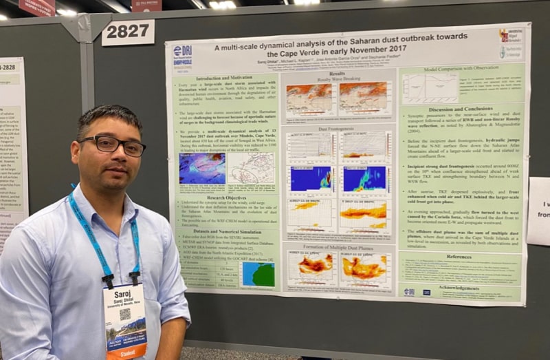
Saroj Dhital presents research on a 2017 dust case at the 2019 AGU Fall meeting.
Working in collaboration with Kaplan and researchers from Spain and Germany, Dhital has been actively involved in an effort to analyze case studies of extreme African dust plumes that impacted the Iberian Peninsula, in the southwest corner of Europe, during 2007, 2008, and 2016. In a new paper in the Journal Atmospheric Environment, Dhital and his colleagues examine the weather patterns and processes that occurred before each one of these major dust events.
“What we are trying to see in this research is what are the precursors before the formation of the dust system,” Dhital explained. “If we can see those types of features in the weather predictions, we could then possibly forecast that there will be a dust storm.”
The analyses of these case studies involve the observational datasets and high-resolution Weather Research and Forecasting model coupled with Chemistry (WRF-Chem) simulations. Numerical simulations are performed inside the National Center for Atmospheric Research (NCAR) high-performance computer, “Cheyenne”.
“Because this area of the Earth is virtually uninhabited, there are almost no surface observations,” Dhital explained. “Remote sensing via satellites and numerical simulations employing a state-of-the-science computer model are our only way of diagnosing the physics of this phenomenon.”
The technology involves the NASA A-train satellite instruments and the supercomputer at NCAR, which can perform more than a trillion operations per second. Without both forms of powerful information processing technology, little would be understood about Sharan dust storms and their long-range transport of dust.
Above: WRF-Chem simulated dust transport video from a 2017 case study that shows the emission of dust over North Africa and subsequent transport towards the tropical Atlantic Ocean (Cape Verde Islands). Credit: Saroj Dhital.
Dhital and his team have recently submitted a second paper for publication on a case study of a 2017 Saharan dust outbreak over the Cape Verde Islands, which lie 650km off the coast of Senegal, West Africa, and is shown in the simulation above. This dust plume led to significant disruptions of local air traffic – disruptions that could have potentially been managed differently if we had the ability to forecast these dust storms or provide early warning to residents.
Additionally, the dust represents a major health hazard as it combines with other pollutants to create respiratory stress in people with lung and breathing problems. This could exacerbate the effect of the COVID-19 epidemic on vulnerable populations in Europe and elsewhere.
”Knowing more about the conditions that lead to dust storms is critically important for operational forecasting and in the development of an early warning system,” Dhital said. “Our research group is now analyzing finer scale meteorological details involved in 2007, 2008, and 2016 dust storm cases utilizing observational and high-resolution WRF-Chem simulations, and we look forward to sharing our findings.”
To learn more about the work of Kaplan, Dhital and their colleagues, read their new paper “Large scale upper-level precursors for dust storm formation over North Africa and poleward transport to the Iberian Peninsula. Part I: An observational analysis” in Atmospheric Environment: https://www.sciencedirect.com/science/article/abs/pii/S1352231020304209?via%3Dihub