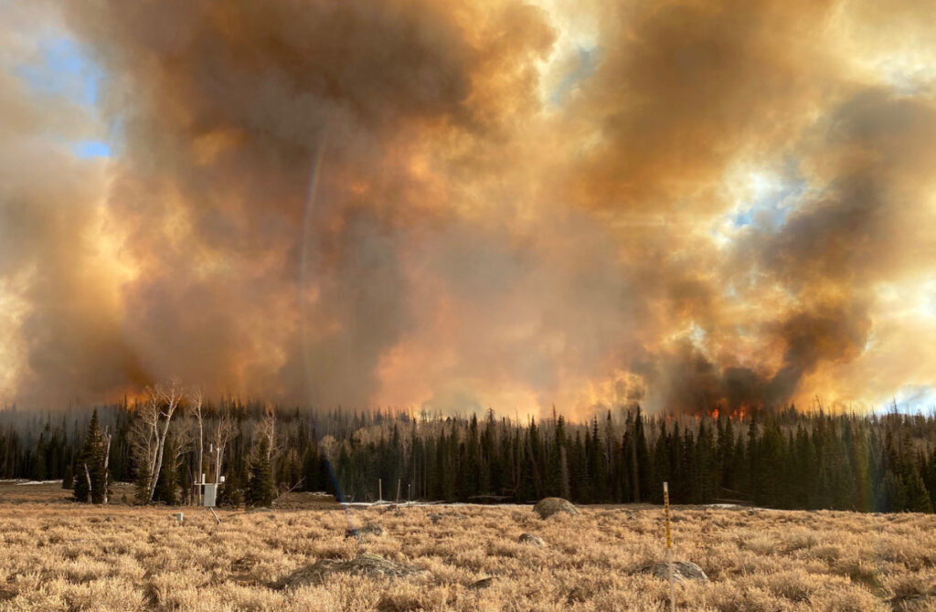
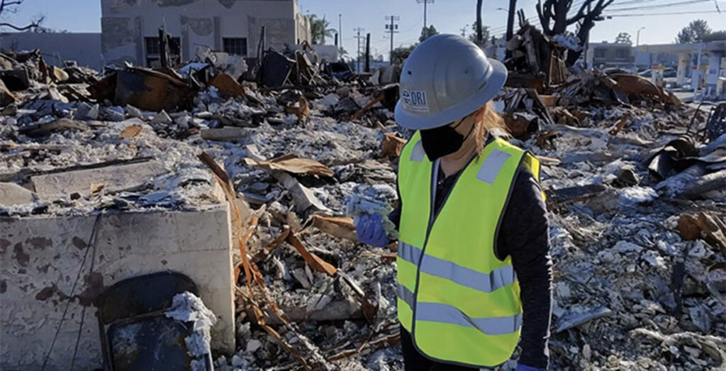
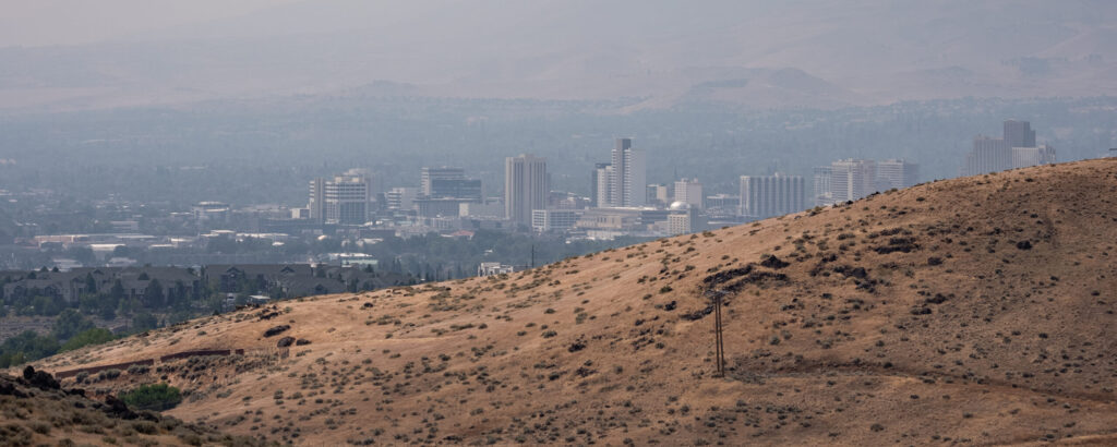
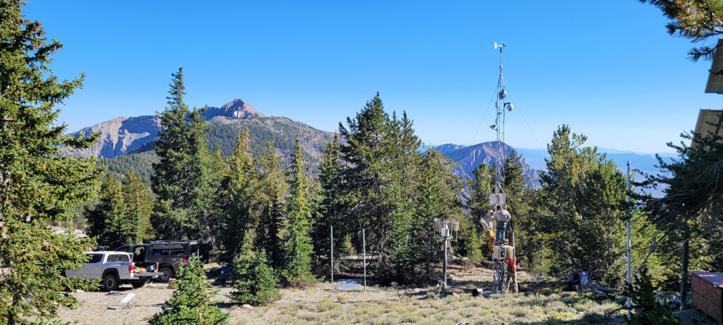
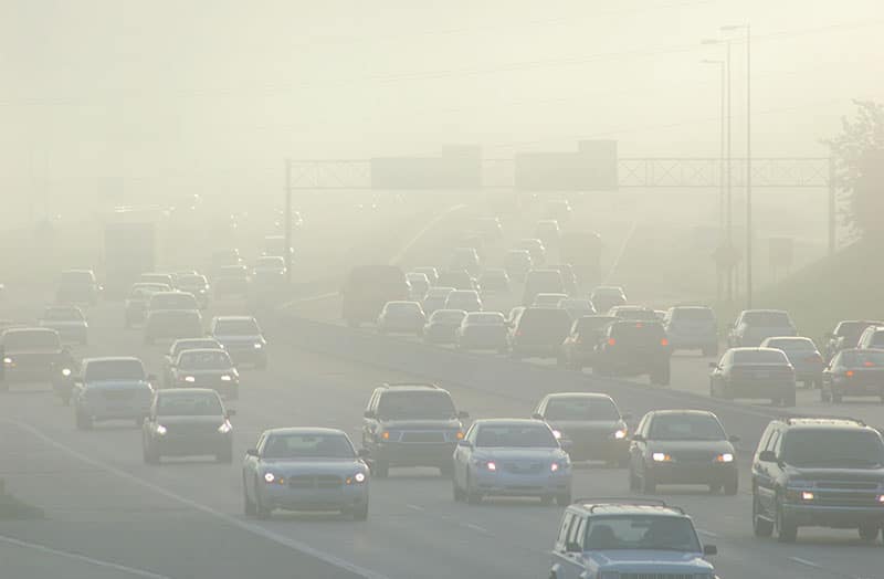
Wildfires Are Increasingly Burning California’s Snowy Landscapes and Colliding with Winter Droughts to Shrink California’s Snowpack

Wildfires Are Increasingly Burning California’s Snowy Landscapes and Colliding with Winter Droughts to Shrink California’s Snowpack

Wildfires Are Increasingly Burning California’s Snowy Landscapes and Colliding with Winter Droughts to Shrink California’s Snowpack

February 1, 2023
RENO, Nevada

Wildfires
Winter Drought
Snowpack

Above: Burned trees on a snowy mountain. The trees in the photo were burned by the Caldor Fire.  

Credit: Anne Heggli/DRI.

A new study shows that midwinter dry spells lead to dramatic losses of winter snowpack in burned areas 

The early pandemic years overlapped with some of California’s worst wildfires on record, creating haunting, orange-tinted skies and wide swathes of burned landscape. Some of the impacts of these fires are well known, including drastic declines in air quality, and now a new study shows how these wildfires combined with midwinter drought conditions to accelerate snowmelt.   

In a study published Jan. 20 in Geophysical Research Letters, a DRI-led research team examined what happens to mountain snowpacks when sunny, midwinter dry spells occur in forests impacted by severe wildfire. The researchers found a substantial increase in wildfires burning in California’s snowy landscapes throughout 2020 and 2021, when large blazes like the Dixie, Caldor, and Creek fires concentrated in snow zones. Using a 2013 midwinter dry spell as comparison, they found that similar weather in the winter of 2021-2022 led to 50% less snow cover. The compounding impacts of wildfire on snow melt include an increase in sun exposure due to loss of forest canopy, and a reduction in the snow’s ability to reflect sunlight.  

“It’s already established that wildfires are increasing spring snow melt, but we wanted to know what happens when you add a long winter dry spell on top of that,” said Arielle Koshkin, M.S., a Ph.D. student now at the Colorado School of Mines who co-led the study as part of her master’s research at DRI and the University of Nevada, Reno. “The Caldor fire burned in our backyard, it was so close to where we live and work. So, the following winter, we wanted to investigate what it looked like.” 

Satellite data showed that compared to the 2001-2019 average, 2020 and 2021 saw a nearly ten-fold increase in wildfires burning in California’s seasonal snow zones. “What that implies is that there’s this increasing overlap between the fire and snow and there’s all these cascading and compounding impacts on the system and especially the hydrology,” said Ben Hatchett, Ph.D., a climatologist at DRI who co-led the study with Koshkin. “This huge increase of fire activity in California snowy regions is exactly what we expect to see more of going forward.”  

A strong winter drought followed during the winter of 2021-2022, when Tahoe City experienced a 46-day long midwinter dry spell (the second-longest since reliable records began in 1917; the long-term median is 22 days without precipitation). A comparable midwinter drought following a wet start to the winter occurred in 2013, giving the researchers the ability to compare and contrast the impacts under more typical conditions with those that occurred in a severely burnt landscape.  

“In 2013 and 2022, we had very similar weather patterns, but we didn’t see notable melt in 2013. And in 2022, we also did not see melt in unburned areas,” Hatchett said. “So that gives two lines of evidence suggesting that it’s the fire and not the meteorology that’s driving this.” 

Forests where severe wildfires have burnt the tree canopy have more exposed snowpacks, which enhances the melting caused by sunny days and warm nights (another recent DRI study examined the snowmelt impacts of spring heatwaves). Snowmelt is further exacerbated by the loss of the snowpack’s albedo, or the natural power of white snow to reflect, rather than absorb, the sun’s radiation. Particularly in the winters immediately following a wildfire, snow is dusted with the black carbon of burnt vegetation, which can accelerate snowmelt rates by up to 57%.  

The enhanced snowmelt was so pronounced within the perimeter of the Caldor fire that the researchers found a total of 50 fewer days with snow cover in the winter of 2021-2022 – the lowest number of snow cover days on record.  

Following a wildfire, “there are two timescales of interest: right after the fire, the loss in albedo really dominates,” said Hatchett. “But impacts from the loss of canopy last for decades, maybe longer if the forest does not recover.” 

The enhanced snowmelt midwinter creates challenges for forecasting water availability from the natural snowpack reservoir. During the winter months, water managers need to leave room in reservoirs to prevent flooding; this means that earlier snowmelt may not be captured for later use in the dry season. Studies like this provide water managers with the tools to make more accurate predictions of the timing and magnitude of snowmelt.  

The fires have made major landscape disturbance that we’re not taking into account in our forecasting abilities,” Koshkin said.I think this study is showing that wildfire impacts are huge, and we need to implement this into our ability to understand how water runs off the landscape. It’s part of our world and it’s increasing and it’s going to affect more snowy places. So, it’s important to make sure that we understand the outcomes in our models and management plans.” 

Koshkin plans to expand on this research for her Ph.D. studies by examining regional variation of fire impacts on snow. She notes that how wildfire impacts snowmelt in the Sierra Nevada may look different in Colorado or Idaho, due to different weather and snowpack conditions.  

The researchers emphasize that the wildfire impacts seen in this study are the result of high-severity wildfires, and not lower-severity burns like prescribed fires. “This study really highlights the importance of bringing fire back onto our landscape in the sense that we need fire – good fire is the answer to our wildfire problem,” Hatchett says. “Bringing a more natural regime of fire, through prescribed and cultural fire, back onto our landscape will help reduce the likelihood of future severe fire.” 

“We can recognize that this could be our new normal,” Koshkin said, “but we also have the ability to adapt and manage and mitigate as much as possible.” 


Scientists measure albedo on a snowy mountain

Study authors Arielle Koshkin and Ben Hatchett measure albedo in the Sierra Nevada foothills. 

Credit: Anne Heggli/DRI.

More information:

The full study, Midwinter dry spells amplify post-fire snowpack decline, is available from Geophysical Research Letters:  https://doi.org/10.1029/2022GL101235 

Study authors include: Benjamin Hatchett (DRI), Arielle Koshkin (DRI/UNR), Kristen Guirguis (Scripps Institution of Oceanography), Karl Rittger (CU Boulder), Anne Nolin (UNR), Anne Heggli (DRI), Alan Rhoades (Lawrence Berkeley National Lab), Amy East (USGS), Erica Siirila-Woodburn (Lawrence Berkeley National Lab), W. Tyler Brandt (Scripps Institution of Oceanography), Alexander Gershunov (Scripps Institution of Oceanography), and Kayden Haleakala (Scripps Institution of Oceanography/UCLA).  

### 

About DRI

The Desert Research Institute (DRI) is a recognized world leader in basic and applied environmental research. Committed to scientific excellence and integrity, DRI faculty, students who work alongside them, and staff have developed scientific knowledge and innovative technologies in research projects around the globe. Since 1959, DRI’s research has advanced scientific knowledge on topics ranging from humans’ impact on the environment to the environment’s impact on humans. DRI’s impactful science and inspiring solutions support Nevada’s diverse economy, provide science-based educational opportunities, and inform policymakers, business leaders, and community members. With campuses in Las Vegas and Reno, DRI serves as the non-profit research arm of the Nevada System of Higher Education. For more information, please visit www.dri.edu.

DRI Leading $5 Million Regional Climate Adaptation Project

DRI Leading $5 Million Regional Climate Adaptation Project

DRI Leading $5 Million Regional Climate Adaptation Project

January 4, 2023
RENO, Nevada

CNAP
Climate Adaptation
Climate Resiliency

Above: Cloud of smoke from a California wildfire. CNAP’s projects will support adaptation needs to address some of the most pressing climate issues in the region including the public health impacts of wildfire smoke. 

DRI is partnering with Scripps Institution of Oceanography to build climate resiliency through the California Nevada Adaptation Program (CNAP)

The impacts of climate change have been acute in California and Nevada, with most of the last two decades spent in extended drought conditions and 2021 wildfires producing Reno’s worst recorded air quality in the 21st century. Adapting to these challenges will require not only focused research to better predict climatic events, but will also depend on empowering local communities to use this knowledge to make informed decisions in the face of adversity. With $5 million in funding from NOAA’s Climate Adaptation Partners initiative, the California Nevada Adaptation Program (CNAP) will spend the next five years bringing together researchers, community members, and practitioners to cooperatively conduct research and identify solutions.

For the first time, CNAP will be hosted in Nevada under the leadership of DRI’s Tamara Wall, Ph.D., research professor of atmospheric science and deputy director of the Western Regional Climate Center (WRCC). DRI’s long-standing partnership with Scripps Institution of Oceanography at the University of California San Diego will continue, with Dan Cayan, Ph.D., regional climate researcher and CNAP lead since its founding in 1999, and Julie Kalansky, Ph.D., who has served as CNAP program manager for six years, joining Wall to lead the project.

“The goal of CNAP has always been to expand more fully across the California and Nevada region,” Wall says. “This is the first time that DRI is leading CNAP, and it’s also the first time that CNAP is a system-wide effort. Bringing on partners from UNLV and UNR is important for meeting that goal and will help us address climate change impacts across the state.”

California and Nevada have partnered for the CNAP program since 2011, producing research and results that include: the first Nevada Climate Assessment; California’s Fourth Climate Change Assessment; recommendations for updating red flag warnings and the fire weather watch system; and analyses of water use and supply in California’s agricultural communities.

The next five years will focus on adaptation, with an intentional transition from statewide climate research toward preparing communities for local-level action to address regional climate hazards. Six projects will support adaptation needs to address four of the most pressing climate issues in the region: extreme heat, wildfire smoke, coastal flooding, and water scarcity. As part of the project’s commitment to equity and diversity, it will include a mentorship program within community colleges to prepare the future’s workforce to address climate impacts. In addition, a small grants program, Building Capacity through Reciprocity with Tribal Communities, will work to enact community-identified solutions for tribal communities by supporting a Leaders Indigenous Climate Fellowship Program.

“Centering CNAP’s research on adaptation allows us to focus on producing community-centered solutions,” Wall says. “Impacts from climate change are expected to amplify in the coming decades, and disadvantaged communities are the least able to manage those impacts without additional support. Our research includes community partners so that we can adequately understand community needs and concerns and actually improve people’s lives.”

Research Focus Areas

Extreme Heat

Highlights for planned research include creating the Southern Nevada Heat Resilience Lab (SNHRL), a regionally focused program that will bring together public service providers, including emergency responders and social services workers, with scientific experts on extreme heat. Real-time air temperature sensors will be installed in at-risk neighborhoods within Las Vegas, targeting locations such as public transit stops and buses, cooling centers, places with outdoor laborers, and unhoused communities. Following a trial period in Las Vegas, the project aims to expand local heat sensor networks to rural and Indigenous communities, where heat impacts are less well studied and understood

Water Resiliency

In order to help California prepare a more resilient workforce in the face of growing issues with water availability, CNAP will partner with community colleges in the San Joaquin Valley to create climate-related workforce training opportunities. The goal is to create a more climate-technical workforce to support community adaptation to changes in water availability and climate extremes.

Coastal Erosion

Southern California is lined with some of the most heavily used beaches on the West coast, and this region is likely to experience increased flooding and erosion due to sea-level rise. CNAP will partner with collaborators to explore nature-based solutions and Indigenous stewardship as coastal adaptation strategies.

Public Health in the Face of Extreme Heat and Wildfire Smoke

California and Northern Nevada are increasingly experiencing extreme weather conditions with overlapping heat waves and intense wildfires. CNAP will explore the public health impacts of these events by directly assessing a sample of households in Washoe County, Nevada. Research will include installing air sensors to monitor heat exposure and air pollution, conducting interviews to understand decision-making under environmentally challenging conditions, and baseline health monitoring.

Understanding Burnout in Climate Change Professionals

Previous CNAP research has shown that climate change professionals are experiencing high rates of burnout, and institutional support isn’t yet providing adequate resources to this population. CNAP will continue this line of study by evaluating the traits and communities that lead to more psychological resiliency and developing training materials based on the results for the CNAP team and partner networks.

State Climate Assessments

Both California and Nevada will likely produce new statewide climate assessments within the next five years, and CNAP will continue to coordinate among state and local efforts. CNAP will also pilot a mentoring program focused on early career faculty at universities and colleges in California and Nevada.

“NOAA Climate Adaptation Partnerships (CAP, formerly ‘RISA’) advances equitable adaptation through sustained regional research and community engagement,” says Caitlin Simpson, Program Manager, NOAA Climate Adaptation Partnerships. “Climate affects every part of society, and this is most visible to us when we see long-term changes in social and environmental conditions, increased unpredictability, and extreme weather events. We seek to help people plan for and adjust to a changing climate by supporting long-lasting partnerships among scientists, decision makers, and communities. The result is a shared understanding about society’s needs and the co-generation of credible and actionable knowledge to support community solutions. We work within regions composed of multiple US state/territory jurisdictions which share similar climates and cultures.”

“CNAP’s long history in the CAP/RISA program dates from 1997, and features many accomplishments, including substantial scientific contributions to all five of California’s climate assessments in close partnership with the state government. CNAP has achieved deep expertise on sea level rise, drought, water resources, and wildfire planning issues and has closely partnered with a number of federal and nonfederal partners to advance local, state, and regional planning around these issues. The NOAA Climate Program Office is thrilled to fund the California-Nevada Climate Applications Program (CNAP) team for another five years as a part of the CAP/RISA Network.”


CNAP logo

More information:

For additional information about CNAP visit: https://www.dri.edu/cnap/

CNAP Principal Investigators include Tamara Wall (DRI), Julie Kalansky (Scripps), and Daniel Cayan (Scripps).

### 

About DRI

The Desert Research Institute (DRI) is a recognized world leader in basic and applied environmental research. Committed to scientific excellence and integrity, DRI faculty, students who work alongside them, and staff have developed scientific knowledge and innovative technologies in research projects around the globe. Since 1959, DRI’s research has advanced scientific knowledge on topics ranging from humans’ impact on the environment to the environment’s impact on humans. DRI’s impactful science and inspiring solutions support Nevada’s diverse economy, provide science-based educational opportunities, and inform policymakers, business leaders, and community members. With campuses in Las Vegas and Reno, DRI serves as the non-profit research arm of the Nevada System of Higher Education. For more information, please visit www.dri.edu.

A new study shows that tailpipe emissions are declining, but brake and tire wear particle emissions remain a persistent – and unregulated – air quality concern

A new study shows that tailpipe emissions are declining, but brake and tire wear particle emissions remain a persistent – and unregulated – air quality concern

Air Pollution Near Roads is Changing

DECEMBER 5, 2022
RENO, Nevada

By Elyse DeFranco

Air Pollution
Roadways
Emissions

Above: Rush hour traffic with thick smog. Even as emissions from engine exhaust decline with stringent regulations and the growing popularity of electric vehicles, other traffic-related pollution remains unaddressed. Of particular concern are the microscopic particles from brakes and tires, worn down from abrasion and degradation, which mix into the air we breathe and wash into our watersheds, creating hazards for human and environmental health. 

Credit: Photo by plherrera, iStock. 

A new study shows that tailpipe emissions are declining, but brake and tire wear particle emissions remain a persistent – and unregulated – air quality concern

Air pollution near roads remains a significant health concern in the U.S., with an estimated 60 million people living within 500 meters of a major highway. Even as emissions from engine exhaust decline with stringent regulations and the growing popularity of electric vehicles, other traffic-related pollution remains unaddressed. Of particular concern are the microscopic particles from brakes and tires, worn down from abrasion and degradation, which mix into the air we breathe and wash into our watersheds, creating hazards for human and environmental health.

In a new study published Nov. 23 in Environmental Pollution, researchers from DRI, UC Riverside, UNLV, and the California Air Resources Board take a closer look at these overlooked pollutants, known as non-tailpipe emissions. With funding from the California Air Resources Board, they placed air quality monitors near two southern California highways and found that air pollutants from brake and tire wear exceed those from engine exhaust.

“We knew that tailpipe emissions are coming down, and that non-tailpipe emissions have been steady or slightly increasing,” says Xiaoliang Wang, Ph.D., Research Professor of Atmospheric Sciences at DRI and the study’s lead author. “But I didn’t realize that it’s already crossing over – that was a surprise.”

California sampling map

Map of roadside sampling locations in Los Angeles, California — one of the most polluted areas in the U.S. 

Credit: Elyse DeFranco/DRI.

Tire wear particles contain rubber and microplastics, as well as thousands of chemicals, some of which are known ecological hazards. Previous research identified one of these chemicals as the primary culprit in the decline of Coho salmon in the Pacific Northwest. And brake pads contain metals and other materials known to be harmful to human health. Non-tailpipe emissions like brake and tire wear particles aren’t regulated the way engine exhaust is, and are expected to become the primary source of particulate matter pollution near roads.

“There is increasing interest in understanding how much non-tailpipe emissions – including brake wear, tire wear, road surface wear, and road dust – are impacting air pollution for people living close to roadways,” Wang says. “This has environmental justice implications as well because many low-income communities tend to live closer to roads.”

The Environmental Protection Agency (EPA) established a near-road air monitoring network that measures nitrogen dioxide (which causes respiratory tract damage and can trigger asthma), but fine and coarse particles that are more related to non-tailpipe emissions than engine exhaust are monitored spottily or not at all.

California has led the way in enacting regulations on exhaust emissions, as Los Angeles first began experiencing smog-choked air in the 1940s. It wasn’t until the early 1950s that scientists discovered that motor vehicles were the primary source of this smog, and that engine exhaust chemically reacts with sunlight and industrial air pollution to create what is known as “secondary pollutants.” This means that air pollution isn’t merely the combination of all added pollutants, but that as these pollutants intermix in the air, new pollutants are born.

Electric vehicles have eliminated tailpipe emissions by transferring their emissions to their power source, but are heavier than conventional gasoline and diesel-powered vehicles. This could mean more road and tire wear particle emissions.

“There’s still active research going on trying to understand what’s the impact of electrification of vehicles on non-tailpipe emissions,” Wang says. Previous research has noted that because electric vehicles don’t reduce non-tailpipe particulate matter emissions, they shouldn’t be considered as the single and only solution to urban air pollution.

Although this study focused on air pollution near roads, Wang notes that the pollutants don’t stay only near highways, but follow wind patterns to become part of the overall air pollution mix, and eventually get washed into storm gutters and out to sea.

The study team is continuing this research to better understand the chemicals in the air samples they collected and will publish a more detailed analysis of the sources. The information will be provided to appropriate environmental and transportation agencies to aid decision-making for air quality improvements.

More on this study:

Evidence of non-tailpipe emission contributions to PM2.5 and PM10 near southern California highways
Environmental Pollution
https://doi.org/10.1016/j.envpol.2022.120691

Study authors include DRI researchers Xiaoliang Wang, Steven Gronstal, Judith C. Chow, Steven Sai Hang Ho, and John G. Watson; UC Riverside researchers Brenda Lopez, Guoyuan Wu, and Heejung Jung; UNLV researcher L.-W. Antony Chen; and Qi Yao and Seungju Yoon of the California Air Resources Board.

Jim Hudson: Celebrating a Career in Cloud Physics

Jim Hudson: Celebrating a Career in Cloud Physics

Jim Hudson: Celebrating a Career in Cloud Physics

NOVEMBER 17, 2022
RENO, NEV.

Cloud Physics
Cloud Condensation Nuclei
Atmospheric Science

Above: Throughout his career Jim Hudson, Ph.D., worked in planes such as the NCAR C-130 on several projects during his time at DRI.

Credit: Jim Hudson/DRI.

Research Professor Jim Hudson, Ph.D., the Institute’s longest-serving employee, recently retired from DRI after 51 years studying cloud condensation nuclei (CCN) – tiny particles around which cloud droplets form. Hudson originally came to DRI as a graduate student in 1970, following the completion of his Master’s degree in physics at the University of Michigan. Here, he worked under the direction of cloud physicist and Director of Atmospheric Sciences Patrick Squires and graduated with his Ph.D. in Atmospheric Physics from the University of Nevada, Reno, in 1976.

Hudson’s long and successful career at DRI has taken him from his current home base in Reno to 31 aircraft field projects around the globe. He developed the continuous flow diffusion cloud chamber, isothermal haze chamber, and five CCN spectrometers. He has led projects sponsored by the National Science Foundation (NSF), National Aeronautics and Space Association (NASA), Department of Energy (DOE), and others. He has co-authored 97 peer-reviewed publications in the Journal of Geophysical Research: Atmospheres, Journal of the Atmospheric Sciences, Journal of Applied Meteorology, Tellus, Atmospheric Chemistry & Physics, Atmospheric Physics, Atmospheric Science Letters, Journal of Atmospheric Chemistry, Geophysical Research Letters, Journal of the Meteorological Society of Japan, Bulletin of the American Meteorological Society, Aerosol Science and Technology, Atmospheric Environment, Journal of Atmospheric & Oceanic Technology, Idojaras, and Science, and delivered 146 conference presentations.

Although he officially retired in August 2021, Hudson is continuing at as an Emeritus Scholar at DRI. We sat down with Hudson to learn about some of his career highlights:

DRI: What inspired you to become a cloud physicist?

Hudson: I did not set out to be a scientist although I had a lot of science interests as a child and took all math and science courses offered in high school. Other interest were law and politics. When taking the Kuder vocational interest test in my junior year in spite of conscious efforts to score high in persuasion (for law or politics) I could not resist science responses.  Thus, I was dismayed that of the ten interest categories science tied with persuasion. Physical Science, biology, and chemistry in the first three high school years did not pique my interest but physics in the senior year with its more logical nature turned me to science. Despite feeling at the time that scientists are mere pawns to politicians and businessmen I majored in physics and mathematics in the Honors College of Western Michigan University (BA 1968).  An attraction of physics was great job prospects, but that crashed, especially for high energy physics that had attracted me to the University of Michigan.  Thus, in my last semester and summer there I drifted into aeronomy, which included a good deal of physics.  When I learned that clouds also have physics, I found a more interesting application of my background.  But the familiar down-to-Earth clouds were not studied at Michigan.  DRI in Reno was the place to study the clouds that concern weather.

Thus, I traded the study of atomic nuclei for cloud nuclei under a founding father of cloud physics, Patrick Squires.  At that time the main goal of cloud physics was understanding the onset of precipitation and perhaps controlling it. This leads to cloud seeding, which usually involved the ice phase, which was thought to be the origin of all precipitation until warm rain was discovered in the 1940s.  Being from Australia where the ice phase is less common directed Squires toward warm non-freezing clouds.

DRI: Which of your career accomplishments are you most proud of?

Hudson: In 2012 I finally realized that the DRI high-resolution CCN spectrometers often resolved two modes.  Although I and many others had known for decades that direct aerosol size distributions often displayed bimodality, I did not appreciate its importance until then.  Only then did I begin analyzing cloud microphysics (droplet and drop size distributions) in terms of CCN bimodality.  I have so far found opposite responses to CCN bimodality in stratus and cumulus clouds.  Bimodality seems to make more smaller droplets and less drizzle in stratus but fewer larger droplets and more drizzle in cumuli.

Jim Hudson and other male scientists

Jim Hudson, Ph.D. (left), poses for a picture with fellow scientists in September 1973 at a lab inside the Sage Building at UNR.

Credit: Jim Hudson/DRI.

DRI: What unanswered questions do you still want to solve?

Hudson: What’s known as the “indirect aerosol effect” continues to be the largest climate uncertainty. This is the interaction of air pollution with clouds and relates back to the 1950s discovery by Squires and Sean Twomey, that continental clouds differ from maritime clouds. They have more droplets, smaller droplets, and don’t precipitate as readily as maritime clouds. Why is that? Because there are more CCN over continents than oceans. Why are there more CCN over continents? That is a billion-dollar question. Are there significant natural continental sources or is it all anthropogenic?  This is such a difficult problem that most research dances around this question.  We actually know more about the unnatural sources, the man-made sources, than we do about the natural sources. The indirect aerosol effect is so important because to some yet to be known extent it probably counteracts the so-called greenhouse trace gas effect.  One does not need a degree to know that clouds are complicated.  We have known since the 1950s that CCN affect clouds though many have claimed that air motions (dynamics) are more important.  But when the effects of the clouds on the CCN are realized things get even more complicated.  Clouds thus are both a sink and a source of the CCN that in turn profoundly affect them.  This makes the foundation of science, cause and effect, especially challenging for clouds.

DRI: What are you working on as an Emeritus Scholar at DRI?

Hudson: I just want to further analyze the data I’ve collected over the last 30 or more years but now in terms of CCN bimodality.  Few atmospheric scientists delve into the extensive sets of aircraft data.  I’ve been in more than 30 cloud projects where we fly 10-20 research flights of 4-12 hours duration in a month or two.  Multitudes of data are collected throughout these flights, but only small fractions are analyzed or presented.  This is very time-consuming work much of which would be impossible if I were still employed.  These CCN cloud interactions are vitally important for the indirect aerosol effect and for fundamental cloud physics. I feel compelled to complete as much of this analysis as possible.

DRI: What has changed most at DRI during the course of your career?

Hudson: In the first, two or three decades of DRI partial contracts were not done.  In the 1970s there was actual pasting of letters and words onto paper.  Before the turn of the century proposals were hand delivered to parcel services.  Before the teens, Journals were printed onto paper and did not have supplementary material.

DRI: What advice do you have for future scientists?

Hudson: Look at the data. All of the data. Not just the data that you think is good, the data that fits your model. In all science, there’s always conflict between the theorists (modelers in cloud physics) and the experimentalists (observationalists). Peter Hobbs of University of Washington would say, “the modelers believe the data, and the observationalists believe the models.” Each are more aware of the pitfalls of their own area. I think he overstated that because he did not believe many models.  Conflicts between modelers and observationalists seem to be most intense in cloud physics. When I was in high energy physics 50 years ago there were articles about how theorists looked down on the experimentalists even though science is based on experiments.

DRI: Who have you most enjoyed working with at DRI?

Hudson: Of course, I did a lot of work with Squires in the beginning and then John Hallett for several field projects.  We must remember the engineers, who really built and maintained the CCN instruments, Gary Keyser, Rick Purcell, Norm Robinson, Dan Wermers and Morien Roberts. And then my students, Paul Frisbie, Xiaoyu Da, Hongguo Li, Yonghong Xie, Seong Soo Yum, David Mitchell, Subhashree Mishra, Samantha Tabor, Vandana Jha and Stephen Noble.  Fred Rogers was my fellow student under Squires.  In earlier years I worked with Dennis Lamb, Dick Egami, and Eric Broten.

male scientist in lab holding equipment

Jim Hudson, Ph.D., inventories the equipment in his lab space.

Credit: Jim Hudson/DRI.

DRI Recognizes Lily Hahn as the 2022 Peter B. Wagner Memorial Award-Winner for Women in Atmospheric Sciences

DRI Recognizes Lily Hahn as the 2022 Peter B. Wagner Memorial Award-Winner for Women in Atmospheric Sciences

DRI Recognizes Lily Hahn as the 2022 Peter B. Wagner Memorial Award Winner for Women in Atmospheric Sciences

November 3, 2022
RENO, Nevada

Wagner Award
Atmospheric Sciences
Lily Hahn

Above: The 2022 Wagner Award winner, Lily Hahn, presents her research during an award ceremony at DRI’s campus in Reno on November 2, 2022.

Credit: Jessi LeMay/DRI.

DRI is pleased to announce that the 24th annual Peter B. Wagner Memorial Award for Women in Atmospheric Sciences has been awarded to Lily Hahn of the University of Washington, Seattle. An award ceremony commemorating her achievement was held at the DRI campus in Reno on Nov. 2, 2022.

The Peter B. Wagner Memorial Award for Women in Atmospheric Sciences is an annual competition recognizing the published works of women pursuing a master’s or Ph.D. in the atmospheric sciences or any related program at a university in the United States. The award is presented to women graduate students with outstanding academic publications and includes a $1,500 prize. This award has been presented annually by DRI since 1998 and is the only such honor designated for graduate women in the atmospheric sciences in the United States.

Hahn, a Ph.D. student in the Department of Atmospheric Sciences at the University of Washington, Seattle, is receiving this award for her paper Seasonality in Arctic Warming Driven by Sea Ice Effective Heat Capacity. Hahn’s research investigates the processes that cause Arctic warming to peak during early winter under rising concentrations of atmospheric greenhouse gases. A fundamental cause of this warming pattern is the transition from frozen sea ice to open ocean, which maintains warmer temperatures later in the year and produces peak warming in early winter. This information is essential for developing accurate models for projecting the timing and extent of Arctic warming under climate change scenarios.

“I’m very excited to receive the Wagner Memorial Award,” Hahn says. “I’m grateful to the selection committee for their time and consideration, and to my advisors and coauthors for their collaboration and guidance. I really enjoyed this project as an opportunity to design idealized model experiments to isolate and understand the mechanisms of Arctic warming. It’s awesome to receive recognition, the opportunity to share this work at DRI, and inspiration to continue pursuing creative and impactful research as I wrap up my Ph.D.”


two female scientists smile at the camera

Lily Hahn (right) the 2022 recipient of the Peter Wagner Memorial Award for Women in Atmospheric Sciences, with Vera Samburova (left), Chair of Award Committee and Associate Research Professor at DRI.

Credit: Jessi LeMay/DRI.

Runners up for the 2022 award include: 2nd place – Lyssa M. Freese from the Department of Earth, Atmosphere and Planetary Sciences at the Massachusetts Institute of Technology for the paper Antarctic Radiative and Temperature Responses to a Doubling of CO2.

3rd place – Tehya Stockman from the Department of Civil, Environmental, and Architectural Engineering at the University of Colorado, Boulder for the paper Measurements and Simulations of Aerosol Released While Singing and Playing Wind Instruments; and Yingxiao Zhang from the Department of Climate and Space Sciences and Engineering at the University of Michigan for the paper Projected Climate-Driven Changes in Pollen-Emission Season Length and Magnitude Over the Continental United States.

About the Peter B. Wagner Memorial Award

Ms. Sue Wagner — former Nevada Gaming Commissioner, Nevada Lieutenant Governor, DRI Atmospheric Scientist, and widow of Dr. Peter B. Wagner — created the Peter B. Wagner Memorial Award for Women in Atmospheric Sciences in 1998. Dr. Wagner, a faculty member at DRI since 1968, was killed while conducting research in a 1980 plane crash that also claimed the lives of three other Institute employees.

In 1981, Dr. Wagner’s family and friends established a memorial scholarship to provide promising graduate students in DRI’s Atmospheric Sciences Program an award to further pursue their professional careers. Since 1998, this opportunity has extended specifically to women pursuing graduate education across the nation.

### 

About DRI

The Desert Research Institute (DRI) is a recognized world leader in basic and applied environmental research. Committed to scientific excellence and integrity, DRI faculty, students who work alongside them, and staff have developed scientific knowledge and innovative technologies in research projects around the globe. Since 1959, DRI’s research has advanced scientific knowledge on topics ranging from humans’ impact on the environment to the environment’s impact on humans. DRI’s impactful science and inspiring solutions support Nevada’s diverse economy, provide science-based educational opportunities, and inform policymakers, business leaders, and community members. With campuses in Las Vegas and Reno, DRI serves as the non-profit research arm of the Nevada System of Higher Education. For more information, please visit www.dri.edu.

The making of a megafire: Study explores why some wildfires grow fast and furious

The making of a megafire: Study explores why some wildfires grow fast and furious

The making of a megafire: Study explores why some wildfires grow fast and furious

August 22, 2022
RENO, Nev.

Megafires
Fire Ecology
Fire Detection

Above: A view of the Las Conchas Fire, which burned more than 150,000 acres in New Mexico in 2011. The fire was among those analyzed as part of this study.

Photo courtesy of the National Interagency Fire Center.

Reposted from https://www.fs.usda.gov/pnw/news-releases/making-megafire-study-explores-why-some-wildfires-grow-fast-and-furious

Some wildfires grow much larger and a lot faster than others to become megafires. But why? As their name suggests, megafires are wildfires of extreme size with great destructive potential, which can make them especially challenging to manage. As megafires become more frequent in the Western United States, better wildfire prediction is needed to protect lives, property, and resources.

A recent study led by the USDA Forest Service’s Pacific Northwest Research Station explores why some fires turn into megafires by analyzing the effects of daily weather conditions. The findings can help fire managers anticipate which fires are likely to grow most rapidly and become megafires.

“Ours is the first study to systematically and quantitatively compare daily weather conditions with daily fire growth using multiple fires across the country,” said Brian Potter, research meteorologist at the station’s Pacific Wildland Fire Sciences Laboratory in Seattle, Wash. Along with Daniel McEvoy, researcher with the Desert Research Institute, Potter analyzed 40 fires that burned in California, the Great Basin, the Rockies, the Northwest, and the Southwest between 2002 and 2017.

The two researchers looked at a particular kind of megafire, which they called “fires of unusual size” or FOUS. These fires were 90,000 acres or larger and grew an additional 22,000 acres or more after at least one blowup, or growth, event. The scientists then compared these unusually large wildfires with smaller wildfires from the same general area. For each fire, they looked at the effects of prevailing dryness and daily weather conditions.

The scientists were surprised to find that the daily weather during these types of fires was, if anything, less extreme than during the smaller fires in their study sample. The FOUS tended to develop after two to four weeks of drier weather, which appears to prime them to grow much more when strong, dry winds occur.

More information:

  • The largest wildfires developed because they responded to one- or two-day, high-wind events and preceding dryness more strongly than the other wildfires.
  • It was how the wildfires responded to weather, not the weather itself, that appeared to differentiate the largest fires from other fires.
  • The study’s findings suggest that when the previous couple of weeks have been dry, fire managers may need to be more aware than usual of infrequent high-wind days, even when overall conditions are mild.

Potter, Brian E.; McEvoy, Daniel. 2021. Weather factors associated with extremely large fires and fire growth days. Earth Interactions. 25(1): 160-176.

Study Develops Framework for Forecasting Contribution of Snowpack to Flood Risk During Winter Storms

Study Develops Framework for Forecasting Contribution of Snowpack to Flood Risk During Winter Storms

flooding along the South Fork of the Yuba River in California

May 3, 2022
RENO, NEV.

Forecasting
Flood Risk
Winter Storms

Above: During January 2017, a rain-on-snow event caused flooding along the South Fork of the Yuba River in California. Climate change is expected to make such events larger and more frequent.

Credit: JD Richey. 

Study Develops Framework for Forecasting Contribution of Snowpack to Flood Risk During Winter Storms

New research advances effort to create a decision-support tool for reservoir operators and flood managers

Anne Heggli in the snow

Lead author Anne Heggli of DRI digs through deep snow to reach a monitoring site during a 2019 field project at the UC Berkeley Central Sierra Snow Laboratory in the Tahoe National Forest.

Credit: M. Heggli. 

Reno, Nev. (May 3, 2022) –In the Sierra Nevada, midwinter “rain-on-snow” events occur when rain falls onto existing snowpack and have resulted in some of the region’s biggest and most damaging floods. Rain-on-snow events are projected to increase in size and frequency in the coming years, but little guidance exists for water resource managers on how to mitigate flood risk during times of rapidly changing snowpack. Their minute-by-minute decisions during winter storms can have long-lasting impacts to people, property, and water supplies.

A new study by a team from DRI, University of California, Berkeley, the National Weather Service, and University of Nevada, Reno, provides the first framework for a snowpack decision support tool that could help water managers prepare for potential flooding during rain-on-snow events, using hourly data from existing snow monitoring stations.

“During rain-on-snow events, the people managing our water resources always have decisions to make, and it’s really challenging when you’re dealing with people’s lives and property and livelihood,” said DRI Graduate Assistant and lead author Anne Heggli, M.S. “With this work, we’re leveraging existing monitoring networks to maximize the investment that has already been made, and give the data new meaning as we work to solve existing problems that will potentially become larger as we confront climate change.”

snow depth sensor installation

Lead author Anne Heggli of DRI installing a snow depth sensor at the UC Berkeley Central Sierra Snow Laboratory in the Tahoe National Forest for the 2021-2022 winter.

Credit: P. Kucera. 

To develop a testable framework for a decision support tool, Heggli and her colleagues used hourly soil moisture data from UC Berkeley’s Central Sierra Snow Laboratory from 2006-2019 to identify periods of terrestrial water input. Next, they developed quality control procedures to improve model accuracy. From their results, they learned lessons about midwinter runoff that can be used to develop the framework for a more broadly applicable snowpack runoff decision support tool.

“We know the condition (cold content) of the snowpack leading into a rain-on-snow event can either help mitigate or exacerbate flooding concerns,” said study coauthor Tim Bardsley of the National Weather Service in Reno. “The challenge is that the simplified physics and lumped nature of our current operational river forecast models struggle to provide helpful guidance here. This research and framework aims to help fill that information gap.”

“This study and the runoff decision framework that has been built from its data are great examples of the research-to-operations focus that has been so important at the Central Sierra Snow Lab for the past 75 years,” said study coauthor Andrew Schwartz, Ph.D., manager of the snow lab. “This work can help inform decisions by water managers as the climate and our water resources change, and that’s the goal – to have better tools available for our water.”

The idea for this project was sparked during the winter of 2017, when Heggli and her brother were testing snow water content sensors in California. Several large rain-on-snow events occurred, including a series of January and February storms that culminated in the Oroville Dam Spillway Crisis.

“I noticed in our sensors that there were these interesting signatures – and I heard a prominent water manager say that they had no idea how the snowpack was going to respond to these rain-on-snow events,” Heggli explained. “After hearing the need of the water manager and seeing the pattern in the data, I wondered if we could use some of that hourly snowpack data to shave off some level of uncertainty about how the snowpack would react to rain.”

Heggli is currently enrolled in a Ph.D. program at UNR, and has been working under the direction of DRI faculty advisor Benjamin Hatchett, Ph.D., to advance her long-term goal of creating a decision support tool for reservoir operators and flood managers.

The results of this study can next be used to develop basin-specific decision support systems that will provide real-time guidance for water resource managers. The study results will also be used in a new project with the Nevada Department of Transportation.

“Anne’s work, inspired by observation, demonstrates how much we still can learn from creatively analyzing existing data to produce actionable information supporting resource management during high-impact weather events as well as the value of continued investment to maintain and expand our environmental networks,” said Hatchett, DRI Assistant Research Professor of Atmospheric Science.

More information:

The full text of the study, Toward snowpack runoff decision support, is available from iScience: https://www.cell.com/iscience/fulltext/S2589-0042(22)00510-7. 

This project was funded by University Corporation for Atmospheric Research’s COMET Outreach program, Desert Research Institute’s Internal Project Assignment program, and the Nevada Space Grant Consortium Graduate Research Opportunity Fellowship. Study authors included Anne Heggli (DRI), Benjamin Hatchett (DRI), Andrew Schwartz (University of California, Berkeley), Tim Bardsley (National Weather Service, Reno), and Emily Hand (University of Nevada, Reno).

###

About DRI

The Desert Research Institute (DRI) is a recognized world leader in basic and applied environmental research. Committed to scientific excellence and integrity, DRI faculty, students who work alongside them, and staff have developed scientific knowledge and innovative technologies in research projects around the globe. Since 1959, DRI’s research has advanced scientific knowledge on topics ranging from humans’ impact on the environment to the environment’s impact on humans. DRI’s impactful science and inspiring solutions support Nevada’s diverse economy, provide science-based educational opportunities, and inform policymakers, business leaders, and community members. With campuses in Las Vegas and Reno, DRI serves as the non-profit research arm of the Nevada System of Higher Education. For more information, please visit www.dri.edu.

Benjamin Hatchett Receives Board of Regents 2022 Rising Researcher Award

Benjamin Hatchett Receives Board of Regents 2022 Rising Researcher Award

Reno, Nev. (April 4, 2022) – DRI scientist Benjamin Hatchett, Ph.D., has been honored with the 2022 Rising Researcher Award from the Nevada System of Higher Education (NSHE) Board of Regents, in recognition of his early-career accomplishments and potential for future advancement in Earth and environmental sciences.

Hatchett is an Assistant Research Professor in DRI’s Division of Atmospheric Sciences and specializes in hydrometeorology and hydroclimatology of dryland and alpine regions spanning the past, present, and future.

“I am honored to receive this award from the NSHE Board of Regents,” Hatchett said. “I look forward to continuing to shift my efforts towards scientific activities with tangible, actionable outcomes and appreciate this recognition of my accomplishments.”

During the past decade, Hatchett has worked on Great Basin paleoclimate and paleohydrologic reconstructions spanning the past 21,000 years; atmospheric modeling of downslope winds (such as Santa Anas) primarily in California but also globally; the observation, analysis, and prediction of western U.S. natural hazards including floods, heat waves, wildfire, drought, air pollution, landslides, and avalanches; strategies to improve communication of weather forecasts in the U.S.; impacts of environmental extremes on human mobility; and projections of 21st-century climate from urban to continental scales with a specific focus on mountain environments along the Pacific Cordillera.

Dr. Hatchett has published 38 articles in a wide variety of peer-reviewed journals and 24 additional peer-reviewed book chapters, non-reviewed articles, and technical reports. He has worked with numerous research teams, partners, and stakeholders to complete projects funded by agencies such as the National Oceanic and Atmospheric Administration (NOAA), the National Aeronautics and Space Administration, and the National Science Foundation. He is most proud of his projects that support decision-making and promote climate resilience.

“Dr. Hatchett has excelled not only in publishing his research in peer-reviewed journals, but also in making science accessible to decision-makers and the public via media interviews, public presentations, and STEM outreach,” said DRI Vice President for Research Vic Etyemezian, Ph.D.

In addition to his research, Hatchett is an active mentor and educator to students of Earth and environmental sciences. He co-teaches a course in air pollution at UNR and is an adjunct faculty member at the Lake Tahoe Community College. He has advised several undergraduate students, served on committees for graduate students in both the Atmospheric Sciences and Hydrologic Sciences programs, and is currently advising one Ph.D. student.

Hatchett holds a B.S. in geography with a minor in hydrogeology, an M.S. in atmospheric sciences, and a Ph.D. in geography, all from the University of Nevada, Reno. He joined DRI as a postdoctoral fellow in 2016 under the mentorship of Professors Michael Kaplan and Craig Smith and became an Assistant Research Professor in 2018.

###

About DRI

The Desert Research Institute (DRI) is a recognized world leader in basic and applied environmental research. Committed to scientific excellence and integrity, DRI faculty, students who work alongside them, and staff have developed scientific knowledge and innovative technologies in research projects around the globe. Since 1959, DRI’s research has advanced scientific knowledge on topics ranging from humans’ impact on the environment to the environment’s impact on humans. DRI’s impactful science and inspiring solutions support Nevada’s diverse economy, provide science-based educational opportunities, and inform policymakers, business leaders, and community members. With campuses in Las Vegas and Reno, DRI serves as the non-profit research arm of the Nevada System of Higher Education. For more information, please visit www.dri.edu.

“Mountain Rain or Snow” Seeks Citizen Scientists and Winter Storm Reports

“Mountain Rain or Snow” Seeks Citizen Scientists and Winter Storm Reports

Reposted from Lynker – https://www.lynker.com/mountain-rain-or-snow-seeks-citizen-scientists-and-winter-storm-reports/

RENO, Nev. –During the winter, a few degrees can make all the difference between digging your car out of a snowbank and rushing rivers overtopping their banks. Why? Winter storms at near-freezing
temperatures have notoriously fickle precipitation, with mixes of rain and snow. While the air temperature difference between the two may be slight, the real-world consequences can be huge.

What’s more, the computer models we use to predict weather and streamflow often struggle to predict whether rain or snow will fall when temperatures are right around 32°F. Satellites don’t do much better. What this means is that scientists need your help!

With NASA funding, a team from Lynker, the Desert Research Institute, and the University of Nevada, Reno are launching a citizen science project where volunteers like you can submit observations of rain, snow, and mixed precipitation via your smartphone, laptop, desktop, tablet, or any other device with a browser. We call it Mountain Rain or Snow and you can report from your backcountry adventures, winter drives (as long as you’re the passenger!), and even the comfort of your own home. Every observation is valuable!

As we grow the community of Mountain Rain or Snow volunteers, we will be better able to analyze patterns of rain and snow to improve satellite monitoring and model predictions. This info can then bring about better weather forecasts, more detailed knowledge of skiing conditions, improved avalanche risk assessments, and more robust understanding of the water stored in mountain snowpacks.

This winter we’re focusing our efforts on the following mountain regions. If you’re in one of these areas, text the region-specific keyword to the number provided. You’ll then get a link to the Mountain Rain or Snow web app and you’ll receive notifications of incoming winter storms in your area. You can opt out at any time.

 The Appalachians and Adirondacks of New England and New York – Text NorEaster to 855-909-0798
 The Cascades, Coast Range, and Klamath Mountains of Oregon – Text OregonRainOrSnow to 855-909-0798
 The Sierra Nevada of California and Nevada – Text WINTER to 855-909-0798
 The Rocky Mountains of Colorado – Text CORainSnow to 855-909-0798

If you don’t happen to find yourself in one of the above areas, don’t fret! We welcome observations from wherever you are. Anyone can submit an observation at any time via https://rainorsnow.app/ and you can check out our website for more information. For Mountain Rain or Snow questions, you can contact the project lead, Dr. Keith Jennings, at rainorsnow@lynker.com.

 ###

Lynker delivers innovative solutions to support global environmental sustainability and economic prosperity as a trusted partner to governments, communities, research institutions, and industry. We are passionate about what we do and the high value we provide to water resources management, hydrologic science, and conservation across the US and beyond. For more information, please visit https://www.lynker.com/.

The University of Nevada, Reno, is a public research university that is committed to the promise of a future powered by knowledge. Nevada’s land-grant university founded in 1874, the University serves 21,000 students. The University is a comprehensive, doctoral university, classified as an R1 institution with very high research activity by the Carnegie Classification of Institutions of Higher Education. Additionally, it has attained the prestigious “Carnegie Engaged” classification, reflecting its student and institutional impact on civic engagement and service, fostered by extensive community and statewide collaborations. More than $800 million in advanced labs, residence halls and facilities has been invested on campus since 2009. It is home to the University of Nevada, Reno School of Medicine and Wolf Pack Athletics, maintains a statewide outreach mission and presence through programs such as the University of Nevada, Reno Extension, Nevada Bureau of Mines and Geology, Small Business Development Center, Nevada Seismological Laboratory, and is part of the Nevada System of Higher Education. Through a commitment to world-improving research, student success and outreach benefiting the communities and businesses of Nevada, the University has impact across the state and around the world. For more information, visit www.unr.edu

The Desert Research Institute (DRI)  is a recognized world leader in basic and applied environmental research. Committed to scientific excellence and integrity, DRI faculty, students who work alongside them, and staff have developed scientific knowledge and innovative technologies in research projects around the globe. Since 1959, DRI’s research has advanced scientific knowledge on topics ranging from humans’ impact on the environment to the environment’s impact on humans. DRI’s impactful science and inspiring solutions support Nevada’s diverse economy, provide science-based educational opportunities, and inform policymakers, business leaders, and community members. With campuses in Las Vegas and Reno, DRI serves as the non-profit research arm of the Nevada System of Higher Education. For more information, please visit www.dri.edu.

DRI project contributes to an air quality win in Jakarta

DRI project contributes to an air quality win in Jakarta

DRI project contributes to an air quality win in Jakarta

Nov 8, 2021
RENO, NV
By Kelsey Fitzgerald

Air Quality
Jakarta
Air Pollution

Above:Jakarta, Indonesia is severely polluted by sources that include vehicle emissions, factories, and coal-fired power plants.

Credit: Arnaud Matar, Flickr Image.

From Nevada to Jakarta, the work of DRI scientists often has long-lasting impacts in far-off places. This fall, scientists Alan Gertler, Ph.D., John Watson, Ph.D., Judith Chow, Sc.D., Sarath Guttikunda, Ph.D., and Ricky Tropp, Ph.D., received word that air quality monitoring guidelines and reports from a decade-old project in Indonesia had served a beneficial new purpose: providing key evidence in an important court decision that will require stricter air quality standards in the City of Jakarta.

The City of Jakarta is home to 10 million people, and severely polluted by sources that include vehicle emissions, factories, and coal-fired power plants. Additionally, burning of rainforest to create space for palm oil plantations in the countryside causes air pollution that extends into neighboring countries such as Singapore, Vietnam, Laos, and Thailand. 

air quality training seminar Jakarta

DRI’s John Watson, Ph.D., introduces an air quality training seminar in Jakarta in 2019.

Credit: DRI

In 2011, this DRI team began a multi-year project funded by the U.S. Environmental Protection Agency to develop an urban air quality management program for Jakarta. The first phase of the project consisted of an emissions inventory, an assessment of health impacts of air pollution, development of pollution abatement strategies, upgrading the air quality measurement and management program, training in-country personnel in air quality management, development of an air quality index, and more.

Unfortunately, the second phase of the project, which would have consisted of developing control strategies for emissions reduction and providing air quality information to the public, was never funded.

“Although Phase II of the project was never funded, we did as much as we could with the funding that we had for Phase I,” said Gertler, Principal Investigator and Project Manager for the Jakarta project. “We worked on the project for a number of years and were able to make great progress toward helping stakeholders in Jakarta develop better air quality management capabilities.”

The DRI team completed their work on this project in 2017, but the air pollution problems in Jakarta continued. In 2019, a group of 32 Indonesian citizens decided to take action and filed a lawsuit against Indonesian President Joko Widodo and other top officials for neglecting the citizens’ rights to clean air.

As evidence, the prosecution requested the use of a number of data files and records from DRI’s project. Gertler and Watson were happy to comply – and in September, the court ruled in the Indonesian citizens’ favor, ordering the officials to tighten national air quality standards and fulfill the rights of citizens to a good and healthy environment.

“I’m really glad that someone was able to make use of the work that we did, and that they were successful at winning their case,” said Gertler. “Let’s hope they can make some progress toward cleaner air in Jakarta.”


Indonesian air quality monitoring station

John Watson (to left) visits a recently installed Indonesian air quality monitoring station.

Credit: DRI

###

About DRI

The Desert Research Institute (DRI) is a recognized world leader in basic and applied environmental research. Committed to scientific excellence and integrity, DRI faculty, students who work alongside them, and staff have developed scientific knowledge and innovative technologies in research projects around the globe. Since 1959, DRI’s research has advanced scientific knowledge on topics ranging from humans’ impact on the environment to the environment’s impact on humans. DRI’s impactful science and inspiring solutions support Nevada’s diverse economy, provide science-based educational opportunities, and inform policymakers, business leaders, and community members. With campuses in Las Vegas and Reno, DRI serves as the non-profit research arm of the Nevada System of Higher Education. For more information, please visit www.dri.edu.

Meet Anne Heggli, Graduate Researcher

Meet Anne Heggli, Graduate Researcher

Meet Anne Heggli, Graduate Researcher

OCTOBER 27, 2021
RENO, NEV.
Atmospheric Science
Weather
Snowpack

Above: DRI graduate research assistant Anne Heggli works at the Virginia Lakes SNOTEL station to collect no-snow data for the cosmic ray detector for snow water content observations.

Credit: M. Heggli.
Anne Heggli is a graduate research assistant with the Division of Atmospheric Science at DRI in Reno. She is a Ph.D. student studying atmospheric science at the University of Nevada, Reno. Learn more about Anne and her graduate research in this interview with DRI’s Behind the Science blog!
Anne Heggli at Snow Laboratory

DRI graduate research assistant Anne Heggli digs through deep snow to reach a monitoring site during a 2019 field project at the UC Berkeley Central Sierra Snow Laboratory in the Tahoe National Forest.

Credit: M. Heggli.

DRI: What brought you to DRI?

Heggli: The applied and operational approach towards research.

DRI: What are you studying?

Heggli: I am studying the role that present weather and snowpack conditions have on the timing of rain-on-snow induced runoff by looking into hourly data from existing snow monitoring stations. I am curious to find out if we can use these existing snow monitoring networks to recognize patterns and learn more about how different snowpack conditions contribute to runoff as a means to improve reservoir operations and aid in flood management.

DRI: What research projects are you working on? And who at DRI are you working with?

Heggli: I am working on the development of a Snowpack Runoff Advisory aimed at identifying high risk weather and snowpack conditions that can be synthesized into a decision support tool for reservoir operators and flood managers. Dr. Ben Hatchett is my advisor and the principal investigator on this.


Anne Heggli at Sagehen Creek Field Station

DRI graduate research assistant Anne Heggli connects a prototype snow water content sensor that measures the attenuation of passive cosmic rays at Sagehen Creek Field Station.

Credit: M. Heggli.

DRI: What are your short-term and long-term goals while at DRI?

Heggli: In the short term, I am looking forward to growing my skills around quantifying risk and how to best communicate those results in a meaningful way. I also hope to develop multi-use data products through the Western Regional Climate Center that are ready for analysis to engage with other researchers that could allow me to acquire interdisciplinary knowledge and skills while I am working at DRI.

DRI: Tell us about yourself. What do you do for fun?

Heggli: In the summer you can find me playing sand volleyball at Zephyr Cove in Tahoe, on my paddle board, or swimming and exploring the American River watershed. I am a beginner at mountain biking and cross-country skiing. I of course love observing the weather and clouds. I also volunteer with Protect American River Canyons and help to engage the community with the stewardship of the recreational area.

Anne Heggli with Hydropower agency in Panama

DRI graduate research assistant Anne Heggli works with a hydropower agency in Panama to help them upgrade their hydrometeorological monitoring network.

Credit: M. Heggli.
Additional Information:

For more information on graduate programs at DRI, please visit: https://www.dri.edu/education/graduate-programs/


Early Human Activities Impacted Earth’s Atmosphere More Than Previously Known

Early Human Activities Impacted Earth’s Atmosphere More Than Previously Known

Early Human Activities Impacted Earth’s Atmosphere More Than Previously Known

Oct 6, 2021
RENO, NV
By Kelsey Fitzgerald

Climate Change
Earth’s Atmosphere
Ice Cores

Above: After a storm at the drilling camp on James Ross Island, northern Antarctic Peninsula.
Credit: Robert Mulvaney
New study links an increase in black carbon in Antarctic ice cores to Māori burning practices in New Zealand more than 700 years ago
drilling the James Ross Island ice core
The James Ross Island core drilled to bedrock in 2008 by the British Antarctic Survey provided an unprecedented record of soot deposition in the northern Antarctic Peninsula during the past 2000 years and revealed the surprising impacts of Māori burning in New Zealand starting in the late 13th century. Robert Mulvaney, Ph.D., pictured here led collection of the core.
Credit: Jack Triest
nature-article-screenshot

The full text of the study, Hemispheric black carbon increase after 13th C Māori arrival in New Zealand, is available from Nature: https://www.nature.com/articles/s41586-021-03858-9

Reno, Nev. (October 6, 2021) – Several years ago, while analyzing ice core samples from Antarctica’s James Ross Island, scientists Joe McConnell, Ph.D., and Nathan Chellman, Ph.D., from DRI, and Robert Mulvaney, Ph.D., from the British Antarctic Survey noticed something unusual: a substantial increase in levels of black carbon that began around the year 1300 and continued to the modern day.

Black carbon, commonly referred to as soot, is a light-absorbing particle that comes from combustion sources such as biomass burning (e.g. forest fires) and, more recently, fossil fuel combustion. Working in collaboration with an international team of scientists from the United Kingdom, Austria, Norway, Germany, Australia, Argentina, and the U.S., McConnell, Chellman, and Mulvaney set out to uncover the origins of the unexpected increase in black carbon captured in the Antarctic ice. 

The team’s findings, which published this week in Nature, point to an unlikely source: ancient Māori land-burning practices in New Zealand, conducted at a scale that impacted the earth’s atmosphere across much of the Southern Hemisphere and dwarfed other preindustrial emissions in the region during the past 2,000 years.  

“The idea that humans at this time in history caused such a significant change in atmospheric black carbon through their land clearing activities is quite surprising,” said McConnell, research professor of hydrology at DRI who designed and led the study. “We used to think that if you went back a few hundred years you’d be looking at a pristine, pre-industrial world, but it’s clear from this study that humans have been impacting the environment over the Southern Ocean and the Antarctica Peninsula for at least the last 700 years.” 

Norwegian US East Antarctic Traverse
Four ice cores from continental Antarctica were drilled in East Antarctica, including two as part of the Norwegian-American International Polar Year Antarctic Scientific Traverse.
Credit: Stein Tronstad
Tracing the black carbon to its source 

To identify the source of the black carbon, the study team analyzed an array of six ice cores collected from James Ross Island and continental Antarctica using DRI’s unique continuous ice-core analytical system. The method used to analyze black carbon in ice was first developed in McConnell’s lab in 2007.  

While the ice core from James Ross Island showed a notable increase in black carbon beginning around the year 1300, with levels tripling over the 700 years that followed and peaking during the 16th and 17th centuries, black carbon levels at sites in continental Antarctica during the same period of time stayed relatively stable.  

Andreas Stohl, Ph.D., of the University of Vienna led atmospheric model simulations of the transport and deposition of black carbon around the Southern Hemisphere that supported the findings.  

“From our models and the deposition pattern over Antarctica seen in the ice, it is clear that Patagonia, Tasmania, and New Zealand were the most likely points of origin of the increased black carbon emissions starting about 1300,” said Stohl.  

After consulting paleofire records from each of the three regions, only one viable possibility remained: New Zealand, where charcoal records showed a major increase in fire activity beginning about the year 1300. This date also coincided with the estimated arrival, colonization, and subsequent burning of much of New Zealand’s forested areas by the Māori people.  

This was a surprising conclusion, given New Zealand’s relatively small land area and the distance (nearly 4,500 miles), that smoke would have travelled to reach the ice core site on James Ross Island. 

“Compared to natural burning in places like the Amazon, or Southern Africa, or Australia, you wouldn’t expect Māori burning in New Zealand to have a big impact, but it does over the Southern Ocean and the Antarctic Peninsula,” said Chellman, postdoctoral fellow at DRI. “Being able to use ice core records to show impacts on atmospheric chemistry that reached across the entire Southern Ocean, and being able to attribute that to the Māori arrival and settlement of New Zealand 700 years ago was really amazing.” 


Graphic showing increase in black carbon at the year 1300 and inset of globe showing the distance ash travelled from new zealand to antarctica
Black carbon deposition during the past 2000 years measured in ice cores from Dronning Maud Land in continental Antarctica and James Ross Island at the northern tip of the Antarctic Peninsula. Atmospheric modeling and local burning records indicate that the pronounced increase in deposition in the northern Antarctic Peninsula starting in the late 13th century was related to Māori settlement of New Zealand nearly 4000 miles away and their use of fire for land clearing and management. Inset shows locations of New Zealand and ice-core drilling sites in Antarctica.
Credit: DRI
Research impacts 

The study findings are important for a number of reasons. First, the results have important implications for our understanding of Earth’s atmosphere and climate. Modern climate models rely on accurate information about past climate to make projections for the future, especially on emissions and concentrations of light-absorbing black carbon linked to Earth’s radiative balance. Although it is often assumed that human impacts during preindustrial times were negligible compared to background or natural burning, this study provides new evidence that emissions from human-related burning have impacted Earth’s atmosphere and possibly its climate far earlier, and at scales far larger, than previously imagined.  

Second, fallout from biomass burning is rich in micronutrients such as iron. Phytoplankton growth in much of the Southern Ocean is nutrient-limited so the increased fallout from Māori burning probably resulted in centuries of enhanced phytoplankton growth in large areas of the Southern Hemisphere. 

Third, the results refine what is known about the timing of the arrival of the Māori in New Zealand, one of the last habitable places on earth to be colonized by humans. Māori arrival dates based on radiocarbon dates vary from the 13th to 14th century, but the more precise dating made possible by the ice core records pinpoints the start of large scale burning by early Māori in New Zealand to 1297, with an uncertainty of 30 years. 

“From this study and other previous work our team has done such as on 2,000-year old lead pollution in the Arctic from ancient Rome, it is clear that ice core records are very valuable for learning about past human impacts on the environment,” McConnell said. “Even the most remote parts of Earth were not necessarily pristine in preindustrial times.”  

Continuous ice core analyses at DRI

Measuring the chemistry in a longitudinal sample of an ice core on DRI’s unique ice core analytical system.

Credit: Joe McConnell

Additional information: 

The full study, Hemispheric black carbon increase after 13th C Māori arrival in New Zealand, is available from Nature: https://www.nature.com/articles/s41586-021-03858-9 

Study authors included Joseph R. McConnell (DRI), Nathan J. Chellman (DRI), Robert Mulvaney (British Antarctic Survey), Sabine Eckhardt (Norwegian Institute for Air Research), Andreas Stohl (University of Vienna), Gill Plunkett (Queen’s University Belfast), Sepp Kipfstuhl (Alfred Wegener Institut, Germany) , Johannes Freitag (Alfred Wegener Institut, Germany), Elisabeth Isaksson (Norwegian Polar Institute), Kelly E. Gleason (DRI/Portland State University), Sandra O. Brugger (DRI), David B. McWethy (Montana State University), Nerilie J. Abram (Australian National University), Pengfei Liu (Georgia Institute of Technology/Harvard University), and Alberto J. Aristarain (Instituto Antartico Argentino). 

This study was made possible with funding from the National Science Foundation (0538416, 0968391, 1702830, 1832486, and 1925417), the DRI, and the Swiss National Science Foundation (P400P2_199285).   

To learn more about DRI’s Ice Core Laboratory, please visit: https://www.dri.edu/labs/trace-chemistry-laboratory/

###

About DRI

The Desert Research Institute (DRI) is a recognized world leader in basic and applied environmental research. Committed to scientific excellence and integrity, DRI faculty, students who work alongside them, and staff have developed scientific knowledge and innovative technologies in research projects around the globe. Since 1959, DRI’s research has advanced scientific knowledge on topics ranging from humans’ impact on the environment to the environment’s impact on humans. DRI’s impactful science and inspiring solutions support Nevada’s diverse economy, provide science-based educational opportunities, and inform policymakers, business leaders, and community members. With campuses in Las Vegas and Reno, DRI serves as the non-profit research arm of the Nevada System of Higher Education. For more information, please visit www.dri.edu.

Fire tornado prediction tools to be developed for public safety during extreme wildfires

Fire tornado prediction tools to be developed for public safety during extreme wildfires

Heavy ash-laden smoke billowed into the Lake Tahoe basin during the Caldor Fire, prompting citizen scientists to document the ash for a research project at the University of Nevada, Reno and the Desert Research Institute that is developing fire tornado prediction tools for public safety during extreme wildfires. 

Researchers at University of Nevada, Reno and DRI launch new citizen science project to gather ashfall data

By: Mike Wolterbeek, University of Nevada Reno

Reposted from University of Nevada, Reno – https://www.unr.edu/nevada-today/news/2021/fire-tornados-and-ashfall

RENO, Nev. – With massive wildfires plaguing the western United States, scientists have been tracking an increase in dangerous wildfire-generated extremes, including fire-generated thunderstorms and tornados embedded in wildfire plumes that can reach up to a mile high. University of Nevada, Reno and DRI researchers are building the predictive and diagnostic tools that will transform the understanding of fire-generated extreme weather and pave the way for future life-saving warnings to firefighters and the general public.

Extreme wildfires have emerged as a leading societal threat, causing mass casualties and destroying thousands of homes – and despite these impacts, fire-hazards are less understood and harder to predict than other weather related disasters. One of the least understood of these wildfire hazards are the severe fire-generated thunderstorms.

“There have been decades of success in using radar and satellite observations to issue life-saving warnings for severe weather; for fire-generated tornadic vortices and explosive storm clouds these same tools show remarkable, yet incompletely realized, potential,” Neil Lareau, atmospheric scientist from the University of Nevada, Reno’s Physics Department and lead for the research, said. “To fully realize this potential, new physical and conceptual models are needed for interpreting radar and satellite observations of the wildfire environment.”

These conceptual models will facilitate life-saving warnings and enhance decision support for wildfire stakeholders, thereby providing an immediate societal benefit.

Lareau and his colleague Meghan Collins of DRI will identify common factors contributing to the fire-generated tornados using satellite and weather radar and combine it with crowd-sourced ashfall data, through the launch of a new citizen science project called Ashfall Citizen Science. These crowd-sourced data will help improve the understanding of wildfire plumes by better documenting the size and shape of fire ash lofted into the sky.

“What we’re looking for are pictures of ash that falls throughout our region from citizen scientists,” Lareau said. “We’ll build conceptual and physical models to facilitate life-saving warnings and enhance decision support for wildfire stakeholders using the citizen science data in conjunction with our radar observations of fire-generated tornadic vortices and wildfire plumes to interpret the wildfire environment.”

The project will engage the public in wildfire science in two ways: it will develop middle-school in-class lessons focused on fire-generated weather, and it will employ a citizen science campaign with a new web app to collect photographs of the ash and debris that “rain” down from wildfire plumes.

The citizen science campaign is expected to reach thousands of users every year, and the in-classroom program upwards of 500 students per year.

“Our team will be sharing the science behind wildland fire with middle school classrooms across the region as part of this project,” Collins said.

So far, since starting the impromptu project in 2020, nearly 20,000 people have engaged the project, with about 100 photographs submitted from a wide ranging area of the western US.

“We’re looking for participation anywhere in the western states, from Idaho to Arizona,” Lareau said. “Community science, also known as citizen science, is important to this project. Gathering this kind of data over time and in many places would be prohibitive otherwise.”

This citizen science capability is well-suited for wildfires, which are hard to predict in their timing and location, and may thereby enhance the team’s ability to quantify fire-generated weather phenomena and their impacts. Citizen science has been used in other analogous applications, including to obtain observations of ashfall from volcanoes.

“You can help track wildfire ash and help scientists demystify fire weather,” Collins said. “Your photos of the size and shape of ash particles that fall around wildfires will play an important role in wildland fire research. Users submit time- and geo-tagged photographs of the ash with objects for scale in the photo.”

With this project funded by the National Science Foundation, the #Ashfallscience Twitter campaign will continue, and be amplified, during high impact wildfires. This approach is expected to reach thousands of users, increasing the likelihood of sufficient data collection. The next steps with these crowd-sourced data are to harvest images from Twitter and apply image processing tools to extract ash shapes and sizes, to aggregate data to form size and shape distributions, and mine NEXRAD radar data corresponding to the time and location of the #Ashfallscience images.

To participate and be a part of this community, use the Citizen Science Tahoe web app. In your phone’s browser (where you would Google something), type in: citizensciencetahoe.app, then click on Sign Up to create a username; or click Continue as Guest. Find the #Ashfall Citizen Science survey and share photos and observations of ashfall and smoke when you see them.

The radar and satellite capabilities described above and the expansion of citizen science observations provide the tools needed to transform the understanding of wildfire convective plumes and their link to fire-generated tornadic vortices. #Ashfallscience is a twitter- and web app-based citizen science data project which will increase the scientists’ ability to quantitively link radar observations with fire processes.

The size and shape distributions of ash in wildfire plumes is poorly characterized and difficult to measure “This combination of researcher- and volunteer-driven data collection will allow us to begin to build both empirical and theoretical relationships between ash properties and radar reflectivity,” Lareau said. “This is the key to building models for prediction of these otherwise mostly unpredictable extreme and dangerous fire behaviors.”

###

The University of Nevada, Reno, is a public research university that is committed to the promise of a future powered by knowledge. Nevada’s land-grant university founded in 1874, the University serves 21,000 students. The University is a comprehensive, doctoral university, classified as an R1 institution with very high research activity by the Carnegie Classification of Institutions of Higher Education. Additionally, it has attained the prestigious “Carnegie Engaged” classification, reflecting its student and institutional impact on civic engagement and service, fostered by extensive community and statewide collaborations. More than $800 million in advanced labs, residence halls and facilities has been invested on campus since 2009. It is home to the University of Nevada, Reno School of Medicine and Wolf Pack Athletics, maintains a statewide outreach mission and presence through programs such as the University of Nevada, Reno Extension, Nevada Bureau of Mines and Geology, Small Business Development Center, Nevada Seismological Laboratory, and is part of the Nevada System of Higher Education. Through a commitment to world-improving research, student success and outreach benefiting the communities and businesses of Nevada, the University has impact across the state and around the world. For more information, visit www.unr.edu

The Desert Research Institute (DRI)  is a recognized world leader in basic and applied environmental research. Committed to scientific excellence and integrity, DRI faculty, students who work alongside them, and staff have developed scientific knowledge and innovative technologies in research projects around the globe. Since 1959, DRI’s research has advanced scientific knowledge on topics ranging from humans’ impact on the environment to the environment’s impact on humans. DRI’s impactful science and inspiring solutions support Nevada’s diverse economy, provide science-based educational opportunities, and inform policymakers, business leaders, and community members. With campuses in Las Vegas and Reno, DRI serves as the non-profit research arm of the Nevada System of Higher Education. For more information, please visit www.dri.edu.

Meet Graduate Researcher Nicholas Kimutis

Meet Graduate Researcher Nicholas Kimutis

Meet Nicholas Kimutis, Graduate Researcher

SEPTEMBER 29, 2021
RENO, NEV.

Public Health
Climate
Epidemiology

Nicholas Kimutis is a graduate research assistant with the Division of Atmospheric Sciences at DRI in Reno. He is a master’s student studying public health with a specialization in epidemiology at the University of Nevada, Reno. Learn more about Nick and his graduate research in this interview with DRI’s Behind the Science Blog!

Nick-net

Graduate research assistant Nick Kimutis prepares to capture Speyeria nokomis (butterflies) at Round Mountain in the Humboldt-Toiyabe National Forest.

Credit: Lauren Redosh.

DRI: What brought you to DRI?

Kimutis: I was originally brought into DRI by Meghan Collins, who hired me as an undergraduate intern with the Stories in the Snow citizen science program back in 2017. At that time, I was interested in ice crystal formation as well as communicating science and engaging with the public in an accessible way. After Stories in the Snow, Tamara Wall brought me into the Western Regional Climate Center where I have worked since. What keeps me at DRI is two-fold: First, the amazing and talented people that work here. Second, the translational research, co-productions and community engagement that we conduct in the climate center. I truly believe that the research questions DRI addresses leave the world a better place.

DRI: What are you studying?

Kimutis: During my undergraduate program, I studied microbiology and immunology. As a graduate student, I am studying epidemiology. To borrow Friss and Sellers 2012 definition, “Epidemiology is concerned with the distribution and determinants of health, diseases, morbidity, injuries, disability, and mortality in populations.” Specifically, I am interested in the intersection of climate and public health. I believe humanity’s biggest public health crisis is climate change.

DRI: What research projects are you working on? And who at DRI are you working with?

Kimutis: First and foremost, my job as a graduate research assistant is climate services. Climate Services involves connecting government, academics, media and the public with historical climate data. Tamara Wall serves as my primary mentor at DRI and Lyndsey Darrow serves as my advisor at UNR. I also work with Tim Brown, Greg McCurdy, Dan McEvoy and Pam Lacy.

In addition to climate services, I am working on two projects that involve health. The first is an extreme heat project located in San Diego County. This work is being done with Kristin VanderMolen and Ben Hatchett. This project aims to make a series of recommendations, based on focus group discussions with vulnerable populations, to the San Diego County Health and Human Services Agency on extreme heat messaging.

Secondly, I am assisting on an EPA Project that will test and install air quality monitoring sensors in rural Nevada. This project will also generate recommendations for Emergency Managers on air quality messaging. This project includes Kristin VanderMolen, Meghan Collins, Yeongkwon Son, Greg McCurdy, Pam Lacy, Tamara Wall and collaborators at the Nevada Division of Environmental Protection.

DRI: What are your short-term and long-term goals while at DRI?

Kimutis: My biggest goal at DRI is to do meaningful work that ultimately helps people. At the same time,  I want to grow and refine my skills as a researcher. I am committed to an inclusive, diverse, equitable, and accessible environment and serve on DRI’s IDEA Committee to help foster and grow that culture.

DRI: Tell us about yourself. What do you do for fun?

For fun, I enjoy all things outdoors including camping, hiking, rock climbing, swimming, biking and paddle boarding. I also have a Rottweiler, named Simon, who occupies quite a bit of my time.

Nick-and-dog-Simon

Nick Kimutis and his dog Simon enjoy camping, hiking, and other outdoor adventures around Reno.

Credit: Ryan Wong

Additional Information:

For more information on graduate programs at DRI, please visit: https://www.dri.edu/education/graduate-programs/


Yi Zhang of Princeton University Receives DRI’s 23rd Annual Wagner Award for Women in Atmospheric Science

Yi Zhang of Princeton University Receives DRI’s 23rd Annual Wagner Award for Women in Atmospheric Science

Photo: Yi Zhang, Ph.D,, (left) of Princeton University and Vera Samburova, Ph.D., (right) of DRI stand outside on DRI’s Reno campus following the Wagner Award Ceremony on Sept. 16, 2021. Credit: DRI.


Wagner Award is the only such honor for graduate women in the atmospheric sciences in the United States


Reno, Nev. (Sept 17, 2021) – DRI is pleased to announce that the 23rd annual Peter B. Wagner Memorial Award for Women in Atmospheric Sciences has been awarded to Yi Zhang, Ph.D., of Princeton University. Zhang received this honor on September 16 at an award ceremony and public lecture on her winning paper at the DRI campus in Reno.

The Wagner Award recognizes a woman pursuing a graduate education in the atmospheric sciences who has published an outstanding academic paper and includes a $1,500 prize.  This competitive national award has been conferred annually by DRI since 1998 and is the only such honor for graduate women in the atmospheric sciences in the United States.

Zhang is a student in Princeton University’s Program of Atmospheric and Oceanic Sciences. Her paper, Projections of tropical heat stress constrained by atmospheric dynamics, was published earlier this year in Nature Geoscience journal.

“We are pleased to honor Yi Zhang with this award, based on her outstanding research addressing knowledge gaps in model projections of extreme heat in tropical regions,” said Chair of the Wagner Award Selection Committee and Associate Research Professor in DRI’s Division of Atmospheric Sciences Vera Samburova. “Zhang was selected from a very strong pool of applicants from excellent colleges and universities around the U.S., and we hope that this recognition of her amazing contributions to atmospheric science helps her as she moves forward with her career.”

Runners up for the 2021 Award included: 2nd place  –  Victoria Ford from the Department of Geography, Texas A&M University College of Geosciences; 3rd place – Lily Hahn from the Department of Atmospheric Sciences, University of Washington; and, Ting-Yu Cha from the Department of Atmospheric Science, Colorado State University.

ABOUT THE PETER B. WAGNER MEMORIAL AWARD

Ms. Sue Wagner—former Nevada Gaming Commissioner, Nevada Lieutenant Governor, and DRI employee and widow of Dr. Peter B. Wagner—created the Peter B. Wagner Memorial Award for Women in Atmospheric Sciences in 1998. Dr. Wagner, an atmospheric scientist who had been a faculty member at the DRI since 1968, was killed while conducting research in a 1980 plane crash that also claimed the lives of three other Institute employees.

In 1981, Dr. Wagner’s family and friends established a memorial scholarship to provide promising graduate students in the DRI’s Atmospheric Sciences Program a cash award to further their professional careers. Ms. Wagner later extended that opportunity nationally and specifically for women through the creation of the Peter B. Wagner Memorial Award in 1998.

For more information on the Peter B. Wagner Memorial Award, please visit: https://www.dri.edu/about/awards-and-scholarships/wagner/

###

The Desert Research Institute (DRI)  is a recognized world leader in basic and applied environmental research. Committed to scientific excellence and integrity, DRI faculty, students who work alongside them, and staff have developed scientific knowledge and innovative technologies in research projects around the globe. Since 1959, DRI’s research has advanced scientific knowledge on topics ranging from humans’ impact on the environment to the environment’s impact on humans. DRI’s impactful science and inspiring solutions support Nevada’s diverse economy, provide science-based educational opportunities, and inform policymakers, business leaders, and community members. With campuses in Las Vegas and Reno, DRI serves as the non-profit research arm of the Nevada System of Higher Education. For more information, please visit www.dri.edu

Study shows a recent reversal in the response of western Greenland’s ice caps to climate change

Study shows a recent reversal in the response of western Greenland’s ice caps to climate change

Study Shows A Recent Reversal in the Response of Western Greenland’s Ice Caps to Climate Change

Sept 9, 2021
RENO, NV

Climate Change
Polar Research
Ice Cores

Above: A wide view of the Nuussuaq Peninsula in West Greenland. Project collaborators investigate an ice core extracted from this region for signs of change and response to past periods of warming.

Credit: Sarah Das © Woods Hole Oceanographic Institution

Research suggests some ice caps grew during past periods of warming

Although a warming climate is leading to rapid melting of the ice caps and glaciers along Greenland’s coastline, ice caps in this region sometimes grew during past periods of warming, according to new research published today in Nature Geoscience. The study team included Joseph McConnell, Nathan Chellman, and Monica Arienzo of DRI, who analyzed a 140 m ice core from an ice cap on Greenland’s Nuussuaq Peninsula at DRI’s Ice Core Laboratory in Reno, Nevada.

“The use of records from Greenland’s coastal ice caps in climate change research has been hampered by difficulties in creating chronologies for ice-core measurements,” said McConnell. “Here we used a novel approach based on synchronizing detailed measurements of heavy metals in an array of Greenland ice cores.”

“This allowed creation of a tightly constrained chronology in a coastal core for the first time, and it was this chronology that underpinned this climate study,” Chellman added.

The analysis was done using DRI’s unique continuous ice core analytical system, which was developed in McConnell’s lab and funded by grants from the National Science Foundation during the past 15 years.

The full news release from Woods Hole Oceanographic Institution is below.

Ice capped and snow-covered mountains of coastal west Greenland. (Apr. 2015)

Ice capped and snow-covered mountains of coastal west Greenland. (Apr. 2015)

Credit: Matthew Osman © Woods Hole Oceanographic Institution

Thumbnail image of nature geoscience paper

The full text of the study, “Abrupt Common Era hydroclimate shifts drive west Greenland ice cap change,” is available from Nature Geoscience: https://www.nature.com/articles/s41561-021-00818-w.pdf 

News release reposted from Woods Hole Oceanographic Institution:

Woods Hole, Mass. (September 9, 2021) – Greenland may be best known for its enormous continental scale ice sheet that soars up to 3,000 meters above sea level, whose rapid melting is a leading contributor to global sea level rise. But surrounding this massive ice sheet, which covers 79% of the world’s largest island, is Greenland’s rugged coastline dotted with ice capped mountainous peaks. These peripheral glaciers and ice caps are now also undergoing severe melting due to anthropogenic (human-caused) warming.  However, climate warming and the loss of these ice caps may not have always gone hand-in-hand.

New collaborative research from the Woods Hole Oceanographic Institution and five partner institutions (University of Arizona, University of Washington, Pennsylvania State University, Desert Research Institute and University of Bergen), published today in Nature Geoscience, reveals that during past periods glaciers and ice caps in coastal west Greenland experienced climate conditions much different than the interior of Greenland. Over the past 2,000 years, these ice caps endured periods of warming during which they grew larger rather than shrinking.

This novel study breaks down the climate history displayed in a core taken from an ice cap off Greenland’s western coast. According to the study’s researchers, while ice core drilling has been ongoing in Greenland since the mid-20th century, coastal ice core studies remain extremely limited, and these new findings are providing a new perspective on climate change compared to what scientists previously understood by using ice cores from the interior portions of the Greenland ice sheet alone.

“Glaciers and ice caps are unique high-resolution repositories of Earth’s climate history, and ice core analysis allows scientists to examine how environmental changes – like shifts in precipitation patterns and global warming – affect rates of snowfall, melting, and in turn influence ice cap growth and retreat,” said Sarah Das, Associate Scientist of Geology and Geophysics at WHOI. “Looking at differences in climate change recorded across several ice core records allows us to compare and contrast the climate history and ice response across different regions of the Arctic.” However, during the course of this study, it also became clear that many of these coastal ice caps are now melting so substantially that these incredible archives are in great peril of disappearing forever.

The research team on the ground of a coastal West Greenland ice cap, preparing to extract and examine ice cores.

The research team on the ground of a coastal West Greenland ice cap, preparing to extract and examine ice cores.

Credit: Sarah Das © Woods Hole Oceanographic Institution

Due to the challenging nature of studying and accessing these ice caps, this team was the first to do such work, centering their study, which began in 2015, around a core collected from the Nuussuaq Peninsula in Greenland. This single core offers insight into how coastal climate conditions and ice cap changes covaried during the last 2,000 years, due to tracked changes in its chemical composition and the amount of snowfall archived year after year in the core. Through their analysis, investigators found that during periods of past warming, ice caps were growing rather than melting, contradicting what we see in the present day. 

“Currently, we know Greenland’s ice caps are melting due to warming, further contributing to sea level rise. But, we have yet to explore how these ice caps have changed in the past due to changes in climate,” said Matthew Osman, postdoctoral research associate at the University of Arizona and a 2019 graduate of the MIT-WHOI Joint program. “The findings of this study were a surprise because we see that there is an ongoing shift in the fundamental response of these ice caps to climate: today, they’re disappearing, but in the past, within small degrees of warming, they actually tended to grow.” 

According to Das and Osman, this phenomenon happens because of a “tug-of-war” between what causes an ice cap to grow (increased precipitation) or recede (increased melting) during periods of warming. Today, scientists observe melting rates that are outpacing the rate of annual snowfall atop ice caps. However, in past centuries these ice caps would expand due to increased levels of precipitation brought about by warmer temperatures. The difference between the past and present is the severity of modern anthropogenic warming.

The team gathered this data by drilling through an ice cap on top of one of the higher peaks of the Nuussuaq Peninsula. The entire core, about 140 meters in length, took about a week to retrieve. They then brought the meter-long pieces of core to the National Science Foundation Ice Core Facility in Denver, Colorado, and stored at -20 degrees Celsius. The core pieces were then analyzed by their layers for melt features and trace chemistry at the Desert Research Institute in Reno, Nevada. By looking at different properties of the core’s chemical content, such as parts per billion of lead and sulfur, investigators were able to accurately date the core by combining these measurements with a model of past glacier flow.

“These model estimates of ice cap flow, coupled with the actual ages that we have from this high precision chemistry, help us outline changes in ice cap growth over time. This method provides a new way of understanding past ice cap changes and how that is correlated with climate,” said Das. “Because we’re collecting a climate record from the coast, we’re able to document for the first time that there were these large shifts in temperature, snowfall and melt over the last 2,000 years, showing much more variability than is observed in records from the interior of Greenland,” Das added. 

“Our findings should urge researchers to return to these remaining ice caps and collect new climate records while they still exist,” added Osman. 

University of Arizona postdoctoral research associate Matthew Osman and U.S. Ice Drilling Program specialist Mike Waszkiewicz move an ice core barrel into place in West Greenland, as part of their work to study ice caps’ response to climate change.

The research team on the ground of a coastal West Greenland ice cap, preparing to extract and examine ice cores.

Credit: Sarah Das © Woods Hole Oceanographic Institution

Additional collaborators and institutions:

  • Benjamin Smith, University of Washington
  • Luke Trusel, Pennsylvania State University
  • Joseph McConnell, Desert Research Institute
  • Nathan Chellman, Desert Research Institute
  • Monica Arienzo, Desert Research Institute
  • Harold Sodemann, University of Bergen and Bjerknes Centre for Climate Research 

This research is funded by the National Science Foundation (NSF), with further support from the U.S. Department of Defense National Defense Science and Engineering Graduate Fellowship; and an Ocean Outlook Fellowship to the Bjerknes Centre for Climate Research; the National Infrastructure for High Performance Computing and Data Storage in Norway; Norwegian Research Council; and Air Greenland. 

 ###

About Woods Hole Oceanographic Institution

The Woods Hole Oceanographic Institution (WHOI) is a private, non-profit organization on Cape Cod, Massachusetts, dedicated to marine research, engineering, and higher education. Established in 1930, its primary mission is to understand the ocean and its interaction with the Earth as a whole, and to communicate an understanding of the ocean’s role in the changing global environment. WHOI’s pioneering discoveries stem from an ideal combination of science and engineering—one that has made it one of the most trusted and technically advanced leaders in basic and applied ocean research and exploration anywhere. WHOI is known for its multidisciplinary approach, superior ship operations, and unparalleled deep-sea robotics capabilities. We play a leading role in ocean observation and operate the most extensive suite of data-gathering platforms in the world. Top scientists, engineers, and students collaborate on more than 800 concurrent projects worldwide—both above and below the waves—pushing the boundaries of knowledge and possibility. For more information, please visit www.whoi.edu

About DRI

The Desert Research Institute (DRI) is a recognized world leader in basic and applied environmental research. Committed to scientific excellence and integrity, DRI faculty, students who work alongside them, and staff have developed scientific knowledge and innovative technologies in research projects around the globe. Since 1959, DRI’s research has advanced scientific knowledge on topics ranging from humans’ impact on the environment to the environment’s impact on humans. DRI’s impactful science and inspiring solutions support Nevada’s diverse economy, provide science-based educational opportunities, and inform policymakers, business leaders, and community members. With campuses in Las Vegas and Reno, DRI serves as the non-profit research arm of the Nevada System of Higher Education. For more information, please visit www.dri.edu.

New Study Points to Increase in High-risk Bushfire Days in Australia

New Study Points to Increase in High-risk Bushfire Days in Australia

Photo credit: Flickr photo by Fvanrenterghem. Shared under Creative Commons license 2.0

DRI Research Highlight

Victoria, Australia is already one of the most bushfire-prone areas in the world, and the number of high-risk days may triple by the end of the century, according to a new study in the International Journal of Wildland Fire. The study team included Tim Brown, Ph.D., research professor of climatology and director of the Western Regional Climate Center at the Desert Research Institute (DRI) in Reno, as well as scientists from Australia and other parts of the US. Brown contributed to the success of the project by collecting information on user needs, overseeing the creation of the historical dataset used in the analysis, and co-developing the methodology used to statistically downscale climate models. He also contributed to results analysis and co-authored the paper.

The full study, Downscaled GCM climate projections of fire weather over Victoria, Australia. Part 2*: a multi-model ensemble of 21st century trends, is available from the International Journal of Wildland Fire : https://www.publish.csiro.au/wf/WF20175

The full news release from CFA is below.

High-risk Bushfire Days Set to Soar This Century

Reposted from CFA

The number of high-risk bushfire days could triple in some parts of Victoria by the end of the century, according to new climate research by CFA and international research bodies.

The research, published this month in the International Journal of Wildland Fire, found that under different emissions scenarios both mean and extreme fire danger are expected to increase in Victoria.

Statewide, research modeling indicates a 10 to 20 percent increase in extreme Forest Fire Danger Index, with the greatest change projected in the northwest region.

However, the greatest relative change in the number of ‘Very High’ days per year will be in central and eastern parts of the state where there is a projected doubling and tripling, respectively in the number of ‘Very High’ days.  Report co-author, CFA Manager Research and Development Dr. Sarah Harris, said scenarios used in the research show increased temperature, caused by human-induced climate change, to be the main driver of heightened fire danger.

“Changes in temperature, humidity, and rainfall during spring and early summer mean the fire season will continue to start earlier and run longer. As a flow-on effect, springtime opportunities for prescribed burning could reduce,” she said.

CFA Chief Officer Jason Heffernan said he was proud of CFA’s robust research program, which he said brought further understanding of the impacts of climate change in the context of firefighting.

“As firefighters, we see the effects of these longer and more severe fire seasons and it’s important that we turn our minds towards what firefighting looks like in the not-too-distant future,” he said.

“CFA is undertaking work to identify challenges brought on by climate change and increased fire risk, and ways to solve them through adaptation and mitigation.

“CFA also proudly works to reduce our own greenhouse emissions, through initiatives such as increasing our use of rooftop solar and the number of hybrid vehicles in the fleet.”

CFA Manager Research and Development Sarah Harris co-authored the research with researchers Scott Clark (School of Earth, Atmosphere and Environment, Monash University), Timothy Brown (Desert Research Institute in Nevada, USA), Graham Mills (Monash University) and John T. Abatzoglou (School of Engineering, University of California).

The research was funded through Safer Together, a Victorian approach to reducing the risks of bushfire through fire and land agencies such as CFA, Forest Fire Management Victoria and Parks Victoria working together with communities, combining in-depth local knowledge with the latest science and technology to reduce bushfire risk on both public and private land.

Forest Fire Management Victoria Chief Fire Officer Chris Hardman said partnerships with community and agencies such as CFA and FRV help ensure we are unified in emergency preparedness and response to keep the community and environment safe.

“We know that Victoria is one of the most bushfire-prone areas in the world. Climate change is increasing the risk bushfires pose to our communities, our critical infrastructure, and our environment,” he said.

“That’s why our strategic approach to managing bushfire risk is based on the best evidence available, such as this research.

“We have a 365-day approach to fuel management, more mechanical treatment, and increasing capacity to contain bushfires at first attack. We are also prioritizing empowering Traditional Owners to lead self-determined cultural fire practices on country.”

Nevada receives $550,000 to enhance wildfire smoke air quality monitoring technologies, public messaging in rural communities

Nevada receives $550,000 to enhance wildfire smoke air quality monitoring technologies, public messaging in rural communities

Carson City, NV – The Nevada Division of Environmental Protection (NDEP) and Desert Research Institute (DRI) are excited to announce a new partnership program that will expand wildfire smoke air quality monitoring infrastructure and public information resources for rural communities across the state. Funded by a $550,000 grant from the U.S. Environmental Protection Agency (EPA), the new Nevada rural air quality monitoring and messaging program includes installation of approximately 60 smart technology air quality sensors that measure fine particle pollution – the major harmful pollutant in smoke – and additional communications tools to help rural Nevada families near the front lines better understand their risks from wildfire smoke and the steps they can take to protect their health.

“The growing impacts of climate change are being felt in all corners of Nevada, with record-breaking temperatures and extreme drought fueling catastrophic wildfires across the west,” said NDEP Administrator Greg Lovato. “In recent years, smoke pollution from increasingly frequent, intense, and widespread wildfires have led to some of the worst air quality conditions in Nevada’s history, and these trends are expected to continue. Given these concerns, over the past three years, the Nevada Division of Environmental Protection has moved quickly to expand and enhance our air quality monitoring network to rural communities throughout the state with new Purple Air sensors deployed in Elko, Spring Creek, Pershing County, Mineral County, and Storey County. The new air quality partnership program builds on this progress bringing us even closer to our goal of providing all Nevadans, in every community, with timely access to air quality information. I thank EPA and DRI for their active collaboration and support as we work together to harness the power of data and technology to bring localized air quality information to the doorsteps of rural Nevada communities.”

This program applies various methods of air quality monitoring and communications including:

  • Evaluating the performance of selected portable air quality sensors in the DRI combustion facility and in three rural NV counties
  • Identifying gaps in public knowledge of wildfire smoke risk in these counties
  • Developing educational materials for emergency managers to use to close the identified gaps

These methods will be continuously monitored and tailored based on the unique needs of the individual communities.

“We are excited to work collaboratively with NDEP and rural county emergency managers to expand the air quality monitoring network in Nevada and to develop custom messaging materials for communities frequently impacted by wildfire smoke,” said DRI Assistant Research Professor Kristin VanderMolen. “Together, this will enable emergency managers to make important safety decisions based on accurate, real-time, local-level air quality data, and to ensure that those communities are well informed about potential health risks and how to mitigate them.”

“Wildfire smoke is a significant threat to public health during fire season,” said Deborah Jordan, EPA’s Acting Regional Administrator for the Pacific Southwest office.   “This research on air quality sensors and purifiers will improve approaches for evaluating wildfire smoke and mitigating the associated health risks in northern Nevada.”

According to the 2020 State Climate Strategy Survey, Nevadans ranked wildfire, drought, and air quality as the top concerns facing the state. By implementing these measures, NDEP and DRI expect to help address these concerns and see a healthier, safer rural Nevada that is better equipped with communications resources needed to successfully minimize the health risks of wildfire smoke.

These improvements are also aligned with the EPA Strategic Plan goal to connect state research needs with EPA priorities. Specifically, the development and assessment of the effectiveness of health risk communication strategies in supporting actions to reduce wildland fire smoke exposure among at-risk and harder-to-reach populations.

For more information about air quality in Nevada, visit https://ndep.nv.gov/air.

###

The Nevada Department of Conservation and Natural Resources’ mission is to protect, manage, and enhance Nevada’s natural, cultural, and recreational resources. This mission is accomplished by leading efforts to address the impacts of climate change and fostering partnerships that advance innovative solutions and strategies to protect natural resources for the benefit of all Nevadans. Established in 1957, the Department includes 11 divisions and programs (Environmental Protection, Forestry, Outdoor Recreation, State Parks, State Lands, Water Resources, Historic Preservation, Conservation Districts, Natural Heritage, Sagebrush Ecosystem, and Off-Highway Vehicles) and 11 boards and commissions.

The Desert Research Institute (DRI) is a recognized world leader in basic and applied environmental research. Committed to scientific excellence and integrity, DRI faculty, students who work alongside them, and staff have developed scientific knowledge and innovative technologies in research projects around the globe. Since 1959, DRI’s research has advanced scientific knowledge on topics ranging from humans’ impact on the environment to the environment’s impact on humans. DRI’s impactful science and inspiring solutions support Nevada’s diverse economy, provide science-based educational opportunities, and inform policymakers, business leaders, and community members. With campuses in Las Vegas and Reno, DRI serves as the non-profit research arm of the Nevada System of Higher Education. For more information, please visit www.dri.edu.

DRI Scientist Contributes to New Research on Toxic Mercury Deposition in Forests

DRI Scientist Contributes to New Research on Toxic Mercury Deposition in Forests

DRI Research Highlight

Mercury is deposited from the atmosphere into forests worldwide in greater quantities than previously thought, according to new research in the journal PNAS led by former Desert Research Institute (DRI) scientist Daniel Obrist (currently with University of Massachusets, Lowell) and a team that included Hans Moosmüller of DRI in Reno. Moosmüller contributed analytical tools for the measurement of mercury fluxes in this study, and also participated in writing the paper. The full news release from UMass Lowell is below.

The full study, Previously unaccounted atmospheric mercury deposition in a midlatitude deciduous forest, is available from PNAS.

Study Shows Forests Play Grater Role in Depositing Toxic Mercury Across the Globe

Reposted from UMass Lowell

LOWELL, Mass. – Researchers led by a UMass Lowell environmental science professor say mercury measurements in a Massachusetts forest indicate the toxic element is deposited in forests across the globe in much greater quantities than previously understood.

The team’s results underscore concern for the health and well-being of people, wildlife and waterways, according to Prof. Daniel Obrist, as mercury accumulating in forests ultimately runs off into streams and rivers, ending up in lakes and oceans.

Mercury is a highly toxic pollutant that threatens fish, birds, mammals and humans. Hundreds of tons of it are released into the atmosphere each year by coal-burning power plants, as well as through gold mining and other industrial processes, and the pollutant is distributed by winds and currents across the globe. Long-term exposure to mercury, or consuming food containing high levels of the pollutant, can lead to reproductive, immune, neurological and cardiovascular problems, according to Obrist, chair of UMass Lowell’s Department of Environmental, Earth and Atmospheric Sciences.

Forests constitute the world’s most abundant, productive and widespread ecosystems on land, according to Obrist, who said the study is the first that examines a full picture of how mercury in the atmosphere is deposited at any rural forest in the world, including the deposition of mercury in its gaseous form, which most previous studies do not address.

“Trees take up gaseous mercury from the atmosphere through their leaves and as plants shed their leaves or die off, they basically transfer that atmospheric mercury to the ecosystems,” he said.

The results of the project, which is supported by a three-year, $873,000 grant from the National Science Foundation (NSF), were published this week in an issue of the Proceedings of the National Academy of Sciences. UMass Lowell student Eric Roy, a double-major in meteorology and mathematics from Lowell, is among the study’s co-authors.

For the past 16 months, the team has measured how mercury in the atmosphere gets deposited at Harvard Forest in Petersham, a nearly 4,000-acre site that includes hardwood deciduous broadleaf trees such as red oak and red maple that shed their leaves every year. A set of measurement systems placed at various heights on the forest’s 100-foot-tall research tower assessed the site’s gaseous mercury deposition from the tree canopy to the forest floor.

“Seventy-six percent of the mercury deposition at this forest comes from gaseous atmospheric mercury. It’s five times greater than mercury deposited by rain and snow and three times greater than mercury that gets deposited through litterfall, which is mercury transferred by leaves falling to the ground and which has previously been used by other researchers as a proxy for estimating gaseous mercury deposition in forests,” Obrist said.

“Our study suggests that mercury loading in forests has been underestimated by a factor of about two and that forests worldwide may be a much larger global absorber and collector of gaseous mercury than currently assumed. This larger-than-anticipated accumulation may explain surprisingly high mercury levels observed in soils across rural forests,” he said.

Plants seem to dominate as a source of mercury on land, accounting for 54 to 94 percent of the deposits in soils across North America. The total global amount of mercury deposited to land currently is estimated at about 1,500 to 1,800 metric tons per year, but it may be more than double if other forests show similar levels of deposition, according to Obrist.

The researchers are continuing their work at a second forest in Howland in northern Maine. Howland Forest, a nearly 600-acre research site full of evergreens that retain their leaves year-round, offers a distinctly different habitat than the deciduous forest in Petersham. Assessing both forests will allow researchers to examine differences in mercury accumulation between different forest types, Obrist said.

The work is providing a hands-on research experience for Roy, a UMass Lowell Honors College student who was invited to become a member of the university’s Immersive Scholar program in 2019. The initiative enables first-year students with outstanding academic credentials to participate in lab work and research right from the start of their academic studies.

“It’s really exciting to be a co-author,” Roy said. “This study allowed us to quantify how much mercury is being accumulated in this type of forest. Modelers can use these results to improve their understanding of how mercury cycles through the environment on a global scale and how that might change in the future.”

Roy helped analyze the data collected in the field.

“Eric’s contributions to the study are tremendous. It’s not very common for an undergrad to play such an important role in a major, federally funded research project,” Obrist said. “His work is really impressive and he has become more and more active in data analysis and doing complex flux calculations and data processing. He really earned himself second author position in the paper in the Proceedings of the National Academy of Sciences.”

Other contributors to the study include Asst. Prof. Róisín Commane of Columbia University; students and postdoctoral researchers from UMass Lowell and Columbia University; and collaborators from Harvard University; the Desert Research Institute in Reno, Nevada; and the Northwest Institute of Eco-Environment and Resources and the University of the Chinese Academy of Sciences in Lanzhou. Additional research support was provided by the U.S. Department of Energy.

###

UMass Lowell is a national research university offering its more than 18,000 students bachelor’s, master’s and doctoral degrees in business, education, engineering, fine arts, health, humanities, sciences and social sciences. UMass Lowell delivers high-quality educational programs and personal attention from leading faculty and staff, all of which prepare graduates to be leaders in their communities and around the globe. www.uml.edu

New DRI Study Investigates Formation of Dangerous Compounds by E-cigarettes

New DRI Study Investigates Formation of Dangerous Compounds by E-cigarettes

Reno, Nev. (July 19, 2021) – Scientists with the Desert Research Institute (DRI) Organic Analytical Laboratory, led by Andrey Khlystov, Ph.D., have been awarded a $1.5M grant from the National Institutes of Health (NIH) to study the formation of dangerous compounds by electronic cigarettes (e-cigarettes).

E-cigarettes have grown in popularity in recent years, and emit nicotine and other harmful compounds including formaldehyde, a dangerous human carcinogen. However, the production of these chemicals may differ across different e-cigarette devices, use patterns, and e-liquid (“juice”) formations – and scientists currently lack a thorough understanding of how these chemicals form and how to best test for their presence.

DRI’s study, which will run for three years, will test popular e-cigarette types and devices under a wide range of use patterns to resolve questions about harmful and potentially harmful substances produced by e-cigarettes. Among other things, the research team will investigate interactions between flavoring compounds and coils at different ages, temperatures, and e-liquid formations, and how different combinations of power, puff topography, and e-liquid viscosity affect emissions.

“This project will identify the most important parameters underlying the formation of harmful and potentially harmful constituents produced by e-cigarettes – and thus help inform the public and policymakers regarding health safety of different e-cigarette devices and e-liquid formulations,” Khlystov said.

Information gained from this project is needed to advise the public on potential health risks of different devices and configurations, to establish standardized testing protocols, and to inform policymakers on regulating certain e-cigarette designs and/or e-liquid constituents.

Additional Information:

###

About DRI:
The Desert Research Institute (DRI) is a recognized world leader in basic and applied environmental research. Committed to scientific excellence and integrity, DRI faculty, students who work alongside them, and staff have developed scientific knowledge and innovative technologies in research projects around the globe. Since 1959, DRI’s research has advanced scientific knowledge on topics ranging from humans’ impact on the environment to the environment’s impact on humans. DRI’s impactful science and inspiring solutions support Nevada’s diverse economy, provide science-based educational opportunities, and inform policymakers, business leaders, and community members. With campuses in Las Vegas and Reno, DRI serves as the non-profit research arm of the Nevada System of Higher Education. For more information, please visit 
www.dri.edu.

Rosen Applauds Over $500,000 Awarded to Desert Research Institute to Mitigate Risk of Wildfire Smoke in Rural Communities


WASHINGTON, D.C. –U.S. Senator Jacky Rosen (D-NV) released the following statement applauding the Environmental Protection Agency (EPA) for awarding a grant totaling $544,763 to the Desert Research Institute (DRI) for development, research, implementation, and evaluation of air quality sensors and purifiers to mitigate wildfire smoke risks in northern Nevada.

“In 2020, nearly 60,000 wildfires burned more than 10.3 million acres across the United States. Unfortunately, the current drought and historic temperatures have a crippling effect on western states like Nevada, creating an ideal environment for the spread of wildfires,” said Senator Rosen. “I am glad that the EPA has recognized the smoke hazard that accompanies these increased wildfires, impacting the air quality in rural communities, and putting Nevadans’ health at risk. With this grant, DRI can provide air quality monitors for rural communities and develop educational materials on wildfire smoke risk. Today’s announcement builds upon bipartisan efforts in the Senate to provide Nevadans with the most up-to-date safety measures and resources to protect them from wildfires.”

BACKGROUND: The goal of the project is to increase wildfire smoke risk mitigation in northern Nevada rural communities through the development, implementation, and evaluation of stakeholder-driven monitoring and messaging. Researchers will evaluate the performance of selected portable air quality sensors and place them in three rural Nevada counties to monitor air quality; develop education materials to reduce knowledge gaps in wildfire smoke risk among emergency managers and the public; and evaluate the effectiveness of in air quality monitoring and messaging to mitigate wildfire smoke risk.

DRI Honors Outstanding Contributions of Faculty and Staff at 2021 Celebration of Science

DRI Honors Outstanding Contributions of Faculty and Staff at 2021 Celebration of Science

Each year, the Desert Research Institute (DRI) honors the incredible commitment and dedication of our faculty and staff through an award ceremony called the Celebration of Science. This year’s event was held virtually and recognized the winners of this year’s Nevada System of Higher Education Rising Researcher Award, the DRI Medals for Science, Service, and Outstanding Contributions, the Technologist of the Year, as well as internal divisional and milestone service awards.


2021 Award Winners

DRI Science Medal – Xiaoliang Wang, Ph.D.
The DRI Science Medal is given based on scientific achievement that has brought recognition to both the winning scientist and to DRI, through either cumulative or a singular outstanding achievement. This award builds on the history of the Count Alessandro Dandini Medal of Science and the Nazir and Mary Ansari Medal for Excellence in Science, which annually recognized the high scientific accomplishments of a DRI faculty member.

Outstanding Contributions Medal – Tim Brown, Ph.D.
The Outstanding Contributions Medial is given annually to a DRI faculty or staff member for outstanding contributions to the Institution. Evidence of contributions can include establishing new directions for research, securing a large grant, or management of large programs.

Service Medal – Jennifer Schultz
The DRI Service Medal is awarded annually to a faculty or staff member who makes broad impacts across the Institution and throughout our communities, making DRI a better place to work and securing our place as a core research asset.

Technical Employee of the Year – Alison Swallow
The Technical Employee of the Year is awarded annually to a staff member for outstanding contributions to the Institution.

Rising Researcher Award – Daniel McEvoy, Ph.D.
Awarded annually by the Nevada System of Higher Education (NSHE) to a faculty member in recognition of outstanding early-career accomplishments in research.


Division Awards

George Burke Maxey Fellowship – Marc Berghouse 

Peter B. Wagner Medal of Excellence – Monica Arienzo, Ph.D.  

Jonathan O. Davis Scholarship – Erica Bradley and Hayden Kingrey 

General Frederick Lander Scholarship – Pearson Nguyen  

Colin Warden Memorial Endowment - Pramod Adhikari 

Advisor of the Year award – Alison Murray, Ph.D. 


Years of Service Milestones

50 Years of Service

  • Jim Hudson

35 Years of Service

  • Judith Chow

30 Years of Service 

  • Lynn Fenstermaker
  • Hans Moosmuller
  • Ron Hershey
  • Tim Minor
  • Peter Ross

25 Years of Service

  • Steve Kohl
  • Gayle Valdez

20 Years of Service

  • Yvonne Rumbaugh
  • Vicki Hall
  • Richard Susfalk
  • Lynn Karr
  • John Karlas
  • Glen Wilson
  • David Page
  • David Campbell
  • Cheryl Collins
  • Alison Murray

15 Years of Service

  • Steven Bacon
  • Sophie Baker
  • Maureen King
  • Karl Schoen
  • Donna Schlemmer
  • Derek Kauneckis
  • Charles Dolbeare
  • Alan Heyvaert

10 Years of Service 

  • Tatianna Menocal
  • Tamara Wall
  • Suzanne Hudson
  • Robert Read
  • Maria Vasquez
  • Jeffrey Wedding
  • Jason Rada
  • Iva Neveux
  • Eric Wilcox
  • Daniel McEvoy
  • Albert Wolff

5 Years of Service 

  • Xuelian Bai
  • William (Jim) Metcalf
  • Vinay Amin
  • Teresa Wriston
  • Rae Yuhas
  • Nicole Sund
  • Kevin Heintz
  • Karen Stewart
  • John Goetz
  • Joanne Huston
  • Erick Bandala Gonzalez
  • Bruce Lipp

Congratulations to our faculty and staff who were recognized during this year’s Celebration of Science! Perhaps our Special Guest, NSHE Regent Jason Geddes put it best when he said, “DRI is known here in Nevada and around the world as a place where groundbreaking research is conducted, but the greatest asset that DRI has is its people.”

Does Cold Wildfire Smoke Contribute to Water Repellent Soils in Burned Areas?

Does Cold Wildfire Smoke Contribute to Water Repellent Soils in Burned Areas?

Does Cold Wildfire Smoke Contribute to Water Repellent Soils in Burned Areas?

May 25, 2021
RENO, NEV.

By Kelsey Fitzgerald

Soil Science
Wildfires
Hydrology

Above: After a wildfire, soils in burned areas often become water repellent, leading to increased erosion and flooding after rainfall events. The hillside shown here burned in California’s Loyalton Fire during August 2020.

Credit: Kelsey Fitzgerald/DRI.

A new DRI pilot study finds severe water repellency in sand samples after treatment with both hot and cold smoke.

After a wildfire, soils in burned areas often become water repellent, leading to increased erosion and flooding after rainfall events – a phenomenon that many scientists have attributed to smoke and heat-induced changes in soil chemistry. But this post-fire water repellency may also be caused by wildfire smoke in the absence of heat, according to a new paper from the Desert Research Institute (DRI) in Nevada.

In this pilot study (exploratory research that takes place before a larger-scale study), an interdisciplinary team of scientists led by DRI Associate Research Professor of Atmospheric Science Vera Samburova, Ph.D., exposed samples of clean sand to smoke from burning Jeffrey pine needles and branches in DRI’s combustion chamber, then analyzed the time it took for water droplets placed on the sand surface to be absorbed – a measure of water repellency.

Natasha Sushenko processes samples in the Environmental Microbiology Lab at the Desert Research Institute during a COVID-19 wastewater monitoring study.

A new pilot study by an interdisciplinary team from DRI exposed samples of clean sand to smoke from burning Jeffrey pine needles and branches, then analyzed the time it took for water droplets placed on the sand surface to be absorbed — a measure of water repellency. After exposure to smoke, water droplets sometimes remained on the sand surface for more than 50 minutes without soaking in.

Credit: Vera Samburova/DRI.

Thumbnail image of new Fire paper

The full text of the paper, Effect of Biomass-Burning Emissions on Soil Water Repellent: A Pilot Laboratory Study, is available from Fire: https://www.mdpi.com/2571-6255/4/2/24

The pilot study investigated the effects of smoke and heat on water repellency of the sand and was the first study to also incorporate an analysis of cold smoke. In the experiments, sand was used in place of soil because it could be cleaned thoroughly and analyzed accurately, and Jeffrey pine for a fuel source because it represents a common wildland fire fuel in the Western U.S.

Before exposure to Jeffrey pine smoke, water droplets placed on the surface of the sand samples were quickly absorbed. But after exposure to smoke, the sand samples showed severe-to-extreme water repellency, in some cases retaining water droplets on the sand surface for more than 50 minutes without soaking in. It made little difference whether or not samples had been exposed to heat and smoke, or just cold smoke.

“The classic explanation for fire-induced water repellency is that it is caused as smoke diffuses under rather hot conditions and settles down into the soils, but our work shows that the smoke does not have to be hot to turn the sand hydrophobic — simply the presence of the chemical substances in the smoke is enough,” Samburova said. “This is something we really need to look deeper into because soil water repellency leads to increases in flooding, erosion, and surface runoff.”

Jeffrey pine needles and sticks used in an experiment on the impacts of wildfire smoke on water repellency of sand
Jeffrey pine needles and branches burn inside of the combustion chamber at DRI during a new study that investigated the effects of smoke and heat on water repellency of sand samples.

Above, left: Jeffrey pine needles and sticks were used as a fuel source in the new DRI study because Jeffrey pine represents a common wildland fire fuel in the Western U.S.

Credit: Vera Samburova/DRI.

Above, right: Jeffrey pine needles and branches burn inside of the combustion chamber at DRI during a new study that investigated the effects of smoke and heat on water repellent of sand samples.

Credit: Vera Samburova/DRI.

This study built on previously published work by former DRI postdoctoral researcher Rose Shillito, Ph.D., (currently with the U.S. Army Corps of Engineers), Markus Berli, Ph.D., of DRI, and Teamrat Ghezzehei, Ph.D., of University of California, Merced, in which the researchers developed an analytical model for relating soil water repellency to infiltration of water.

“Our earlier paper focused on how fire changes the properties of soils, from a hydrology perspective,” Berli explained. “In our current study, we were interested in learning more about the chemistry behind the process of how soils come to be hydrophobic. We’re bringing together geochemistry and organic geochemistry with soil physics and hydrology to understand the impact of fire-induced water repellency on hydrology.”

The project team is now working on a larger proposal to further investigate questions touched on by this study about the roles of heat and smoke in fire-induced water repellency. Among other things, they would like to know how long soil water repellency lasts after a fire, and gain a better understanding of the detailed processes and mechanisms through which cold smoke affects the soil.

In her free time, Natasha enjoys hiking and being outside in beautiful areas like the Desolation Wilderness in California.

DRI’s combustion chamber, pictured here, is a specialized facility that has been designed and built for the open combustion of solid fuels under controlled conditions. In this experiment, it was used to expose samples of clean sand to Jeffrey pine smoke. 

Credit: Kelsey Fitzgerald/DRI.

Gaining a thorough understanding of the process that leads to fire-induced soil water repellency is important because land managers need this information in order to accurately predict where soils are likely to be hydrophobic after a fire, Berli explained.

“We still don’t really understand the processes that lead to this fire-induced soil water repellency,” Berli said. “Depending on what we find, the measures to predict fire-induced water repellency might be different, and this can have a significant impact on how we can predict and prevent flooding or debris flows that happen after a fire.”

“This study was one big step forward, but it highlights the importance of future research on how fires affect soil, because wildfires are affecting thousands and thousands of square kilometers of land each year in the Western U.S., ” Samburova added. “Some of our future goals are to find out how exactly this soil water repellent happens, where it happens and how long it lasts.”

Additional Information:

This study was made possible with support from DRI and the National Science Foundation. Study authors included Vera Samburova, Ph.D., Rose Shillito, Ph.D. (currently with U.S. Army Corps of Engineers), Markus Berli, Ph.D., Andrey Khlystov, Ph.D., and Hans Moosmüller, Ph.D., all from DRI.

The full text of the paper, Effect of Biomass-Burning Emissions on Soil Water Repellency: A Pilot Laboratory Study, is available from Fire: https://www.mdpi.com/2571-6255/4/2/24

###

About the Desert Research Institute
The Desert Research Institute (DRI) is a recognized world leader in basic and applied interdisciplinary research. Committed to scientific excellence and integrity, DRI faculty, students, and staff have developed scientific knowledge and innovative technologies in research projects around the globe. Since 1959, DRI’s research has advanced scientific knowledge, supported Nevada’s diversifying economy, provided science-based educational opportunities, and informed policy makers, business leaders, and community members. With campuses in Reno and Las Vegas, DRI serves as the non-profit research arm of the Nevada System of Higher Education. For more information, please visit www.dri.edu

Restoration by Drone: DRI and Partners Test New Method for Reseeding Native Forests after Wildfire

Restoration by Drone: DRI and Partners Test New Method for Reseeding Native Forests after Wildfire

Restoration by Drone

DRI and partners test new method for reseeding native forests after wildfire

MAY 3, 2021
RENO, NEV.

By Kelsey Fitzgerald

Forest Restoration
Technology
Wildfire

Featured research by DRI’s Dave Page, Jesse Juchtzer, and Patrick Melarkey.

As Western wildfires grow larger and more severe, the need for efficient and effective forest restoration techniques is growing as well. In April, scientists from the Desert Research Institute (DRI) partnered with the Sugar Pine Foundation, Flying Forests, and the Carson Ranger District of the Humboldt-Toiyabe National Forest to test a new method for reseeding burned slopes by drone.

Dylan Person is a graduate research assistant with the Desert Research Institute in Las Vegas.

Patrick Melarkey of the Desert Research Institute flies the drone during a reseeding flight at the Loyalton Fire burn area on April 22, 2021.

Credit: DRI.

Drones are being tested for use in reseeding projects in other parts of the world, including California and the Pacific Northwest, but this project marks the first time this technology has been tested in the Eastern Sierra. For a trial area, the group selected a 25-acre site in a portion of the Humboldt-Toiyabe National Forest that burned in the Loyalton Fire of August, 2020.

Dylan Person is a graduate research assistant with the Desert Research Institute in Las Vegas.

A hillside burned by the Loyalton Fire during August 2020. On April 22, 2021, the Desert Research Institute, Flying Forests, the Sugar Pine Foundation, and the Humboldt-Toiyabe National Forest conducted a reseeding project at this site using new drone technology. 

Credit: DRI.

Prior to the drone reseeding event, DRI archaeologist Dave Page, M.A., conducted aerial mapping at the burn site. This detailed imagery was used to determine an appropriate flight path for dispersing seeds evenly across the burn area, and was programmed into software that guided the drone during the reseeding mission.

drone landing in burnt forest

A drone carrying small seed balls of Jeffrey pine takes flight during a reseeding project at the Loyalton Fire burn area on April 22, 2021. 

Credit: DRI.

On April 22nd and 23rd, 2021, DRI scientists Patrick Melarkey and Jesse Juchtzer provided technical expertise as drone pilots for the reseeding portion of the project. Over the course of two days of flying, Melarkey and Juchtzer dropped 25,000 Jeffrey pine seedballs across the 25-acre burn area. The drone made a total of 35 flights, carrying approximately 700-750 seedballs per flight.

drone flys in the sky with forest trees in the background
Personnel from the Desert Research Institute and Flying Forests watch a drone take off on a reseeding flight at the Loyalton Fire burn area on April 22, 2021.
two men fly drone in a burnt forest location
Patrick Melarkey of the Desert Research Institute flies the drone during a reseeding flight at the Loyalton Fire burn area on April 22, 2021.

Above: Patrick Melarkey and Jesse Juchtzer from DRI fly a drone carrying small seed balls of Jeffrey pine during a reseeding project at the Loyalton Fire burn area on April 22, 2021.

Credit: DRI.

The seed balls were provided by the Sugar Pine Foundation, which worked with local community volunteers to collect more than 30 pounds of Jeffrey pine seed during the past year. The seed was combined with soil and nutrients into small balls that could be carried and distributed by the drone.

Dylan Person is a graduate research assistant with the Desert Research Institute in Las Vegas.
Small seedballs containing seeds of Jeffrey pine were prepared by the Sugar Pine Foundation in preparation for reseeding the Loyalton Fire burn area by drone. Each seedball contains approximately 3 seeds of Jeffrey pine. April 22, 2021.

Credit: DRI.

The technology used on this project to plant with drones was invented by Dr. Lauren Fletcher of Flying Forests. Fletcher is a 5th generation Nevadan and graduate of the University of Nevada, Reno, Stanford, and Oxford.    
two people perform maintenance and analysis on drone after flight
Lauren Fletcher of Flying Forests is a 5th generation Nevadan, and invented the seed-spreading technology that was used during the drone reseeding project at the Loyalton Fire burn area on April 22, 2021

Above, left: Personnel from Flying Forests load seedballs of Jeffrey pine into a drone prior to a reseeding flight at the Loyalton Fire burn area on April 22, 2021. Above, right: Lauren Fletcher of Flying Forests invented the seed-spreading technology that was used during the drone reseeding project.

Credit: DRI.

Replanting native trees in burned areas can help stabilize slopes, reduce erosion, discourage growth of non-native plant species, and speed up the recovery of critical habitat for wildlife. Reforestation of burned areas is often done by planting small tree seedlings – but in areas far from roads or areas with especially steep terrain, this method can be expensive, labor-intensive, and dangerous. Spreading seeds by drone may provide a safer, cheaper, and easier alternative.

Next, the group will monitor and study the area to observe the success rate of this method of restoration. 
Yuan Luo near a lysimeter tank at DRI's SEPHAS Lysimeter facility in boulder city, nevada

Looking west from a hillside burned by the Loyalton Fire during August 2020. On April 22, 2021, the Desert Research Institute, Flying Forests, the Sugar Pine Foundation, and the Humboldt-Toiyabe National Forest conducted a reseeding project on the burn area using new drone technology. 

Credit: DRI

Additional photos: 

For more photos of the drone replanting project, please visit: https://www.flickr.com/photos/driscience/albums/72157719000696158/with/51133563971/

Links to Media Coverage:

Restoring area forests one flight at a time, KOLO8 – https://www.kolotv.com/2021/04/23/restoring-area-forests-one-flight-at-a-time/

Drone scatters pine seeds to reforest hillside burned in Loyalton Fire, News4 – https://mynews4.com/news/local/drone-scatters-pine-seeds-to-reforest-hillside-burned-in-loyalton-fire

Pilot drone program helps reseed wildfire-ravaged areas in Tahoe, Sierra Nevada; Reno Gazette-Journal –https://www.rgj.com/story/news/2021/04/26/pilot-drone-program-reseeds-wildfire-ravaged-areas-tahoe-sierra-nevada/7384862002/

###

About Desert Research Institute

The Desert Research Institute (DRI) is a recognized world leader in basic and applied interdisciplinary research. Committed to scientific excellence and integrity, DRI faculty, students, and staff have developed scientific knowledge and innovative technologies in research projects around the globe. Since 1959, DRI’s research has advanced scientific knowledge, supported Nevada’s diversifying economy, provided science-based educational opportunities, and informed policy makers, business leaders, and community members. With campuses in Reno and Las Vegas, DRI serves as the non-profit research arm of the Nevada System of Higher Education.

Drought Conditions Intensify Across California and Nevada

Drought Conditions Intensify Across California and Nevada

Above: WestWide Drought Tracker data for winter 2020-21 show that precipitation levels across California and Nevada have fallen far below normal. Credit: WRCC/DRI.


91 percent of California and 100 percent of Nevada now in drought

Reno, Nev. (Mar 11, 2021) – Drought conditions are intensifying across California and Nevada, with U.S. Drought Monitor showing 91 percent of California and 100 percent of Nevada now in drought, according to a Drought Status Update released this morning by the National Oceanic and Atmospheric Administration (NOAA) National Integrated Drought Information System (NIDIS), the California-Nevada Applications Program (CNAP), and the Western Regional Climate Center at the Desert Research Institute.

The Drought Status Update is issued every two weeks on Drought.gov as part of the California-Nevada Drought Early Warning System and communicates the current state of drought conditions in California and Nevada using information from sources such as the U.S. Drought Monitor, NOAA, CNAP, the Natural Resources Conservation Service (NRCS), the Center for Western Weather and Water Extremes (CW3E), and others.

According to today’s update, California and Nevada remain entrenched in moderate-to-exceptional levels of drought, with precipitation totals and snowpack falling below normal. Although recent spring storms have brought moisture to certain areas of the region, those and other potential spring storms are not expected to significantly improve the drought conditions.

“The chance of getting back to an average snowpack for this winter is looking less and less likely,” said Tamara Wall, Ph.D., Associate Research Professor at DRI and Co-Principal Investigator of the CNAP program. “It is time to really start thinking about the impact that this will have across California and Nevada as we move into the warmer months.”

In Nevada, conditions are especially dire, with 40 percent of the state now classified by the U.S. Drought Monitor as “exceptional drought,” or D4 – more area than at any point during the previous drought of 2012-2016. In the Carson, Truckee, and Walker Basins, reservoir storage is also lower than it was this time last year, all currently at less than 40 percent of capacity.

During the last two weeks, the authors have noted a significant increase in drought impact reports from water utilities to agriculture as it has become clearer that drought is here to stay in California and Nevada and the region’s odds of reaching normal are low.

“Recently, we’ve seen confirmation that any remaining storms won’t bring much drought relief and drought impacts are intensifying and expanding,” said Amanda Sheffield, Ph.D., NOAA NIDIS Regional Drought Information Coordinator for California-Nevada.

Seasonal forecasts predict a continuation of warm, dry conditions over the Great Basin and Southwestern U.S. as we head into spring and early summer. As drought conditions intensify, impacts to agriculture, water supplies, and forests are expected, as well as increased wildfire potential.

“The abnormally dry conditions that we’ve had this winter mean a second dry year for much of California and Nevada, which means that working on our drought preparedness right now is essential,” said Julie Kalansky, CNAP Program Manager, Scripps Institution of Oceanography. “These conditions have potential implications for agriculture, ecosystem health, water supply, and fire potential.”

Additional information:

To view the full Drought Status Update for March 11, 2021, on Drought.gov, please visit: https://www.drought.gov/drought-status-updates/drought-status-update-california-nevada-2 

Partner logos


###

The Desert Research Institute (DRI) is a recognized world leader in basic and applied interdisciplinary research. Committed to scientific excellence and integrity, DRI faculty, students, and staff have developed scientific knowledge and innovative technologies in research projects around the globe. Since 1959, DRI’s research has advanced scientific knowledge, supported Nevada’s diversifying economy, provided science-based educational opportunities, and informed policy makers, business leaders, and community members. With campuses in Reno and Las Vegas, DRI serves as the non-profit research arm of the Nevada System of Higher Education. For more information, please visit  www.dri.edu.


Daniel McEvoy Receives Board of Regents 2021 Rising Researcher Award

Daniel McEvoy Receives Board of Regents 2021 Rising Researcher Award

Reno, Nev. (Mar. 9, 2021) – Last week, the Nevada System of Higher Education (NSHE) Board of Regents named Desert Research Institute (DRI) scientist Daniel McEvoy, Ph.D., the recipient of the 2021 Rising Researcher Award. This honor is given annually to one NSHE faculty member from DRI, the University of Nevada, Reno (UNR), and the University of Nevada, Las Vegas (UNLV) in recognition of their early-career accomplishments and potential for future advancement and recognition in research.

McEvoy is an Assistant Research Professor with DRI’s Division of Atmospheric Sciences and Regional Climatologist for the Western Regional Climate Center. His research has increased our understanding of land surface-atmospheric feedbacks and evaporative processes on droughts, the connections between drought, climate, and wildland fire, and natural resource management applications of weather, climate, and satellite data.

“It is a great honor to receive this year’s Rising Researcher Award,” McEvoy said. “I look forward to continuing my work in climatology for many years to come.”

Some of McEvoy’s most recent published work describes how changes in evaporative demand (a measure of how dry the air is, sometimes described as “atmospheric thirst”) is expected to impact the frequency of extreme fire danger and drought in Nevada and California through the end of the 21st century. He specializes in using big climate data to create applied climate products such as Climate Engine and the Evaporative Demand Drought Index that can be accessed and used in real-world settings such as land and water management.

During the first five years of his career, McEvoy has given over 60 presentations at national scientific conferences and workshops, published 17 peer-reviewed publications to high-quality journals such as Geophysical Research Letters and Journal of Hydrometeorology, and has contributed to two book chapters. McEvoy has also successfully developed and funded more than a dozen grants and contracts from diverse sources such as the National Oceanic and Atmospheric Administration, California Department of Water Resources, NASA, SERVIR, and Google. These funded projects total more than $3.2 million.

McEvoy holds Ph.D. and M.S. degrees in Atmospheric Science from the University of Nevada, Reno, and a B.S. in Environmental Science from Plattsburgh State University of New York. He joined DRI in 2010 as a graduate research assistant working under advisor John Mejia, Ph.D.

###

The Desert Research Institute (DRI) is a recognized world leader in basic and applied interdisciplinary research. Committed to scientific excellence and integrity, DRI faculty, students, and staff have developed scientific knowledge and innovative technologies in research projects around the globe. Since 1959, DRI’s research has advanced scientific knowledge, supported Nevada’s diversifying economy, provided science-based educational opportunities, and informed policy makers, business leaders, and community members. With campuses in Reno and Las Vegas, DRI serves as the non-profit research arm of the Nevada System of Higher Education. For more information, please visit  www.dri.edu.

Climate change and “atmospheric thirst” to increase fire danger and drought in Nevada and California

Climate change and “atmospheric thirst” to increase fire danger and drought in Nevada and California

Climate change and “atmospheric thirst” to increase fire danger and drought in Nevada and California

RENO, NEV.
NOV 19, 2020

Climate Change
Wildfire
Drought

New study shows impacts of increased levels of evaporative demand as climate grows warmer and drier

Climate change and a “thirsty atmosphere” will bring more extreme wildfire danger and multi-year droughts to Nevada and California by the end of this century, according to new research from the Desert Research Institute (DRI), the Scripps Institution of Oceanography at the University of California, San Diego, and the University of California, Merced.

In a new study published in Earth’s Future, scientists looked at future projections of evaporative demand – a measure of how dry the air is – in California and Nevada through the end of the 21st century. They then examined how changes in evaporative demand would impact the frequency of extreme fire danger and three-year droughts, based on metrics from the Evaporative Demand Drought Index (EDDI) and the Standardized Precipitation Evapotranspiration Index (SPEI).

According to their results, climate change projections show consistent future increases in atmospheric evaporative demand (or the “atmospheric thirst”) over California and Nevada. These changes were largely driven by warmer temperatures, and would likely lead to significant on-the-ground environmental impacts.


Maps showing increases in evaporative demand toward end of next century.

Study results show increases of 13 to 18 percent in evaporative demand during all four seasons by the end of the century.

Credit: Dan McEvoy/DRI.

“Higher evaporative demand during summer and autumn—peak fire season in the region—means faster drying of soil moisture and vegetation, and available fuels becoming more flammable, leading to fires that can burn faster and hotter,” explained lead author Dan McEvoy, Ph.D.,  Assistant Research Professor of Climatology at DRI.

“Increased evaporative demand with warming enables fuels to be drier for longer periods,” added coauthor John Abatzoglou, Ph.D., Associate Professor with the University of California, Merced. “This is a recipe for more active fire seasons.”

The research team found that days with extreme fire danger in summer and autumn are expected to increase four to 10 times by the end of the century. Their results also showed that multi-year droughts, similar to that experienced in California and Nevada during 2012-2016, were projected to increase three to 15 times by the end of the century.

“One major takeaway was that we can expect to see a lot more days in the summer and autumn with extreme fire danger related to increased temperature and evaporative demand,” McEvoy said. “Another takeaway was that even in locations where precipitation may not change that much in future, droughts are going to become more severe due to higher evaporative demand.”

Graph showing increase in extreme fire danger days in 2020.

California and Nevada on average experienced a record-setting number of “extreme fire danger” days in 2020, as indicated by the line on the graph above. Extreme fire danger days were calculated using the Evaporative Demand Drought Index (EDDI), with methods described in McEvoy et al. (2020). Data source: http://www.climatologylab.org/gridmet.html.

Credit: Dan McEvoy/DRI.

Study authors say that the cumulative effects of increases in evaporative demand will stress native ecosystems, increase fire danger, negatively impact agriculture where water demands cannot be met, and exacerbate impacts to society during periods of prolonged dryness. Several members of the research team are part of the California-Nevada Applications Program (CNAP), and will use these study results to provide resource managers with a view of possible future scenarios.

“These results provide information to support science-based, long-term planning for fire management agencies, forest management agencies, and water resource managers,” said coauthor Julie Kalansky, Ph.D., Program Manager for CNAP. “We plan to work with partners to help integrate the findings from this paper to support building climate resilience.”


Additional Information:

This study was funded by the National Oceanic and Atmospheric Administration (NOAA) California-Nevada Climate Applications Program (CNAP) and the NOAA National Integrated Drought Information System (NIDIS) California-Nevada Drought Early Warning System.

The full text of the paper, “Projected Changes in Reference Evapotranspiration in California and Nevada: Implications for Drought and Wildland Fire Danger,” is available from Earth’s Future: https://doi.org/10.1029/2020EF001736. 

###

The Desert Research Institute (DRI) is a recognized world leader in basic and applied interdisciplinary research. Committed to scientific excellence and integrity, DRI faculty, students, and staff have developed scientific knowledge and innovative technologies in research projects around the globe. Since 1959, DRI’s research has advanced scientific knowledge, supported Nevada’s diversifying economy, provided science-based educational opportunities, and informed policy makers, business leaders, and community members. With campuses in Reno and Las Vegas, DRI serves as the non-profit research arm of the Nevada System of Higher Education. For more information, please visit  www.dri.edu.

What’s in the plume? Researchers compare health impacts of smoke from wildfires versus prescribed burns

What’s in the plume? Researchers compare health impacts of smoke from wildfires versus prescribed burns

What’s in the plume?

Scientists compare health impacts of smoke from wildfires versus prescribed burns.
Reno, Nev.
October 26, 2020

Plumes
Human health
Wildfire smoke

Featured research by DRI’s Andrey Khlystov, Dante Staten, Jim Metcalf, Adam Watts, Vera Samburova, Siying Lu, and Hans Moosmuller.

When the air over Reno and other western communities turns hazy-brown with wildfire smoke, many can’t help but wonder – what is in the smoke, and can it make us sick? Desert Research Institute (DRI) scientists Andrey Khlystov, Ph.D., Dante Staten, M.S., and a team of colleagues from DRI and the University of Nevada, Reno (UNR) are currently working to find out, as part of a five-year project funded by the National Institutes of Health.

The project, which began in 2019, will compare the impacts on human health of two different types of fire smoke – smoke from wildfires versus that from prescribed burns. Although each can generate large plumes of smoke, wildfires often burn hotter and their plumes may include chemicals released by burning houses or other structures.

“Prescribed fires do still generate smoke, but they are usually lower intensity fires, so they generate different amounts of pollutants and different kinds of particles to some extent,” Khlystov said. “So, our study is asking, what is the relative benefit to health of managing land with prescribed fires? Or, is prescribed fire and wildfire smoke about the same?”

DRI researchers collect data from air quality monitoring station on DRI rooftop

DRI scientists Dante Staten (left) and Andrey Khlystov (right) collect air quality data from sensors located on the roof of the Desert Research Institute in Reno. October 19, 2020.

Credit: DRI.

In 2019, Khlystov, Staten and their colleagues began collecting and analyzing air samples at Environmental Protection Agency (EPA) monitoring sites in Reno and Sparks, as well as on the DRI rooftop. They have continued to collect air quality samples during summer and fall of 2020.

“Last year our air was pretty clean – unlucky for the project, but lucky for everyone else,” Khlystov said. “But this year, from about mid-August to mid-September, we had almost non-stop smoky days.”

Staten, a graduate research assistant and Ph.D. student with UNR’s environmental science program, has been heavily involved in sample collection during his time at DRI. With more than 150 air quality samples now in hand, he is beginning to process and analyze them in DRI’s Organic Analytical Lab.

air quality monitoring equipment
researchers at air quality monitoring station on DRI roof

Above: Using air quality monitoring equipment located at sites in Reno and Sparks, DRI researchers have collected more than 150 air quality samples during the 2020 season. The photos above were taken from the DRI rooftop in 2019 and 2020.

Credit: DRI.
Next, Khlystov and his team plan to conduct laboratory experiments in DRI’s combustion chamber in order to learn more about the specific air quality impacts of burning different fuel types collected from around Reno and other parts of the Sierra Nevada and California, and to learn about how the chemical composition of smoke changes over time. They will use this data and information to create a model of the pollutants present in smoke plumes.  

Working in collaboration with epidemiologist Matt Strickland, Ph.D., of UNR, the researchers will then compare information from the air quality model with a database of health records provided by Renown Health. This will allow the team to investigate impacts of smoke on human health in terms of number of hospital visits that occurred during wildfire or prescribed fire smoke events.  

“Renown has millions of health records, all anonymized so that there are no privacy issues, but we can use them to see how many people have health complaints after an episode of wildfire or prescribed fire smoke,” Khlystov explained. “This will allow epidemiologists to figure out how bad an impact was – for example, if we have an increase in smoke particle concentration by a factor of two, does that mean 100 more people coming to the hospital, or 1,000, or 10,000?” 

Researchers analyze air quality samples in DRI's organic analytical laboratory.

Researchers Dante Staten (left) and Andrey Khlystov (right) analyze air quality samples in DRI’s Organic Analytical Laboratory. October 19, 2020.

Credit: DRI.

As climate change continues to alter natural fire regimes, Khlystov, Staten and their colleagues hope that their study findings will provide needed information to help everyone from land managers to the medical community and individual citizens better manage risk during the fire season.

“The incidence of wildfires here in the west and around the world is increasing, it’s very difficult not to notice,” Khlystov said. “People know that the particles are not good for you and are causing all sorts of health effects, but there are still a lot of unknowns.”

Additional information

For more information on this study, read the project summary: Associations of smoke from wildfires and prescribed burns with cardiorespiratory health outcomes in Reno, NV 

To view realtime air quality data from the rooftop of Desert Research Institute’s Reno campus, visit the Purple Air Network’s air quality map: https://www.purpleair.com/map?opt=1/mAQI/a10/cC0#10.94/39.5768/-119.8067

DRI Video – Wildfire Smoke, Air Quality, & Public Health  

Tiffany Pereira works at Tule Springs
During August and September of 2020, smoke drifted into Nevada from numerous California wildfires. This satellite image shows extremely smoky conditions on September 14, 2020
Credit: NASA Worldview.

Xiaoliang Wang Receives 2020 Benjamin Y. H. Liu Award for Aerosol Research

Xiaoliang Wang Receives 2020 Benjamin Y. H. Liu Award for Aerosol Research

Reno, Nev. (Oct 7, 2020) – Xiaoliang Wang, Ph.D. of the Desert Research Institute (DRI) in Reno, Nev. is the winner of this year’s Benjamin Y. H. Liu Award from the American Association of Aerosol Research (AAAR). He was recognized for this honor today at a virtual ceremony during the AAAR’s Annual Conference.

Wang, a research professor with DRI’s Division of Atmospheric Science, studies aerosols – tiny solid particles or droplets that are suspended in the air. His research interests include physical and chemical characterization of aerosols, pollution source characterization, air quality measurement, and aerosol instrument development. He is being honored with this award in recognition of his outstanding contributions to aerosol instrumentation and experimental techniques that have significantly advanced the science and technology of aerosols.

Wang is the co-inventor of the nanoparticle aerodynamic lenses and the DustTrak DRX aerosol monitor, an instrument named after him. He developed the new the data inversion algorithms for the TSI Engine Exhaust Particle Sizer Spectrometer (EEPS) for compact shape and soot particles. He led the development of the Aerodynamic Lens Calculator, the DRI portable emissions measurement system, and the DRI Model 2015 multi-wavelength thermal/optical carbon analyzer.

Wang holds M.S. and Ph.D. degrees in mechanical engineering from the University of Minnesota, and B.E. degrees in thermal engineering and environmental engineering from Tsinghua University in Beijing, China. He has been a member of the DRI community since 2009.

The award honors Professor Benjamin Liu for his leadership in the aerosol community and his own seminal contributions to aerosol science through instrumentation and experimental research. Professor Liu is a founding father of the AAAR and of the society’s journal, Aerosol Science and Technology, and helped establish the International Aerosol Research Assembly. He received the Fuchs Memorial Award in 1994 and retired as Regents’ Professor from the University of Minnesota in 2002, where he also served as the director of the Particle Technology Laboratory from 1973 to 1997.

DRI Research Professor Xiaoliang Wang received the 2020 Benjamin Y. H. Liu Award in a virtual ceremony during the American Association of Aerosol Research’s Annual Conference on October 7, 2020.

Additional information:

For more information about Xiaoliang Wang and his research, please visit: https://www.dri.edu/directory/xiaoliang-wang/

For more information about the Benjamin Y.H. Liu Award, please visit: https://www.aaar.org/awards/annual-awards/benjamin-y-h-liu-award/ 

New study explores relationship between dust and Valley Fever

New study explores relationship between dust and Valley Fever

New study explores relationship between dust and Valley Fever

RENO, NEV.
AUG 31, 2020

Valley Fever
Dust
Atmospheric Science

Above: Aerial view of Twentynine Palms, California. Credit: Dicklyon/Creative Commons

Q & A with Vic Etymezian, Ph.D. 

Vic Etyemezian, Ph.D., is the Interim Vice President of Research at the Desert Research Institute (DRI) and specializes in the study of dust emissions. Vic has been a member of the DRI community since 1999, when he started his career at DRI as a post-doctoral scientist with the Division of Atmospheric Sciences in Las Vegas. He recently published a paper in the International Journal of Environmental Research and Public Health titled “Valley Fever: Environmental Risk Factors and Exposure Pathways Deduced from Field Measurements in California,” working alongside colleagues Antje Lauer, Ph.D. (California State University Bakersfied), George Nikolich, M.S. (DRI), and others, so we connected with Vic to learn more about the project.

DRI: What is Valley Fever?

Etyemezian: Valley Fever is an infection that you can get from breathing in spores of a fungus called Coccidioides. In some people the infection is mild or flu-like, but in others, especially people who are immunocompromised, this fungus can cause a serious or even fatal infection. Valley Fever seems to occur primarily in the southwestern US, but it is also found in parts of Central and South America. The military has a record of people stationed at bases in the southwestern US getting sick from Valley Fever going all the way back to the 1940s, so it does seem to occur in and around the training lands that they use in the southwest. The military also has really good records, so it is likely broadly occurring in the arid southwest –  it’s just that they have great records in these places.

Scientists inspect dust measurement device

DRI’s Vic Etyemezian (left) and Jack Gillies (Right) inspect dust measurement instrumentation mounted onto a telescoping tower at Jean Dry Lake Bed in Southern Nevada. The measurements that ensued were critical for calibrating the TRAKER instrument.

Credit: George Nikolich/DRI.

DRI: How did you originally become interested in studying this disease?

Etyemezian: Six or seven years ago, I was working on a DRI project at NASA’s Armstrong Flight Research Center in the Mojave Desert of southern California related to potential future impacts of climate change on capital infrastructure such as buildings and runways. My colleague, Dr. Antje Lauer from Cal State University Bakersfield, was there at the site working on a different project related to the potential influence of climate change on Valley Fever. Our own Dr. Lynn Fenstermaker (also working on the Armstrong project) and NASA’s now retired Dr. Tom Mace had the foresight to introduce Antje and me to one another and identify that we can leverage each other’s expertise. We got into a discussion of whether there was some overlap between her Valley Fever research and the dust research that George Nikolich and I do. We did a little pilot (exploratory) work together, and then put in a proposal to the DoD SERDP Program to do a project near several military facilities in the Southwest to see if we could say something about how Valley Fever might be changing with climate.

Image of Valley Fever paper

Read the new paper, “Valley Fever: Environmental Risk Factors and Exposure Pathways Deduced from Field Measurements in California”, in the International Journal of Environmental Research and Public Health.

DRI: Tell us a little bit about the paper that you and your colleagues just published. What were your major research questions?

Etyemezian: In this study, we were trying to find out several things, and the paper that was led by my colleague, Dr. Lauer reported our preliminary findings. One, are there any environmental parameters that can help us identify whether or not this Coccidioides fungus will be present at a given site? Can we say that this fungus tends to be found in certain kinds of soils, or on certain slopes of hillsides, or on shaded hillsides, or in soils with a certain chemistry? If so, then we can look at some of these properties and try to identify areas that are fairly high risk for the fungus.

The second goal was to determine whether dust was a possible pathway by which people are getting exposed to this fungus. So, in areas where you find this fungus in the soil, can you also find it in the dust that comes off of the surface during high winds, or in the dust that gets stirred up when someone drives a vehicle along a dirt road? We hypothesized that this study may be of particular relevance for people in the military, because oftentimes they are working in very dusty conditions, especially during training exercises. Our study sites were located around three military bases in southern California, all of which have documented cases of Valley Fever throughout the years.

Researcher conducts a PI-SWERL test near Edwards Air Force Base in California
Researcher preparing the TRAKER instrument for measuring and collecting dust from unpaved roads

Above, left: George Nikolich (Division of Atmospheric Sciences, DRI) notes field conditions as he oversees a PI-SWERL test near Edwards Air Force Base in California. The orange case contains specialized instrumentation for collecting particles that are suspended by the PI-SWERL during its testing cycle. These are later analyzed for fungal DNA. Above, right: George Nikolich preparing the TRAKER instrument for measuring and collecting dust from unpaved roads near Twentynine Palms, California. 

Credit: Vic Etyemezian/DRI.

DRI: What was your/DRI’s role in this investigation?

Etyemezian: Our expertise mainly came in in the area of dust. We used an instrument called the PI-SWERL®, which was developed at DRI, on dozens of test surfaces to simulate high winds on that suspend  dust from the surface into the air. Then we collected that dust and gave it to our colleague, Dr. Lauer, for analysis to see if she could find DNA of the fungus. We also used another device that we developed at DRI called the TRAKER™, which is basically a heavily instrumented vehicle that you can drive on unpaved roads . As you drive on these dirt roads and suspend dust behind the vehicle, you can sample this material, and then subject it to analysis to see if there is genetic material from airborne Coccidiodes spores in that dust.

DRI: What were some of your findings?

Etyemezian: It’s important to emphasize that this was really kind of a pilot study. One of the things that was pretty clear from the study was that there are unfortunately no simple parameters you can look at in the soil to determine whether or not this fungus exists at a given location. It appears to be fairly widespread across the southwest. Another finding was that traveling in a vehicle on unpaved roads in these endemic areas is a plausible pathway for exposure, and farmers or military folks who live and train in these areas might get exposed to potentially high concentrations of infectious fungal material.

Overall, it seems that there are sort of two endpoints in the landscape. If you look at a natural desert landscape that hasn’t been disturbed in some time, you could find a lot of the Valley Fever pathogen in the actual soil, but the potential for the fungus to be suspended under normal windy conditions seems to be quite small. And if you look at an extremely disturbed landscape such as a farm, where you’ve completely changed the original ecosystem, it appears that there’s very little fungus or Valley Fever spores – maybe because people apply fungicide to the crops and are creating not a very hospitable environment. But it seems like there’s a period of time in between, when you’re transitioning from a natural landscape to an extremely anthropogenically impacted landscape, that’s probably when and where the exposure happens.

Researchers standing next to PI-SWERL during a test on a disturbed surface

Student Eduardo Garcia (left, CSU Bakersfield), George Nikolich (middle, DRI), and Dr. Antje Lauer (Right, CSU Bakersfield) standing next to PI-SWERL during a test on a heavily disturbed surface near Twentynine Palms, California.

Credit: Vic Etyemezian/DRI.

DRI: How do you hope that these findings are used?

All of our research findings are preliminary, but they essentially provide a conceptual model of how we think the exposure happens. We think that most of the time when people are exposed to this, it is probably as a result of a recent land disturbance — maybe a construction or farming activity that disturbs otherwise undisturbed landscapes. So, you have this fungus that’s been growing in the soils at some depth below the surface for who knows how long, and then all of the sudden, something changes. You pull off the vegetation, you turn it over, and as a result you bring a lot of this fungus to the surface. Then as a part of that process, you have an enormous amount of material available for resuspension by wind or even direct resuspension. So, I think a logical next step would be to very specifically target those kinds of activities to see if that hypothesis holds true.

Additional Information

The full text of the paper “Valley Fever: Environmental Risk Factors and Exposure Pathways Deduced from Field Measurements in California,” is available from the International Journal of Environmental Health and Public Research: https://www.mdpi.com/1660-4601/17/15/5285

For more information on Vic Etyemezian and his research, please visit: https://www.dri.edu/directory/vicken-etyemezian/

For more information on the PI-SWERL (Portable In-Situ Wind Erosion Lab), please visit: https://www.dri.edu/project/pi-swerl/

DRI scientists investigate effectiveness of heat warnings along US-Mexico border

DRI scientists investigate effectiveness of heat warnings along US-Mexico border

DRI scientists investigate effectiveness of heat warnings along US-Mexico border

RENO, NEV.
AUG 25, 2020

Anthropology
Meteorology
Climatology
Population Heath

Above: Aerial view of California’s Imperial Valley, where daytime temperatures during summer months can reach as high as 120 degrees. Credit: Thomas Barrat/Shutterstock.com

Featured research by DRI’s Kristin VanderMolen, Ben Hatchett, Erick Bandala, and Tamara Wall


In July and August, daytime temperatures along parts of the US-Mexico border can reach as high as 120 degrees – more than 20 degrees above normal human body temperature. For agricultural workers and others who live and work in the region, exposure to these extreme high temperatures can result in serious health impacts including heat cramps, heat exhaustion, heat stroke, and heat-related death.

Although the National Weather Service and public health organizations issue heat warnings to communicate risk during extreme heat events, heat-related illness and death are still common among vulnerable populations. Now, a group of DRI scientists led by Kristin VanderMolen, Ph.D., Assistant Research Professor with DRI’s Division of Atmospheric Sciences, is trying to figure out why.

“With the continued increase in episodes of extreme heat and heat waves, there has been an increase in warning messaging programs, yet there continue to be high numbers of heat-related illness and death in communities along the US-Mexico border,” VanderMolen said. “So, there’s this question – if agencies are doing all of this messaging, and people are still getting sick and even dying, then what’s going on?”

An agricultural field in California’s Imperial Valley

An agricultural field in California’s Imperial Valley, where DRI researchers are exploring questions about heat messaging and vulnerability in populations of agricultural workers and others who are vulnerable to heat-related illness and death. 

Credit: Winthrop Brookhouse/Shutterstock.com

Assessing heat messaging: An interdisciplinary approach


In 2018, VanderMolen and colleagues Ben Hatchett, Ph.D., Erick Bandala, Ph.D., and Tamara Wall, Ph.D. received funding from NOAA’s International Research and Applications Project (IRAP) to explore questions about heat messaging and vulnerability in two pairs of US-Mexico border cities, San Diego-Tijuana and Calexico-Mexicali. Collectively these areas form the boundaries of the Cali-Baja Bi-national Megaregion. This unique transboundary location integrates the economies of the United States and Mexico, exporting approximately $24.3 billion worth of goods and services each year.

With expertise in the areas of anthropology, meteorology, climatology, and population health, this interdisciplinary team of researchers is now working on this problem from several angles. They are using climate data to characterize and assess past heat extremes as well as using long-range weather forecasts and climate projections to help improve the ability to put out advance messaging about future heat waves. They are working to identify and map populations that are particularly vulnerable to extreme heat and are collaborating with local agencies to understand why people may or may not take protective action during heat waves.

From initial conversations with local civic organizations and public health agencies, the team has learned that the reasons people may not be following heat warnings are complex. Recommended actions such as “stay indoors and seek air-conditioned buildings,” or “take longer and more frequent breaks,” may not be realistic for agricultural workers or others who don’t have access to air-conditioned spaces. There can even be negative consequences for those who choose to seek medical help.

“A big piece of the story that we’ve heard from some of the independent groups that work with agricultural workers in the region is that if someone gets sick and doesn’t show up for work, they can lose their job,” Hatchett explained. “If they go to the hospital and somebody sees them or hears about it, they can lose their job. There are some really big issues related to people not feeling okay with trying to get the help they need.”

“There is evidence to suggest that cases of heat-related illness and death are underreported, probably severely underreported,” VanderMolen added. “The demographics of the individuals for documented cases don’t reflect the population demographics overall. We know that there are a lot of inequalities in that area that may get in the way of people reporting illness.”

A map of summer maximum near-surface temperatures in Imperial Valley, CA

A map of summer maximum near-surface temperatures over the 30-year period from 1981–2010 shows that Imperial Valley (at the border between Mexico and the southeastern corner of California) is the hottest place in in North America, with an average maximum temperature from June to August of 40° Celsius (104° Fahrenheit). Data is from the North American Regional Reanalysis.

Credit: Ben Hatchett/DRI

COVID-19 complications and next steps


Originally, VanderMolen was planning to travel to the US-Mexico border this summer to do one-on-one interviews with members of vulnerable populations, but the COVID-19 pandemic has resulted in unforeseen complications.

Imperial County has been hit very hard by COVID-19, compounding the effects of extreme heat for the vulnerable populations that VanderMolen and her team hope to work with. The pandemic has also made it unfeasible to travel to the region to do face-to-face interviews, and has created challenges in coordinating with local agencies that are now overwhelmed in their efforts to address COVID-19.

“It’s a really interesting place and time to do this work because there are questions about what it means to be on stay-at-home orders and limited travel orders when it’s 114 degrees outside and you don’t have reliable air conditioning or its cost is prohibitive,” VanderMolen said. “At the same time, because they’re so overwhelmed right now with caseload, most folks in the area can’t really afford to address issues beyond COVID-19.”

As the research team works to navigate a path forward that is safe for both the interviewers and interviewees, they remain committed to developing information that will help vulnerable populations along the border.

“I hope that the information we provide is something decision-makers can use to make the right decision or create legislation that can help protect workers in the field, or at least call attention to the kind of inequalities and risk that the people there are being exposed to,” Bandala said. “Or, if we can produce information to change the mindset of the people to start thinking of themselves as a population at risk, and put more attention on the heat warnings, that will suffice for me to feel satisfied with the results of our research.”

The US-Mexico border is just one of many places around the globe where heat-related illness is a problem, added Hatchett – and many of those places happen to be where a lot of our food is grown or where important industries are located.

“I think this is a somewhat ubiquitous problem around the planet. We have these really important places that are susceptible to environmental extremes and these people that we rely on to have these regions be productive in terms of agriculture or industry. Unfortunately, those people are often the most susceptible and underserved populations to these compound environmental hazards,” Hatchett said. “It’s so easy to forget them, but one of the goals of this project is really to bring to light the importance of aiming much-needed resources at trying to help those populations and those places.”

Additional information

For more information on the members of this DRI research team, please visit: 

This research was supported by NOAA’s International Research and Applications Project (IRAP).

Featured Research: DRI scientists analyze origins of the Saharan dust plume

Featured Research: DRI scientists analyze origins of the Saharan dust plume

On June 18, 2020, NASA-NOAA’s Suomi NPP satellite captured this visible image of the large light brown plume of Saharan dust over the North Atlantic Ocean. The image showed that the dust from Africa’s west coast extended almost to the Lesser Antilles in the western North Atlantic Ocean. Credit: NASA Worldview.


In late June 2020, a phenomenon known as the Saharan dust plume made headlines in the U.S., as warm, dry winds from northern Africa carried an unusually thick layer of dust more than 5,000 miles across the Atlantic Ocean into parts of the southeastern US, Puerto Rico, and Caribbean.

The arrival of this African dust cloud may have seemed unusual to residents of Florida and other Gulf-coast states, who experienced several days of darkened skies, degraded air quality and spectacular sunsets, but it came as no surprise to DRI Professor Emeritus Michael Kaplan, Ph.D., and Saroj Dhital, M.S., who have been working to understand the origins of Saharan dust plumes for some time.

Dhital, a graduate researcher with DRI’s Division of Atmospheric Sciences in Reno, joined DRI in 2016 as a member of Kaplan’s research group. He is originally from Nepal, and holds a master’s degree in Atmospheric Physics from Tribhuvan University in Kathmandu. In his doctoral work, Dhital is studying the weather patterns and processes that are responsible for large-scale Saharan dust storms that move north from Africa toward Europe and the Tropical Atlantic.

DRI researcher Saroj Dhital

Saroj Dhital presents research on a 2017 dust case at the 2019 AGU Fall meeting.

Working in collaboration with Kaplan and researchers from Spain and Germany, Dhital has been actively involved in an effort to analyze case studies of extreme African dust plumes that impacted the Iberian Peninsula, in the southwest corner of Europe, during 2007, 2008, and 2016. In a new paper in the Journal Atmospheric Environment, Dhital and his colleagues examine the weather patterns and processes that occurred before each one of these major dust events.

“What we are trying to see in this research is what are the precursors before the formation of the dust system,” Dhital explained. “If we can see those types of features in the weather predictions, we could then possibly forecast that there will be a dust storm.”

The analyses of these case studies involve the observational datasets and high-resolution Weather Research and Forecasting model coupled with Chemistry (WRF-Chem) simulations. Numerical simulations are performed inside the National Center for Atmospheric Research (NCAR) high-performance computer, “Cheyenne”.

“Because this area of the Earth is virtually uninhabited, there are almost no surface observations,” Dhital explained. “Remote sensing via satellites and numerical simulations employing a state-of-the-science computer model are our only way of diagnosing the physics of this phenomenon.”

The technology involves the NASA A-train satellite instruments and the supercomputer at NCAR, which can perform more than a trillion operations per second. Without both forms of powerful information processing technology, little would be understood about Sharan dust storms and their long-range transport of dust.

Above: WRF-Chem simulated dust transport video from a 2017 case study that shows the emission of dust over North Africa and subsequent transport towards the tropical Atlantic Ocean (Cape Verde Islands). Credit: Saroj Dhital.

Dhital and his team have recently submitted a second paper for publication on a case study of a 2017 Saharan dust outbreak over the Cape Verde Islands, which lie 650km off the coast of Senegal, West Africa, and is shown in the simulation above. This dust plume led to significant disruptions of local air traffic – disruptions that could have potentially been managed differently if we had the ability to forecast these dust storms or provide early warning to residents.

Additionally, the dust represents a major health hazard as it combines with other pollutants to create respiratory stress in people with lung and breathing problems. This could exacerbate the effect of the COVID-19 epidemic on vulnerable populations in Europe and elsewhere.

”Knowing more about the conditions that lead to dust storms is critically important for operational forecasting and in the development of an early warning system,” Dhital said. “Our research group is now analyzing finer scale meteorological details involved in 2007, 2008, and 2016 dust storm cases utilizing observational and high-resolution WRF-Chem simulations, and we look forward to sharing our findings.”


To learn more about the work of Kaplan, Dhital and their colleagues, read their new paper “Large scale upper-level precursors for dust storm formation over North Africa and poleward transport to the Iberian Peninsula. Part I: An observational analysis” in Atmospheric Environment: https://www.sciencedirect.com/science/article/abs/pii/S1352231020304209?via%3Dihub 

New study investigates link between clothes dryers and microplastic pollution in Lake Tahoe

New study investigates link between clothes dryers and microplastic pollution in Lake Tahoe

Reno, Nev. & South Lake Tahoe, Cal. (July 20, 2020) – Last year, Desert Research Institute (DRI) and the League to Save Lake Tahoe detected microplastics in Lake Tahoe for the first time ever, many of which were microfibers. This discovery revealed that microplastic pollution is not just present in oceans, but also in mountains and lakes, including highly protected areas like Lake Tahoe.

Now, two DRI scientists aim to identify the source of these microfibers, with help from the League to Save Lake Tahoe’s citizen scientists and other volunteers from the Tahoe Basin. In a new study, volunteers from around the Tahoe region are installing specially made lint-catchers on the vents of their clothes dryers to assess whether dryers are releasing these tiny fibers into the environment.

“Several studies have been done on the washing process and how that can input microplastics into our waterways, but only a few studies have look at the drying process as a source of microplastics,” said Monica Arienzo, Ph.D., Assistant Research Professor of Hydrology at DRI. “That got us thinking about studying the drying process as a source of microplastics to the air.”

Working in collaboration with Meghan Collins, M.S., DRI’s Education Program Manager, the researchers developed a design for a lint-catcher that fits on the outside of a dryer vent. They then worked with the League to Save Lake Tahoe to create a plan for engaging citizen scientists in the study, tapping into the League’s network of dedicated Pipe Keepers and other volunteer groups.


Photo caption: (Above, left) Using a custom-made lint catcher, citizen scientist volunteers in the Tahoe Basin will help collect data for a new study on dryer lint. (Above, right) Closeup image of microfibers found in snow from Sierra Nevada. Fibers such as these are potentially emitted from the drying process. Credit: DRI.


Citizen scientists, including those who are brand new to volunteer data collection and research, can contribute to the study in one of two ways: 1) By sharing their drying habits with the researchers (how many loads they dry, dryer settings, and other details) for a month via the Citizen Science Tahoe app, or 2) By installing a lint catcher on the dryer vent on the outside of their home and sharing their drying habits.

The study will run from July 12 until August 7, at which time participants will mail back a custom-made fiberglass mesh net that sits inside the dryer vent cover, and researchers will analyze the contents.

“We will use all of this information to understand the connection between synthetic clothes, dryers, and microfiber emissions into the environment,” Collins said. “We are also hoping that our lint catcher design will provide an easy solution for helping individuals to reduce their ‘microplastic footprint’. We’re excited to see what citizen scientists think about this solution.”

While litter of all types poses a threat to the Lake Tahoe environment, plastic trash is consistently the most-gathered class of litter items at Keep Tahoe Blue beach and community cleanups. Plastic trash may breakdown to create microplastic pollution, which can end up in the Lake.

“Our hope is that this and future studies will narrow in on the sources of microplastic pollution at Tahoe,” noted Jesse Patterson, Chief Strategy Officer at the League to Save Lake Tahoe. “Combined with litter data gathered by Keep Tahoe Blue volunteers, we hope to convert the findings into solutions to the pollution problem facing our Lake. This is only possible through the partnership of research experts at DRI and passionate citizen scientists.”

This project is made possible in part by support from the REI Co-op. For more information on how to participate, please visit: https://t.e2ma.net/webview/d5jb6e/5737d228884cbb56c17378bdf8decceb

###

About the Desert Research Institute

The Desert Research Institute (DRI) is a recognized world leader in basic and applied interdisciplinary research. Committed to scientific excellence and integrity, DRI faculty, students, and staff have developed scientific knowledge and innovative technologies in research projects around the globe. Since 1959, DRI’s research has advanced scientific knowledge, supported Nevada’s diversifying economy, provided science-based educational opportunities, and informed policy makers, business leaders, and community members. With campuses in Reno and Las Vegas, DRI serves as the non-profit research arm of the Nevada System of Higher Education. For more information, please visit www.dri.edu.

Media Contact:
Justin Broglio, Communications Manager
Desert Research Institute
775.762.8320
justin.broglio@dri.edu

About the League to Save Lake Tahoe

The League to Save Lake Tahoe, also known by the slogan “Keep Tahoe Blue,” is Tahoe’s oldest and largest nonprofit environmental advocacy organization. The League is dedicated to community engagement and education, and collaborating to find solutions to Tahoe’s environmental challenges. Through the League’s main campaigns, its expert staff and dedicated volunteers A.C.T. to Keep Tahoe Blue: we Advance restoration, Combat pollution and Tackle invasive species. Learn more at keeptahoeblue.org.

Media Contact:
Chris Joseph, Communications Manager
League to Save Lake Tahoe
805.722.5646
cjoseph@keeptahoeblue.org

Camp Fire tragedy leads to new wildfire research

Camp Fire tragedy leads to new wildfire research

With a new $2 Million grant from the National Science Foundation, an interdisciplinary team of researchers including Adam Watts, Ph.D. of the Desert Research Institute (DRI) in Reno are initiating an effort to develop new tools for assessing and mitigating wildfire risk. Watts, an associate research professor in fire ecology at DRI, will contribute expertise in fire surveying and data collection using unmanned aerial systems (UAS). Working alongside researchers from UCLA, University at Buffalo, National Center for Atmospheric Research in Boulder (NCAR), and the University of Nevada, Reno, Watts will help the project team to create a live digital platform that quantifies the risk of wildfires to wildland-urban interface communities in terms of probability of loss. The tool will be used by wildfire managers, emergency responders, and utility companies help them make informed decisions and take preventive actions in order to scientifically reduce the risk of fires.

The press release below is reposted with permission from the University of Nevada, Reno.


“Our lives should not be sacrificed this easily”: Camp Fire tragedy leads to new wildfire research

On November 8, 2018, the deadliest wildfire in California’s history ignited in Butte County outside the city of Paradise. When it was declared contained 17 days later, the Camp Fire had burned more than 150,000 acres, destroyed 18,000 buildings and taken 86 lives.

Like many, Hamed Ebrahimian, assistant professor in the College of Engineering, was moved by this tragedy. And when he discovered the fire was part of a growing trend of wildfire danger—for the last twenty years, on average, seven million acres of U.S. land have burned in wildfires annually—he got to work.

Harnessing his expertise in computational modeling in civil engineering, Ebrahimian began pursuing a better way to understand fire risk. He assembled a multi-institutional group of researchers with a similar desire to use science and technology to reduce the chances that the world would suffer from another wildfire of the magnitude of the Camp Fire. Now, with the help of a 5-year, $2 million grant from the National Science Foundation’s LEAP-HI program, Ebrahimian is ready to realize his vision.

“Some of the most tragic fatalities in the Camp Fire were due to unpredicted fire behavior, which surprised the victims and eliminated the proper reaction time. I told myself that we are in a digital and technology era and our lives should not be sacrificed this easily,” Ebrahimian said. “Two years later, I am grateful to be part of a solid team and to have received the support to execute this vision.”

The vision: A computational platform for multi-level wildfire risk assessment

Researchers at the Desert Research Institute (DRI), UCLA, University at Buffalo, National Center for Atmospheric Research in Boulder (NCAR), and the University of Nevada, Reno Colleges of Science and Business are gathered together under the leadership of the University’s College of Engineering to redefine wildfire risk monitoring and management through the development of a new computational platform. The platform is intended for use by wildfire managers, emergency responders and utility companies to plan for, respond to, and mitigate the risk of wildfires.

“This is an interdisciplinary intervention with a diverse team to blend different thinking modalities and to build a digital platform that can be used to monitor the risk of wildfire on a spectrum of spatial resolution and time,” Ebrahimian said. “Once developed, the computational platform will increase the efficiency of the wildfire management process by providing timely actionable information to decision-makers.”

The research project envisions an eventual live digital platform that evolves with new data and dynamically updates the long-term (seasons/months ahead) to short-term (weeks/days ahead) pre-ignition fire risks at regional and community scales for risk management, and the post-ignition fire behavior at near-real-time (hours-days) for situational awareness.

Ebrahimian explained, “Our objective is to develop a systematic framework to quantify the risk of wildfires to wildland-urban-interface communities in terms of the total probability of loss. Loss is defined as a combination of monetary damage and the change in the quality of life of people. The risk, thus, depends, on one hand, on the characteristics of the community, its structure, and location and, on the other hand, on the wildland and the factors affecting the fire ignition and spread, such as topography, climate conditions, fuel type and moisture. Now, we want to have the capability to combine all these factors and predict the seasons-month ahead to weeks-days-ahead risk for different communities and regions.”

This goal will be accomplished by creating and integrating transdisciplinary scientific knowledge and techniques in the fields of data harnessing (collection, processing, fusion, and uncertainty quantification), computational modeling (wild- and urban-fire initiation and spread, as well as social quality-of-life models), stochastic simulation, and model-based inference.

“This is a complex undertaking and requires the integration of various sources of data with a hierarchy of data-driven and physics-based models,” Ebrahimian continued. “The core idea is inspired by the many years of research advancement in the field of earthquake risk assessment and disaster resilience. Once developed and validated, the framework will be crucial to help make informed decisions and take preventive actions in order to scientifically reduce the risk of fires, and therefore, their effects on our communities and people. This can help reduce the risk of fires but the risk can never be eliminated. Therefore, another component of our computational platform is focused on predicting how active fires will behave and propagate. This will be instrumental to help the ground-zero firefighting activities.”

“A global concern”: collaboration through the NSF LEAP-HI program

Designed to challenge the engineering research community to take a leadership role in addressing demanding, urgent and consequential issues facing our nation, the Leading Engineering for America’s Prosperity, Health, and Infrastructure (LEAP-HI) program supports research that requires “sustained and coordinated effort from interdisciplinary research teams.” As such, LEAP-HI grants are complex, cross-disciplinary, and highly competitive—only a few projects are granted in each annual cycle. For Ebrahimian’s project, key contributions will come from engineers and scientists from institutions across the nation.

UCLA

Ertugrul Taciroglu

Ertugrul Taciroglu, professor and chair of the civil and environmental engineering department at the  UCLA Samueli School of Engineering, will lead the development of advanced tools that will make use of computer vision and machine-learning techniques to extract terrain and fuel characteristics from satellite and drone data. He will also work on the development of the Bayesian model updating techniques that will assimilate live-data from an ongoing fire into a high-fidelity wildfire forward simulation code.

“This approach is expected to enable direct utilization of event data for physics-based, near-real-time predictions of fire propagation,” Taciroglu said. “Better characterization wildfire propagation will help improved understanding of loss risks as well as pre-emptive mitigation methodologies.”

Taciroglu’s current research focuses on combining physics-based and data-driven models using a variety of techniques ranging from the more-conventional Bayesian updating and particle-filtering approaches to machine learning. His research group is also developing various tools for extracting metadata from images and point clouds to be used for defining computational domains in a variety of applications ranging from earthquake engineering to wildfire modeling.

University at Buffalo

Negar Elhami-Khorasani (photo courtesy of The Onion Studio)

Negar Elhami-Khorasani, assistant professor in the Department of Civil, Structural and Environmental Engineering at the University at Buffalo (UB), will develop a data-driven urban fire spread model to evaluate risk of wildfire in wildland urban interface communities (WIC). She will study temporal and spatial spread of fire in WIC, considering uncertainties in urban fuel, landscape, vegetation, and environmental factors. She will work with the rest of the team to establish a continuous fire risk assessment framework moving from the wildland into the urban interface. She will also collaborate with the University of Nevada, Reno to translate total burned area in a community to economic losses and its effects on community residents’ perception of life.

“. . . [F]ires are projected to become more frequent and intense. The economic and social impacts of wildfires . . . represent a global concern.”

“Wildfires have always been part of the natural landscape for a healthy ecosystem, yet these fires are projected to become more frequent and intense,” Elhami-Khorasani said. “The economic and social impacts of wildfires have risen in recent years, and now represent a global concern.”

National Center for Atmospheric Research in Boulder (NCAR)

Branko Kosovic

Branko Kosovic, director of the Weather Systems and Assessment Program at the Research Applications Laboratory of the National Center for Atmospheric Research, will lead the NCAR effort on assessing wildland fire risk assessment. He will focus on combining satellite imagery with highly detailed weather forecasts, analyzing environmental conditions such as fuel moisture, and applying an advanced weather-fire computer model.

“The goal is to develop a unique system for detailed assessments of wildland fire risk, alerting residents and firefighters days to weeks in advance of the potential for a major fire,” Kosovic said. “Such predictions can be vital for reducing the likelihood of a major fire and enabling fire crews to respond more rapidly in the event of a blaze igniting.”

An expert on wildfire prediction, Kosovic has led the NCAR team that is developing an advanced weather–wildland fire behavior model for the Colorado Wildfire Prediction System. He also oversaw the development of a data product of daily dead and live fuel moisture across the contiguous United States, which combines satellite and surface observations using a machine learning model. Kosovic is the Chair of the Ad Hoc Committee on Wildfire Weather, Technology and Risk of the American Meteorological Society.

Desert Research Institute (DRI)

Adam Watts

From the Desert Research Institute (DRI), Adam Watts, associate research professor in fire ecology, will contribute his expertise in fire surveying and data collection using unmanned aerial systems (UAS).

“Collecting refined data though aerial surveillance is an important undertaking that will inform the properties of fuel on the ground for pre-ignition fire risk assessment,” said Watts. “We, moreover, have significant experience in flying instrumented UAS on active fires to collected near-real-time data that will be used for fire propagation and behavior predictions.”

Watts is UAS Lead for the Fire and Smoke Model Evaluation Experiment (FASMEE) project, and a certified Wildland Fire Ecologist and Wildland Fire Practitioner. These skills and connections will provide prescribed-fire observation opportunities, leveraged data resources, and valuable external collaborations as well as extension capabilities via DRI’s Science Alive programs. Watts also directs the Airborne Systems Testing and Environmental Research Laboratory, where expertise in UAS payload development and deployment over wildland fires will be used to support relevant project tasks.

The Colleges of Business, Science and Engineering at the University of Nevada, Reno

Amir Talaei-Khoei

In the College of Business, Amir Talaei-Khoei, associate professor, will extend the engineering approach of the team to a humanistic perspective. His main goal is to understand the underlying effects of wildfire on the quality of people’s lives, including their perception about their individual and social viabilities. Amir is looking into closing the loop by not only investigating physical damages caused by wildfires, but also exploring the changes in people’s quality of life. In this study, the quality of life assessment instruments will be employed for the first time to take a social and humanistic approach in understanding wildfire impacts. This perspective is the first of its kind.

Talaei-Khoei has previously taken a similar approach utilizing quality of life assessment instruments to understand the effect of aging in people’s individual and social enthusiasms. Amir’s experience in leading a global multi-institutional initiative for Improving Elderly’s Quality of Life will provide an infrastructure in which the impact of wildfire will be assessed. The Department of Information Systems at the College of Business in the University of Nevada, Reno has a group of experts in this area and will provide a collaborative environment that will support Talaei-Khoei’s work in wildfire.

Neil Lareau

Neil Lareau, assistant professor in the Atmospheric Sciences program of the Department of Physics, will lead the effort to collect real-time data on wildfire plumes and fire progression using state-of-the-science scanning lidars and radars. These scanning remote sensors can see into the dense ash surrounding a fire, thereby enabling researchers to probe fire evolution by measuring fire-generated winds, plume dynamics, and changes in the fire perimeter. These real-time data will be fed into the modeling components of the study to constrain, and ultimately improve, the model predictions of fire progression.

Hamed Ebrahimian

The research of Hamed Ebrahimian, assistant professor in the Department of Civil and Environmental Engineering, is mainly focused on integrating physics-based models with data for data assimilation, estimation, identification, model updating, and uncertainty quantifications. As the project PI, he will oversee the development of various project pieces and their integration into a unified whole. He will also contribute his research expertise to develop a stochastic simulation framework for probabilistic wildfire risk assessment. Further, he will integrate measurement data with computational fire models to improve fire behavior prediction capabilities.

Community Engagement

This research and the technological outcomes of the project will not have an impact without the contribution and guidelines of the community partners, including researchers, field experts, practitioners and fire management authorities. Therefore, an active outreach effort is embedded in the research execution plan.

“We are looking forward to work with the broader fire community to exchange knowledge and tune the research outcomes toward addressing the existing pain points and technical gaps. Our objective is to have a practical, adoptable, and useful technology framework, and for this, we welcome any collaborative efforts,” said Ebrahimian.

For Ebrahimian and the rest of the researchers, the education of academic scholars and motivating K-12 students is essential. A sustainable technology development effort necessitates a comprehensive educational component, which trains the future workforce to continue carrying the torch. The project will involve eight graduate students and one post-doctoral scholar in a convergence research environment, training the next generation of transdisciplinary experts and researchers on wildfire hazards. A new joint educational curriculum between the civil engineering and physics departments at the University of Nevada, Reno, is planned to train the future workforce in wildfire engineering. Finally, the project includes an educational outreach program that will target local schools through University K-12 outreach programs. This effort will yield lesson modules on wildfires, which will highlight the important roles of STEM research in developing novel solutions to emerging problems.

“This project exemplifies the engineering spirit. Through collaboration, it provides multiple lenses for understanding a pressing problem not only in the United States but around the world. It advances our common goal of protecting lives and increasing prosperity. Because it integrates essential educational components, it further ensures that the next generation will build on its successes,” University of Nevada, Reno College of Engineering Dean Manos Maragakis said. “We are proud of Hamed and his exceptional collaborators, and we are grateful for their contributions to our global community.”

Like the LEAP-HI wildfire project itself, this article represents a collaborative effort from Christine Lee (UCLA), Peter Murphy (UB), David Hosansky (NCAR), Justin Broglio (DRI), Allie Crichton (College of Business), Jennifer Kent (College of Science), Mike Wolterbeek (Marketing and Communications) and each member of the research team. 


Eruption of Alaska’s Okmok volcano linked to mysterious period of extreme cold in ancient Rome

Eruption of Alaska’s Okmok volcano linked to mysterious period of extreme cold in ancient Rome

Reno, Nev. (June 22, 2020) – An international team of scientists and historians has found evidence connecting an unexplained period of extreme cold in ancient Rome with an unlikely source: a massive eruption of Alaska’s Okmok volcano, located on the opposite side of the Earth.

Around the time of Julius Caesar’s death in 44 BCE, written sources describe a period of unusually cold climate, crop failures, famine, disease, and unrest in the Mediterranean Region – impacts that ultimately contributed to the downfall of the Roman Republic and Ptolemaic Kingdom of Egypt. Historians have long suspected a volcano to be the cause, but have been unable to pinpoint where or when such an eruption had occurred, or how severe it was.

In a new study published this week in Proceedings of the National Academy of Sciences (PNAS), a research team led by Joe McConnell, Ph.D. of the Desert Research Institute in Reno, Nev. uses an analysis of tephra (volcanic ash) found in Arctic ice cores to link the period of unexplained extreme climate in the Mediterranean with the caldera-forming eruption of Alaska’s Okmok volcano in 43 BCE.

“To find evidence that a volcano on the other side of the earth erupted and effectively contributed to the demise of the Romans and the Egyptians and the rise of the Roman Empire is fascinating,” McConnell said. “It certainly shows how interconnected the world was even 2,000 years ago.”

Landsat Image of Alaska's Okmok Caldera in the Aleutian Islands

Alaska’s Umnak Island in the Aleutians showing the huge, 10-km wide caldera (upper right) largely created by the 43 BCE Okmok II eruption at the dawn of the Roman Empire. Landsat-8 Operational Land Imager image from May 3, 2014. Credit: U.S. Geological Survey.

The discovery was initially made last year in DRI’s Ice Core Laboratory, when McConnell and Swiss researcher Michael Sigl, Ph.D. from the Oeschger Centre for Climate Change Research at the University of Bern happened upon an unusually well-preserved layer of tephra in an ice core sample and decided to investigate.

New measurements were made on ice cores from Greenland and Russia, some of which were drilled in the 1990s and archived in the U.S., Denmark, and Germany. Using these and earlier measurements, they were able to clearly delineate two distinct eruptions – a powerful but short-lived, relatively localized event in early 45 BCE, and a much larger and more widespread event in early 43 BCE with volcanic fallout that lasted more than two years in all the ice core records.

The researchers then conducted a geochemical analysis of the tephra samples from the second eruption found in the ice, matching the tiny shards with those of the Okmok II eruption in Alaska – one of the largest eruptions of the past 2,500 years.

“The tephra match doesn’t get any better,” said tephra specialist Gill Plunkett, Ph.D. from Queen’s University Belfast. “We compared the chemical fingerprint of the tephra found in the ice with tephra from volcanoes thought to have erupted about that time and it was very clear that the source of the 43 BCE fallout in the ice was the Okmok II eruption.”

Ice core samples contain records of past climate such as layers of ash from volcanic eruptions

Detailed records of past explosive volcanic eruptions are archived in the Greenland ice sheet and accessed through deep-drilling operations. Credit: Dorthe Dahl-Jensen.

Working with colleagues from the U.K., Switzerland, Ireland, Germany, Denmark, Alaska, and Yale University in Connecticut, the team of historians and scientists gathered supporting evidence from around the globe, including tree-ring-based climate records from Scandinavia, Austria and California’s White Mountains, and climate records from a speleothem (cave formations) from Shihua Cave in northeast China. They then used Earth system modeling to develop a more complete understanding of the timing and magnitude of volcanism during this period and its effects on climate and history.

According to their findings, the two years following the Okmok II eruption were some of the coldest in the Northern Hemisphere in the past 2,500 years, and the decade that followed was the fourth coldest. Climate models suggest that seasonally averaged temperatures may have been as much as 7oC (13oF) below normal during the summer and autumn that followed the 43 BCE eruption of Okmok, with summer precipitation of 50 to 120 percent above normal throughout Southern Europe, and autumn precipitation reaching as high as 400 percent of normal.

“In the Mediterranean region, these wet and extremely cold conditions during the agriculturally important spring through autumn seasons probably reduced crop yields and compounded supply problems during the ongoing political upheavals of the period,” said classical archaeologist Andrew Wilson, D.Phil. of the University of Oxford. “These findings lend credibility to reports of cold, famine, food shortage and disease described by ancient sources.”

“Particularly striking was the severity of the Nile flood failure at the time of the Okmok eruption, and the famine and disease that was reported in Egyptian sources,” added Yale University historian Joe Manning, Ph.D.  “The climate effects were a severe shock to an already stressed society at a pivotal moment in history.”

Timeline showing the Okmok II eruption in relation to European summer temperatures, volcanic sulphur and ash levels, and significant historical events in the Mediterranean from 59 to 20 BCE

Timeline showing European summer temperatures and volcanic sulphur and ash levels in relation to the Okmok II Eruption and significant historic events of the Roman Republic and Ptolemaic Kingdom from 59 to 20 BCE.

Volcanic activity also helps to explain certain unusual atmospheric phenomena that were described by ancient Mediterranean sources around the time of Caesar’s assassination and interpreted as signs or omens – things like solar halos, the sun darkening in the sky, or three suns appearing in the sky (a phenomenon now known as a parahelia, or ‘sun dog’). However, many of these observations took place prior to the eruption of Okmok II in 43 BCE, and are likely related to a smaller eruption of Mt. Etna in 44 BCE.

Although the study authors acknowledge that many different factors contributed to the fall of the Roman Republic and Ptolemaic Kingdom, they believe that the climate effects of the Okmok II eruption played an undeniably large role – and that their discovery helps to fill a knowledge gap about this period of history that has long puzzled archaeologists and ancient historians.

“People have been speculating about this for many years, so it’s exciting to be able to provide some answers,” McConnell said.


Additional information

This project received support from the National Science Foundation, the Sir Nicholas Shackleton Visiting Fellowship, Clare Hall, Cambridge and the John Fell Oxford University Press Research Fund. Additional authors from DRI included Nathan Chellman, Ph.D.

To view the full text of the article “Extreme climate after massive eruption of Alaska’s Okmok volcano in 43 BCE and effects on the late Roman Republic and Ptolemaic Kingdom”  in PNAS, please visit:  [add link]

For more information on lead author Joe McConnell, Ph.D., and his research, please visit: https://www.dri.edu/directory/joe-mcconnell/

###

About the Desert Research Institute

The Desert Research Institute (DRI) is a recognized world leader in basic and applied interdisciplinary research. Committed to scientific excellence and integrity, DRI faculty, students, and staff have developed scientific knowledge and innovative technologies in research projects around the globe. Since 1959, DRI’s research has advanced scientific knowledge, supported Nevada’s diversifying economy, provided science-based educational opportunities, and informed policymakers, business leaders, and community members. With campuses in Reno and Las Vegas, DRI serves as the non-profit research arm of the Nevada System of Higher Education. For more information, visit www.dri.edu.


New donor-powered research underway to address climate adaptation, water resources, and more

New donor-powered research underway to address climate adaptation, water resources, and more

The DRI Foundation has just awarded the next round of seed grants to six teams of researchers through the Innovation Research Program (IRP). The IRP provides the start-up funding DRI scientists need to test new ideas and produce initial data, which will help them build the scientific case for future research projects.

The 2020 Innovation Research Project winners were chosen through a competitive selection process and reviewed by a committee comprised of previous IRP recipients and DRI’s Vice President for Research. The selected projects demonstrate creative, innovative research or technological development that advances DRI’s mission.


Dr. Mary Cablk’s cadaver dog Inca sniffing in the field.

Dr. Mary Cablk’s cadaver dog Inca sniffing in the field.

Advancing the science behind canine odor detection evidence in criminal trials
Mary Cablk, Yeongkwon Son, Andrey Khlystov

Cadaver dogs are often called on to detect the odors of human remains at a crime scene, and the evidence they find—the odor left behind from a body on a killer’s clothing, for example—is treated as hard scientific fact in criminal trials. However, there are currently no physical or chemical forensic methods to verify this kind of evidence. In a first-of-its-kind study, Dr. Mary Cablk and her team are employing a scientific approach to compare the detection of residual odors by dogs and laboratory instrumentation. This research will bolster the scientific foundation for canine evidence used in homicide cases and position DRI to secure future funding for projects investigating a wider span of canine evidence, such as contraband.

Workers in Pajaro Valley, Watsonville, CA. Credit: Lance Cheung/USDA.

Workers in Pajaro Valley, Watsonville, CA. Credit: Lance Cheung/USDA.

Supporting climate adaptation for specialty crop farmers
Kristin VanderMolen 

Climate change impacts like flooding and drought threaten the production of specialty crops like fruits, nuts, and vegetables in California, a state that grows more than half of these crops nationwide. DRI’s Kristin VanderMolen, PhD, and partners at the Climate Science Alliance at Scripps Institution of Oceanography are investigating how farmers are adapting to these challenges in order to identify how climate research can best support them. This research lays the groundwork for field studies to test and verify the effectiveness of farmers’ adaptation strategies and the development of climate information products to support farmers into the future. Additionally, this project builds relationships between DRI and critical partners, like the Climate Science Alliance and University of California Cooperative Extension.

A section of Smoke Creek Road in rural Northwestern Nevada. Credit: Bob Wick/BLM.

A section of Smoke Creek Road in rural Northwestern Nevada. Credit: Bob Wick/BLM.

Enhancing soil moisture data to improve hydrologic modeling
Ming Liu

Soil moisture is a critical variable when it comes to understanding processes like evapotranspiration, the transfer of water from land surfaces and plants into the atmosphere. Most hydrologic models rely on soil moisture data from satellite remote sensing, but this data lacks ground truthing, especially in remote arid places. In collaboration with Myriota, an Internet of Things (IoT) nanosatellite startup, DRI’s Ming Liu, PhD, is developing sensor stations by integrating Myriota’s nanosatellite transceiver with custom-made universal dataloggers. The sensor stations will be deployed across Nevada to collect soil moisture readings from the field. This project aims to improve the data used in hydrologic models and build the foundation for broader sensor deployment for environmental research in arid lands.

Researchers sample snow

Researchers sample snow for a previous research project. Credit: Nathan Chellman/DRI.

Tracing the history of atmospheric river events to improve water resource management in the Western U.S.
Joe McConnell, Nathan Chellman, Christine Albano

Atmospheric rivers carry significant amounts of water vapor from the tropics to the Western United States, providing 30-40% of the total precipitation during a typical winter season. However, these rivers in the sky can also result in extreme weather like flooding and wind storms, which pose risks to infrastructure and human safety. Despite the significant impacts of atmospheric rivers, little is known about how their frequency and intensity has changed over the past several centuries. Using chemical analysis in DRI’s state-of-the-art Ice Core Laboratory, Joe McConnell, PhD, and his team are working to identify isotopic signatures that differentiate snow produced by atmospheric rivers from that produced by other storms. If successful, researchers will be able to leverage this work in future projects to develop a history of atmospheric rivers over the last several hundred years. Such a record will be valuable for informing water resource management and hazard mitigation, especially as the climate continues to warm and change.

A cannabis growing facility

A cannabis growing facility, part of a previous DRI air quality study. Credit: Vera Samburova/DRI.

Evaluating health risks from cannabis smoking and vaping
David Campbell

The legalization of cannabis products for both medical and recreational use in many states, including Nevada, has resulted in widespread commercial production of non-tobacco smoking and vaping products. However, this growth hasn’t been accompanied by research into the health effects from use of those products—in fact, there has been virtually no analysis of the many chemical compounds that are inhaled by users when smoking or vaping cannabis, due in part to federal research restrictions. Dr. David Campbell is developing a portable sampling system to collect the smoke or vapor for laboratory analysis, and it will be tested with cigarettes made from legal hemp, which is identical to marijuana except for the lower THC content. This research will bolster what we know about the health risks associated with cannabis use and develop intellectual property DRI researchers can leverage in future projects.

The Oceano Dunes State Vehicular Recreation Area (SVRA) on the Central California Coast,

The Oceano Dunes State Vehicular Recreation Area (SVRA) on the Central California Coast, where Gillies and colleagues have previously conducted research on dust and wind erosion.

Modeling and Analysis of Fluid Flow Interactions with Porous/Permeable 3-Dimensional Forms
Jack Gillies, Eden Furtak-Cole

Dust emissions, particularly from arid regions, directly impact air quality, human health, agricultural production, and the planet’s climate. Windy conditions drive the formation of dust through erosion, and while vegetation and structures like fencing are known to mitigate wind erosion and dust emissions, researchers have been unable to quantify their actual impact in large scale models. Dr. Jack Gillies and his team are working to incorporate the erosion mitigation impact of vegetation and engineered control structures into wind erosion models. These models will provide a cost-effective, efficient way to develop dust control strategies and improve air quality. This work will also position DRI as a leader in the ability to evaluate dust emissions and lay the foundation for future projects, particularly as problems like drought and desertification become more pronounced under a warming climate.

DRI Air Quality Experts Awarded Prestigious Haagen-Smit Prize

DRI Air Quality Experts Awarded Prestigious Haagen-Smit Prize

April 30, 2020 (RENO) – Drs. Judith Chow and John Watson, research professors in the Division of Atmospheric Sciences at the Desert Research Institute in Reno, were awarded Elsevier Publisher’s 2019 Haagen-Smit Prize for outstanding paper published in the journal Atmospheric Environment.

Awarded annually, the Haagen-Smit Prize recognizes two outstanding papers out of the nearly 24,000 articles published in Atmospheric Environment since 2001. The 2019 Prize went to Chow, Watson, and their colleagues for their 1993 paper, “The DRI thermal/optical reflectance carbon analysis system: Description, evaluation and applications in U.S. air quality studies,” which has received more than 925 citations. It is the 12th most cited article in Atmospheric Environment since the journal’s inception.

“This paper has had a major influence on the practice of atmospheric science as evidenced by its very high number of citations,” wrote the Haagen-Smit Prize Committee.

The winning paper by Chow, Watson, and their DRI colleagues describes and evaluates instrumentation and methodology developed at DRI. The DRI Carbon Analyzer instrument and their analytical method was subsequently commercialized and adopted in air quality networks in the United States and other countries, including Canada and China. The resulting measurements have been used to determine the contributions to air pollution from sources like domestic cooking and heating, engine exhaust, wildfires, and other emitters, all of which affect human health, visibility, material soiling, and climate.

“We greatly appreciate this recognition for all of the contributing DRI faculty and staff, including Lyle Pritchett, Cliff Frazier, Rick Purcell, and especially our former Executive Director, the late Bill Pierson,” said Chow. “It illustrates the importance of the team efforts that distinguishes DRI.”

Dr. Ari Haagen-Smit was a pioneering air quality scientist who discovered and elucidated the origins of photochemical smog in southern California. He was a colleague of Dr. Frits Went at the California Institute of Technology, who later joined the DRI faculty and is the namesake of DRI’s Frits Went laboratory. Dr. Went developed methods to measure organic emissions from agricultural crops that Dr. Hagen-Smit applied to the engine exhaust emissions that created the smog.

This award is distinct from the California Air Resources Board’s (ARB) Haagen-Smit Clean Air Awards, often termed the “Noble Prize” of air quality science and policy. Dr. Haagen-Smit was the first ARB chairperson. Dr. Chow received this honor in 2011, and the 2018 award was bestowed on Dr. Watson.

At DRI, Chow leads Environmental Analysis Facility, where she, Watson, and her colleagues develop and apply advanced analytical methods to characterize air pollutants, identify sources and their effects on health, climate, visibility, ecosystems, and cultural artifacts.

Prescribed Fire Science Key to Sustaining Fire We Use

Prescribed Fire Science Key to Sustaining Fire We Use

A team of leading fire scientists, including DRI’s Adam Watts, PhD, are advocating for fire research to place a priority on the area of prescribed fire science. In a recently published article in Frontiers in Fire Ecology, Watts and colleagues argue that while the vast majority of fire research focuses on issues related to suppressing wildfires, more attention must be paid to prescribed fires, which behave differently and burn more land each year than wildfire. With a greater focus on “fire we use,” authors argue, fire scientists will be able to maximize the societal and ecological benefits of prescribed burning. 

The press release below is reposted with permission from Tall Timbers Research Station in Tallahassee, Florida. 


Fire researchers provide new agenda for a future with safer fire

April 17, 2020  Leading fire researchers join together and advocate for new direction and funding to place a priority on prescribed fire science to address the global challenge of managing wildland fires. Prescribed fires are planned burns that protect communities by clearing out overgrowth that fuels out-of-control wildfires and restores and maintains plant and animal biodiversityThe March 2020 peer reviewed article is published in the journal ​​​​​​Fire Ecology and has been added to the special “Frontiers in Fire Ecology” compilation of manuscripts that represents current advances and directions. 

“You can’t just use wildfire research to address prescribed fire needs, the contexts are fundamentally different,” explains lead author Kevin Hiers from Tall Timbers Research Station. Prescribed fires are increasingly recognized as the solution to minimize impacts from wildfires and maintain ecosystem resilience, but there has been a lack of targeted science to support their expanded use. Most of the research has focused on needs and tools for wildfire suppression, despite the fact that prescribed fires cover more area each year, and there is a demonstrated need for science to guide its application and safely increase its use. 

Grants from the US Joint Fire Science Program are awarded 3:1 in favor of wildfire- to prescribed-fire-focused research, while we use 4 to 4.5 million hectares of prescribed fire in the US, versus only 2 to 4 million hectares of wildfire occurring each year. Prescribed fire is one of the most effective techniques for enabling a future in which people can live sustainably with fire. The article explains, “focus on the ‘fires we use’ has an immediate impact on the ability to safely and effectively achieve natural resource objectives for societal benefit and ecosystem resilience.” 

Watts pilots the UAS, stationed on the ground near the burn area, during the Prescribed Fire Science Consortium’s 2018 research burn, hosted by the Tall Timbers Research Station and the U.S. Forest Service. Credit: David Goodwin/Southern Fire Exchange.

The researchers, from more than ten organizations spanning the US, also highlight the important role of the individuals who actually apply prescribed fire. Prescribed fire managers bear the responsibility of choosing to start a fire, a decision with weighty career and legal consequences. Given the societal and ecological benefits of their actions, we should be arming them with the best available science and technology. As a complicating factor, climate change is challenging decades of firsthand knowledge prescribed fire managers have used to safely apply beneficial burns. The article identifies the research gaps that provide a blueprint to help fire managers worldwide protect our communities and forests.

Technology is likely to play a big role in the future of prescribed fire.  Just as flight simulators are required for airplane pilots, use of such tools for prescribed fire manager training could become a standard supplemental experience to better align fire behavior with prescribed fire planning, implementation, and outcomes.  

Tall Timbers is a research station and land conservancy in Tallahassee, Florida, with a primary research focus on the ecology and management of fire-dependent ecosystems. Author information and affiliations for the paper follow. “Prescribed fire science: the case for a refined research agenda” appears in “Fire Ecology volume 16, Article number: 11 (2020), it is open access and available at the following link https://fireecology.springeropen.com/articles/10.1186/s42408-020-0070-8. 

  • Tall Timbers Research Station, Tallahassee, Florida, 32312, USA.
    Kevin Hiers, J. Morgan Varner, Kevin Robertson & Eric M. Rowell
  • USDA Forest Service Center for Forest Disturbance Science, Athens, Georgia, 30602, USA
    Joseph J. O’Brien, Scott L. Goodrick & E. Louise Loudermilk 
  • USDA Forest Service Rocky Mountain Research Station, Missoula, Montana, 59808, USA
    Bret W. Butler & Sharon M. Hood 
  • USDA Forest Service Northern Research Station, Delaware, Ohio, 43015, USA
    Matthew Dickinson 
  • USDA Forest Service Northeastern Area State and Private Forestry, Munson, Florida, 32570, USA
    James Furman 
  • USDA Forest Service Northern Research Station, New Lisbon, New Jersey, 08064, USA
    Michael Gallagher 
  • Southern Fire Exchange, University of Florida & Tall Timbers Research Station, Tallahassee, Florida, 32312, USA
    David Godwin 
  • USDA Forest Service Rocky Mountain Research Station, Moscow, Idaho, 83844, USA
    Andrew Hudak 
  • University of Idaho, Department of Natural Resources & Society, Moscow, Idaho, 83844, USA
    Leda N. Kobziar 
  • Los Alamos National Lab, Los Alamos, New Mexico, 87545, USA
    Rodman Linn 
  • USDA Forest Service Rocky Mountain Research Station, Fort Collins, Colorado, 80526, USA
    Sarah McCaffrey 
  • USDA Forest Service Northern Research Station, Morgantown, West Virginia, 26505, USA
    Nicholas Skowronski 
  • Desert Research Institute, Reno, Nevada, 89512, USA
    Adam C. Watts 
  • USDA Forest Service Forest Products Lab, Madison, Wisconsin, 53726, USA
    Kara M. Yedinak 

### 

Media Contact: 
Contact: Brian Wiebler
Phone: 850-363-1079
Email: bwiebler@TallTimbers.org 

Meet Ben Hatchett

Meet Ben Hatchett

Benjamin Hatchett, Ph.D., is an assistant research professor in the Division of Atmospheric Sciences at the Desert Research Institute in Reno. Ben has been a member of the DRI community since 2005 when he began as an undergraduate lab assistant. He holds a Bachelor’s degree in geography, Master’s in atmospheric sciences, and Ph.D. in geography, all from the University of Nevada, Reno. Ben specializes in dryland and alpine hydroclimatology and hydrometeorology. In addition to his research and teaching, he enjoys watching the sunrise with a cup of coffee before going backcountry skiing, climbing, or mountain biking in the Sierra Nevada.


DRI: You’ve been in Reno for some time now. Could you tell us about what brought you to Reno originally and your educational background? 

BH: I came to the University of Nevada as an undergraduate. I was always planning on going to Montana State, but I grew up snowboarding on Donner Summit, and friends and I would ride Boreal for the night sessions. I remember riding there one night, in the evening when the sun was setting and everything was purple and pink in alpenglow, and I thought, I just can’t leave. This is where I’m from, and this is what I do, and I want to keep doing this. And I can go to school right down the street from here. Perfect! So, that’s what brought me to UNR.

During my time as an undergrad, I took the full sequence of avalanche safety courses because I’d gotten really into being in the backcountry. Those courses started convincing me that I needed to learn more about meteorology, then I spent a summer in Chamonix, which reinforced that idea. Skiing in the Alps, in an environment so different than the Sierra Nevada with huge glaciers and extreme hazards, and seeing how fast the weather changed there, made me realize that I really needed to learn more about weather and its relationship to snow science.

DRI: Now you do quite a bit of work related to avalanches. What does that research involve, and what are the big questions? 

BH: My goal is to better apply what we know about meteorology to understand the timescales and prediction skill for avalanches and how we can use that to minimize risk. Subtle changes in weather, like wind direction or snow crystal shape, can quickly create massive changes in the safety of a slope and the state of a given snowpack. As soon as you want to apply what you know about snow to understand its relation to the mountain environment, you need meteorology so you can say, for example, this is the sort of storm that can create large and widespread avalanche activity, thus we’ll need extra patrollers at the resorts.

For me, it all comes from the question: where’s the best safe place to ski and why? So much of my work is seeing something interesting while I’m in the mountains and thinking “I wonder why that happened?” For example, why did that slope slide when another didn’t? How does that tie into the meteorological history of the snow season?

skier

A skier poses on the massive pile of snow and debris left behind by the Valentine’s Day 2019 avalanche on Mt. Shasta. Credit: Ben Hatchett.

DRI: Can you tell us about one of those times you saw something interesting out in the field and investigated it? 

BH: Probably the best recent example I have is the avalanche that took place on Valentine’s Day 2019 on Mt. Shasta. In late June of last year, we skied up what was left after the avalanche, a fifty-foot-tall pile of debris. Skiing up it and seeing the remnants many months later was really striking and made me want to look further into it.

The big question that folks in my field were speculating about was when it happened, because that can tell us a lot about why it happened. I thought of checking the seismic network to see if it would have registered there, and sure enough, it did! This allowed us to pinpoint the time of the slide to the second it occurred. From there, we could evaluate all the other information we typically look at, like wind speed and direction, precipitation phase, and temperature, and begin to make more-informed hypotheses about what caused the avalanche.

DRI: Have you seen that snowpacks, and the potential for avalanches, are changing under warming climate conditions? 

BH: Climates have always changed, but what we’re seeing now across mountain landscapes is something different. We have background warming, which is causing more precipitation to fall as rain instead of snow in middle and lower elevation mountains. This warming is also causing fewer freezing nights in the spring, which goofs up our historically awesome spring skiing. We’re seeing more extreme loading events, with lots of snow falling all at once, but also more prolonged (and warmer) dry spells. High elevation rain-on-snow events are becoming more frequent, which creates an unstable surface for additional snowfall once they freeze. All of this favors weaker snowpacks, which suggests more, and larger, avalanches may be possible.

I’m working on an article right now related to this and the future of skiing. As lower elevation snowpacks disappear, more skiers and snowboarders are pushed into the higher elevations, where conditions are often sketchier and more objectively hazardous. With more people recreating in a relatively small area, there’s a greater likelihood that people will be exposed to avalanches.

snowpack graphic

This graphic shows that snowpack accumulation is taking longer and longer–it’s now happening about 15 days later in the season than it did in 1985. Credit: Ben Hatchett.

DRI: What’s happening with our snowpack in the Sierra Nevada this year? 

BH: This winter is a classic “what the heck?!” winter. It started off very dry, with well-below normal precipitation into November. Then we had a warm, wet storm around Thanksgiving to get us back to “normal” mid-winter conditions up high. Throughout December, the storms we got were cold enough to accumulate a healthy, above-average snowpack. January was very dry, but we had a few nice cold storms. This was followed by one of the driest Februaries on record. Basically, we enjoyed spring skiing conditions in February and early March that are more typical of April. Mid-March brought us an ideal snow-producing storm that did wonders for the ski conditions and made a nice dent in the snowpack deficit. So far, April has brought us another decent storm. These spring storms help to create interesting avalanche situations as the sun becomes increasingly intense and temperatures warm. While we’re still looking likely to end up with a below-average year, compared to the other recent drought years this season has far and away had the best ski conditions.

This winter, along with the other variable winters we’ve seen in the last decade, makes me wonder whether this is the jumping off point into a new kind of mountain recreation landscape, where we can go from excellent conditions to something that’s not so great in no time. I think the Sierra Nevada, and other maritime mountain ranges, are going to continue to become more susceptible to changes in weather and climate variability.

DRI: What drives you to continue doing this work? 

BH: Just being in the mountains and trying to pick the optimal weather conditions for ski runs or mountain bike rides has been a huge motivation for my research. I’m most mentally productive when I’m climbing up mountains. You’re able to just let go of everything when you’re spending several hours going up a hill, whether that’s on skis, on a trail, on rock, wherever! It gives you a lot of time to think, observe, and consider.

I’m always trying to see new things and then better understand what I’ve seen. As a backcountry enthusiast, you get to see all kinds of interesting environments with different kinds of weather, geology, as well as human relationships to those places. Wanting to protect alpine environments and get other people psyched on them inspires my research quite a bit.

Lake Tahoe

Lake Tahoe. Credit: Ben Hatchett.

Dr. Naresh Kumar appointed to lead Atmospheric Sciences at the Desert Research Institute

Dr. Naresh Kumar appointed to lead Atmospheric Sciences at the Desert Research Institute

Reno, NV (April 7, 2020): The Desert Research Institute (DRI) proudly announced today that Dr. Naresh Kumar has been selected to lead the Institute’s Division of Atmospheric Sciences.

Naresh KumarDr. Kumar comes to DRI from the Electric Power Research Institute (EPRI) in Palo Alto, California, where he served for more than 20 years as a senior program manager and environmental leader in the areas of air quality, climate change, renewable energy, and multimedia sciences.

“I am extremely pleased to join DRI and honored to lead its Division of Atmospheric Sciences,” said Dr. Kumar. “DRI has an excellent reputation for conducting the highest quality of science for the betterment of society, and I am committed to maintaining that excellence while expanding research and solutions to solve emerging environmental challenges.”

While at EPRI, Dr. Kumar oversaw a diverse research portfolio, while inspiring teams of scientists and the development of multi-disciplinary programs and international collaborations. His technical leadership and success fostering key relationships helped EPRI significantly grow and expand its program offerings in air quality and health, climate change, and environmental aspects of renewables research beyond market expectations.

“Dr. Kumar brings an impressive record of accomplishments to DRI,” said Dr. Kumud Acharya, Interim President of DRI. “He has a depth of experience and relationships across a broad network of national and international scientific experts in top academic institutes, as well as our national labs, many federal and state agencies, private industry, and well-known environmental groups.”

Dr. Kumar has a Ph.D. in Mechanical Engineering from Carnegie Mellon University, an MBA from the Walter Haas School of Business at UC Berkeley, an M.S. in Mechanical Engineering from UC Santa Barbara, and a B.Tech. in Mechanical Engineering from the Indian Institute of Technology, Kharagpur, India.

For more information about the DRI Foundation or DRI please visit www.dri.edu

###

The Desert Research Institute (DRI) is a recognized world leader in basic and applied interdisciplinary research. Committed to scientific excellence and integrity, DRI faculty, students, and staff have developed scientific knowledge and innovative technologies in research projects around the globe. Since 1959, DRI’s research has advanced scientific knowledge, supported Nevada’s diversifying economy, provided science-based educational opportunities, and informed policy makers, business leaders, and community members. With campuses in Reno and Las Vegas, DRI serves as the non-profit research arm of the Nevada System of Higher Education.

Why scientists are studying stories during the COVID-19 pandemic

Why scientists are studying stories during the COVID-19 pandemic

The family dinner table. The water cooler with coworkers. Your social media feed. Bedtime with your toddler.  

What do all these places have in common? They’re full of stories.  

Look closely at your day and, chances are, you’ll notice that stories permeate just about every nook and cranny of your life, from the podcast you listen to as you’re getting ready for work to the Netflix show you binge in the evening to wind down.  

It’s not just because stories entertain us. Science has shown that storytelling has an even more powerful function—stories help coordinate behavior in communities, teach shared values and norms, and even synchronize our brainwavesThey’re so important to successful group interactions, according to one study on hunter-gatherer societies, that the best storytellers turn out to be preferred social partners and have greater reproductive success, suggesting that storytelling has evolved through individual-level selection.  

The research makes it clear that stories ground us and guide us. That’s why social scientists have started listening for them as the world grapples with the devastating impacts of the COVID-19 pandemic. 

My COVID-19 Journey 

Researchers at the Desert Research Institute, Spryng.io, and the Human Systems Dynamics Institute have launched a project called My COVID-19 Journey that aims to collect stories from people throughout the world over the coming year. The team hopes that they’ll gather tens of thousands of unique entries to the project, enough to begin identifying patterns of behavior and decision-making in the face of uncertainty and chaos caused by the pandemic. 

Map of My Covid-19 Stories: Blue dots represent locations where stories have been submitted from so far.

The goal isn’t to collect a library of individual stories—instead, it’s about finding patterns among them.  

While individual stories are important, the collective experience and the patterns that can be found in it are what we’re really looking for,” explained Tamara Wall, PhD, associate research professor at DRI and project lead. This is a pattern seeking process. 

Historically, this kind of inquiry—one that invites stories and asks questions to facilitate pattern spotting—has only been possible at a very small scale over long periods of time, practiced by ethnographers and anthropologists who examine communities and groups to learn about their customs, relationships, and systems of power. 

Now, with an easy-to-use online tool developed by Spryng.io, researchers can collect this kind of information rapidly and in real-time. More than just a survey, the tool is rooted in sense-making methodology, which aims to learn the participants’ opinions and the context that informs and shapes those opinions.

An example question that respondents answer after writing and titling their submission. These kinds of questions help provide the context that shapes the experiences participants share.

This data helps researchers discern patterns that emerge out of what may feel like chaos—sparse grocery store shelves, overburdened hospitals, canceled plansand get a better sense of what influences and shapes those patterns.  

To understand why some folks went for toilet paper while others began making protective masks,” explained Ajay Reddy, founder of Spryng.io. 

Putting the data to work 

With a deeper understanding of how we are collectively experiencing the COVID-19 pandemic, and why we’re making the choices we are during the crisis, researchers are optimistic about what they can do to improve our collective response to this crisis. 

In past research projects, for example, this methodology has helped fire captains adapt the training for wildland firefighters to account for rapidly shifting fire behavior and the changing risks on the front lines of wildfire. 

For the COVID-19 project, the team plans to share data and findings with several levels of decision-makers, including the US Department of Health and Human Services, state and local governments, and non-profit organizations.  

“We expect that county and state-level elected officials and decisionmakers will probably find this work most useful,” said Wall. “For example, it could be really interesting to examine how people in different areas respond to public health messages, or to see the different concerns that motivate behavior change, whether that’s the health of the economy or their own personal health.” 

Data collection began this month, and participants from around the world have submitted more than 200 stories. The research team’s goal is to have at least 5,000 before they can begin analysis. 

Participants will be able to submit stories for the next year, but researchers hope to have enough data this spring to help inform decision-makers in the fall when COVID-19 cases could rise again, according to medical experts. 

“While each of us may be alone in our day-to-day experience, we are participating in an emerging global crisis,” reflected Glenda H. Eoyang, Ph.D., founding executive director of the Human Systems Dynamics Institute. “Statistics about our behaviors and health status fill the public press and social media, but the patterns of our individual experiences are hidden from view. When we share our stories and make sense of them for ourselves and with others, we will begin to see how the future is unfolding around the world.”  

In just 5-10 minutes, you can contribute to this project and help researchers understand how communities across the globe are being impacted by COVID-19because your story is more important now than ever. 


Portions of this blog are adapted with permission from Decision-making and COVID-19, published by Spryng.io’s CEO and Chief Product Officer Ajay Reddy. 

What is your COVID-19 story?

What is your COVID-19 story?

New study collecting human experiences emerging from the global pandemic

Reno, Nev: (Tuesday, March 31, 2020) – As the number of people and communities impacted by the novel coronavirus (COVID-19) continues to grow by the hour, a group of social scientists has turned their attention to collecting the stories emerging out of this pandemic.

Using an approach that combines short narratives and responses to questions about people’s experiences with COVID-19, Spryng.io, the Human Systems Dynamics Institute, and the Desert Research Institute (DRI) have launched an online tool for people to share their COVID-19 stories.

“In our connected society, it’s easy to post pictures and tweets about what you’re experiencing at the moment,” says Tamara Wall, Ph.D., an associate research professor at DRI, “but those social media posts are often lost in the noise and the detailed stories behind those moments are never collectively interpreted. Most importantly, the patterns that could have led to our decisions in those moments are never defined.”

With the ability to quickly collect the narratives and stories of the things people are experiencing in real-time researchers hope to make sense of, and learn from, the decisions being made during the COVID-19 pandemic.

“While each of us may be alone in our day-to-day experience, we are participating in an emerging global crisis,” says Glenda H. Eoyang, Ph.D., founding executive director of the Human Systems Dynamics Institute. “Statistics about our behaviors and health status fill the public press and social media, but the patterns of our individual experiences are hidden from view. When we share our stories and make sense of them for ourselves and with others, we will begin to see how the future is unfolding around the world. That is the innovative contribution of this instrument at this time.”

Commonly referred to as “sense-making,” this type of social science research allows the people who share their experiences to also interpret what they’ve shared. They do this by answering a short set of questions through which they convey the meaning behind their experience. This can then illuminate new wisdom and insight, both individually and collectively (as communities and society) and provide lessons to go forward with new resilience and wisdom.

“Only a month or two ago we all had plans — things we were going to do, places we were going to go, people we were going to see, or projects that felt critically important. And now? Now we are faced with re-thinking and re-imagining what our lives are actually about,” explains Ajay Reddy, founder of Spryng.io. “Our challenge in this profound moment of renewed awareness is to discern patterns that emerge out of what looks like chaos. To understand what was influencing and shaping those patterns. To understand why some folks went for toilet paper, while others began making protective masks.”

The research team’s previous work in the area of sense-making has successfully illustrated how understanding patterns in wildland firefighter’s perceptions of extreme fire behavior can help communities better respond to changing climate conditions and large wildfires.

To share your story and help researchers understand how people and communities across the globe are being impacted by and experiencing COVID-19 please go to https://crm.spryng.io/r/DRI.

###

Media Contacts:
Justin Broglio, Communications Manager
Desert Research Institute
(775) 762-8320
jbroglio@dri.edu

Jack Speranza, Chief Operating Officer
Spryng.io
(508) 847-3660
jack@spryng.io

The Desert Research Institute (DRI) is a recognized world leader in basic and applied interdisciplinary research. Committed to scientific excellence and integrity, DRI faculty, students, and staff have developed scientific knowledge and innovative technologies in research projects around the globe. Since 1959, DRI’s research has advanced scientific knowledge, supported Nevada’s diversifying economy, provided science-based educational opportunities, and informed policy-makers, business leaders, and community members. With campuses in Reno and Las Vegas, DRI is one of eight institutions in the Nevada System of Higher Education. Learn more at https://www.dri.edu/

Spryng.io combines software and professional services that enable organizations to develop better understandings of the complex environments within which they operate. Just as a telescope or microscope amplifies the natural human ability to see, Spryng delivers a variety of ways to amplify the natural human ability to notice and respond to patterns in complex human systems. By making it possible to discern patterns within human systems at scale (including the ability to monitor how patterns shift and respond to adaptive actions over time), organizations can make more informed decisions that shape change toward desirable outcomes. Learn more at https://spryng.io/

The Human Systems Dynamics Institute builds capacity among individuals, teams, communities to deal with the complexity of day-to-day existence. In public and private Adaptive Action Labs, we guide clients through innovative design, implementation, and assessment cycles to find breakthrough responses to intractable issues. In research and writing, we create and disseminate perspectives, models, and methods for thriving in the 21st century. Learn more at https://www.hsdinstitute.org/

Dust Control at the Oceano Dunes

Dust Control at the Oceano Dunes

Last May, DRI scientist Jack Gillies, Ph.D. spent three weeks at the Oceano Dunes State Vehicular Recreation Area (SVRA), a 3,500-acre area of sandy beach and coastal dune habitat located within the Guadalupe-Nipomo Dunes complex on the central California coast. Unlike most visitors to this popular park, Gillies was not there to camp, or to ride OHVs over the miles and miles of beaches and dunes; he was there to measure the dust.

For more than 100 years, people have visited the Oceano Dunes region to drive on the beaches – beginning in the early 1900s with horse-drawn carriages and early automobiles, then later with ATVs, dune buggies, dirt bikes, trucks, RVs, and other types of vehicles. All of this activity, however, has not been without impact: Dust emitted by the dunes routinely blows toward the nearby Nipomo Mesa area, violating air quality standards for particulate matter and posing a public health threat to residents.

Last year, the Oceano Dunes SVRA was issued an Order of Abatement, which requires the development and implementation of a management plan to bring the park’s dust emissions back into compliance with State and Federal air quality standards within four years. Now, with new funding from the California State Parks Off-Highway Vehicle Division, Gillies and several other DRI researchers – Vic Etyemezian, Ph.D., George Nikolich, and John Mejia, Ph.D.—are continuing a long-term effort to help park officials understand and manage dust emissions from the Oceano Dunes. But in order to stop the dust, it would help to know how it forms, and this is still a bit of a mystery.

Researchers measure dust emissions at Oceano Dunes.

The source of the problem

“Dunes are always sandy, but they aren’t normally dusty; at least not to this extent,” said Gillies, who has worked at the Oceano Dunes since 2010. “Part of our research is to actually come up with the scientific reasons why the dunes are so dusty.”

Neither the park nor the town has long-term air quality data to show what conditions were like prior to the presence of vehicles, says Gillies, but there is evidence that suggests that the presence of the vehicles exacerbates the problem. Gillies and Etyemezian hypothesize that the dust emitted under elevated wind speeds could be a result of the re-working of the dunes by the vehicles and re-shaping of the dunes by coastal winds.

Researchers do know that dust is released from the dunes through a natural process called saltation, in which wind-blown sand particles bounce along the surface of the dune, kicking up smaller particles of dust – and that holding the sand in place helps to prevent that dust from being released.

“When the wind blows the sand across the dune surface, it’s like all these little missiles of sand coming in,” Gillies explained. “That’s what kicks out the dust, and then the dust is dispersed by the wind.”

Tools of the trade

To help park officials identify major sources of dust, Gillies and his DRI colleagues are engaged in an effort to map out specific areas of the park where dust originates. This spring, they collected more than 500 dust emissions measurements in a grid pattern through the OHV recreation area using a tool called the PI-SWERL (Portable In-Situ Wind Erosion Lab).

“The last time we did such an extensive measurement of dust emissions at the Oceano Dunes was in 2013, so it was decided that we should go back this year to update the underlying emission grid and see if, or how much, it has changed,” Gillies said.

PI-SWERL at the Oceano Dunes

Pi-SWERL at the Oceano Dunes. Credit: Jack Gillies/DRI.

PI-SWERL

The PI-SWERL at Oceano Dunes. A flat blade several cm above the surface in PI-SWERL rotates creating a shear stress like the wind created when it blows across a surface, causes the sand to saltate and the dust is emitted. The inset shows the sand surface after a test. PI-SWERL sits on the metal frame to provide a stable surface for testing. Credit: Jack Gillies/DRI.

The PI-SWERL, which was developed at DRI by Etyemezian and Nikolich, measures the potential for dust emissions from real-world surfaces. It acts as a miniature wind tunnel to simulate the high winds that produce dust storms. The dust emissions measurements are fed into a computer model, developed in part by DRI’s John Mejia, which simulates the action of coastal winds and the subsequent dispersal of dust. Using this model, the team can help park officials identify “hot-spot” areas where dust originates, and target those areas for remediation.

The team has also installed a network of air quality monitors throughout the park, which monitor wind speed, wind direction, relative humidity, and particulate matter. These data are adding to their overall understanding of the spatial variability and strength of the dust emissions at the dunes.

“These data will help us answer questions like whether dust emissions levels are different on weekdays versus weekends, when human activity in the park is higher,” Gillies explained. “It will also allow us to see how things are changing over time.”

Researchers gather dust emissions data at the Oceano Dunes SVRA using the PI-SWERL. May 2019. Credit: Vic Etyemezian/DRI.

Researchers gather dust emissions data at the Oceano Dunes SVRA using the PI-SWERL. May 2019. Credit: Vic Etyemezian/DRI.

Seeking new solutions

As the DRI team works to answer underlying scientific questions about the Park’s dust problem, they are also engaged in efforts to help develop and monitor solutions. They are working with Park officials on various dust control strategies, such as the use of temporary sand fencing, and revegetation with native plants to help hold sand in place and trap moving sand.

“Our aim is to stop the sand from moving, because when you stop the sand moving, you essentially stop the dust from being emitted,” Gillies said.

They are guiding the creation of “vegetation islands” of native plants, similar to that which are found in undisturbed dune areas to the north and south of the SVRA. OHVs are excluded from these areas, as well as from large sections of the park where endangered California least terns and threatened Western snowy plovers breed and nest during spring and summer.

As new dust control measures are added, the team monitors the remediation sites to see if dust emissions levels are reduced. The goal, Gillies says, is to help the park develop a management plan that will bring them into attainment with the Federal air quality standard for particulate matter within four years.

“The park has been ordered to find a solution to this problem, and it’s a problem that has raised a lot of contention among people of the region,” Gillies said. ”There are a lot of people who enjoy OHV recreation at the dunes and their visits contribute to the local economy, and another contingent of people who live downwind of the park and really want to breathe clean air. So, it is an interesting project to work on, both from a scientific perspective and as a project that deals with real-world problems.”

Vegetation islands at Oceano Dunes

At the Oceano Dunes SVRA, native “vegetation islands” are being restored to help reduce dust emissions from the dunes. Credit: Jack Gillies/DRI.


About Jack Gillies: Jack Gillies, Ph.D. is a Research Professor of Geography with DRI’s Division of Atmospheric Sciences. Jack specializes in the physics of sediment transport by wind, and applies this knowledge to solve problems related to air quality. He grew up in Ontario, Canada, and holds bachelors, master’s and doctoral degrees in physical geography from the University of Guelph, Ontario. Jack began his career at DRI as a post-doctoral researcher in 1994, and has been a member of the DRI community for 25 years. To learn more about Gillies and his research, please visit: https://www.dri.edu/directory/5427-jack-gillies 

Emissions from cannabis growing facilities may impact indoor and regional air quality, new research shows

Emissions from cannabis growing facilities may impact indoor and regional air quality, new research shows

RENO, Nev. (Sept. 16, 2019) – The same chemicals responsible for the pungent smell of a cannabis plant may also contribute to air pollution on a much larger scale, according to new research from the Desert Research Institute (DRI) and the Washoe County Health District (WCHD) in Reno, Nev.

In a new pilot study, DRI scientists visited four cannabis growing facilities in Nevada and California to learn about the chemicals that are emitted during the cultivation and processing of cannabis plants, and to evaluate the potential for larger-scale impacts to urban air quality.

At each facility, the team found high levels of strongly-scented airborne chemicals called biogenic volatile organic compounds (BVOCs), which are naturally produced by the cannabis plants during growth and reproduction. At facilities where cannabis oil extraction took place, researchers also found very high levels of butane, a volatile organic compound (VOC) that is used during the oil extraction process.

“The concentrations of BVOCs and butane that we measured inside of these facilities were high enough to be concerning,” explained lead author Vera Samburova, Ph.D., Associate Research Professor of atmospheric science at DRI. “In addition to being potentially hazardous to the workers inside the cannabis growing and processing facilities, these chemicals can contribute to the formation of ground-level ozone if they are released into the outside air.”

Although ozone in the upper atmosphere provides protection from UV rays, ozone at ground-level is a toxic substance that is harmful for humans to breathe. Ozone can be formed when volatile organic compounds (including those from plants, automobile, and industrial sources) combine with nitrogen oxide emissions (often from vehicles or fuel combustion) in the presence of sunlight. All of these ozone ingredients are in ample supply in Nevada’s urban areas, Samburova explained – and that impacts our air quality.

“Here in our region, unfortunately, we already exceed the national air quality standard for ground-level ozone quite a few times per year,” Samburova said. “That’s why it is so important to answer the question of whether emissions from cannabis facilities are having an added impact.”

A scientist from the Desert Research Institute measures air quality inside of a cannabis growing facility. Credit: Vera Samburova/DRI. 2019.

At one of the four cannabis growing facilities visited during this study, the team measured emission rates over time, to learn about the ozone-forming potential of each individual plant. The results show that the BVOCs emitted by each cannabis plant could trigger the formation of ground-level (bad) ozone at a rate of approximately 2.6g per plant per day. The significance of this number is yet to be determined, says Samurova, but she and her team feel strongly that their findings have raised questions that warrant further study.

“This really hasn’t been studied before,” Samburova said. “We would like to collect more data on emissions rates of plants at additional facilities. We would like to take more detailed measurements of air quality emissions outside of the facilities, and be able to calculate the actual rate of ozone formation. We are also interested in learning about the health impacts of these emissions on the people who work there.”

The cannabis facility personnel that the DRI research team interacted with during the course of the study were all extremely welcoming, helpful, and interested in doing things right, Samburova noted. Next, she and her team hope to find funding to do a larger study, so that they can provide recommendations to the growing facilities and WCHD on optimum strategies for air pollution control.

“With so much growth in this industry across Nevada and other parts of the United States, it’s becoming really important to understand the impacts to air quality,” said Mike Wolf, Permitting and Enforcement Branch Chief for the WCHD Air Quality Management Division. “When new threats emerge, our mission remains the same: Implement clean air solutions that protect the quality of life for the citizens of Reno, Sparks, and Washoe County. We will continue to work with community partners, like DRI, to accomplish the mission.”

This research was funded by the WCHD and DRI. Members of the DRI team included Vera Samburova, Ph.D., Dave Campbell, M.Sc., William R. Stockwell, Ph.D., and Andrey Khlystov, Ph.D.  To view this study online, please visit: https://www.tandfonline.com/doi/full/10.1080/10962247.2019.1654038

###

The Desert Research Institute (DRI) is a recognized world leader in basic and applied interdisciplinary research. Committed to scientific excellence and integrity, DRI faculty, students, and staff have developed scientific knowledge and innovative technologies in research projects around the globe. Since 1959, DRI’s research has advanced scientific knowledge, supported Nevada’s diversifying economy, provided science-based educational opportunities, and informed policy makers, business leaders, and community members. With campuses in Reno and Las Vegas, DRI serves as the non-profit research arm of the Nevada System of Higher Education. For more information, please visit  www.dri.edu. 

The Washoe County Health District has jurisdiction over all public health matters in Reno, Sparks, and Washoe County through the policy-making Washoe County District Board of Health. The District consists of five divisions: Administrative Health Services, Air Quality Management, Community and Clinical Health Services, Environmental Health Services and Epidemiology & Public Health Preparedness. To learn more, visit https://www.washoecounty.us/health/  

Into the Plume: Advancing Fire Science Using Drone Technology

Into the Plume: Advancing Fire Science Using Drone Technology

Photo: Drone pilots look toward their aircraft flying through the smoke. Credit: DRI’s Dave Vuono.

Fire science research using drone technology at DRI

“It was sort of like a deep-sea exploration, with a submarine scanning the ocean floor,” said DRI research technician Jesse Juchtzer. “We’d never flown into a smoke plume above a fire like this, no one has. We really didn’t know what we’d find.”

Juchtzer and a team of DRI researchers, along with nearly 35 other scientists, embarked on a unique kind of camping trip this June. The group spent several days and nights in a remote area of central Utah’s Fishlake National Forest to do something that’s never been done before: to light 2000 acres of forest on fire and conduct the biggest prescribed fire experiment yet attempted.


Led by the U.S. Forest Service, the Fire and Smoke Model Evaluation Experiment (FASMEE) has been years in the making. Tim Brown, Ph.D., Research Professor of Climatology at DRI and Director of the Western Region Climate Center, began collaborating on the project with colleagues at the USFS Pacific Northwest Research Station in 2013, with the idea of giving scientists the unprecedented opportunity to collect a range of data before, during, and after a large wildland fire.

Today, the project has evolved to bring together researchers from several universities and government agencies, including NASA and the EPA, in order to study fire from as many angles as possible, like the characteristics of the burning fuels, the chemistry of the smoke plume, fire behavior, and more. Roger Ottmar, Ph.D., Research Forester with the U.S. Forest Service and FASMEE lead, says the diversity of expertise is essential to the project’s goals.

“This is multi-agency and multi-organizational because we’re trying to collect not just smoke or soil but an entire suite of data that can be used to both evaluate and advance the fire and smoke models we use now,” Ottmar explained.

Fire managers rely on models to make critical on-the-ground decisions, like who to evacuate and when, where to allocate resources on the fire line, and when to issue air quality warnings, to name just a few. However, fires are changing, and the tools designed understand them aren’t keeping up.

“As fires get bigger and more destructive, we’re finding that the tools scientists and resource managers use to understand fires and predict their behavior are becoming inadequate,” explained Adam Watts, Ph.D., Associate Research Professor and director of DRI’s Airborne Systems Testing and Environmental Research (ASTER) Lab. “We need to develop the next generation of tools to help us understand modern wildfires, and that’s what this project aims to achieve.”


Adam Watts and a drone at DRI in Reno.

Adam Watts, PhD, outfits a drone in the ASTER laboratory with a custom air sampling canister. Credit Cathleen Allison/Nevada Momentum.


The DRI team, which included Watts and Juchtzer along with Dave Vuono, Patrick Melarkey, and David Page, deployed unmanned aircraft systems (UAS, or drones) outfitted with scientific instruments over the fire as it burned. This is precisely the specialty of the ASTER lab: developing and refining scientific equipment, installing it on DRI’s UAS fleet, and deploying them in challenging environments like wildland fires.

For this FASMEE burn, the DRI team’s particular focus, among the many research areas explored in the project, was to better understand the chemical and biological components of smoke. To study these elements, DRI collaborated with the EPA and the University of Idaho to fly custom air quality sensors and samplers above and inside the smoke plume.

This research burn allowed the team to not only collect valuable data but also run critical tests of their equipment. The task of getting the UAS loaded with scientific instruments off the ground and into the hot column of smoke was a daunting technical challenge. When asked how this UAS flight compared to others he’s piloted in the past, DRI field technician Patrick Melarkey just laughed.

“It was like night and day,” he said. “During the flight, they’d say, okay, see that dark, black part [of the smoke plume]? Fly into that.”

Now that the burn is over, researchers have returned to the lab to analyze samples and make the necessary updates to their equipment. Though this project was the first of its kind, Watts says it’s definitely not the last.

“In the future, I expect that we’ll incorporate even more sophisticated science teams and work to develop more innovative equipment to collect data,” he explained. “This work is essential if we’re going to create the next generation of tools to help us cope with modern, extreme fires.”

The team will be heading back to central Utah later this year for the next FASMEE research burn. Stay tuned for updates about the project this fall!


DRI team at FASMEE research burn in Idaho

The DRI-led team at the June burn included (from left) Dave Vuono, Johanna Aurell of the UNiversity of Dayton Research Institute, Adam Watts, Dave Page, Brian Gullet of the Environmental Protection Agency, Leda Kobziar of the University of Idaho, Patrick Melarkey, and Jesse Juchtzer. Credit: Dave Vuono/DRI.


Meet Graduate Researcher Dante Staten

Meet Graduate Researcher Dante Staten

Meet Dante Staten, a Ph.D. student in environmental science with an emphasis in environmental chemistry. Staten recently graduated from the University of Nevada, Reno with a Master’s Degree in environmental science. At DRI, Staten is working with Dr. Andrey Khlystov in the Organic Analytical Laboratory to study the human-caused air pollutant emissions and their effects on public health.


DRI: What brought you to DRI?

DS: I was brought to the Desert Research Institute following the pending completion of my master’s degree in environmental science at the University of Nevada, Reno, where I focused on chemistry and the public health implications of nicotine containing products. I have a lot of experience with analytical devices used in chemistry and have a strong interest in public health implications in general. After a tour of Professor Andrey Khlystov’s laboratory, a brief about some of the work that is being done there, and an overview of the incredible range of instruments they have available, there was no question about joining the laboratory. I am excited to be a part of their team for my PhD track.


DRI: What are you studying?

DS: Currently I am working on a PhD in environmental science with an emphasis in environmental chemistry. More so, I am interested in chemistry and human-caused pollutant emissions into the environment that lead to public health implications.

Dante Staten at graduation.

Staten poses with friends and family at his recent graduation from the University of Nevada, Reno.


DRI: What research projects are you working on? And who are you working with here at DRI?

DS: I am currently working in the organic analytical laboratory run by Professor Andrey Khlystov. I am hoping to eventually collaborate with another one of his students on electronic cigarette work, and I am finishing a thesis defense from my master’s degree where I focused on manufacturer discrepancies found within smokeless tobacco products in regards to the accuracy of contaminant labeling. My major research project is coming within the next few months under a grant—I cannot discuss this project in depth, but it is relevant to forest fires and the public health implications resulting from them!


DRI: What are your short-term and long-term goals while at DRI?

DS: I believe that the people that I am working with here at DRI are very smart. I believe that is a very important quality of the work environment, especially in a competitive field such as science and academics. To be surrounded by such people is inspiring. Regarding my goals both short-term and long-term, they are simply to become the best scientist and best version of myself with the help of my colleagues.


DRI: Tell us about yourself. What do you like to do for fun?

DS: I enjoy a bunch of things, including binge-watching shows on Netflix, volleyball, taking pictures, skateboarding, good food, the gym, and studying!

Meet Kristin VanderMolen, Ph.D.

Meet Kristin VanderMolen, Ph.D.

Kristin VanderMolen, Ph.D., is an assistant research professor and social scientist with the Division of Atmospheric Sciences at the Desert Research Institute in Reno. She grew up in northern California, and holds a bachelor’s degree in Spanish from Humboldt State University, a Master’s degree in Latin American Studies from the Universidad Andina Simón Bolívar in Quito, Ecuador, and a Ph.D. in environmental anthropology from the University of Georgia. Kristin has been a member of the DRI community since 2016, when she came to DRI for a postdoctoral position. In her free time, she enjoys spending time outdoors – road cycling, hiking, and snowshoeing in the Sierras.


DRI: What do you do here at DRI?

KV: I see my job in two parts. One is that I do purely social sciences research. For example, right now I’m working with the National Park Service at Pipe Spring National Monument in northern Arizona to do a series of oral history interviews with tribal communities and the descendants of early pioneers. Together, those groups have inhabited the area surrounding the monument for a very long time, and NPS wants to build out its oral history archives with their knowledge, experience, and stories. They’ll use that information to help inform the park’s interpretation and management.

The other main area that I work in is to provide social science support to physical scientists such as the climatologists in DRI’s Western Regional Climate Center when their work applies to land and natural resource management. On these projects, I’m often liaising between the researchers and management professionals. I’m also evaluating their research processes or products to help ensure that the results are useful to management.


DRI: What is the importance or value of integrating social science work with other types of scientific research? What can a social scientist bring to the table?

KV: The social sciences have a lot to offer theoretically and methodologically, as well as a different perspective. They also have a lot to offer in practical application. For example, over the last several years, there has been a proliferation of climate-related decision support tools intended for use in land and natural resource management, but in many cases, researchers have produced those tools without end-user feedback. When I first came to DRI as a postdoc, I worked on a project with Tamara Wall where we conducted a multi-stage or “developmental” evaluation of a web interface that provides managers access to climate data and analysis tools. The results emphasized the need to involve end-users from the start and for evaluation to be embedded throughout the development of tools like this. So, as social scientists, we can make evaluation a part of the research process to help ensure that research products are useful to the intended users.


DRI: We understand that you’re involved with an interesting project related to heat related illnesses. Can you tell us about that?

KV: It’s a project with colleagues here at DRI that looks at the messaging about the health impacts of extreme heat and heat waves on vulnerable populations in southern California and northwestern Mexico. The impacts of extreme heat and heat waves on human health can be significant, but heat consistently ranks of little concern to the public in comparison to other climate-related hazards.

So this is an interdisciplinary project, and we’re using a “vulnerability mapping” approach that combines past and projected trends in extreme heat and heat waves with data on cases of heat-related illness and heat-related deaths to identify vulnerable populations in those areas. We’re then doing focus groups with members of those populations to evaluate current heat warning messaging, like from the National Weather Service and public health entities in the U.S. and Mexico. Specifically, we are interested in understanding what knowledge those populations have about extreme heat and heat waves and the impacts to human health, whether they receive messaging, whether they do or do not take recommended protective actions and why. We’re doing this in the interest of helping those messaging agencies to increase the effectiveness of their communications by better targeting them both geographically and socioculturally.


DRI: How did you become interested in this line of work?

KV: I happened upon a notice for a postdoc position within the Western Regional Climate Center where they were looking for someone with a social science background to work in an applied interdisciplinary setting on land and natural resource management issues. I had already been working in such a setting in agricultural research and knew that I liked it, because as much as I love anthropology, I also enjoy learning about other disciplines and what other people do. So, there was a lot of appeal for me in the opportunity to work in an interdisciplinary setting on purposeful research—research focused on environmental problem solving, or now in the case of the heat-health project, on supporting activities to help safeguard human health.

Meet John Watson, Ph.D.

Meet John Watson, Ph.D.

John Watson, Ph.D., is a research professor of air quality science with the Division of Atmospheric Sciences at the Desert Research Institute in Reno. John specializes in air quality measurements, source apportionment (tracing pollutants to their sources), and adverse effects of air pollutants. He recently received the 2018 Haagen-Smit Clean Air Award in honor of his five decades of air quality studies in central California. He grew up in southern California, and holds a bachelor’s degrees in physics from the State University of New York at Brockport, a master’s degree in physics from the University of Toledo, and a Ph.D. in environmental sciences from the Oregon Health and Science University. John has been a member of the DRI community since 1982. In his free time, John enjoys hiking in the mountains; his favorite National Park is Lassen. 

DRI: What do you study here at DRI?

JW: Most of my work involves air pollution studies with a focus on small particles — the inhalable kind that get into your body. The two big pollutants we’re interested in right now are ozone and particulate matter. Most of the other major pollutants have been pretty much brought under control.

Right now, some of our biggest projects are for the national speciation networks, where we prepare and send out air quality filters to locations all over the country, including many sites in national parks and wilderness areas (the IMPROVE program and Chemical Speciation Network). When we get the filters back to DRI, we analyze them for different compounds that impact things like visibility and human health.

Another big thing we’re looking at right now is wildfires. As our climate is changing, we’re getting prolonged periods of droughts interspersed with very extreme storms. We’re seeing that these are becoming not only more numerous, but more intense. We’ve developed a method that separates fire contributions from other sources of the particulate matter. We do this by measuring what we call the brown carbon. It turns out there’s a different color to the smoke. You don’t always know it when you see it, but once you sample it and make a measurement of it, we can separate it from things like engine exhaust.

DRI: You mentioned that you are especially interested in ozone and particulate matter. Why are these two pollutants so concerning?

JW: Air quality standards are based on public health. It should be of concern to most people that they’re taking years off their lives if they live in a polluted environment. These pollutants also cause material damage. Ozone destroys rubber, so windshield wipers, tires, and things like that deteriorate more rapidly.

Particulate matter deposits onto surfaces. Back when we had belching smokestacks, it used to be that you couldn’t hang your clothes out on a clothesline to dry, because they would be covered in black soot. In the mid-80s, we had a tremendous haze here in the Truckee Meadows because of pollution related to residential wood smoke, and even some of the road sanding. They were using a very fine sanding material to improve traction on the roads, which wasn’t effective; it was from volcanic material and it crushed up into very fine particles so it that would get suspended and be a nuisance as well. A more durable granite sand is currently in use.

DRI: What kind of tools and technology do you use to take air quality measurements?

JW: We’re starting to use small air quality monitors, which are battery powered devices that you can put in different places. Some have a wi-fi interface so you can look at the data in real time. Since they’re so small, you can power them with a five-volt charger. There are thousands of them in China, and some in California.

These types of micro-sensing devices are probably one of the areas where we’ll see a lot of growth in the future. Most of our instrumentation is bigger and bulkier, and a lot is based on filters that we take and we run thru different analyses in our laboratory. We can get up to 200 or 300 different chemical components from these samples.

The chemistry is important for several reasons – it’s kind of a fingerprint, so if you have a pattern of chemistry, you can use that to identify where the compounds came from. The other important aspect is the adverse environmental effects on health, ecosystems and other things.

Richard Corey (on left) of the California Air Resources Board congratulates DRI scientist John Watson (on right) on the receipt of the Haagen-Smit Award for air quality research

Richard Corey (on left) of the California Air Resources Board congratulates DRI scientist John Watson (on right) on the receipt of the Haagen-Smit Award for air quality research in February 2019. Credit: California Air Resources Board.

DRI: You were recently awarded the California Air Resource Board’s 2018 Haagen-Smit Clean Air Award for your work in California. Can you tell us about that?

JW: Arie Haagen-Smit was one of the early scientists that worked in air quality in Southern California. He is the one that discovered the mechanism of photochemical smog back in the late 1940s or early 1950s, which linked smog in Southern California to engine exhaust. He came up with some ingenious methods for measuring ozone; he didn’t have all the equipment we have now. He was also the first chair of the California Air Resources Board. The award was established to honor him and those who follow in his footsteps. I received the award for my work in air quality science;  there are also categories for international contributions, policy, and control technology.

I’ve been working in air pollution in California for almost 50 years. California is one of the best air quality laboratories in the world, because it has such diverse terrain, populations, meteorology, and types of emissions. We’ve made some important discoveries over the last few decades. I would say probably the one we learned the most from was the Fresno Supersite, mainly because we kept at it for almost 10 years, from 1999 to 2007.

We had a large array of instrumentation out there, and this allowed us to discover some new phenomena. Probably the most important one from an air pollution control standpoint was seeing that the ammonium nitrate particles, which form from atmospheric gases, are created above the surface at night, then mix down to the surface after sunrise. The implication of this is that oxides of nitrogen emissions need to be reduced  throughout the entire Central Valley, not just in the cities where these emissions from engine exhaust are most intense. The Supersite provided opportunities to experiment with new technologies, try out new things, and interpret the data in ways that revealed new air pollution science.


To learn more about John Watson and his research, please visit: https://www.dri.edu/directory/4861-john-watson

To view his recent presentation from the 2018 Clean Air Leadership Talks, please visit: https://www.youtube.com/watch?v=bFhwP72hU6g

Meet Jim Hudson, Ph.D.

Meet Jim Hudson, Ph.D.

Jim Hudson, Ph.D., is a research professor of physics with the Division of Atmospheric Sciences at the Desert Research Institute in Reno. Jim specializes in cloud physics, and has worked throughout his career to gather and analyze field measurements of cloud condensation nuclei (CCN) from around the world. He is originally from Michigan, and holds bachelor’s degrees in physics and mathematics from Western Michigan University, a master’s degree in physics from University of Michigan, and a Ph.D. in atmospheric physics from the University of Nevada, Reno. Jim has been a member of the DRI community since 1970, when he started here as a graduate research assistant. In his free time, Jim can often be found at an ice rink; he is a passionate hockey player and carries his equipment wherever he goes. 


DRI: You are DRI’s longest serving employee. What initially brought you here to DRI?

JH: Yes, I’ve been here the longest of anybody – almost 50 years. I came as a grad student in 1970. I had been studying physics at the University of Michigan, looking at aurora and air glow, which is an upper atmospheric phenomenon. But my interests drifted, and the job situation drifted. I had seen brochures from DRI and UNR about lower atmospheric work, mainly to do with clouds, which I thought was a little more interesting. So, I applied and came as a graduate student in 1970, and continued on as a grad student for six years and got my Ph.D. My professor left shortly after I got my Ph.D., but I was able to stay and continue the work that he was doing here.

Jim Hudson examines an instrument screen inside of the Aerosol Physics Laboratory at DRI.

Inside of the Aerosol Physics Laboratory at DRI, Jim Hudson examines an instrument screen on the CCN spectrometer, used to measure cloud condensation nuclei. February 2019. Credit: DRI.

DRI: What is the focus of your research?

JH: I study cloud condensation nuclei (CCN), which are tiny particles in the atmosphere that cloud particles form on. In my work, I compare the measurements of the CCN with cloud droplet measurements and other characteristics of clouds. Over the years, I have worked with two or three different engineers to develop instruments that go on airplanes to measure the full spectrum of these cloud condensation nuclei. We make the CCN measurements while other instruments on the plane measure the cloud droplets. Then we compare them and write papers on our findings.

DRI: Why are cloud condensation nuclei important to measure and understand?

JH: Cloud condensation nuclei are actually the greatest uncertainty in climate, because many of these particles are manmade, from air pollution. If you have more cloud condensation nuclei, you have more cloud droplets. And if you have more cloud droplets, you reflect more sunlight back to space. This is a primary determinant of global climate.

At the moment, we don’t know how many of these CCN particles are manmade compared to how many are natural. We know that there are natural sources, because certainly there have been clouds long before human beings started perturbing the atmosphere, but we don’t understand the natural sources very well.

Jim Hudson stands near a CCN Spectrometer, an instrument designed by Jim and other DRI team members to measure cloud condensation nuclei from an aircraft.

Jim Hudson stands near a CCN Spectrometer, an instrument designed by Jim and other DRI team members to measure cloud condensation nuclei from an aircraft. February 2019. Credit: DRI.

DRI: Can you tell us about a project that you’re working on right now?

JH: My latest work, starting six years ago, focuses on the size spectrum of these CCN particles. We have enough resolution in our instruments to detect bimodality in the CCN spectrum, meaning that we are often seeing two different size classes of CCN. And we only see that under clouds. Where you don’t have any clouds, you don’t have this bimodality, you just have one mode (size class). A similar type of bimodality has been observed previously by scientists that measure particle size distributions, but our instrument is the first one that has seen this in the cloud condensation nuclei.

I’ve found that this bimodal spectrum of CCN is having different effects on different types of clouds. When we find the bimodal spectrum under stratus clouds, it tends to make clouds with more droplets but less precipitation, because the droplets are smaller and can’t get big enough to fall out. In cumulus clouds, it seems to be exactly the opposite – when you have the bimodal spectrum, you get fewer droplets and more precipitation. But these observations are only from two field projects. I want now to go back and do additional analysis using data that we’ve collected in about 25 other projects to see if this is a general thing that happens or how often it happens.

DRI: What has been your most memorable day on the job?

JH: That’s hard to say. I’ve been involved with 30 or so field projects over about three decades, all over the world. During those projects, we’d go off for a month or sometimes two months, often on islands, so that we could fly out over the oceans. I’m not a pilot, I would never do that. But I’ve logged thousands of hours flying. The Azores were very interesting. And in the Indian Ocean, the little island of Malé — that was very interesting because you had very polluted air coming off of India, but a few times we flew south, below the equator, and the air down there was very clean. So there was a big contrast.

I used to really enjoy doing fieldwork, but my last field project was in 2011. I thought that I would not be that interested in sitting around analyzing data, but I found that this latest work on the bimodal spectrum is extremely interesting. Looking at the data, analyzing the data – I’ve never had anything more interesting in my entire career.


For more information about Jim and his research, please visit: https://www.dri.edu/directory/jim-hudson

New research shows impact of using shared language and building public trust in weather forecasts

New research shows impact of using shared language and building public trust in weather forecasts

Reno, Nev. (January 22, 2019): For meteorologists, effectively communicating weather forecasts and their related dangers is essential in maintaining the health, safety, and resilience of communities. A new study published by a team of researchers from the University of Nevada, Reno (UNR), the Desert Research Institute (DRI), and the National Weather Service (NWS) Reno suggests that effective communication isn’t only about sharing information on upcoming weather events—it’s about building trust and common ground between forecasters and the public.

A common focus of science communication research is the difficulty of communicating technical information about weather forecasts to the public, including the likelihood that the forecasted events will actually come to pass. However, personal risks and uncertainty about potential impacts also affect how people respond to and act upon information about subjects like weather forecasts.

In a study published in the Bulletin of the American Meteorological Society, researchers sought to investigate the effect of personal uncertainties on people’s responses to weather forecasts by analyzing posts by the NWS Reno on Facebook. Researchers analyzed a total of 470 Facebook posts by the NWS Reno and 6,467 user comments on the posts about high impact weather events from January to May 2017. This range overlapped with the Reno area’s record wet period during from October 2016 to April 2017, a time when the region’s residents were impacted by several high impact weather events.

The team’s analysis showed that the public’s uncertainty about weather forecasts isn’t usually technical—more often, it’s personal.

“The NWS Reno’s Facebook community engages far less with the technical uncertainties of forecasts than with the personal risks implied in those forecasts,” said Kathryn Lambrecht, Ph.D., lead author on the study and Assistant Director of the Composition and Communication in the Disciplines program at UNR. “People in this community frequently use the NWS posts to share their own experiences with weather, express concern, and reach out to family and friends, not to calculate the technical likelihood of a forecast.”

What’s more, this study’s results showed that posts that used “commonplaces”—or expressions of common values or norms among a community—generated the strongest responses, many of which acknowledged a connection or understanding between the NWS Reno and its followers on Facebook.

Graphic from the NWS Reno Facebook page

Most of the population in the Reno area is located in valleys where it only snows occasionally. Feet of snow can fall in the higher elevations of the Sierra Nevada with the Reno area receiving little to no snow accumulation, so the public often asks “Is it really going to snow down here [in the valley]?” The commonplace “down here” was added to what became a widely shared and commented forecast graphic on the NWS Reno Facebook page.

“Commonplaces speak the language of the community,” explained Ben Hatchett, co-author on the study and assistant professor of atmospheric science at DRI. “We found that the posts using shared language in forecasts helped build a feeling of solidarity among the NWS Reno and followers. Perhaps more importantly, this encouraged sharing of forecasts between users through tagging and comments, broadening the distribution of the posts.”

Because high-impact weather events can severely impact life and property, it is imperative that the public trusts the information coming from the National Weather Service or emergency managers. Commonplaces, this study revealed, can be an effective way for forecasters to build trust with the community and encourage behavioral changes—like changing driving routes or stocking up on sandbags—that ultimately promote public safety.

From here, the team is considering applying for more funding in order to scale up their research and see if their results are consistent in other regions beyond the Reno area.

Researchers on this study included a meteorologist, an atmospheric scientist, a STEM education expert, and a pair of rhetoricians, scholars who study how communication forms communities—an unusual combination of disciplines.

“Past research has shown that science communication benefits from bringing together multiple types of expertise,” Hatchett said. “Our group came together organically, and the result was a highly transdisciplinary project. Personally, I think it is one of the most unique and collaborative projects I have been a part of, which made it even more fun.”

This project was supported by the Nevada NASA Space Grant Consortium and the Desert Research Institute.

The full study, titled “Improving Visual Communication of Weather Forecasts with Rhetoric” is available online from the Bulletin of the American Meteorological Society: https://journals.ametsoc.org/doi/abs/10.1175/BAMS-D-18-0186.1

###

The Desert Research Institute (DRI) is a recognized world leader in basic and applied interdisciplinary research. Committed to scientific excellence and integrity, DRI faculty, students, and staff have developed scientific knowledge and innovative technologies in research projects around the globe. Since 1959, DRI’s research has advanced scientific knowledge, supported Nevada’s diversifying economy, provided science-based educational opportunities, and informed policy makers, business leaders, and community members. With campuses in Reno and Las Vegas, DRI is one of eight institutions in the Nevada System of Higher Education.

Nevada’s land-grant university founded in 1874, the University of Nevada, Renoranks in the top tier of best national universities by U.S. News and World Report and is steadily growing in enrollment, excellence and reputation. The University serves nearly 22,000 students. Part of the Nevada System of Higher Education, the University is home to the University of Nevada, Reno School of Medicine, University of Nevada Cooperative Extension and Wolf Pack Athletics. Through a commitment to world-improving research, student success and outreach benefiting the communities and businesses of Nevada, the University has impact across the state and around the world. For more information, visit www.unr.edu.