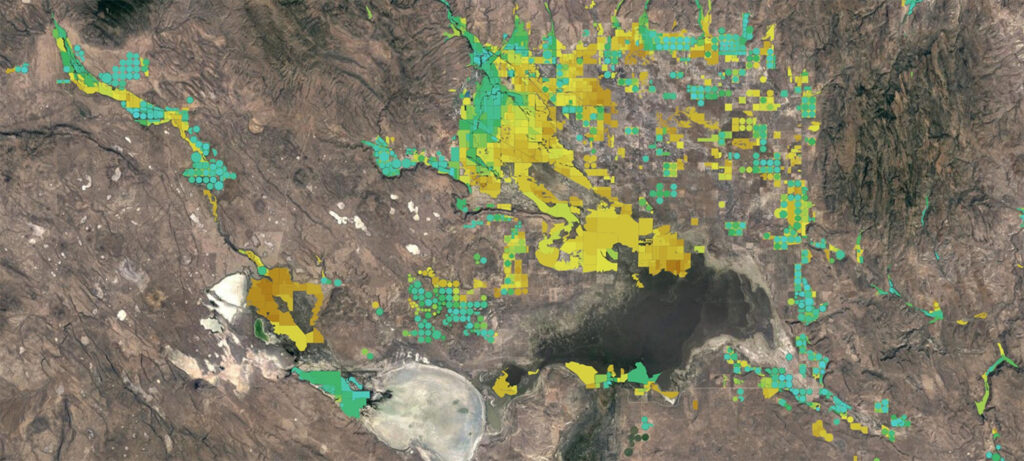
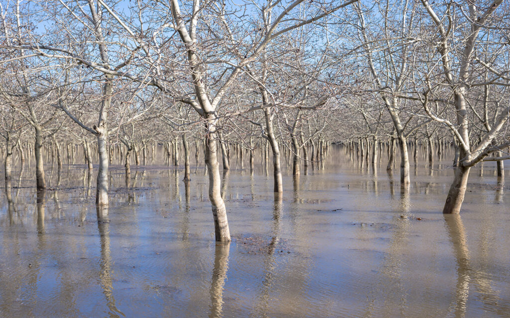
Arial image of a river running through a canyon between mountains with pine trees and scrubs.

Spring Runoff is Older Than You Think

DRI’s Rosemary Carroll, Research Professor of Hydrology, co-authored a new study that found spring runoff in mountains across the Western U.S. is much older than previously known. Using advanced dating techniques, the research discovered that melting mountain snowpacks first replenish groundwater reserves before filling springs several years later. This means that the water relied on by communities across the West takes over five years from snowflake to streamflow. The research has implications for water management and our understanding of the changing dynamics of water availability.

Satellite image from OpenET that displays a map of blue and green circles.

OpenET’s New CEO, Sara Larsen, Discusses the Future of the Revolutionary Water-Monitoring Initiative

OpenET, a nonprofit initiative focused on improving water management with accessible, satellite-based evapotranspiration (ET) data, has welcomed Sara Larsen as the new CEO. DRI sat down with Sara to discuss what makes the initiative unique, her plans for the organization, and how OpenET can help address the biggest challenges in water management.

A river winds through a snow covered landscape with mountains in the distance.

New Study Finds Rocky Mountain Snow Contamination

An examination of Rocky Mountain snow finds higher contamination levels of mercury and others metals in the northern part of the range, consistent with increased current and historical mining in the region. The study, published in the May issue of the journal Environmental Pollution, examined contamination levels for Mercury, Zinc, Cadmium and Antimony from nearly 50 sites in the Rocky Mountains.

Satellite Image of Simushir Island covered in snow and ice surrounded by the Pacific Ocean.

New Research Solves 200 Year Volcanic Mystery

DRI scientists Joe McConnell and Nathan Chellman are co-authors on a new study that sheds light on a historical mystery that has plagued historians and scientists alike for nearly two centuries. Using Arctic ice core records, the team identified the volcano responsible for an enormous eruption in 1831 that caused global cooling of around 1°C, leading to crop failures and famines around the world.

Headshot of Tyler smiling with arms crossed in front of pine trees.

Meet Tyler Doane

Tyler Doane, Ph.D., started in May 2024 as Assistant Research Professor in the Division of Hydrologic Sciences. He works remotely from Cleveland, Ohio, where his wife teaches bioethics at Case Western Reserve University’s medical school. Doane is a geomorphologist who received his Ph.D. at Vanderbilt University before completing a postdoctoral position at Indiana University, Bloomington. In the this Behind the Science interview, Doane talks about his interest in applying math to describe scientific phenomena, his interest in embracing noise and chaos to understand Earth systems, and his favorite method for coming up with new research questions.

A satellite and Hydrosat Logo appear over a background of a thermal map.

Measuring Colorado River Evaporation from Reservoirs

DRI is advancing water management in the Colorado River basin with support from the National Science Foundation's Southwest Sustainability Innovation Engine (SWSIE) and the Governor's Office of Economic Development. Partnering with Hydrosat, DRI uses high-resolution satellite thermal imaging to enhance evaporation estimates from key reservoirs, ensuring better resource planning amidst drought and population growth.