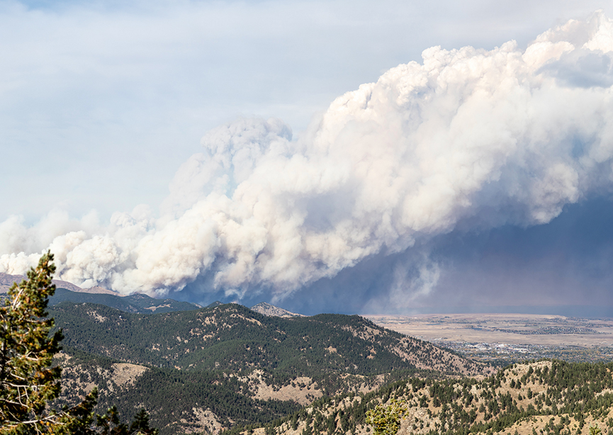
Wetland Map of Nevada

Wetland Map of Nevada

Wetland Map of Nevada

Project Description

Wetland Map of Nevada

As part of a grant from the United States Environmental Protection Agency, the Desert Research Institute has compiled existing geospatial and remote sensing data for Nevada into a statewide map of wetlands. This map incorporates data from multiple sources, including:

• USFWS National Wetlands Inventory
• USGS National Hydrography Dataset
• NRCS GSSURGO soils data
• Spring locations from the Spring Stewardship Institute
• The DRI Map of Riparian Vegetation for Nevada
• Wet meadow maps from USFS and the University of Nevada, and
• Landsat normalized difference vegetation index data

This map product indicates which sources contributed to the identification of a mapped wetland polygon and provides a confidence indicator based on the number and type of coincident sources.

Please use the following citation:

Wetland Analysis Toolbar

The WetBar application is an ArcMap toolbar (Desktop version only) that links in real-time to Google Earth Engine in order to calculate time-series of climate data, vegetation vigor and waterbody extent from Landsat imagery from 1985 to current, access and past aerial photography, and other geospatial data. Definition of study areas is like a simple paint program and requires no knowledge of ArcMap editing methods. The toolbar application organizes information on wetland study areas, allowing the user to group and sort sites based on various criteria. The toolbar can generate a wide variety of information for a selected site, such as descriptions of the extent and hydrological setting, soils, climate, land ownership, wetland type, phenology, interannual variability in vegetation and hydrology, and more.

Version 1.2b of the WetBar installation (3 GB) can be downloaded at the right of this page.  The toolbar only option to the right does not work with prior versions.  To update from earlier versions, install 1.2b and use the ‘Convert to project’ function under Utilities.  

Please use the following citation:

  • McGwire, K., 2021, Advanced remote sensing and GIS methods for restoration of the Lahontan Cutthroat trout, SPIE Remote Sensing 2021, Paper 11863-29, Sept. 13-16, Madrid, Spain.

Photo of spring wetlands in Big Smokey Valley by Janel Johnson, Nevada Natural Heritage Program

CONTACT

Ken McGwire, Ph.D.
Principal Investigator
Ken.McGwire@dri.edu

LOCATION

Desert Research Institute
2215 Raggio Parkway
Reno, NV 89512

DIVISION

Earth & Ecosystem Sciences

Deciphering the metagenome-encoded pathway and domain structure for Palmerolide biosynthesis

Deciphering the metagenome-encoded pathway and domain structure for Palmerolide biosynthesis

Deciphering the metagenome-encoded pathway and domain structure for Palmerolide biosynthesis

Project Objective

To identify the Pal producing gene cluster (an antimelanoma gene product) in the microbial metagenome of the Antarctic ascidian, Synoicum adareanum. This entails assembling, annotating and mining the S. adareanum microbial metagenome. Then, a predictive bioorganic synthesis strategy will be applied to identify potential Palmerolide biosynthetic gene clusters. These predictions will be validated using single cell genome sequencing approach to screen candidate organism(s) gene content. 

Project Team

• Alison Murray, DRI (lead)
• Bill Baker, USF, Co-I
• Patrick Chain, LANL, Co-I
• Armand Dichosa, LANL, Senior Scientist

Funded by

DRI | IPA | NIH NCI Clinical and Translational R21


CONTACT

Alison Murray, Ph.D.
Principal Investigator
Alison.Murray@dri.edu  

LAB LOCATION

Desert Research Institute
2215 Raggio Parkway
Reno, NV 89512

DIVISION

Earth & Ecosystem Sciences

Native Waters on Arid Lands

Native Waters on Arid Lands

Native Waters on Arid Lands

Project Description

Native Waters on Arid Lands is a five-year (2015-2020) project that partners researchers and extension experts with tribal communities in the Great Basin and American Southwest to collaboratively understand the impacts of climate change, and to evaluate adaptation options for sustaining water resources and agriculture.

Climate resilience is the capacity to adapt or respond effectively to change in the face of extreme climate events. The goal of the Native Waters on Arid Lands project is to increase the climate resilience of tribal agriculture and water resources on American Indian lands of the Great Basin and Southwest.

CONTACT

Maureen McCarthy, Ph.D.
Project Director
Maureen.McCarthy@dri.edu 

LOCATION

Desert Research Institute
2215 Raggio Parkway
Reno, NV 89512

DIVISION

Earth & Ecosystem Sciences

Healthy Nevada Project

Healthy Nevada Project

Healthy Nevada Project

About the Project

Since launching on September 15, 2016, the Healthy Nevada Project has become the largest community-based population health study in the world. Ultimately, the Project aspires to offer genetic testing to any Nevadan interested in learning more about their health and genetic risks while serving as a model for other communities across the country.

By better understanding how genetics, environment, social factors and healthcare interact we can help predict who may be at greater risk – allowing for quicker diagnoses and the development of more precise treatment.

Project Expansion & Evolution

September 15, 2016: The launch of the Healthy Nevada Project saw unprecedented response with 10,000 study volunteers joining in just 48 hours and DNA sample collection completed in 60 working days. Pilot participants ranged from 18-90 years old across 135 northern Nevada zip codes.

March 15, 2018: Eighteen months after the Project’s launch – another key milestone: The Project opened 40,000 more testing slots and provided initial findings from the pilot phase.

October 3, 2018: The Healthy Nevada Project becomes one of the first population health studies in the country to return clinical results to study volunteers. This means you can learn your genetic risks tied to heart disease and certain cancers, as well as what lifestyle changes can help reduce your risk and prevent disease.

What’s Next

Leveraging Renown’s forward-thinking approach to community healthcare and Desert Research Institute’s data analytics and environmental expertise, Renown Institute for Health Innovation has quickly grown its capabilities to lead a larger, more complex research study that will analyze and model public health risks for future generations of Nevadans and ultimately improve health outcomes nationwide.


Healthy Nevada Project logo
Renown Institute of Health logo

STUDY PRINCIPAL INVESTIGATOR

Joe Grzymski, Ph.D.
Research Professor, Director of Genomic Medicine
Joe.Grzymski@dri.edu

Desert Research Institute
2215 Raggio Parkway
Reno, NV 89512

Map of Riparian Vegetation in Nevada

Map of Riparian Vegetation in Nevada

Map of Riparian Vegetation in Nevada

Project Description

The Map of Riparian Vegetation in Nevada (MRVN) identifies the distribution of riparian vegetation across the entire state of Nevada.  Despite variations in climate and plant species composition across the state, the enhanced vigor of plants in riparian settings during the hot summers of the arid to semiarid climate provides a greenness signal that can be detected in NDVI data derived from Landsat satellites.  By stratifying the landscape of a subregion into units of similar elevation and solar exposure, changes in NDVI due to surface or near surface water availability were differentiated from changes that were due to the amount of vegetation present.  Thousands of calibration points were used to identify the best spatial neighborhood to consider, the step sizes for stratifying elevation and insolation data, the minimum NDVI to be considered as potentially riparian, the magnitude of NDVI anomaly that would be classified as riparian, and a limit on upslope position.  A further enhancement to the map incorporated the areas near perennial streamlines from the NHDPlus product that had the highest NDVI values.  Intensive agriculture (e.g. center pivot) and urban areas were removed by using land ownership maps and manual editing.  The final map was tested with 400 independent test points, and producer’s accuracy (1.0 – errors of omission) for riparian vegetation was 84.6%, and user’s accuracy (1.0 – errors of commission) was 93.5%.

Please use the following citation for the MRVN product:

Update 1.1 of the MRVN product includes the raster map of riparian vegetation, and the average and standard deviation of late summer Landsat NDVI datasets that were used in making MRVN (WARNING: statewide NDVI products are 1.04GB).  

CONTACT

Ken McGwire, Ph.D.
Principal Investigator
Ken.McGwire@dri.edu

LOCATION

Desert Research Institute
2215 Raggio Parkway
Reno, NV 89512

DIVISION

Earth & Ecosystem Sciences