Using Machine Learning to Address Land Subsidence in Pahrump Valley

Using Machine Learning to Address Land Subsidence in Pahrump Valley

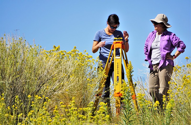
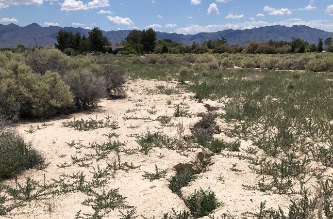
As populations in the southwestern United States continue to grow, the demand on water resources also increases. One region experiencing this stress on its groundwater resources is Pahrump Valley in southern Nye County, Nevada. Pahrump Valley is one of the fastest growing counties in Nevada, which has led to groundwater-related issues such as land subsidence. “Land subsidence has been reported in Pahrump Valley since the 1960s,” says Dr. Hai Pham the principal investigator (PI) of this project, which also includes co-PIs Karl Pohlmann, Susan Rybarski, and Kevin Heintz and research assistant Larry Piatt. “It has caused damage to building foundations and slabs, fissuring, shearing of well casings, and extensive damage to roadbeds.”

In their 2017 Water Resources Plan Update, the Nye County Water District determined that land subsidence is one of the key issues related to population growth in Nye County. However, the causes of land subsidence still haven’t been clearly identified. “Previous studies failed to precisely map spatiotemporal evolutions of subsidence, or adequately clarify the causes of subsidence,” Pham says. “These studies were limited by data quantity and quality. The goal of this project is to identify and prioritize predominant factors that cause subsidence and make predictions using machine learning algorithms and big data.”

A concrete well pad exposed by land subsidence around the well casing (right) observed during a field survey in May 2019 (photo by Karl Pohlmann).

Land subsidence is a complicated process that is driven by multivariate intercorrelated factors, such as groundwater decline, soil and sediment types, and tectonic and geologic settings. For example, excessive groundwater pumping results in soil compaction, which has been identified as a primary cause of land subsidence in Pahrump Valley. However, the magnitude of soil compaction depends on aquifer materials, and therefore understanding the geologic structure of Pahrump Valley is vital to evaluating future subsidence. The advantage of using machine learning to assess potential areas of land subsidence is that it can help illuminate complicated data relationships that may not be as obvious using traditional data analysis techniques.

In this project, the researchers will use machine learning algorithms and high-resolution data sets to identify the predominant factors causing land subsidence in Pahrump Valley. “In this study, we will derive spatiotemporal subsidence maps using recent high-quality satellite images and the Interferometric Synthetic Aperture Radar [InSAR] technique,” Pham says. “InSAR is a powerful technique that allows us to measure and map vertical changes on the earth’s surface as small as a few millimeters.”

The researchers will then build three-dimensional (3-D) computer models of the subsurface geological structures in Pahrump Valley at a very fine (one-foot) vertical resolution using data from 13,000 boreholes. “Compaction of aquifer materials can accompany excessive groundwater pumping and it is by far the single largest cause of subsidence, but the magnitude of soil compaction differs by soil type,” Pham explains. “Therefore, it is important that we account for these well log data to construct high resolution 3-D models of geologic structures.” The researchers will also develop groundwater drawdown maps by processing data from records of 130 groundwater observation wells that range from the 1940s to the present. “Incorporating these high-resolution datasets will help us identify and prioritize the causes of subsidence and make better predictions,” Pham adds.

The groundwater level has declined approximately 25 feet from December 1999 to December 2017 (photo taken in May 2019 by Karl Pohlmann).

Because of the limitations of existing field data, the researchers will generate high-resolution datasets to train and validate the machine learning algorithms. Advanced machine learning algorithms will then be run on supercomputers to analyze the data. By analyzing this data, the researchers hope to identify the factors that cause subsidence and ultimately predict possible subsidence in the future. “Once we have identified these factors, we can roughly predict areas that are prone to subsidence,” Pham explains. “This information can also be used to predict subsidence in other arid and semiarid regions.”

This story was originally written for the Nevada Water Resources Research Institute (NWRRI) October 2019 Newsletter. Success and the dedication to quality research have established DRI’s Division of Hydrologic Sciences (DHS) as the Nevada Water Resources Research Institute (NWRRI) under the Water Resources Research Act of 1984 (as amended). The work conducted through the NWRRI program is supported by the U.S. Geological Survey under Grant/Cooperative Agreement No. G16AP00069.

DRI Launches Two New Projects to Study Hydrology at The Nature Conservancy’s 7J Ranch

DRI Launches Two New Projects to Study Hydrology at The Nature Conservancy’s 7J Ranch

Scientists will investigate water quality and flow in critical desert wetland habitat


LAS VEGAS, NEV. (Sept. 30, 2019) —The Desert Research Institute (DRI) is pleased to announce the launch of two new research projects to study hydrology at The Nature Conservancy in Nevada’s 7J Ranch property near Beatty, Nevada. Work will begin in September on two complementary projects, funded by the Sulo and Aileen Maki Endowment, which will install meteorological stations and develop a watershed model to monitor how future restoration activities at the 7J Ranch will affect its water resources.

The 900-acre working ranch in Southern Nevada’s Oasis Valley is a unique place to study water, as it contains the headwaters of the Amargosa River, one of the world’s longest spring-fed river systems that runs mostly below the surface. The ranch’s unique geography and location where the Great Basin and Mojave deserts meet, and its habitat for many endemic and protected species, make it a globally important site for conserving biodiversity and give it strategic value for facilitating climate change adaptation for wildlife. The highly arid environment of southern Nevada and the Amargosa River’s status as an important source of groundwater discharge in the region also make its headwaters an important place to study hydrology.

The first project, led by Kevin Heintz, will install a hydrometeorological station to monitor the habitat at the 7J Ranch and study how surface water is affected by restoration activities and extreme weather conditions.  This study is significant to southern Nevada water issues because it will contribute to estimating the flow of water in a critical wetland habitat and it will continuously monitor for environmental stressors, both of which have implications for southern Nevada’s biodiversity and wetland health.

DRI’s second project, led by Gabrielle Boisramé, Ph.D., will study how the potential removal of ponds will impact downstream hydrology and habitat. This project will use a variety of environmental data to develop a water budget model that can describe the movement of water in and out of the restoration area under various scenarios.

DRI researcher Gabrielle Boisrame, Ph.D., inspects a floating evaporation pan at The Nature Conservancy’s 7J Ranch on September 18, 2019. Credit: Ali Swallow/DRI.

“Stream restoration in arid environments like the Mojave Desert has not been studied extensively,” explained Boisramé. “Our hope is that this new research will help guide other restoration work in similar spring-fed streams systems of southern Nevada.”

The Conservancy plans to encourage long-term research at the 7J Ranch, and this project will provide an important base of knowledge for future researchers to build upon.

“This research will provide critical information for needed restoration projects at 7J Ranch, and we are so grateful to the Desert Research Institute for their support,” said John Zablocki, Southern Nevada Conservation Director for The Nature Conservancy.  “The insights gained from these projects, and the instruments installed, will help inform better water management decisions for southern Nevada, help predict hydrologic responses to climate change, and help improve modeling on how groundwater flows in the region.”

The Sulo and Aileen Maki Endowment was established by the Sulo and Aileen Maki Trust to be used by the DRI’s Division of Hydrologic Sciences for research, instruction, and scholarships relevant to southern Nevada water issues. The endowment supports innovative, creative, and multidisciplinary research, as well as scholarly endeavors such as journal publications and presentations at scientific conferences, water resources course instruction and student scholarships, and community outreach and service. The overall goal of these efforts is to make the DRI’s Division of Hydrologic Sciences and the name Maki stand for excellence in water resources research, education, and outreach.

Desert Research Institute scientist Gabrielle Boisrame, Ph.D., (left) and graduate research assistant Rose Shillito from the University of Nevada, Las Vegas (right) prepare a pressure sensor for measuring water depth

Desert Research Institute scientist Gabrielle Boisrame, Ph.D., (left) and graduate research assistant Rose Shillito from the University of Nevada, Las Vegas (right) prepare a pressure sensor for measuring water depth at The Nature Conservancy’s 7J Ranch on September 18, 2019. Credit: Ali Swallow/DRI.

For more information, please contact Sara Cobble, Marketing and Communications Manager for The Nature Conservancy in Nevada, at sara.cobble@tnc.org or Kelsey Fitzgerald, Science Writer for the Desert Research Institute Communications Office at kelsey.fitzgerald@dri.edu

To view a photo gallery of images from 7J Ranch, please visit: https://flic.kr/s/aHsmHaHULv

###

About The Nature Conservancy

The mission of The Nature Conservancy is to conserve the lands and waters on which all life depends. Guided by science, we create innovative, on-the-ground solutions to our world’s toughest challenges so that nature and people can thrive together. Working in 72 countries, we use a collaborative approach that engages local communities, governments, the private sector, and other partners. We’ve been working in Nevada for nearly 35 years. To learn more, please visit www.nature.org/nevada.

About the Desert Research Institute

The Desert Research Institute (DRI) is a recognized world leader in basic and applied interdisciplinary research. Committed to scientific excellence and integrity, DRI faculty, students, and staff have developed scientific knowledge and innovative technologies in research projects around the globe. Since 1959, DRI’s research has advanced scientific knowledge, supported Nevada’s diversifying economy, provided science-based educational opportunities, and informed policymakers, business leaders, and community members. With campuses in Reno and Las Vegas, DRI is one of eight institutions in the Nevada System of Higher Education.

About the Nevada System of Higher Education The Nevada System of Higher Education (NSHE), comprised of two doctoral-granting universities, a state college, four comprehensive community colleges and one environmental research institute, serves the educational and job training needs of Nevada. NSHE provides educational opportunities to more than 100,000 students and is governed by the Board of Regents.